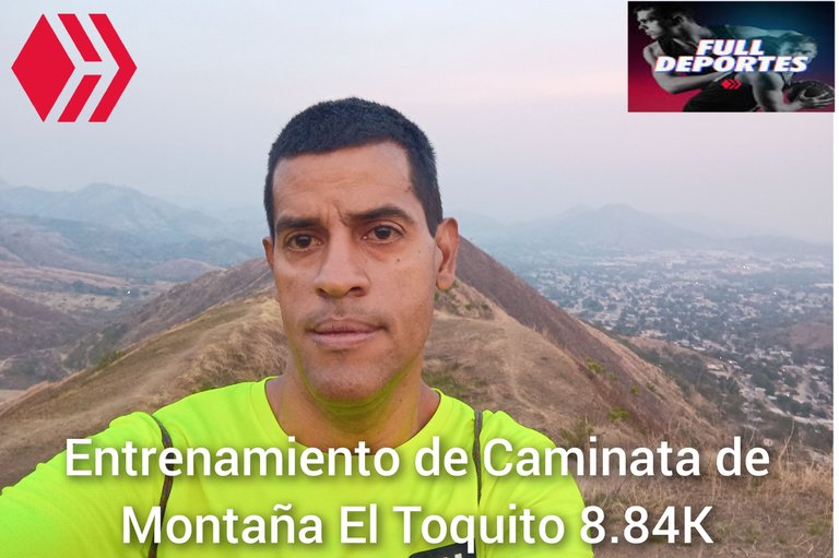
Greetings friends of Hive and @fulldeportes, today I am going to share with you my mountain hiking training that I did yesterday, Sunday, in the mountain El Toquito - Nueva ruta, in the community of Villa
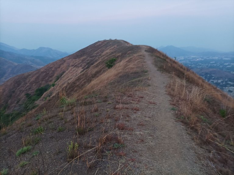
Cabe destacar que el día de ayer domingo, no había decido si iban al cerro El Toquito o Las Atenas, después tomé el rumbo al Toquito, saliendo a las 5:46 am, el clima estaba fresco y un poco oscuro, activando la aplicación strava y Actifit, para recorrer el centro de la comunidad y llegar al sector El Toquito, intenté buscar otro camino para subir prácticamente por detrás de la montaña, pero como todavía no había aclarado, baje para subir por dónde siempre lo hago.
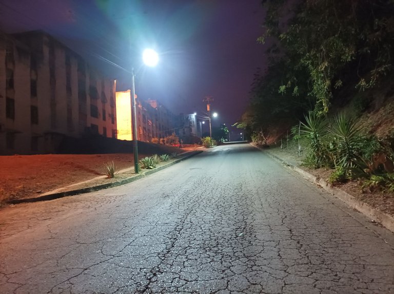
It should be noted that yesterday, Sunday, I had not decided whether to go to the hill El Toquito or Las Atenas, then I took the course to the Toquito, leaving at 5:46 am, the weather was cool and a little dark, activating the strava application and Actifit, to walk through the center of the community and reach the sector El Toquito, I tried to find another way to climb practically behind the mountain, but as it had not yet cleared, I went down to climb where I always do.
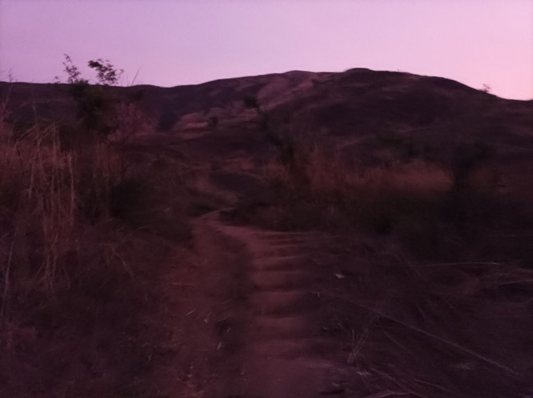
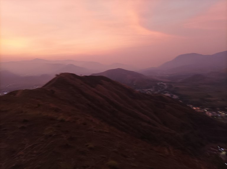
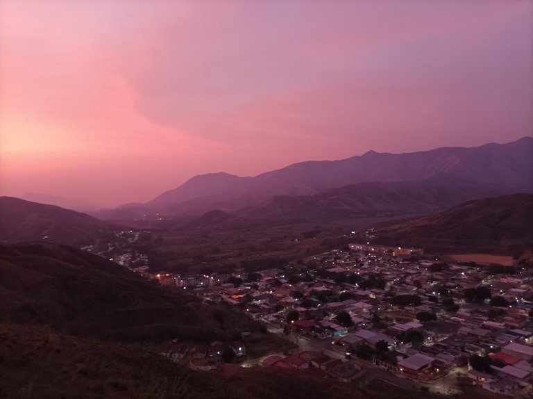
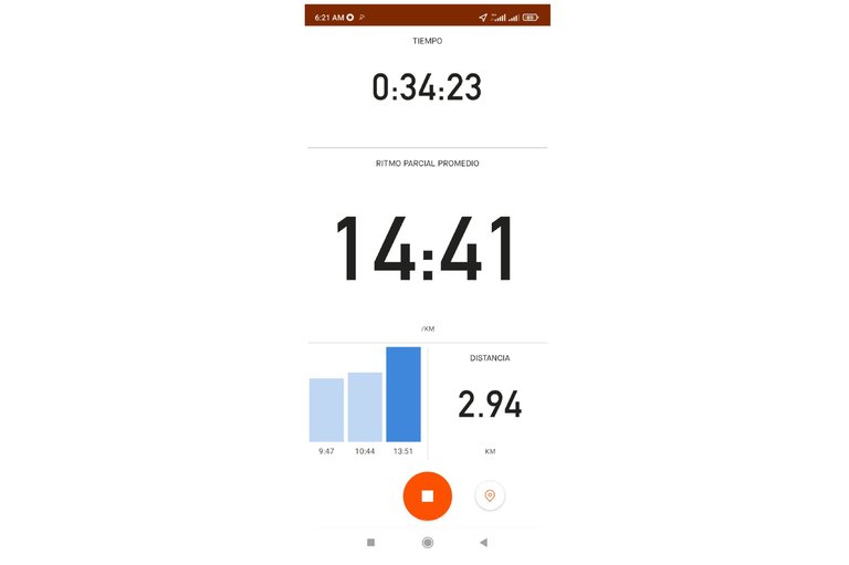
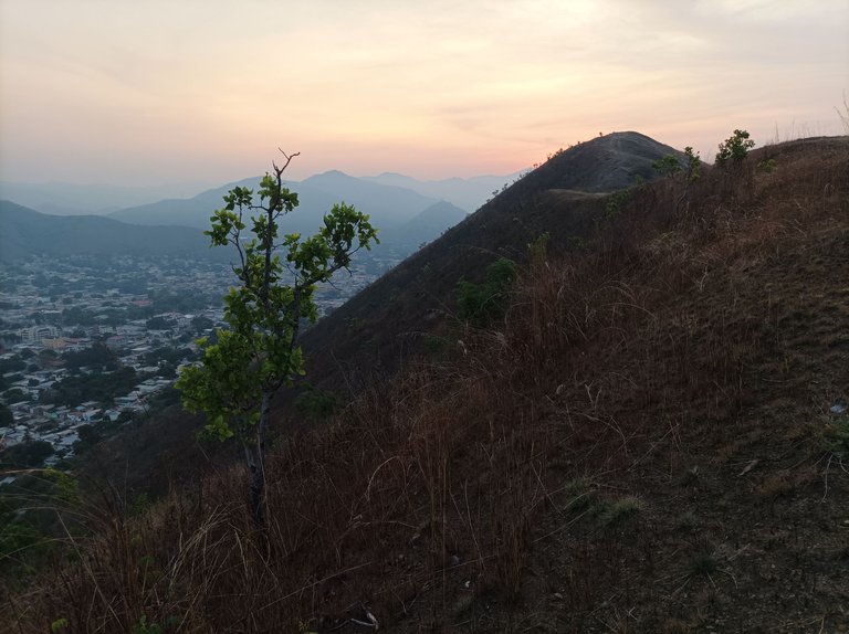
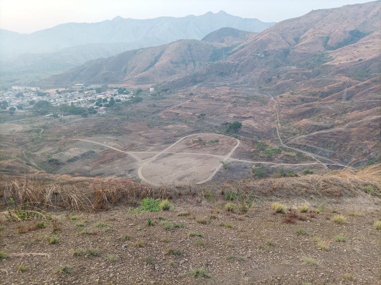
Comencé a subir, y pude apreciar el hermoso amanecer desde la montaña, adelante me encontré con un amigo caminante que estaba entrenando, en esta ruta hay tres pendientes, en la segunda fue que pude alcanzar a una persona y al llegar a la cima de esta montaña, la aplicación marco una distancia de 2.94 y un tiempo de 34 minutos, desde aquí podemos ver toda Villa de Cura y también la comunidad del Toquito.
I started to climb, and I could appreciate the beautiful sunrise from the mountain, ahead I met a walking friend who was training, in this route there are three slopes, in the second one was that I could reach a person and when I reached the top of this mountain, the application marked a distance of 2.94 and a time of 34 minutes, from here we can see all Villa de Cura and also the community of Toquito.
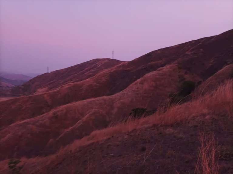
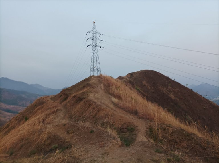
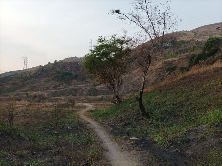
Asimismo me desplace a la derecha de la montaña, y me tope con otro caminante, lo salude y continúe hasta la parte final, luego me regresé para descender por donde está la pista de atletismo, al terminar de bajar, la aplicación Strava registro 4.31K y un tiempo de 52 minutos,en este recorrido tomé una nueva ruta que nunca la había caminado, de un 1 K de distancia, para después volver a salir por el camino que llevo a la urbanización de El Toquito, marcando una distancia de 6.26K y un tiempo de 1 hora 13 minutos.
also moved to the right of the mountain, and I ran into another walker, I greeted him and continued to the end, then I returned to descend where the athletics track is, at the end of the descent, the Strava application recorded 4.31K and a time of 52 minutes, in this route I took a new route that had never walked, a 1 K distance, and then go back out on the road that leads to the urbanization of El Toquito, marking a distance of 6.26K and a time of 1 hour 13 minutes
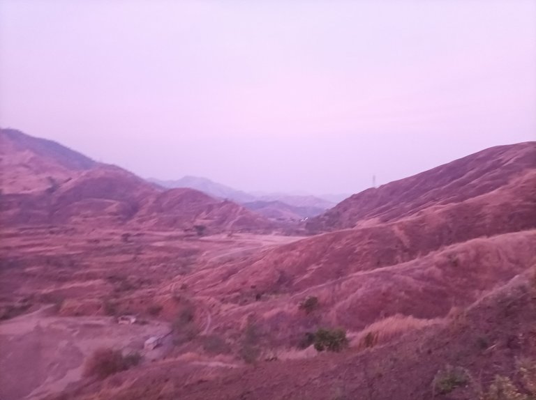
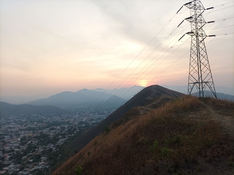
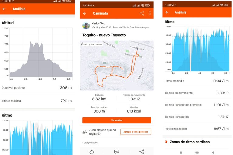
Después continúe bajando para nuevamente llegar al centro de Villa de Cura y finalmente terminar mi entrenamiento con un tiempo de 1 hora 37 minutos, distancia 8.82 K, altura máxima de 720m y un desnivel positivo de 306 m. La altura de esta montaña es menor en comparación con la de Las Antenas, que tiene una altura de 1000 metros
Then continue downhill to again reach the center of Villa de Cura and finally finish my training with a time of 1 hour 37 minutes, distance 8.82 K, maximum altitude of 720m and a positive vertical drop of 306m. The height of this mountain is lower compared to Las Antenas, which has a height of 1000
Espero que les haya gustado mi entrenamiento de caminata de montaña, nos vemos en el próximo.
hope you liked my mountain hiking training, see you in the next one.
Fotografías: Teléfono Redmi Note 10
Portada realizada en APP GridArt
Logos utilizados de Hive y de fulldeportes
Traductor utilizado: Traductor de Google
Photos: Redmi Note 10 Phone
Cover made in The APP GridArte
Used logos of Hive and fulldeportes
Translator used: Translator used: Google Translate

Vote la-colmena for witness By @ylich

Hola @cetb2008,
El Toquito tienes varias rutas, las de Antenas es una. Subiste temprano.
Saludos amigo, así es, gracias por tu comentario.
Chamo, eso sí está bello, El Toquito, sus amaneceres son increíbles, agradecida por tus fotos, yo me deleito con ellas, sigamos por más rutas y kilómetros, vamos por más. Saludos 🥰🤗
Hola amiga, si un bello amanecer, gracias por pasar y comentar en mi blog.
🥰🤗
Amigo cuánta magia en este post! Casi 9 km! Un genio!! Y además, ese amanecer que has presenciado es una delicia! Muchas gracias por compartirlo con nosotros! Es admirable tu compromiso con tus trekkings! Me encanta!!
Hola amiga, que bueno que te gustó ese bello amanecer, agradecido por tu comentario.
!HUESO
Click on this banner, to be directed to the Virtual World Discord and learn more about the curation project.
!PIZZA
Saludos muchas gracias por valorar mi publicación.
https://inleo.io/threads/cetb2008/re-leothreads-yxpcivhm
The rewards earned on this comment will go directly to the people ( cetb2008 ) sharing the post on LeoThreads,LikeTu,dBuzz.