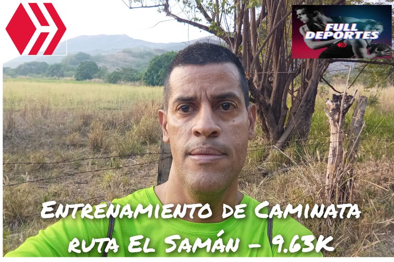
Greetings friends of Hive and @fulldeportes, today I'm going to share with you my hiking training on the El Samán route, in the community of Villa de Cura, Aragua state, Venezuela.
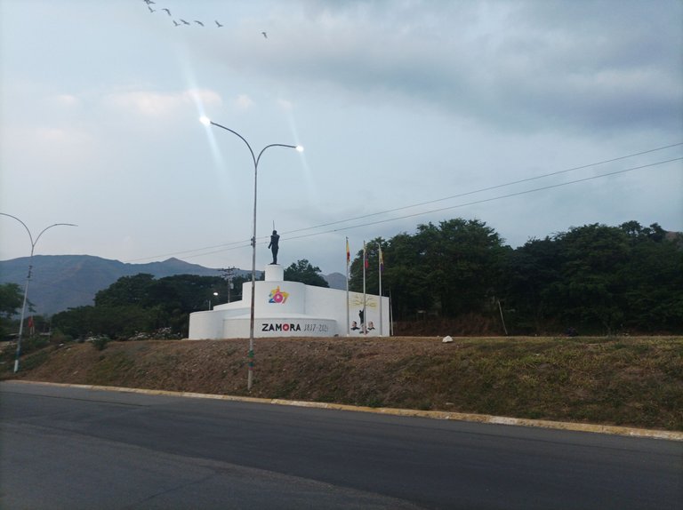
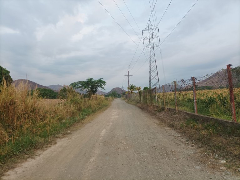
Cabe destacar que me levanté a la 5:45 am, para salir a la 6:00 am, activando la aplicación Strava para registrar este entrenamiento, al comienzo no me sentía muy bien debido a que no dormí muy bien porque anoche se fue la luz eléctrica y esta llegó a la medianoche. Caminando toda la avenida Lisandro Hernández y al llegar al monumento Ezequiel Zamora con un tiempo de 21 minutos.
It is noteworthy that I got up at 5:45 am, to leave at 6:00 am, activating the Strava application to record this training, at the beginning I did not feel very good because I did not sleep very well because last night the electricity went out and this came at midnight. Walking all the Lisandro Hernandez avenue and arriving at the monument Ezequiel Zamora with a time of 21 minutes.
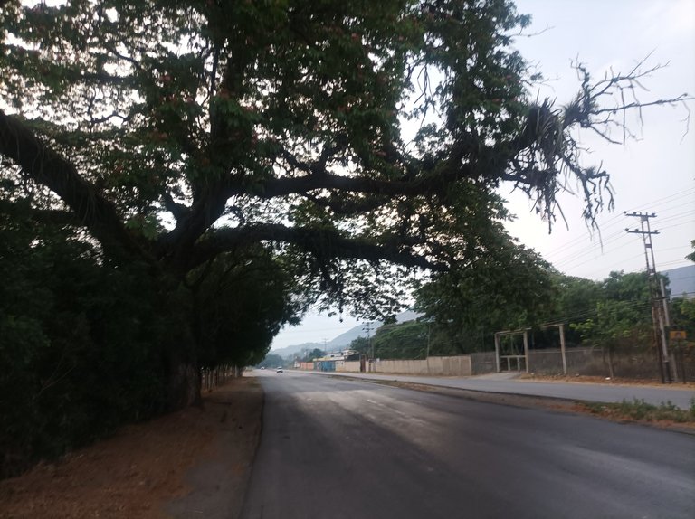
En este entrenamiento no aumente mucho el ritmo de la caminata, quería ir a un ritmo sostenido, en los primeros 3K en 29 minutos, continúe avanzando y al pasar la primera recta y llegar a la esquina en 36 minutos y una distancia de 3.68 K, este recorrido es la parte más corta porque no tomé la ruta nueva que son más distancia.
In this training I did not increase the pace of the walk much, I wanted to go at a steady pace, in the first 3K in 29 minutes, I continued to move forward and passing the first straight and reach the corner in 36 minutes and a distance of 3.68 K, this route is the shortest part because I did not take the new route that are more distance.
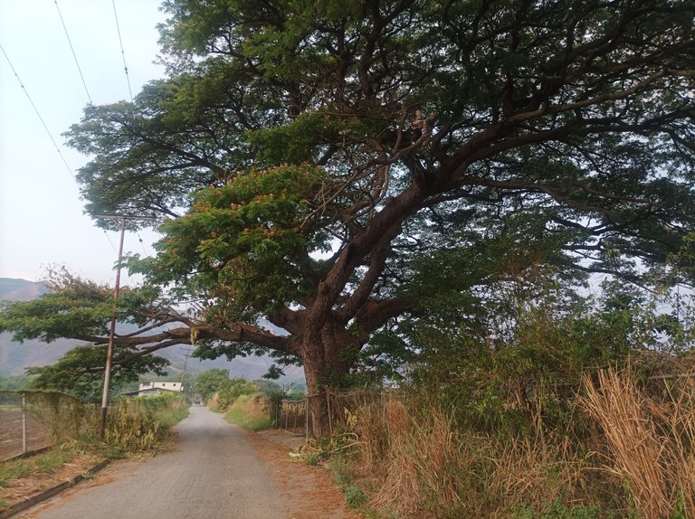
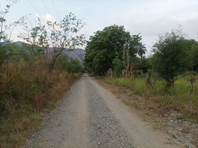
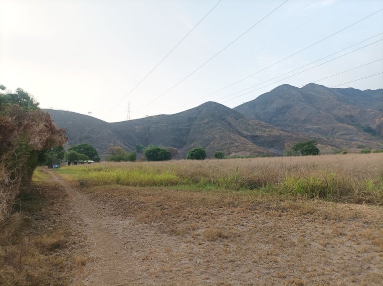
Asimismo, al llegar a la siguiente esquina, me dirigí al sector Dimas, para comenzar a subir, en una de las parcelas me salieron varios perritos y después se quedaron tranquilos cuando los dueños los llamaron. Una vez que llegué al final de esta carretera donde complete la distancia de 5K en 50 minutos. En esta parte me detuve unos segundos y me hidrate para luego tomar algunas fotografías.
Also, when I got to the next corner, I headed to the Dimas sector, to start climbing, in one of the plots several dogs came out and then stayed quiet when the owners called them. Once I reached the end of this road where I completed the 5K distance in 50 minutes. At this point I stopped for a few seconds and hydrated and then took some pictures.
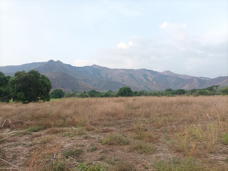
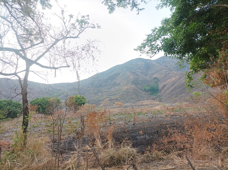
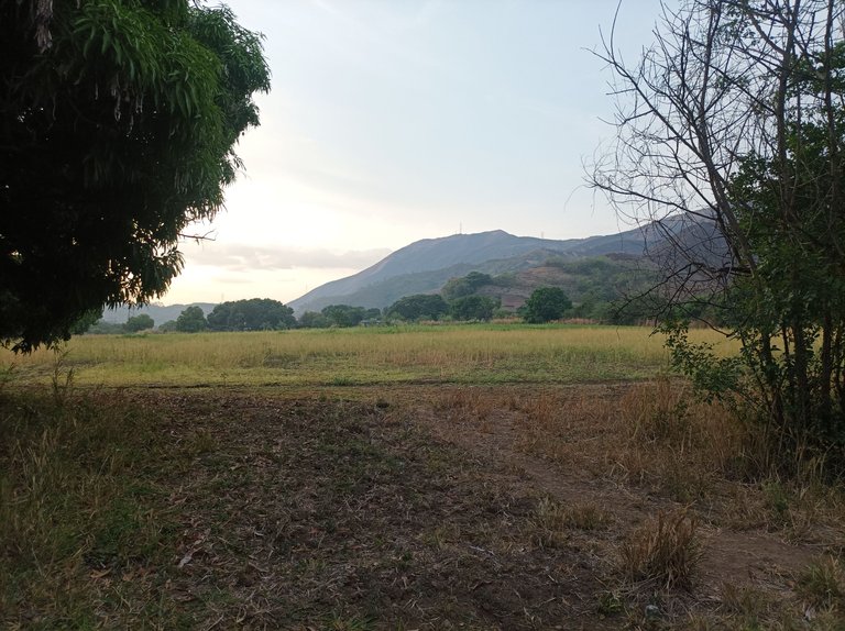
En esta parte se ve la montaña que ha sufrido de los incendios y pude observar una entrada en la cual podría explorar y conocer una nueva ruta, pero no me motive mucho porque no me sentía muy bien y no lo hice. A pesar de que salí temprano, ya se sentía el calor, me imagino en la tarde el calor va estar un poco fuerte debido al aumento de la temperatura, de regreso me vine para salir donde están las montañas, donde me tomé otras fotografías para continuar mostrando esta ruta.
In this part you can see the mountain that has suffered from the fires and I could see an entrance in which I could explore and know a new route, but I was not very motivated because I did not feel very well and I did not do it. Although I left early, the heat was already felt, I imagine in the afternoon the heat will be a little strong due to the increase in temperature, back I came to leave where the mountains are, where I took other pictures to continue showing this route.
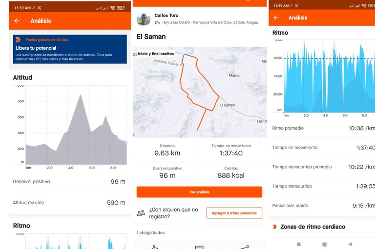
Después continúe el rumbo al sector Santa Eduviges, para continuar bajando y pasar por el sector de La Represa, luego seguí avanzando para llegar al centro de la comunidad y finalizar mi entrenamiento en el punto de salida, con un registro de 1 hora 39 minutos, 55 segundos, una distancia de 9.63K, un desnivel positivo de 96 m.
Then I continued my course to the Santa Eduviges sector, to continue descending and pass through the sector of La Represa, then I continued advancing to reach the center of the community and finish my training at the starting point, with a record of 1 hour 39 minutes, 55 seconds, a distance of 9.63K, a positive difference in altitude of 96 meters.
Espero que les haya gustado este entrenamiento, nos vemos en el próximo.
hope you liked this training, see you in the next one.
Fotografías: Teléfono Redmi Note 10
Portada realizada en APP GridArt
Logos utilizados de Hive y de fulldeportes
Traductor utilizado: Traductor de Google
Photos: Redmi Note 10 Phone
Cover made in The APP GridArte
Used logos of Hive and fulldeportes
Translator used: Translator used: Google Translate

Vote la-colmena for witness By @ylich

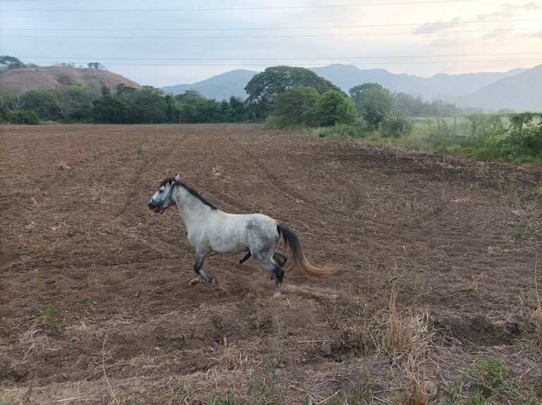
Wow un recorrido totalmente largo, ese caballo quería aparecer en la imagen que buen estilo 😁
Saludos amigo, gracias
Excelente recorrido amigo, me gustaron la foto del caballo y de las montañas, seguimos avanzando por más kilómetros, saludos 😘🤗
A qué bueno, gracias amiga.
🥰😁
Qué buen recorrido, lo felicito a seguir con todo.
Hasta pronto.
Gracias amiga, saludos.
Excelente como siempre mi pana
Saludos amigo, gracias por pasar.