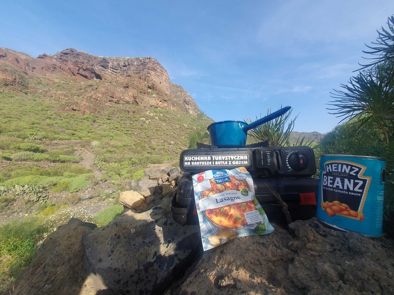
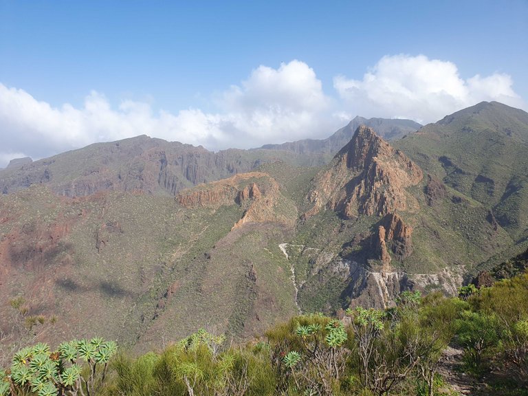
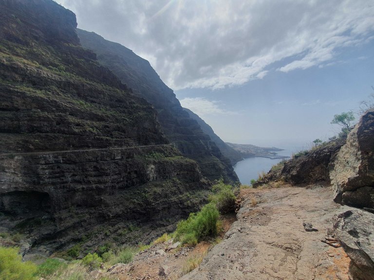
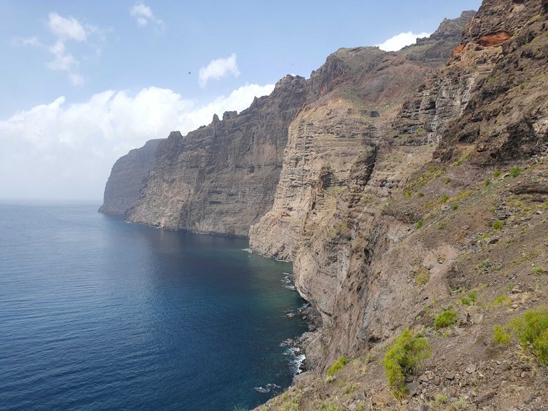
Po krótkim epizodzie w turystycznym piekiełku udałem się na północ. Los Gigantes, czyli wysokie na 500m klify półwyspu Teno były wysoko na mojej teneryfiańskiej bucket liście. Klify są zresztą nieodłączną częścią zlokalizowanych na północnym-zachodzie gór. Zaplanowałem sobie trasę na około 20km i znalazłem miejsce na nocleg niedaleko za turystyczną miejscowością Los Gigantes. Rano przygotowałem sobie jeszcze posiłek w drogę, bo cała trasa miała mi zająć około 8h. Spanko trafiło mi się w idealnym miejscu, koniec drogi, 100m od zabudowań, płasko, tuż obok początku mojej trasy.

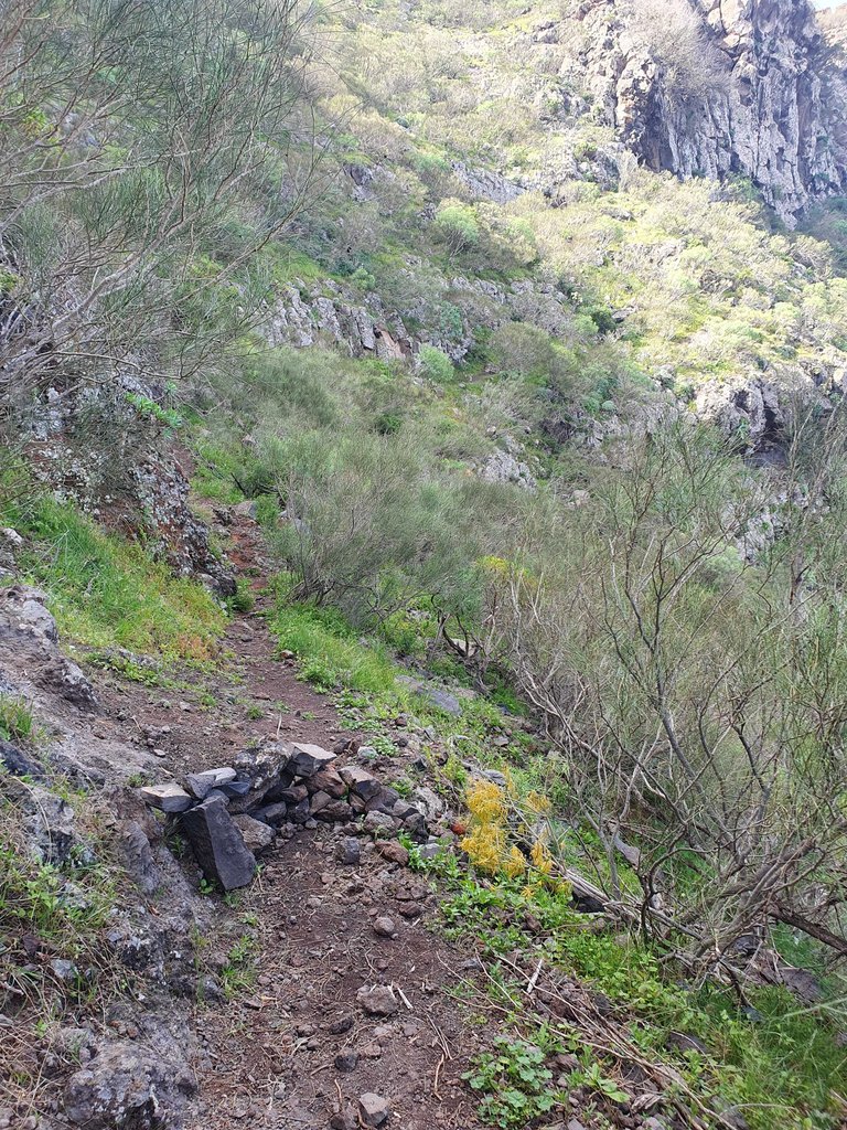
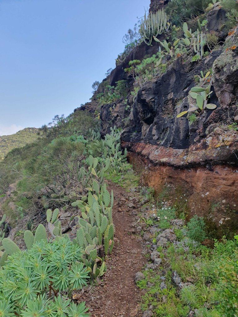
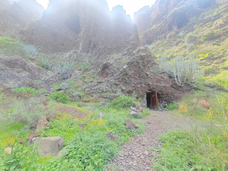
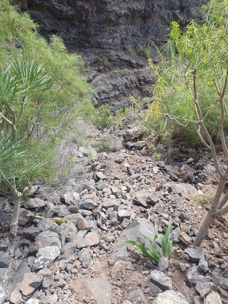
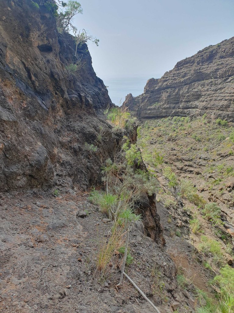
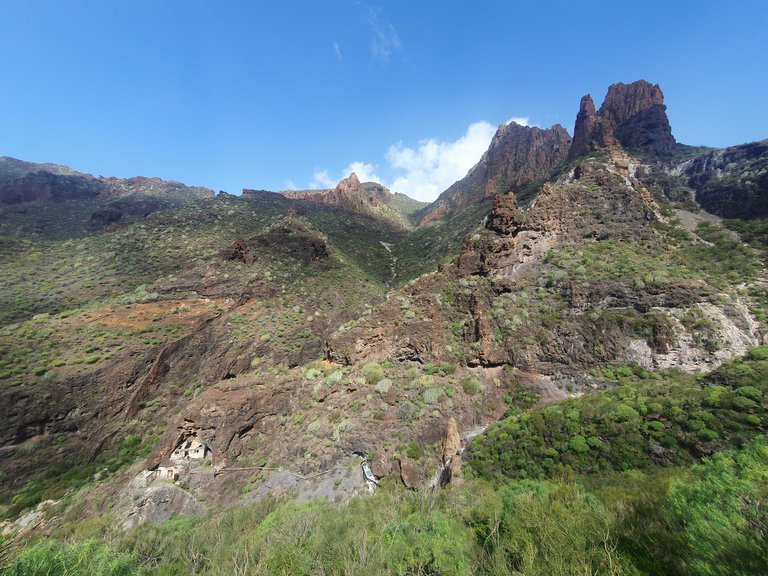
Trasę zaplanowałem w taki sposób, żeby nie wracać tą samą drogą, byłem przekonany, że w górach nie będę miał zasięgu, oznaczyłem sobie więc drogę w aplikacji. Przy takiej liczbie skrzyżowań można się pogubić. Niedawno @klub-wloczykijow pisał o wojnie znakarzy w Beskidach, teneryfiańscy znakarze w większości znajdują się wciąż w epoce kamienia łupanego. Szlak często oznaczony jest po prostu kupką kamieni lub wyspreyowaną na skale kropą. W niejasnych przypadkach zwodnicze ścieżki są po prostu zablokowane przez kamienną barierę. Jakość szlaków też jest nieco inna niż to, do czego przyzwyczaić mogą polskie góry, na trzecim zdjęciu jest najłatwiejszy do przejścia fragment. Taki już chyba urok tych terenów, nie będę narzekał, bo bawiłem się świetnie.

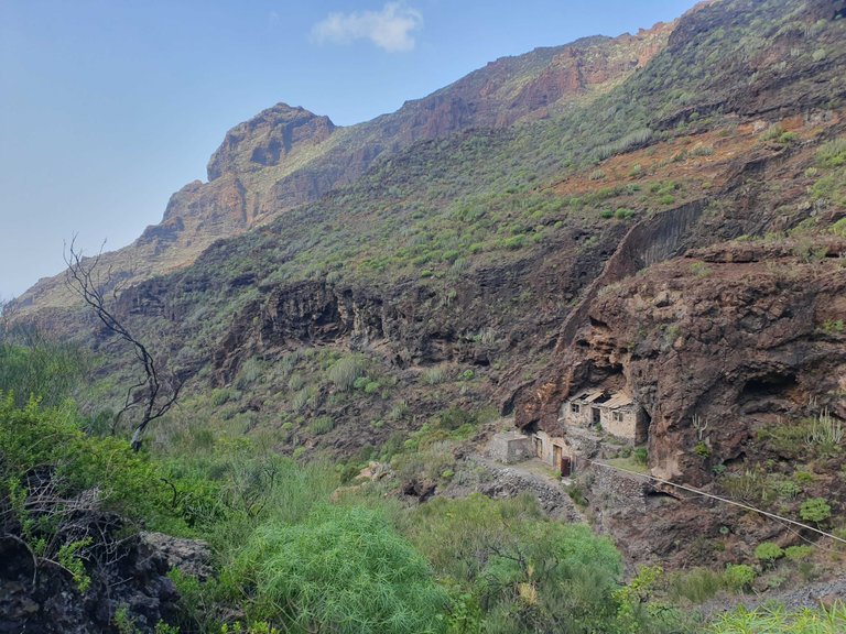
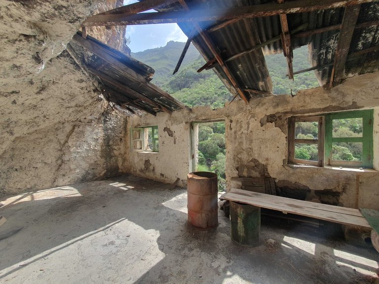
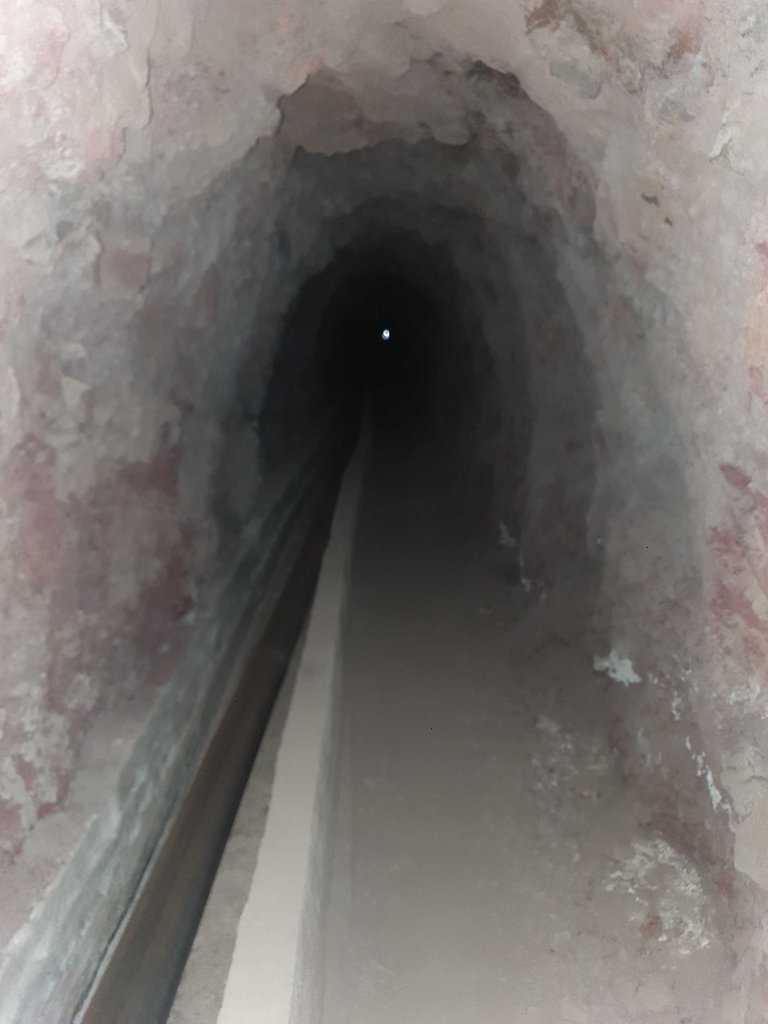
Poza widokami najwiekszą atrakcję stanowiła opuszczona wiata i tunel, którego przejście zajęło mi około 15min. W pewnym momencie szlak kończył się po prostu wejściem do góry, tunel był prosty i wysoki na 180-200cm, co dość szybko zmieniło się z atrakcji w bardzo frustrujące doświadczenie. Cały czas musiałem pochylać lekko głowę, żeby nie nabić sobie guza, jednocześnie świecąc pod nogi, żeby się nie potknąć. Od samego początku na końcu majaczyło słynne światełko w tunelu, jednak przez cały czas wcale nie zdawało się ono przybliżać. Bardzo nieprzyjemne uczucie. Co jeśli to błąd w symulacji i tunel nigdy się nie skończy?
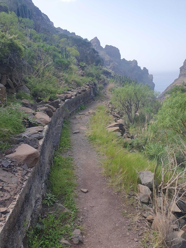
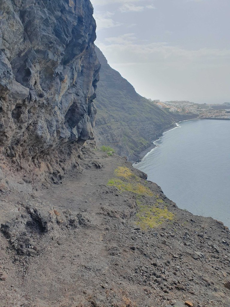
Tuż za wyjściem z tunelu czekali na mnie giganci. Pierwszym wyzwaniem było pokonanie rumowiska, urobek z kopania tunelu gdzieś trzeba było przecież zostawić. Droga prowadziła kilkadziesiąt metrów w dół przez bardzo niestabilny teren. Następne parę kilometrów trasy wiodło bardzo wąską ścieżką na skraju głębokiej na ponad 100m przepaści. Czasem trzeba było wspiąć się parę metrów, cały czas trzeba było niezwykle uważać. Tutaj ścieżka była już łatwiejsza do znalezienia, jednak zachowanie zimnej krwi wielokrotnie stanowiło wyzwanie.
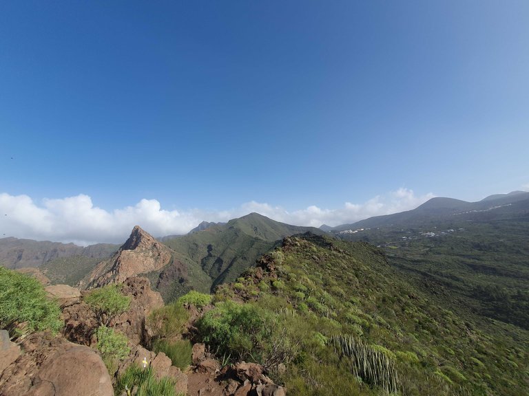
Po pożeganiu się z gigantami czekało mnie jeszcze 5km żmudnego podejścia w górę do auta, ta część była dla mnie najtrudniejsza. Chyba lepiej byłoby zaplanować tę trasę tak, aby kulminacyjny moment był na samym końcu. Nie mniej jednak było super! Na całej dość wymagającej trasie widoki zapierają dech w piersi i to całkiem dosłownie, moja astma daje dziś o sobie znać. Czas na dwa dni plażowania.
ENG
After a short stay in a touristy hotspot, I headed north. Los Gigantes, the 500m high cliffs of the Teno peninsula, were high on my Tenerife bucket list. The cliffs are an integral part of the mountains located in the northwest. I planned a route of about 20km and found a place to stay overnight near the tourist town of Los Gigantes. In the morning, I prepared a meal for the journey because the whole route was going to take about 8 hours. I found a perfect spot to sleep at the end of the road, 100m from the buildings, flat, right next to the start of my route.
I planned the route in such a way that I wouldn't have to go back the same way, and since I was convinced that I wouldn't have cell phone reception in the mountains, I marked the path on my app. With so many intersections, it's easy to get lost. Recently, @klub-wloczykijow wrote about the war of sign makers in the Beskids, but the Tenerife sign makers are mostly still in the Stone Age. The trail is often simply marked by a pile of stones or a dot sprayed on a rock. In unclear cases, deceptive paths are simply blocked by a stone barrier. The quality of the trails is also somewhat different from what one might be used to in the Polish mountains, as shown in the third photo, which is the easiest section to pass. I guess that's just the charm of these areas, and I won't complain because I had a great time.
Apart from the views, the biggest attraction was an abandoned shelter and a tunnel, which took me about 15 minutes to pass through. At one point, the trail simply ended with an entrance up the mountain. The tunnel was straight and about 180-200cm high, which quickly turned from an attraction into a very frustrating experience. I had to constantly tilt my head slightly to avoid hitting it, while shining a light at my feet to avoid tripping. From the very beginning, the famous light at the end of the tunnel was visible, but it didn't seem to be getting any closer all the time. It was a very unpleasant feeling. What if it's a glitch in the simulation and the tunnel never ends?
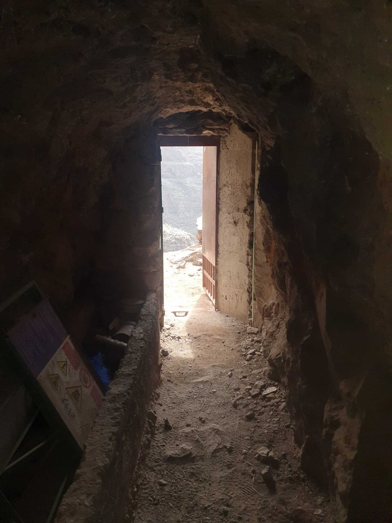
Just outside the tunnel, giants were waiting for me. The first challenge was to navigate through the rubble, the remains of digging the tunnel had to be left somewhere after all. The path led down several dozen meters through very unstable terrain. The next few kilometers of the trail led along a very narrow path on the edge of a deep 100-meter abyss. Sometimes, it was necessary to climb a few meters, and extreme caution was required at all times. Here, the path was easier to find, but keeping a cool head was often a challenge.
After saying goodbye to the giants, I still had a tedious 5km uphill hike to get back to my car, and this part was the hardest for me. Perhaps it would have been better to plan the route so that the climax was at the very end. Nevertheless, it was great! The views throughout the demanding trail are breathtaking, quite literally in my case, as my asthma is acting up today. Now it's time for two days of beach relaxation.
This report was published via Actifit app (Android | iOS). Check out the original version here on actifit.io


https://leofinance.io/threads/@polish.hive/re-leothreads-2rfviqn3p
The rewards earned on this comment will go directly to the people ( @polish.hive ) sharing the post on LeoThreads.
What a fascinating place, man! I would love to hike in such a place. The geography of my region is unfortunately less interesting haha, my country has amazing places, but everything is so far away... I end up being limited to venturing into the dark green woods of riverbanks I find around here, but no mountains, rocks, etc. Thanks for sharing!
Sound such a cool Place for relaxing and mind refreshing... Reminded me off my village... Exactly match same vibes with this place.. must be so Good experience!
Yeah, it really was! So calm in valleys. What's your home village?
Awesome. It's called "Murree" in northern side of my country.
Just googled it. I would definitely find some great hikes there!
Lasagna in a bag? Now that's a shock! 🤯
Right?! XXI century just doesn't cease to amaze me!
Do you have other food hiden gems like this one? 🤔
Truly a majestic tour, was you alone or there was someone with you in this journey ?
Just by myself. Most of this travel is alone, just meeting my friends living here from time to time
Hey great seeing your actifit report! Now is the time to support actifit's growth and services on hive blockchain.
Please vote for our DHF proposal via link here