it is holiday season in japan, the time of the year dubbed as golden week because of 4 national holidays cramped up in 1 week. people usually extends this holiday season and take longer vacations to enjoy some time off. i usually take this time to visit my family in the philippines, i just do not have the necessary funds this time.
instead of the usual breaks, we took it again to the mountains. the plan was established as early as the monday. a friend of mine hiked this mountain while we were hiking mt mito last week and she posted beautiful pictures of the place. my hiking friends immediately recognized the mountain and the plan took root. i inquired my friend regarding the hike experience, her legs are still in pain three days after, she said. this is the tonodake hike.
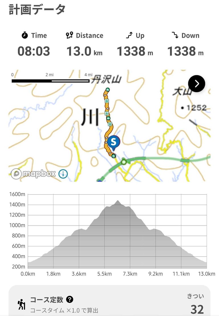
looking for a possible trail in our hiking app, yes it was confirmed difficult at a level of 32. tonodake rises at 1490 meters as one of the peaks of the tanzawa mountains. we chose this trail above for a slightly easier route. it was the easiest based on the app but easy meant 1338 meters cumulative elevation at 13 kilometers in distance. 8 hours was the suggested hike time. there was very little time to breathe and rest.
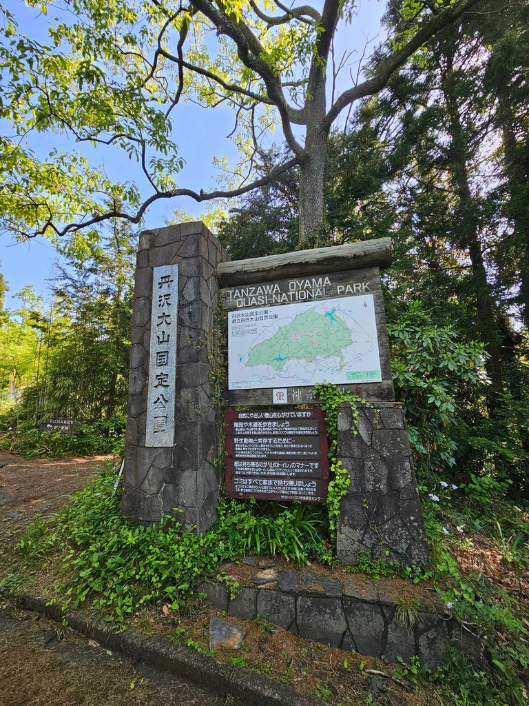
we were all scared a bit but everyone was on challenge mode come the day. we arrived at the starting site a few minutes passed 8 am. and to our surprise, a crowd of mountain hikers were gathering at the bus stop. this is one famous mountain indeed. but it was also one of those mountains were trail runners try to beat their times. these runners were dressed and packed differently. as we were carrying quite heavy bags, some pass by with virtually no bags in those light clothes for the run.
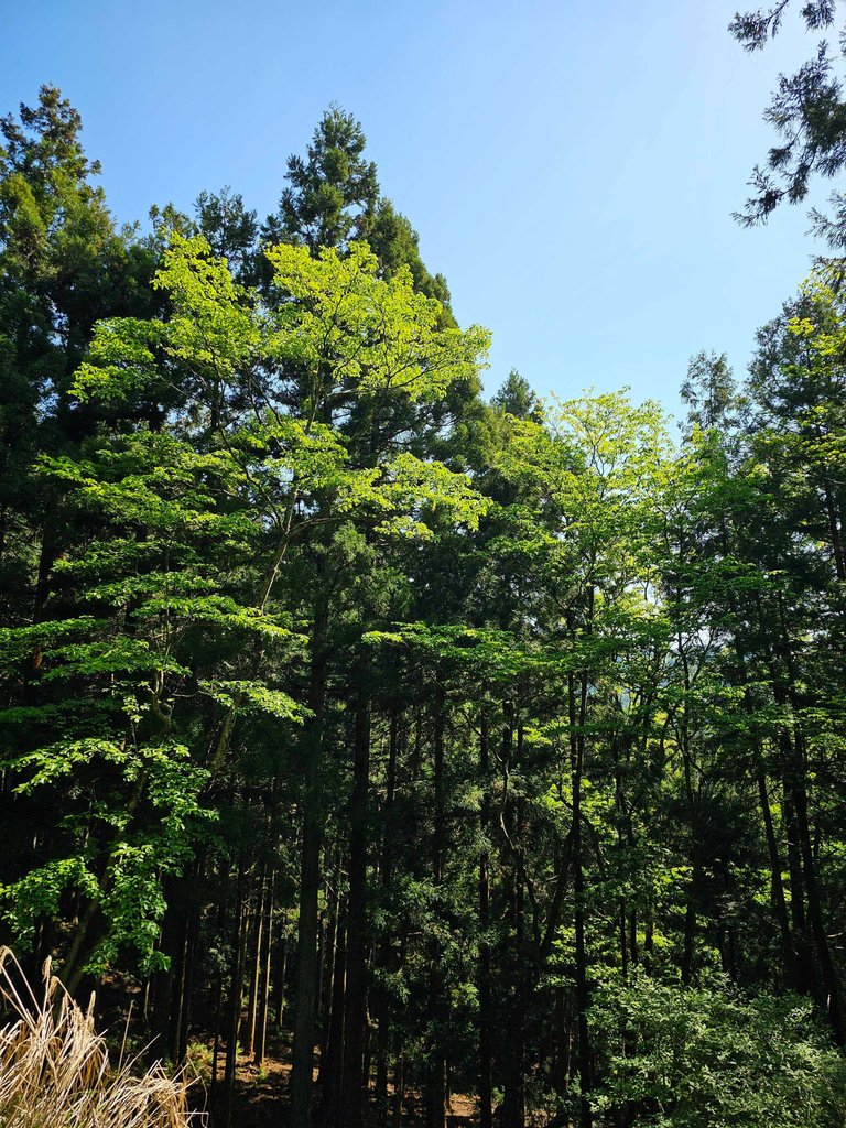
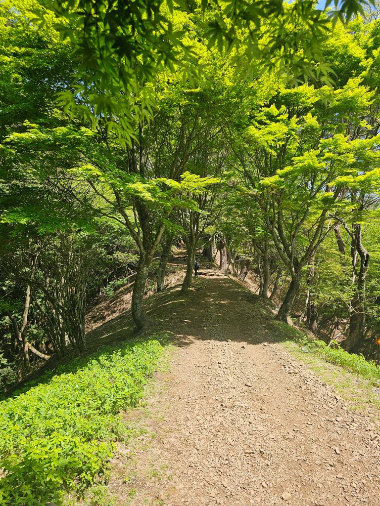
the mountain trail passes through some thick vegetation of lush green trees. these trees made the path cooler, ideal for some summer hikes.
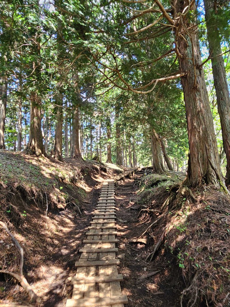
these wooden planks were also abundant along the trail. it was indeed difficult to climb on loose soil specially when it rains, so these planks help in those times.
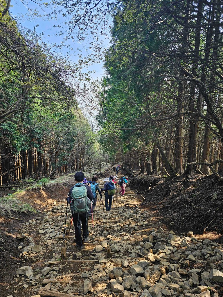
near the top, loose rocks made the hike difficult. it was easy to lose your footing, a misstep could be catastrophic.
flat sites like these are quite rare. the mountain is relentlessly uphill. and very very long. i told the group before this hike to bring flashlights just in case we don't get down before sundown. we were prepared.
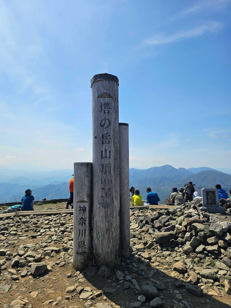
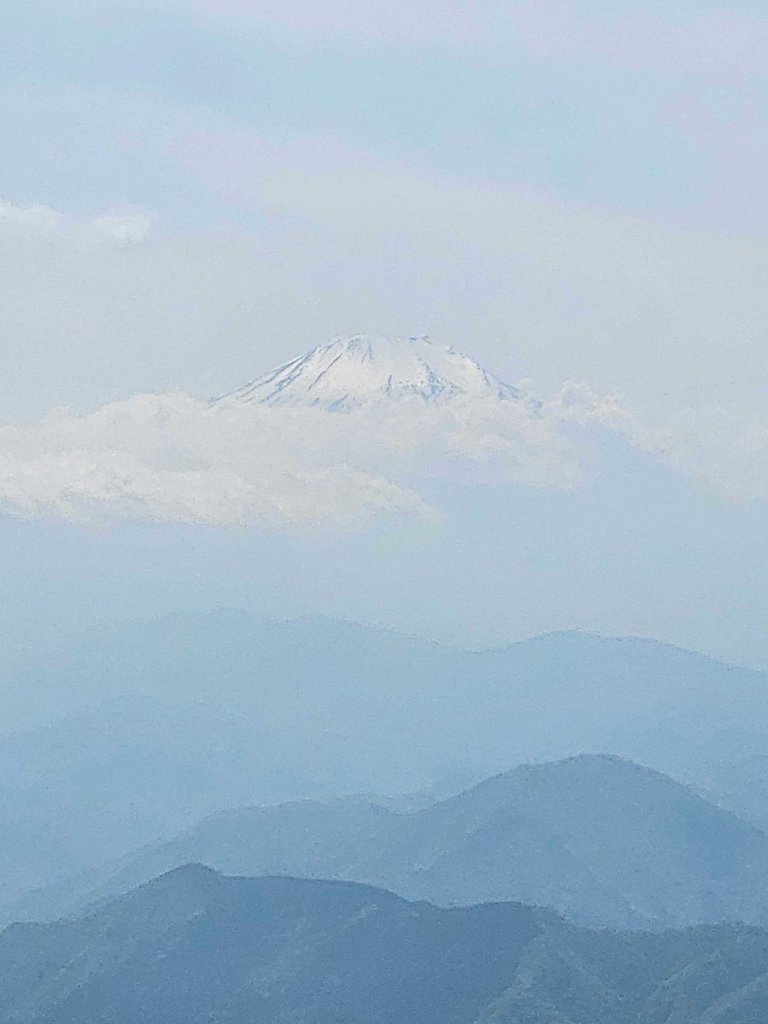
and then we reached the peak. it was such a site! the top was a wide area with lots of viewing and resting spots. we even saw mount fuji from the distance, still majestic.
this mountain hike was a trial for a great one we were planning this july. we planned to scale a mountain for days by then. if we survive mount tonodake, we will most definitely make it on that mountain as well.
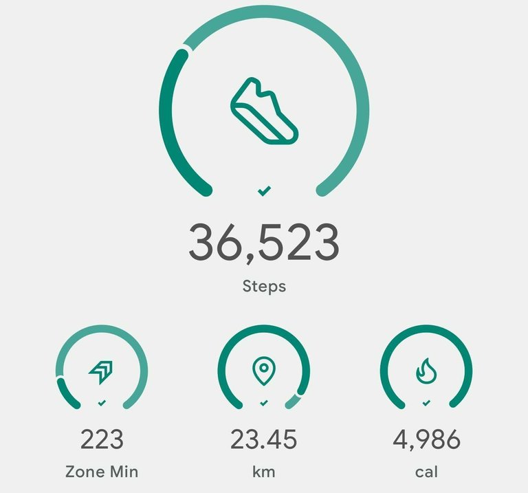
this was one hell of a walk. 36 thousand steps is something worth sharing. my legs were in a constant cycle of getting cramps and getting okay. i just kept on pushing, the cramps had no other choice but to get fixed. that was one hell a lot of calories burnt as well. that was one hell of an experience. that mountain looked scary on paper, very tiring to hike but so so so much fun to be on. let me share more photos in future posts.
as always, stay safe and keep on winning those hurdles.
AMPING KANUNAY MGA MAANYAG!
- -- ----- » «««- »» »-»» ł »» ««« ł «- ł «--« --- «« -» - ł --- ««-« ł «««- «« « «-- ----- -- -
all content is by yours truly unless otherwise specified
all photos are taken with a galaxy s23 ultra
This report was published via Actifit app (Android | iOS). Check out the original version here on actifit.io


Height168.0 cm |  | Weight71.7 kg |  | Body Fat20.6 % |  |
Waistcm |  | Thighscm |  | Chestcm |  |


Congratulations, your post has been added to Pinmapple! 🎉🥳🍍
Did you know you have your own profile map?
And every post has their own map too!
Want to have your post on the map too?
kasuyaaaaa man!
nah lisud. ahahahah
Congratulations @itz.inno! You have completed the following achievement on the Hive blockchain And have been rewarded with New badge(s)
Your next target is to reach 15000 upvotes.
You can view your badges on your board and compare yourself to others in the Ranking
If you no longer want to receive notifications, reply to this comment with the word
STOPCheck out our last posts:
Such beautiful places for hiking is amazing, I would also love to visit these type of places.
i'm sure there are lots in your place too
I am always amazed to see people go hiking. You always make sound like fun, but I know if I try it my legs will have lots of painful stories to tell 😂😂😂.
Anyways, keep doing what you love, and keep keeping fit.