The Portolan Maps are a series of maps of the world or of portions of the world that were developed starting about the end of the 13th century of the common era. Before those maps the maps that were used were derived from the work of Claudius Ptolemy. The difference in accuracy between the portolans and the Ptolemy's maps is abysmal. Ptolemy's maps were rudimentary for our standards, the portolans were very accurate. The issue is that the portolans seem to have appeared from nowhere. There was not an evolution in map making during the Middle Ages. One of the theories that exist is that the maps were found by the Western world when Constantinople was sacked in the year 1204 CE by the 4th Crusade.
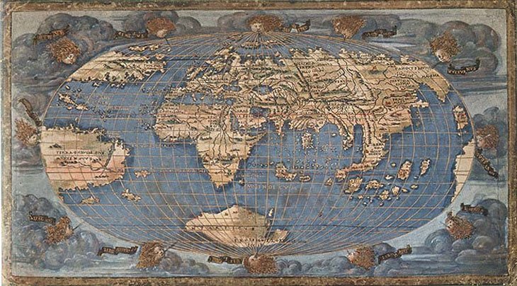
Accuracy is not the only issue with these maps. To cite one example of another issue, Antarctica was discovered in 1820. However, it shows up in several of the portolans! The maps by Francesco Rosselli (1508), Oronce Fine (1531) and Merctor (1538) show clearly Antarctica. How is this possible?
To follow on the theory that states that the maps were found in Constantinople, supporters of this theory say that an unknown culture did map and circumnavigate the world millennia ago. Their maps were stored and preserved in Constantinople and made their way to the West after the fourth Crusade. I do not have the answer to this enigma, however, there has to be a logical answer that explains how does Antarctica appear in maps, before it was discovered.
Credits