This Post was created according to the contest of @anomadsoul and your post "CONTEST: My 2018: A tour around my town - 100 SBD in Prizes"
Link: https://steemit.com/my2018/@anomadsoul/contest-my-2018-a-tour-around-my-town-100-sbd-in-prizes
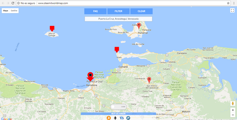
My town is located on the coasts of eastern Venezuela, next to the Caribbean Sea, wonderful people, good food and extraordinary places.! Its name, "Puerto La Cruz".
We can enjoy the beach and the mountains, with tropical climates to enjoy the beach all year round.
Near Puerto la Cruz, 20 minutes approximately north direction, we have the national park "Mochima", formed by several islands and of course by many beaches, some better than the others.
In the following photos you can see part of the beaches that this national park has, specifically it is an island called "Arapo", also part of the canals in the city of "Lecheria" and its mansions, and part of what we can get in the beach as food that are lobsters, you can also eat fried fish, tostones with striped cheese, mayonnaise and ketchup, fried arepa of these last I have no photo of my authorship, and more importantly, its fauna.

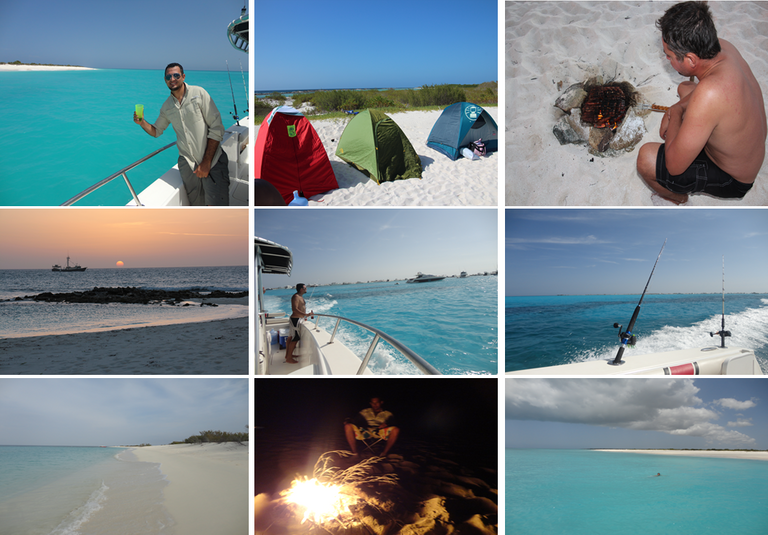
In the next pictures, they are dedicated to an island located north-west of the mochima national park, called "La Tortuga", so called because of its shape (on the map you can see its location) ; this island is one of the most wonderful in Venezuela, a virgin island, with crystal clear water; in that opportunity we went for two days and we stayed in tent, we have to go prepared with provisions, plenty of water, ice, food and long-distance intercom radio in case of any unexpected, we thought we had taken everything necessary but when we arrived we gave mind that we had forgotten something important, it was fire. If you want to spend a relaxing day, go snorkeling, I recommend this island.
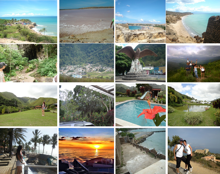
To finish, I leave a series of photos of beaches and mountains located north-west of the map, the first row, are the photos of the peninsula of Araya, with its water rich in salt and its constructions of the year 1800. In the second and third row is the town of caripe, at almost 1000 meters of altitude, located in a valley with a cold climate, has many inns, waterfalls and the cave of guacharo. And the last row are some photos of the island of Margarita, the largest island of Venezuela.
This post is a small sample of what you can find in Oriente venezolano. I hope you enjoyed the photos.
All the photos are from my author!!!
Special thanks to @blocktrades for their contribution in this contest, whose main purpose is to interact and learn more about the town around the world.
Realmente las playas de Venezuela son hermosas en toda su extensión, !gracias por publicar y exaltar la belleza de nuestro hermoso país¡
Gracias!!! Puedes participar en este concurso!!! El link esta al inicio de este post, alli puedes ver las reglas!!! Así conocemos un poco mas tu pueblo!!!
Thank you for taking part in this months #culturevulture challenge. Good Luck.
Thanks!!!
Congratulations, Your Post Has Been Added To The Steemit Worldmap!
Author link: http://steemitworldmap.com?author=josedasilva
Post link: http://steemitworldmap.com?post=my-2018-a-tour-around-my-town-el-oriente-venezolano
Want to have your post on the map too?
Las mejores imágenes! Lindos paisajes.