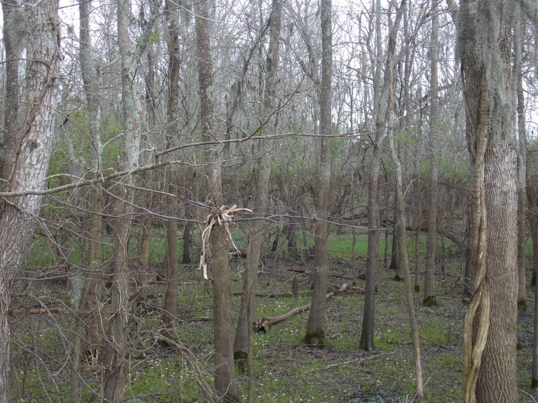
Hello again Steemians! Welcome to part three of five in my photo tour of Brazos Bend State Park in Texas! Like many areas of south Texas, Brazos Bend was mostly submerged in the floods following hurricane Harvey. In the first photo you can clearly see what is locally referred to as "the death line". This is the point at which the flood waters peaked and stayed for an extended period of time. Debris and sediment from the flood waters gathered on the leaves of the plants and trees effectively killing them. This creates the clear line of dark brownish colors below normal vegetation. At the place where I am standing the water height sustained at well over 6' (1.8 m), and would have been over most peoples heads! As you can see, nature is resilient and these trees and plants are recovering nicely.
(All photos are my creative works. Shot with a Nikon Coolpix L320. All rights reserved.)