I have had a lot of questions about the lake by my new homestead called Keystone Lake. The scope of this lake confuses people, so I decided to post some pictures to help explain the size of this lake.
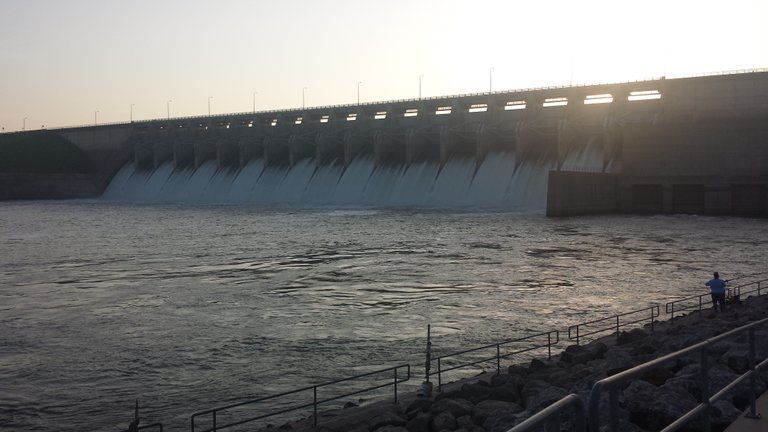
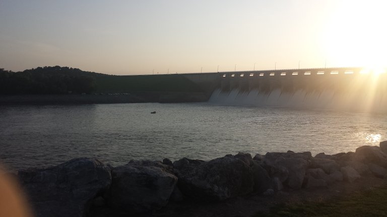
Here is the spillway of this dam and it is about 200 yards long on the concrete part, the entire dam is about 1/2 mile long with a road over top.
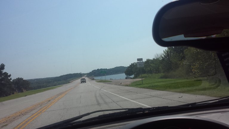
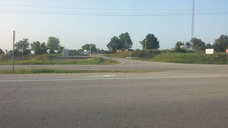
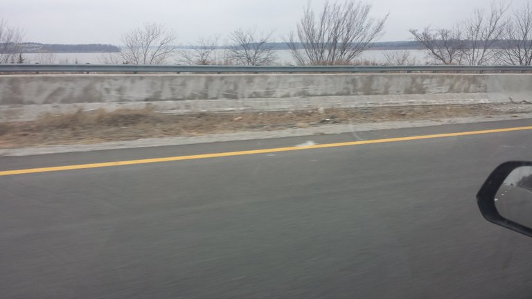
The road view is interesting in that it is deep water to the west, and a 200 foot drop to the east. Here is what it looks like:
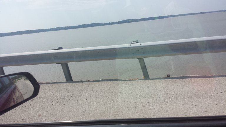
This it a view off of the dam:
Now I got you a picture of the overall dam:
The best paddle fish location in Oklahoma is below this dam, they pull fish over a hundred pounds out regularly here.
That is a full sized bass boat on the river....
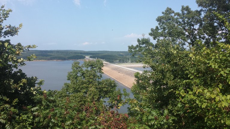
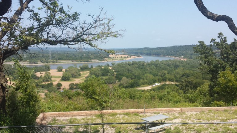
The lake us shaped like a V, with the dam at the base of the V. This is the lake behind the dam:
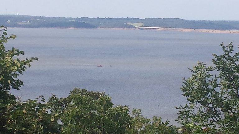
The bridge on the top of this picture crosses the north leg of the lake, which extends 45+miles to the north west. The other leg to the south is slightly shorter at 40+ miles. The lake is about 24,000 acres of water, depending on how full it is.
There actually is a Jellystone Park close to Mannford Oklahoma, that is a water park for kids. Just east of town, it looks like this but is closed for repairs right now.
The south fork of the lake by Mannford about 7 miles upstream from the dam:
Only 30 more miles of lake to go on this branch, LOL.
Thr hydroelectric power house is the cement blockhouse on the right:
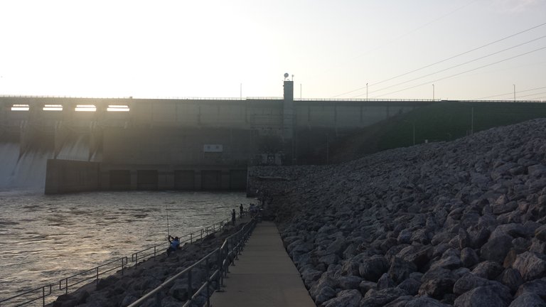
That is not a chimney, it is control access for the spillway from the blockhouse.
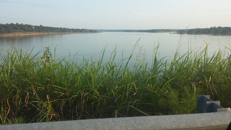
Here is a view off of the north fork crossing bridge:
The lake (about 25 miles up the north fork of this lake) is close to my new property. It is over a mile wide there, and about half a mile from the property to the lake. I have had several people ask what I will do, in a survival situation, when the lake is fished out. I honestly don't think that will be a problem with this much water. If things do crash, I can sail to the dam, then about 10 miles up the south fork, and I will be at my Sister's house. She is also by the lake, LOL.
The river east of the dam is also good fishing fun:
Tulsa is about 10 miles east of this picture.
I hope you liked the picture tour. Stay blessed!
How old the structure is?
Posted using Partiko Android
It was built in the late 1960's by the Corp of Engineers for flood control.
That is why Jellystone Park is closed, they held back a massive amount of water, recently and flooded the Park. But they save a lot of lives downstream
:)>Yeah. Thanks for your kind information.
Posted using Partiko Android
No problem, happy to answer. It is a nice lake.
♡♡♡♡Dam!
Posted using Partiko Android
Exactly, LOL!
:)>Nice and I don't think it would get fished out. I will have to show you some lakes and dams near my place.
Posted using Partiko Android
I look forward to it! Send me some cool, while you are at it, LOL! Janton was asking, and Hananali wanted to see too.
:)>No problem though will be a while as I am away for a week or two interstate.
Posted using Partiko Android
You've gone walkabout? Sounds good, enjoy! See ya when you get back.
♡♡♡Thanks mate.
Posted using Partiko Android
You know where I will be, LOL! Watch out, when you get back, HF21 is due in a week....
>:(Always fascinating to see how man tries to dominate nature. Wondering about the HUGE and DEVASTATING changes to the environment this one dam created. Appreciating the scale and the feeling (and your pics x) but worrying about what we do to Mother Earth.
Leading the curation trail for both @ecotrain & @eco-alex.
Together We’re Making This World A Better Place.
Click Here To Join the manually curated trail "@artemislives" to support quality eco-green content.
@ecoTrain
Well there are no salmon being blocked, so there isn't that worry. Eventually, it will silt in, and they will loose the ability for flood control, but will make some impressive farmland in another couple of centuries.
Lots of new fish habitat, above and below the dam, and the paddle fish are from a hatchery. There wasn't enough water for them here originally.
The hydroelectric power is the cleanest we have, better than wind and solar; because it is on demand.
These lakes (there are several) were added to avoid any chance of another dust bowl in this region , which was devastating to just about everything!
This part of Oklahoma is calked "Green Country" now, in part because of the moisture.
This dam is part of the navigation channel water feed, for low cost transportation from the Gulf.
So some of the environmental impact is a positive here too. This dam saved a lot if life during the recent rains, it also limited damages down stream.
:)>Sir smithlabs! Where is our friend to tell you how dumb you are and how far off you are on your dumb plans? lol. That is ONE good sized lake! It must be pretty darn deep too. I think it would take a few years to fish that out and by that time hopefully civilization would be back up and running.
They can breed faster than I can catch them, LOL!
I wonder if Civilization can come back from this? This is all under the direct control of Satan, and he does NOT intend that we should recover...ever!
Watch to the East, my Friend!
:'(well yes, exactly. It depends on if the next crash is going to be part of the End Times, really bad stuff or just a bump in the road that we'll recover from. Won't know until we go through it.
I think they intend to finish us, or at least if you believe them.
:)>Something has happened to them, they were never this vicious before!
They know this is make or break, they MUST win this time, or we have a chance of fixing their mess!
They will kill, lie, cheat, and steal; to keep political power! They are 100% committed to Satan, and his goals.
>:(Well, I think it will be close but I think Trump will pull out a squeaker.