The world's top traditional map known as the Mercator map, may be the most viewed map to describe our planet, but this map is also believed to be less accurate because Antarctica and Greenland are not very good shape.
Now, a Japanese artist and architect believes he has solved a 447-year-old problem with an origami map that accurately represents the earth and the earth.
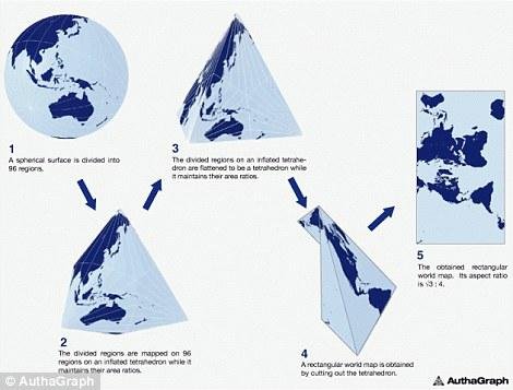
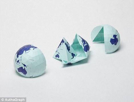
To create a proportional map, Hajime Narukawa split the globe into 96 triangles that will be leveled and made tetrahedron or 3-dimensional geometric shape.
This allows an image to be 'opened' into a fixed rectangle by maintaining the proportion of an area.
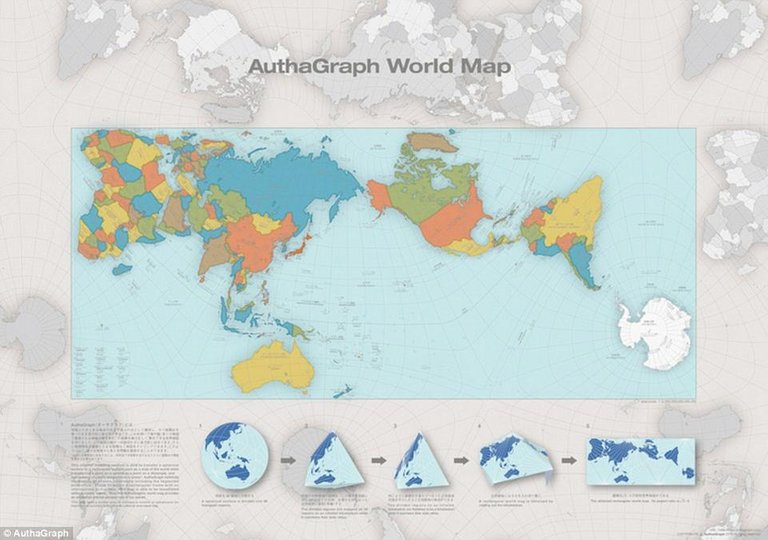
Map Narukawa won the Grand Award of Japan as the best design at the 2016 Good Design Award.
Gerardus Mercator is widely known as a creator of maps currently accepted by the world, he also makes the word "atlas" to describe a collection of maps.
In 1569, Mercator introduced his map to the world using a method called Mercator projection.
This process projects the world into a cylinder where all parallel lines of latitude have the same length as equatorial lines, commonly used as charts in seas and certain climatological maps.
Although used throughout the world, it is known that the map is a very inaccurate map, originally designed to help seafarers navigate the world.
To provide an accurate picture, Narukawa created a different method with the goal of creating a map where the land and sea areas are accurately sized.
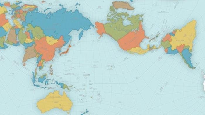
The triangular map of the world is called the AutaGraph World Map, made by splitting the circular surface to 96 triangles, making it a tetrahedron while maintaining the proportion area and then making it a rectangle. This world map can be arranged from different directions without any visible creases. From the preparation of the map, a new world with triangles, squares or rectangular parallels that can be framed with various areas at the center. Source: Narukawa on AuthaGraph website
He told Spoon-Tamago a few years back that this map might not be very accurate. The large portion is dominated by attention with East and West relations. Now, there is the issue of climate change, which makes glaciers in Greendland melt and the oceans have changed.
Map lovers can print and fold the map to create their own proportional maps. While this map provides the land and sea of space it should be, it is not yet perfect.
This map takes further steps to increase the number of solutions to improve accuracy to be a fair map. Mercator's projection gives the right formation for the land, but it makes the size of the land in the north become larger. For example in the Mercator projection, North America is as large as Africa and Greenland can be comparable to Africa.
Though the reality of Africa is greater than both. In fact, North America can enter Africa and still have room for India, Argentina, Tunisia and some others.
Reference source: