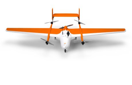
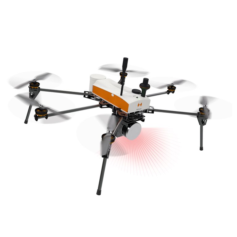
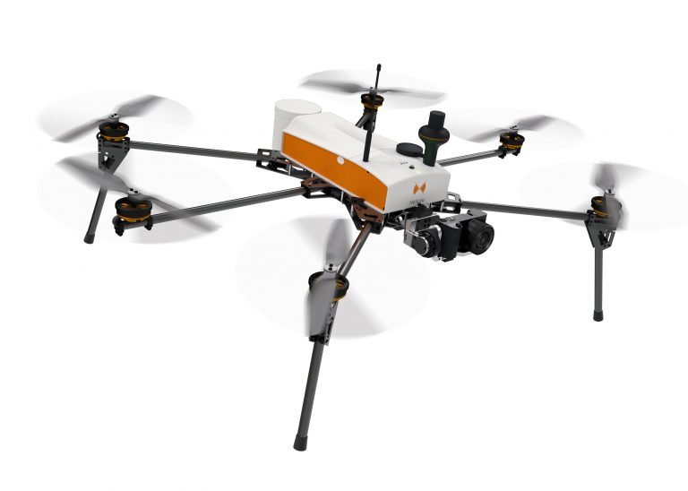
SuperFox6
the LiDAR and photogrammetric drone surveyor
Screenshots
Hunter's comment
The SuperFox6 is a solution for precision measurement.
It is designed to ease surveying, and it can also carry out photogrammetric missions.
Pros.
It can carry out a wide variety of topographic surveys up to 150 hectares (370 acres).
Wind resistance of 55 Km / h.
It has the ability to fly higher.
Access a 3 cm accuracy without support point.
Cons.
Non for this hunt.
Link
Contributors
Hunter: @adahmiracle

This is posted on Steemhunt - A place where you can dig products and earn STEEM.
View on Steemhunt.com
Congratulations...!
This Hunt has been Approved by the Steemhunt Moderation Team!
Note:
This hunt was "exceptionally approved, but shortened URLs are not among the 4 valid links in Section 3 of the Publishing Guidelines and therefore cannot be a consideration unless a mod/team member uses them".
Please read our posting guidelines. If you have any questions, please join our Discord Group.
I think we all need drones in our life's & this one has lots of cool features, it comes with lidar and Photogrammetric surveyor system with HConnect Technology which is cool and a very interesting looking drone with 6 carbon propellers and brush-less motors. thanks for sharing this cool drone with us. Awesome Hunt
SuperFox6 is an amazing gadget. It gives an amazing accuracy. It can do topographic survey of 370 acres along with handling wind resistance of 55 km/hr Great hunt
Thank you...
With a new engine power generation offering a 20% increase in wind resistance, it is even more powerful. It allows you to fly in extreme conditions for more mission opportunities.
Thanks alot
This is undoubtedly a very useful drone since it gives us the possibility of doing remote soil studies and studies thanks to the fact that it can perform terrain scans using its integrated photogrammetric system. An excellent drone that will be of great help to architect engineers and even farmers.
Great hunt.
Thanks
Pros:
Cons:
Thanks
Amazing Hunt @adahmiracle. This is the best drone for earth survey. I am a CIVIL ENGINEER. This drone is also used in construction sites.
What a cool way to survey
no more carrying of survey material up and down
Thanks very much.
Congratulations!
We have upvoted your post for your contribution within our community.
Thanks again and look forward to seeing your next hunt!
Want to chat? Join us on: