During the flight from China to England, @mobbs made many mysterious photographs from the window of the plane. I do not have answers to all the questions that @mobbs listed in the description own trip, but I'm ready to clarify the situation with mysterious direct lines on the territory of Russia. These are not traces of ancient civilizations and not proof of the basing of UFOs on the territory of Russia, but it is still an impressively interesting story.
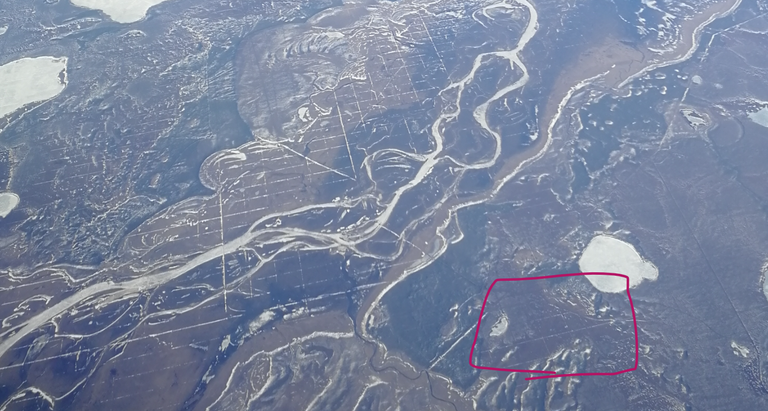
Image from:The Russian Whale & Other Mysterious Geography from the Frozen Deserts of Asia-Author:@mobbs
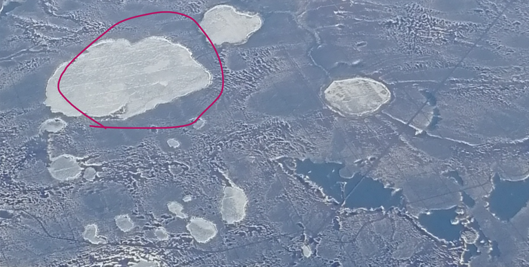
Image from:The Russian Whale & Other Mysterious Geography from the Frozen Deserts of Asia-Author:@mobbs

Image from:The Russian Whale & Other Mysterious Geography from the Frozen Deserts of Asia-Author:@mobbs
In Russia geophysical studies have always been and are being conducted at the present time.. In fact, these straight lines are the result of the work of seismic reconnaissance, this is the case:
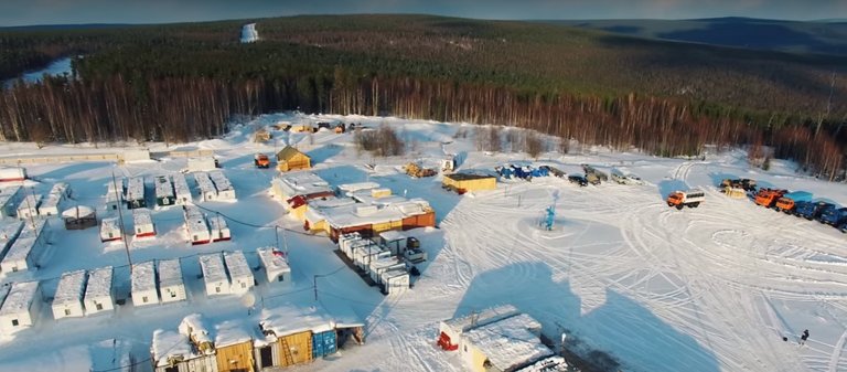
Image from: Youtube.com "The science 2.0"
Geophysical research is an expedition of a large group of specialists and equipment to the place.
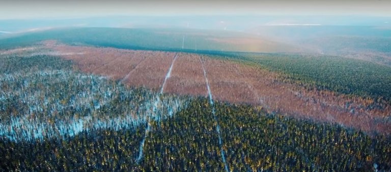
Image from:Youtube.com "The science 2.0"
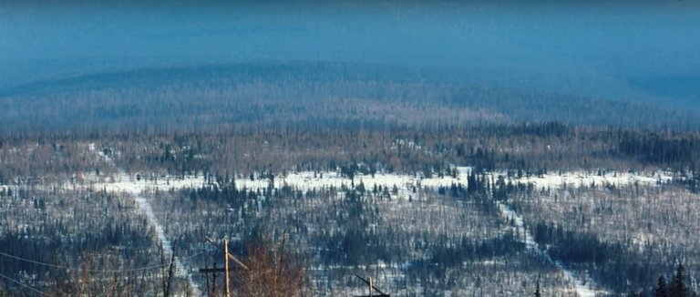
Image from:Youtube.com "The science 2.0"
If the terrain is covered with forest, the clearings are laid, they are called profiles. These profiles @mobbs observed from the window of the plane.
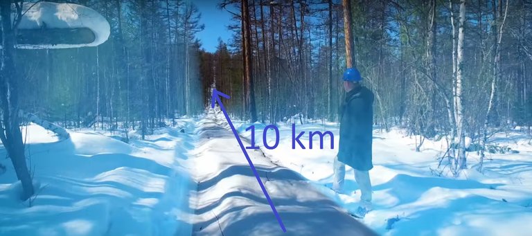
Image from:Youtube.com "The science 2.0"
The length of one profile can be up to 10 kilometers.
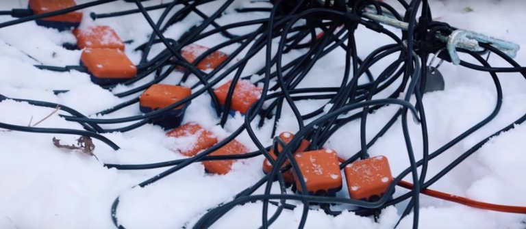
Image from:Youtube.com "The science 2.0"
A cable with seismic sensors is laid along the profile.
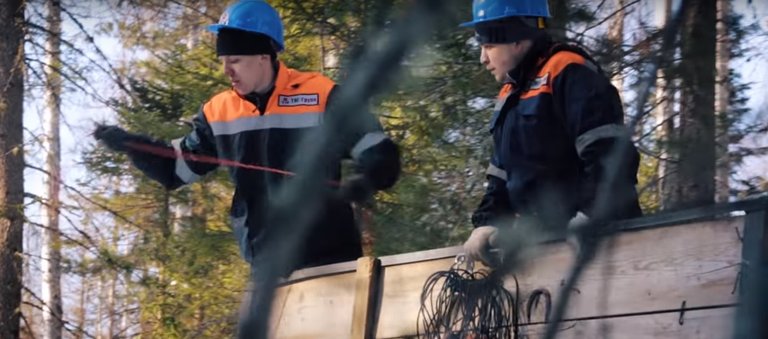
Image from:Youtube.com "The science 2.0"
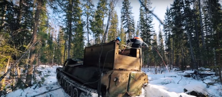
Image from:Youtube.com "The science 2.0"
The laying works are carried out using caterpillar technology.
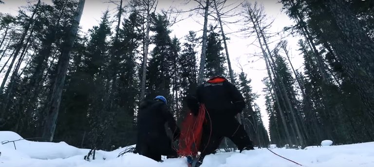
Image from:Youtube.com "The science 2.0"
In hard-to-reach places it is necessary to go on foot.

Image from:Youtube.com "The science 2.0"
Walk in the fresh air at thirty degrees of frost with sixty kilograms of cable behind.
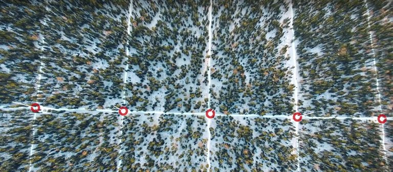
Image from:Youtube.com "The science 2.0"
It is important to note that there are lines vertical and horizontal. Vertical lines are needed for cable routing. Horizontal lines are needed for driving a driling mobile rig.
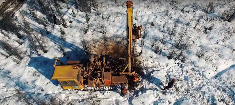
Image from:Youtube.com "The science 2.0"
In the drilled nine-meter wells, explosives are laid.
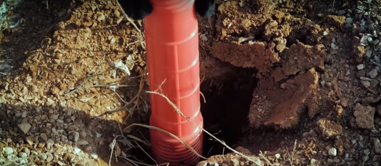
Image from:Youtube.com "The science 2.0"
After laying, all cables with sensors are connected to the mobile sesmic station.
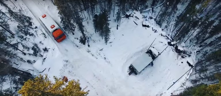
Image from:Youtube.com "The science 2.0"
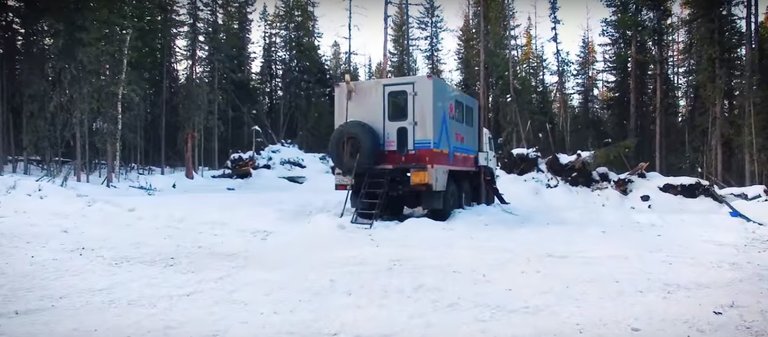
Image from:Youtube.com "The science 2.0"
After the sesmic station is ready to fix seismic oscillations, a command is given to blast the charges in the wells.
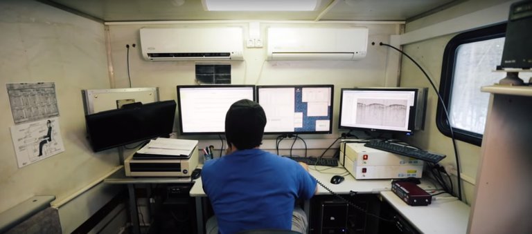
Image from:Youtube.com "The science 2.0"
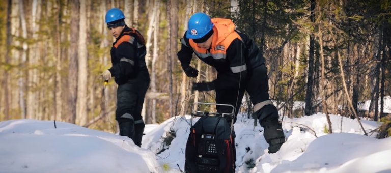
Image from:Youtube.com "The science 2.0"
Boom!!!
The blast wave goes deep into the earth, is reflected and returns. Our sensors are already ready and fix the reflected blast wave of it over the entire area on which we arranged them. The degree and speed of reflection of the blast wave form a 3D mapand determine the types and depth of occurrence of minerals and hydrocarbons. Based on the results of such studies, an assessment of mineral resources is carried out and projects are being developed for the development of mineral deposits.
I hope now you will not doubt the origin of these lines when you see these lines from the window of the plane 😊
References Used:
https://en.wikipedia.org/wiki/Seismic_tomography
https://en.wikipedia.org/wiki/Geophysics
Youtube.com "The science 2.0"