I've been reading some people claiming that the earth is flat because it looks flat. It turns out the curvature is there you just need to look. From an airplane, if you have a clear horizon you can actually see a slight curvature, although there is a noticeable drop in the horizon compared to when seen from sea level. But nearer the ground the curvature manifest's as a change in the distance to the horizon, as your elevation changes. This can be readily seen on a clear day as was the case in the following images.
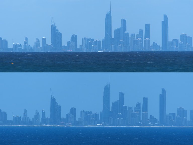
2 views of Surfers Paradise from a location 20 km away from an elevation of 4m (top image) and 29m (bottom image). Click here for larger image.
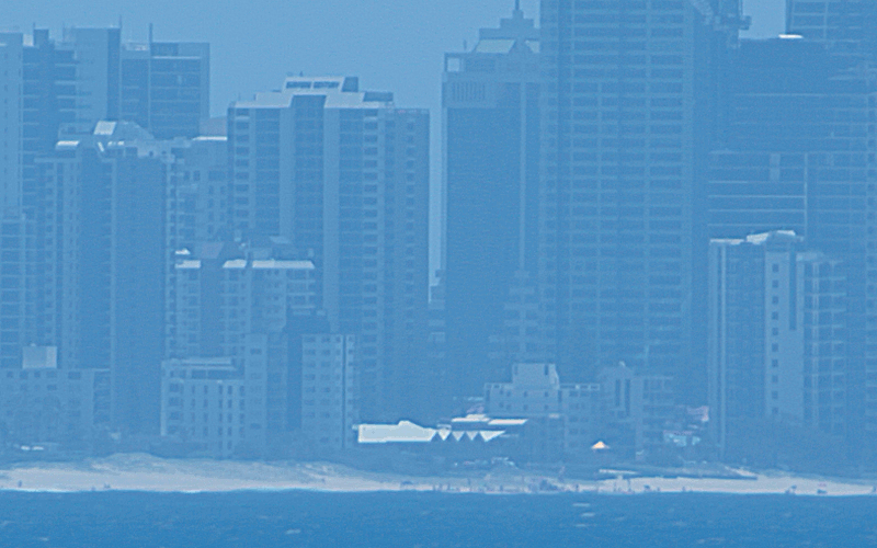
The above images were made of Surfers Paradise, Queensland, Australia from both the top and bottom of a small hill located near the seaside town of Coolangatta. Using Google maps I was able to determine the location to the small white building as 20.0km from the hill I was photographing from. Here is a crop from the center of the image from the top of the hill, showing the small white building. You can clearly see that the sea horizon blocks the beach and some of the buildings in the right-hand image.
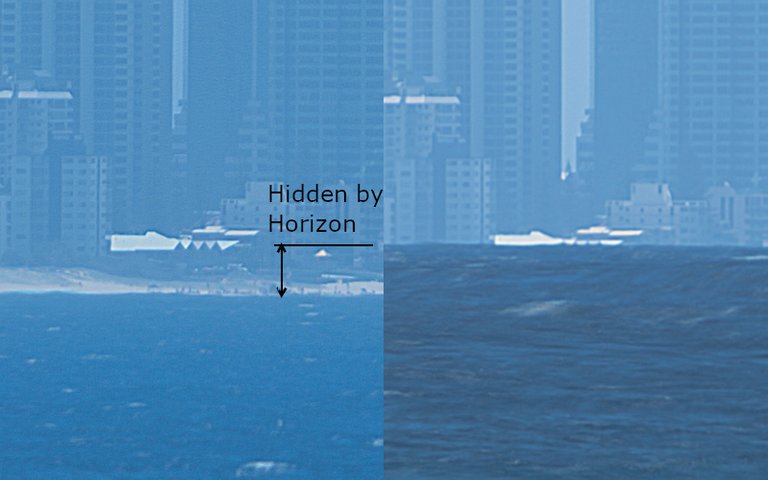
Crops from the above images showing the same part of Surfers Paradise from 20km at observer heights of 29m (left) and 4m (right)
The website Metabunk.com has a useful earth curve calculator and it is interesting to compare the calculations from this and what we see in the images above. Inputting an observer height of 4m and a distance of 20km, we see that the horizon should obscure anything below 13m above sea level. If we add to that the slight effect of refraction that value reduces to 10m. If we look at that image we do observe that all of the beach, as well as much of the white roofed building, is obscured. This does indeed look like everything below 10m above sea level is obscured. When we the redo the calculation for an observer height of 29m we find that should be no obstruction of the beach by the horizon, which is indeed what we see.
As a bonus here is an animated gif that blinks between the 2 images.
Relevant Data for Observations
| Location | Latitude | _ | Longitude | _ | Elevation |
| Target (midpoint of Surfers Paradise Skyline) | 28°00'38.6"S | 153°25'54.9"E | estimated 10m at roofline | ||
| Viewing Point - Top of Hill | 28°09'58.3"S | 153°32'05.4"E | 29m | ||
| Viewing Point - Bottom of Hil | 28°09'56.0"S | 153°32'08.4"E | 4m |
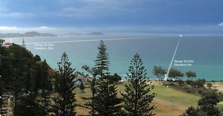
Here is a wide angle image of the 2 viewing points and the target. The distance from the viewing points is shown on the image and is just slightly over 20.0km.
Suggested Links
Please check out youtube channel Soundly for some remarkable footage showing earth curvature in the Lake Pontchartrain Causeway. Also, check out Mike to Globetard's Channel for more images of the causeway.
Ok... Terrylovejoy, unfollow, he is one of those globe-people :D
He is such a ball-head :D
I think the flat earth term is globetard :)
Globetard.. LOL
Hmm... Interesting stuff.
Posted using Partiko Android
This post has been voted on by the SteemSTEM curation team and voting trail in collaboration with @utopian-io and @curie.
If you appreciate the work we are doing then consider voting all three projects for witness by selecting stem.witness, utopian-io and curie!
For additional information please join us on the SteemSTEM discord and to get to know the rest of the community!
Great. Let me share this to our fb friend.
Congratulations @terrylovejoy! You have completed the following achievement on the Steem blockchain and have been rewarded with new badge(s) :
Click here to view your Board
If you no longer want to receive notifications, reply to this comment with the word
STOP