This hike deserves a 10/10 rating for not only the gorgeous views and the fantastic features but the ability to turn up the challenge as you see fit. Stanley Glacier Trail head is off of Highway 93, connecting the Banff-Lake Louise portion of the Trans-Canada Highway to the town of Radium Hot Springs. Arrive early or mid day as parking can be tight on weekends. It's well worth the drive to Kootenay National Park as this trail has an active glacier, waterfalls, granite cliffs, scree, flora, fauna and a raging stream.
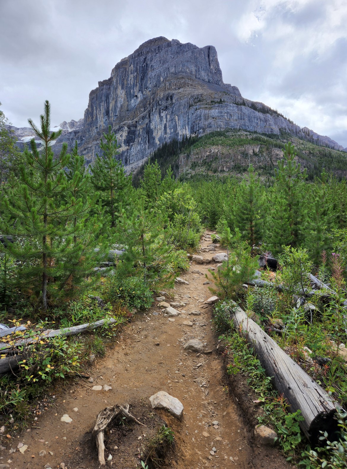
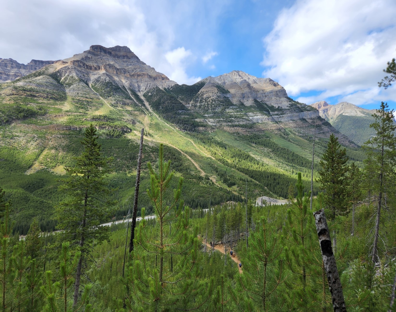
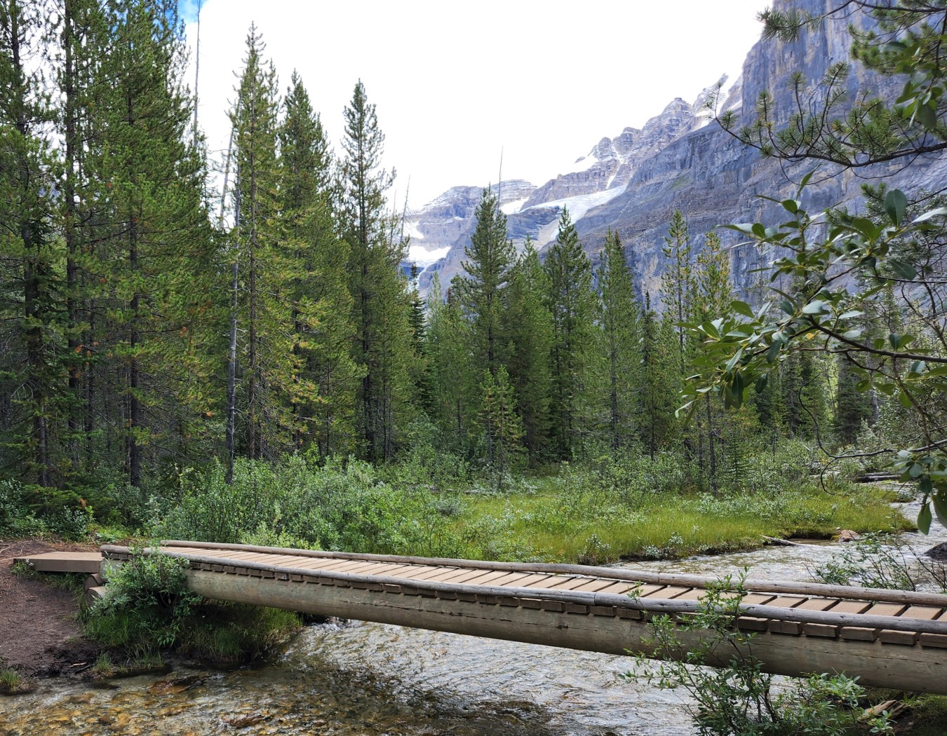
The hike starts by crossing a river and then goes up, up a few hundred meters above the highway. The forest is new growth as a couple of fires took this area out. The path does switchbacks and is moderately challenging.
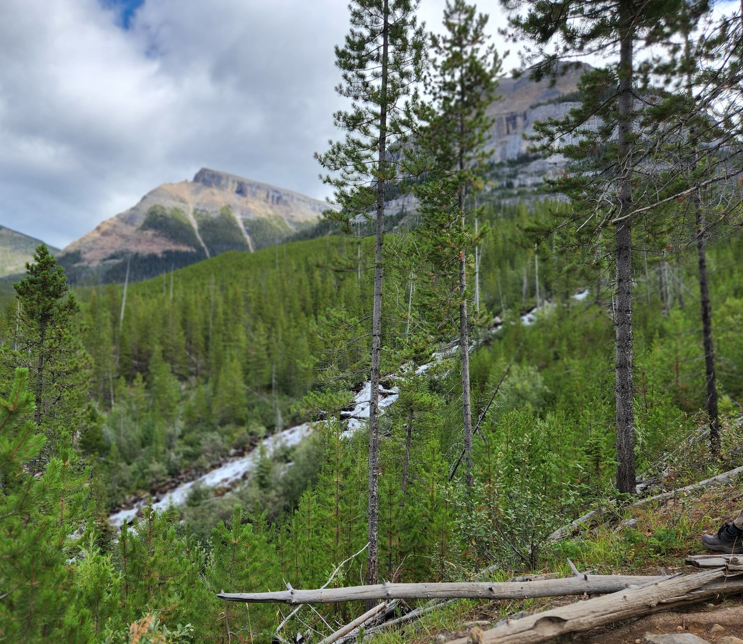
The next photo was a mild disapointment as it is slightly out of focus. The stream here ran at almost a 45% angle which I didn't think was possible, but this is not a trick. The tree in the middle of the photo is as straight as an arrow.
You can see some of the burnt trees jutting out from the new growth. The path has risen steadily since leaving the parking lot next to the road. Looking back is much more interesting than looking forward, we took a few breaks for water and to catch our breath.
At the start of the alpine valley the trail crosses the glacier fed water. You can see the ice in the back ground, it's not just Stanley Glacier than feeds this now calm stream. It was late August in the midst of a heatwave, after that climb we were sweating.
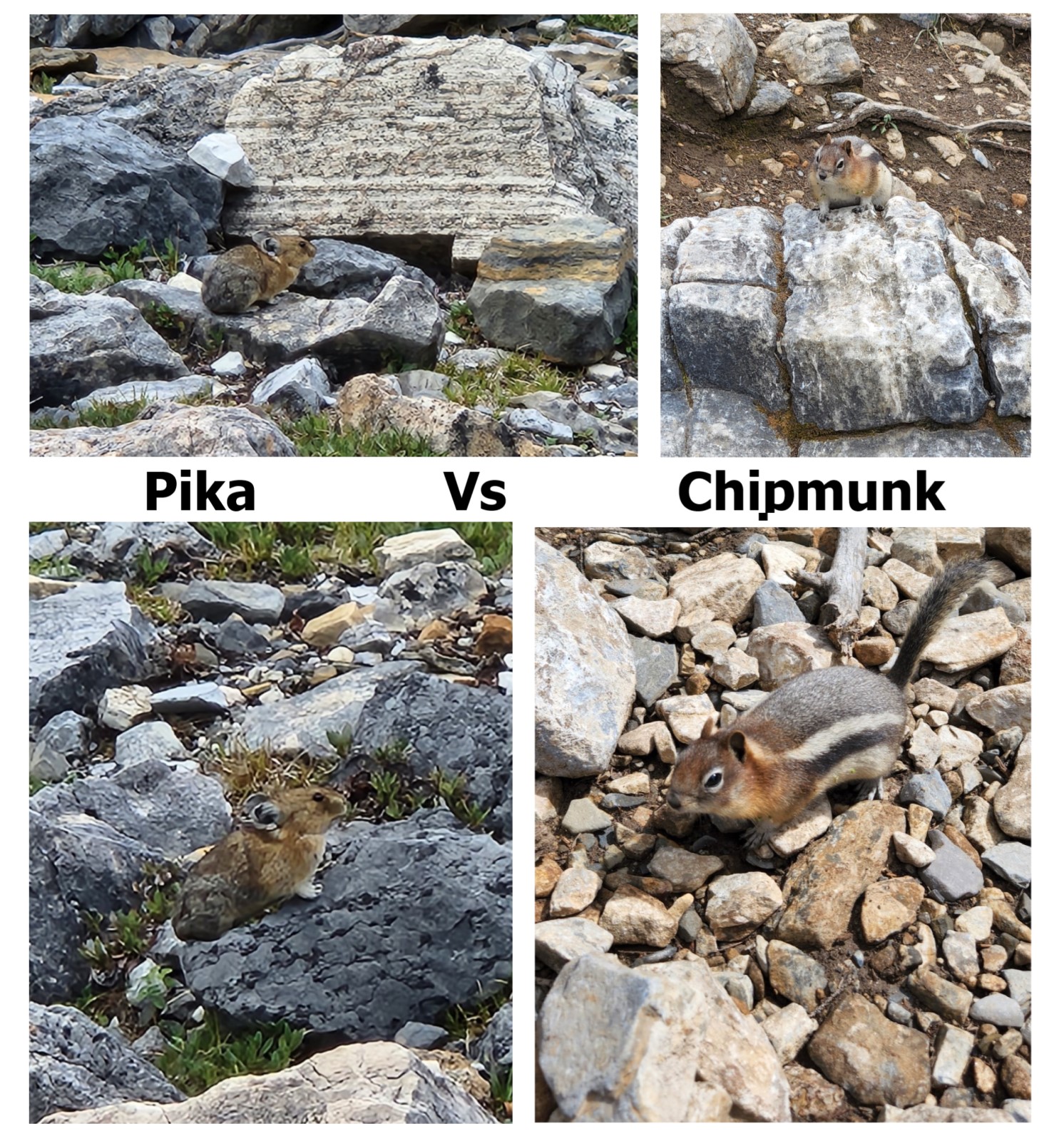
There are bears here, but we only saw Chipmunks, birds and Pikas. The chipmunks lived in the forest, the Pikas live above the treeline. They scream Pika and don't get as close as the Chimpmunks, it's probably the critter Pikachu was named after.
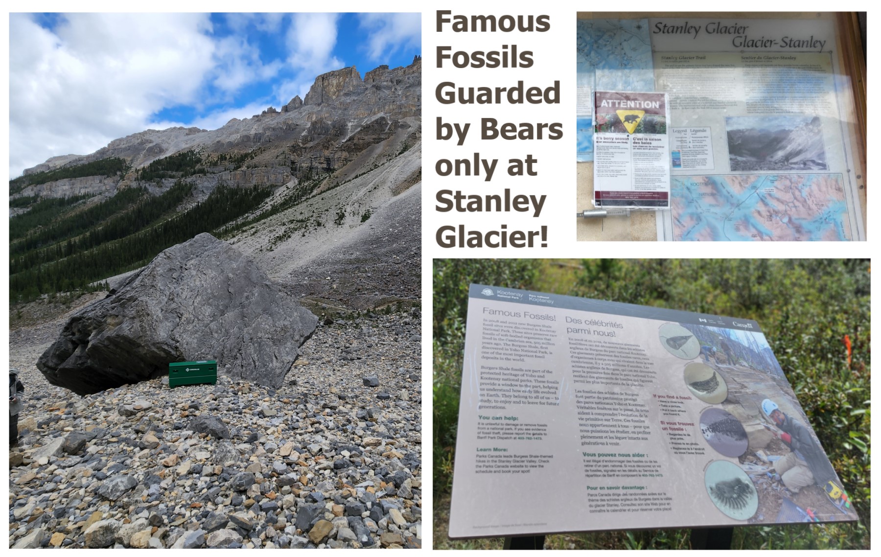
There is a fossil hike here, it's part of the Burgess Shale. They offer a 10km (345m vertical) guided tour where you can learn all about the fossils, look for them, see some stored in the green box hidden behind a rock from the main trail all while being protected from the bears.
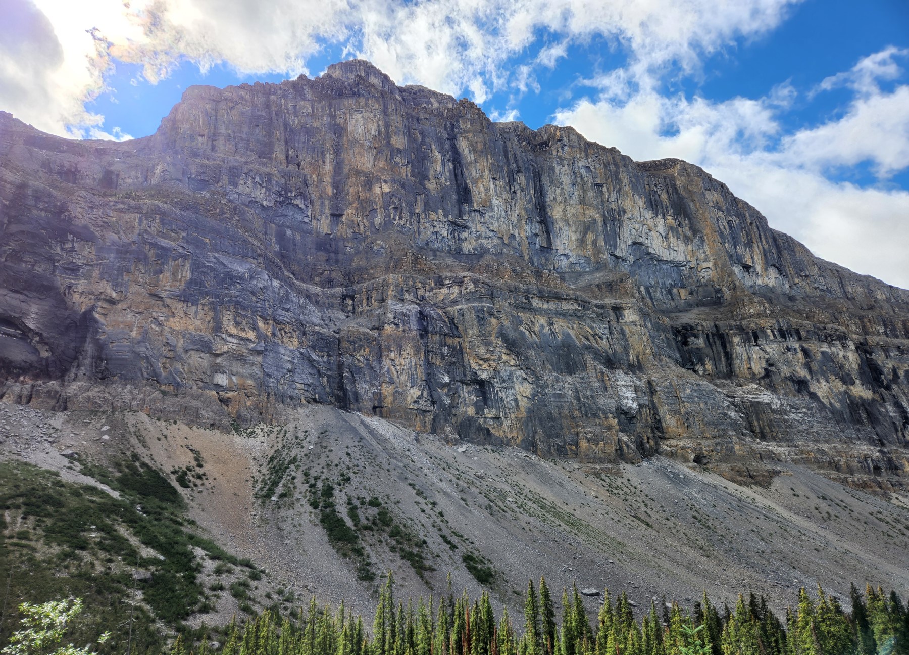
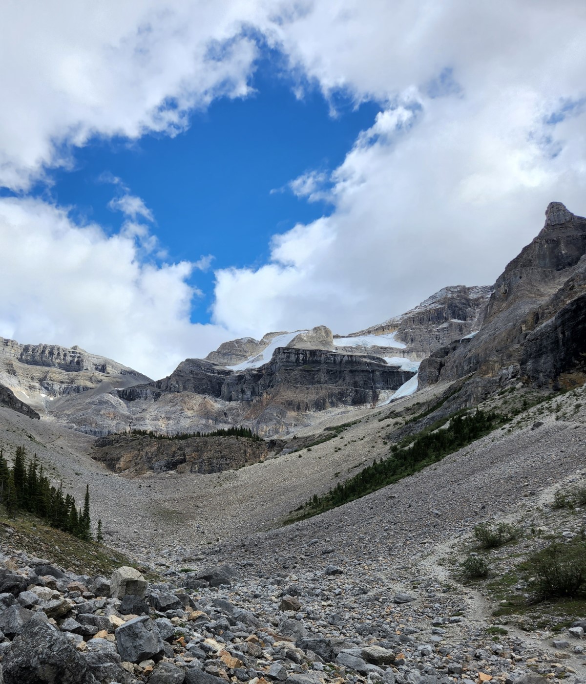
This is a good stopping point for most people as the trail goes up some scree towards the glacier and scrambling might be required. There were also some people climbing this cliff. The hike can be as challenging as you wish to make it.
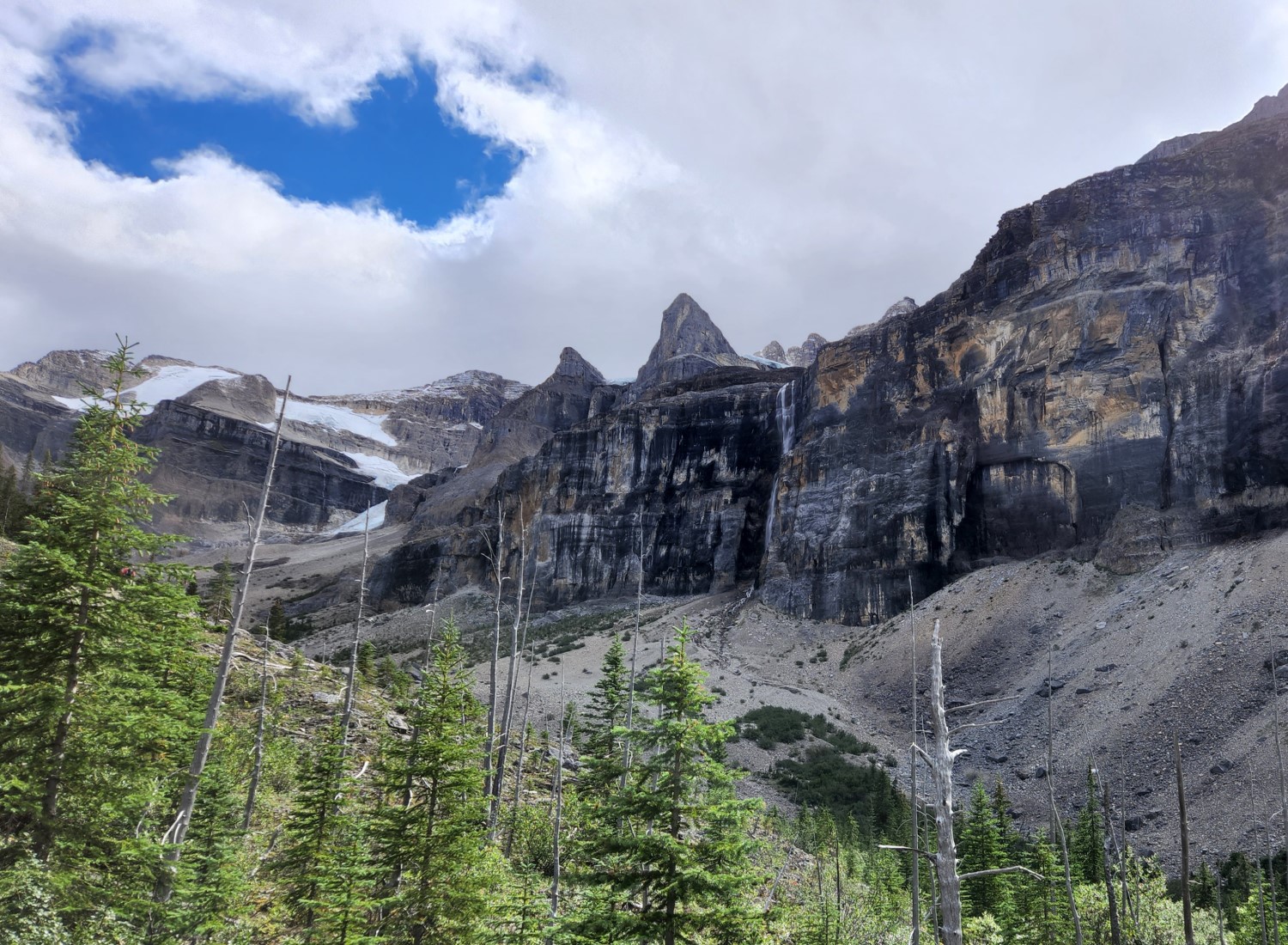
We chose to admire the glacier from afar although the trail does loop around those trees on the cliff. Some brave souls walk up the moraine and touch the glacier but you might want to consider more serious hiking gear and training for that.
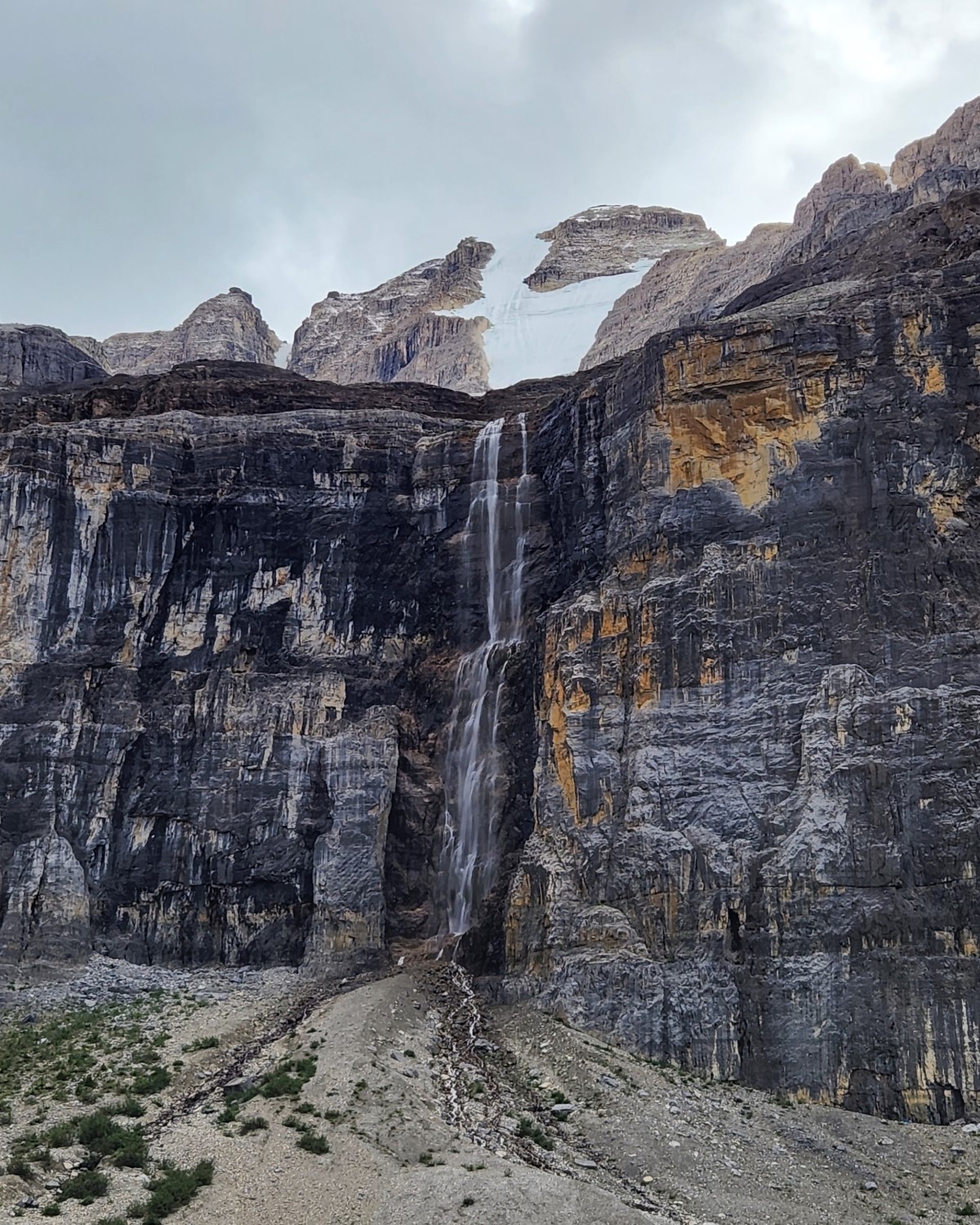
We stopped at this waterfall, it's a couple hundred feet tall at least, so don't attempt to climb it. There are some shallow caves in the area and much to explore.
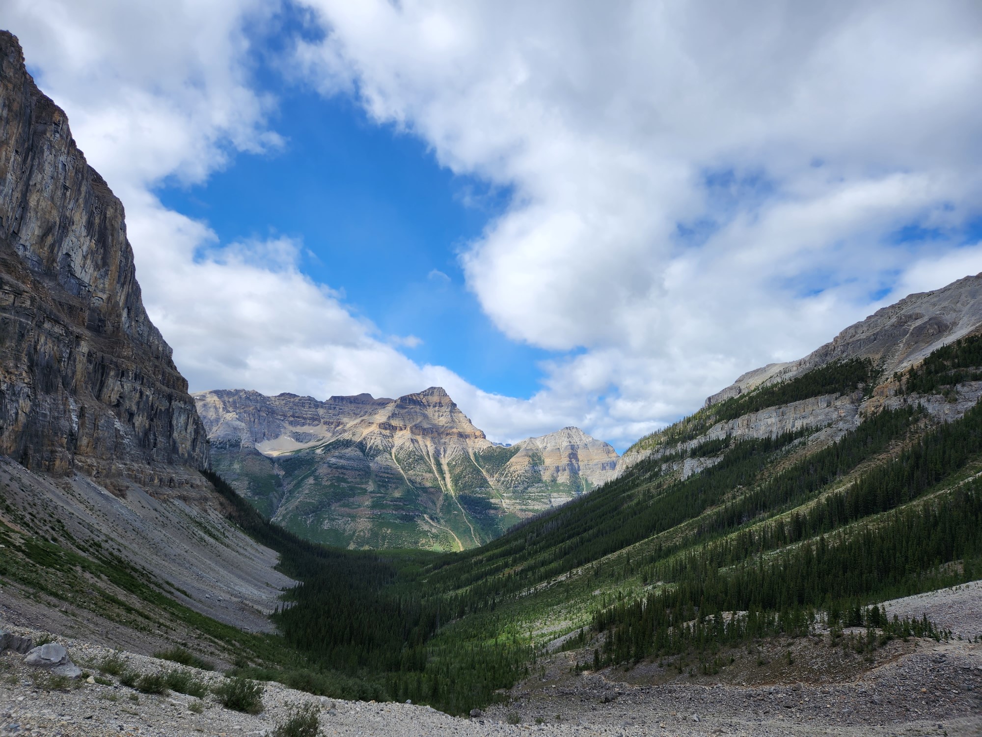
Looking back from the glacier towards mount Wymper, which offers an alternative hike for those who are more hardcore. We spent a while in the bowl exploring and enjoying the view. The highway was not visible, but would be further down in the Kootenay river valley.
The way down is always much easier and more rewarding than the way up. The view is incredible the entire time and you don't need to catch your breath. We went on one other short hike in the area right after, Marble Canyon, which is another post for another day.

All in all, I'd say this is a must do hike if you're in the area. Kootenay National Park is one of the big four National Parks in the Canadian Rockies. The season is short, it's not the easiest to get here, but it's a once in a lifetime experience for those who don't live in the BC/Alberta area.
All photos taken on an S22, no filters, just cropping.
Your content has been voted as a part of Encouragement program. Keep up the good work!
Use Ecency daily to boost your growth on platform!
Support Ecency
Vote for new Proposal
Delegate HP and earn more
Congratulations, your post has been added to Pinmapple! 🎉🥳🍍
Did you know you have your own profile map?
And every post has their own map too!
Want to have your post on the map too?
Congratulations, your post has been added to Pinmapple! 🎉🥳🍍
Did you know you have your own profile map?
And every post has their own map too!
Want to have your post on the map too?