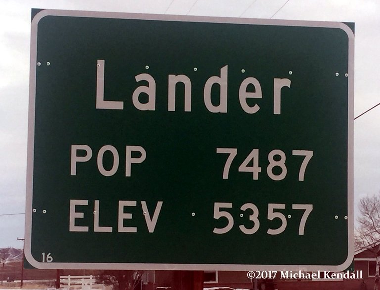
A few miles west of my hometown of Lander Wyoming exist one of the rarest natural occurrences on earth. It is a place where the middle fork of the Popo Agie river pronouced "Puh - Po Shuh" disappears into a serious of vastly unexplored cave systems only to reappear about a quarter mile further down the canyon. There are less than a handful of other places on earth were this occurs naturally.
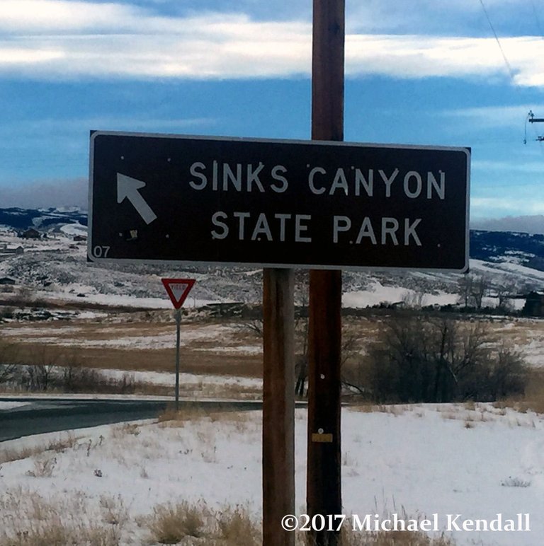
 Taking Wyoming state highway 131 other wise known as Sinks Canyon Road will lead you to Sinks Canyon State Park it's a short but scenic drive to an amazing place seen by few.
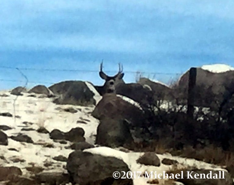
On the way up the highway you will most likely encounter lots of wildlife including mule deer, moose, bears, elk, foxes, and if your really lucky maybe even wolves.
Once you enter the mouth of the canyon there are ancient writings know as petroglyphs. This were carved into the rocks by indigenous people many years in the past.
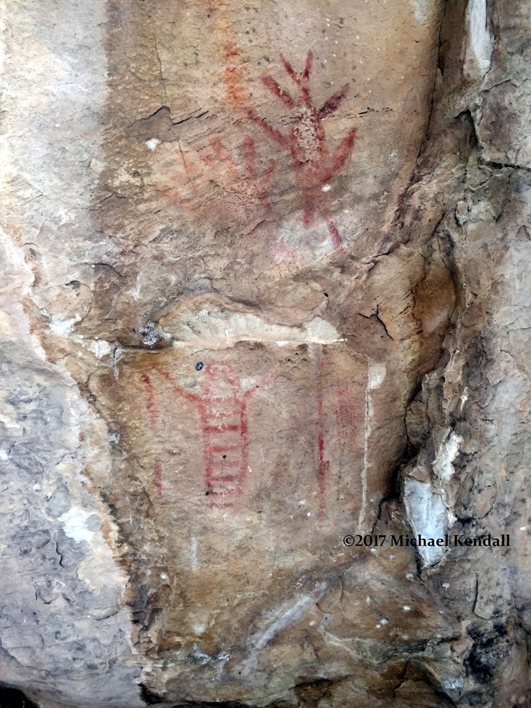 Someone at some point painted them so they would stand out better, However this is against the law and is very frowned upon.
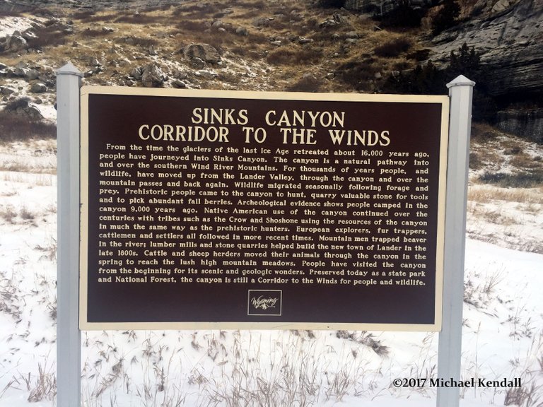
There are many informative signs on the way up that explain the geological occurrences that formed the canyon. there are several places along the route for picnicking as well as over night camping.
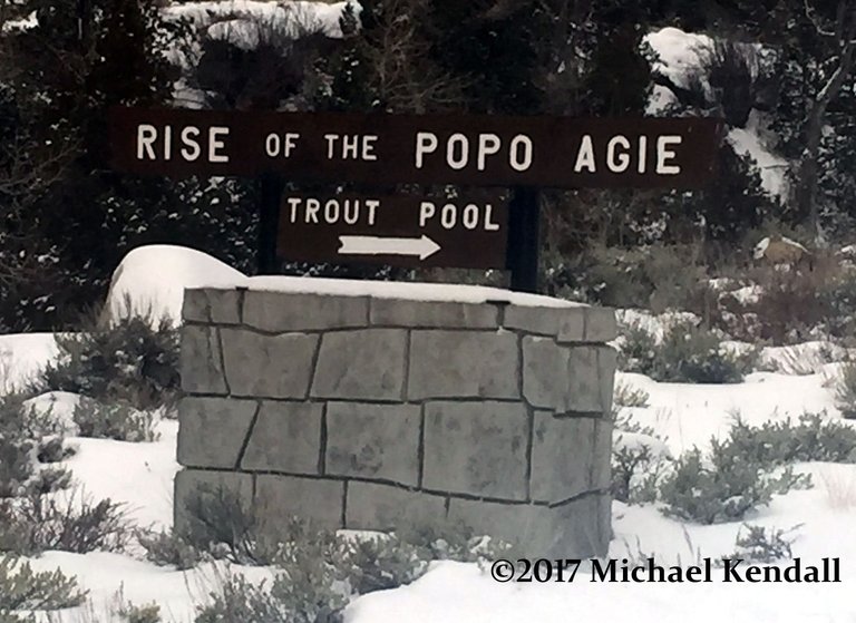
The first part of this natural wonder is called the rise this is where the water from the river begins it's journey again after exiting the caves. There are very large brown and rainbow trout that you can feed on the overlook. Fishing this portion of the river is prohibited but you can fish further below and also above the sink.
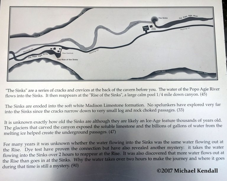 The photo above explains this natural occurrence.
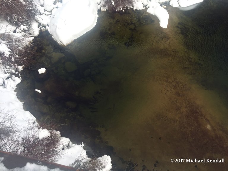
The photo above shows were the rises back out of the ground as well as some of the trout that call this place home. There are many trout, some very large.
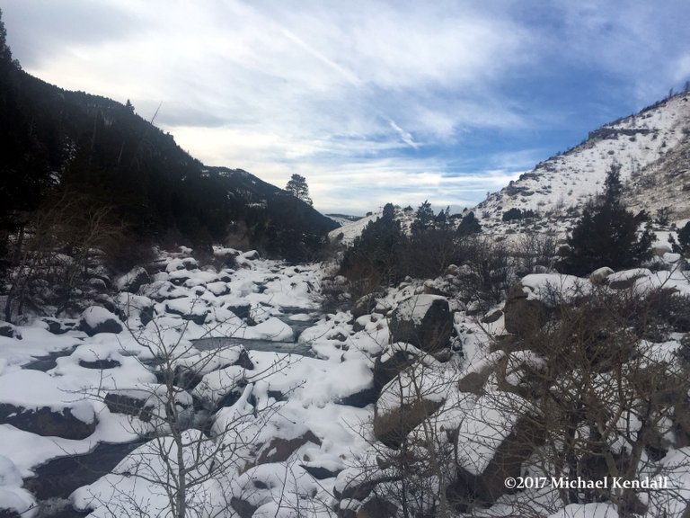
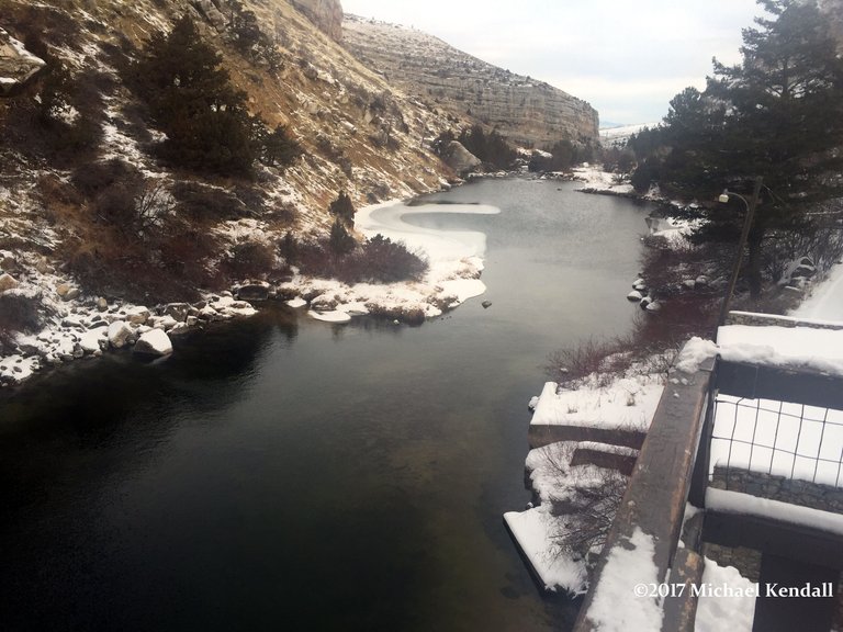 (Standing on the overlook of the rise facing east looking down the canyon.)
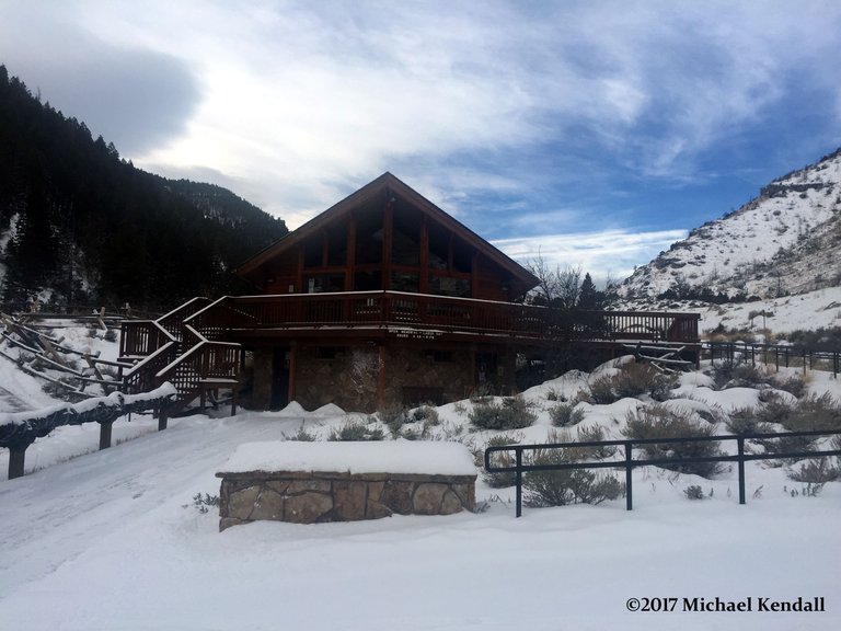 A quarter mile up the road is the visitors center and what is called the sinks. this is where the river disappears into the mountain.
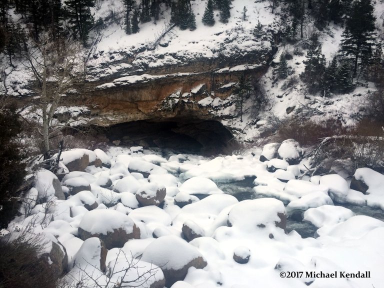 The mouth of the cave system. During the spring run off this entire area fills to the top of the cave with millions of gallons of water being forced by nature into the ground.
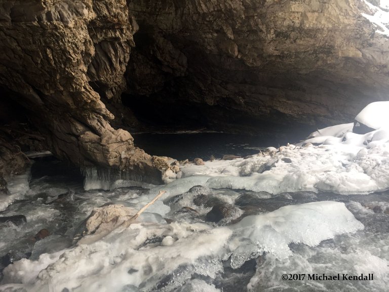
This photo shows the actual mouth of the cave where the water disappears.
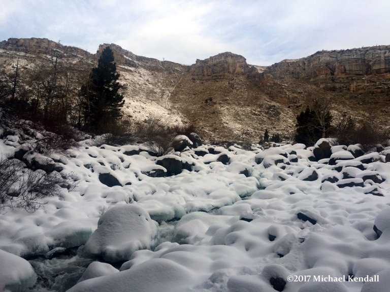
 Looking west into the Wind River Mountain Range and the continental divide from the mouth of the cave.
 Looking north at the canyon walls. Climbing enthusiasts from all over the world can be seen scaling these cliff walls 365 days of the year.
Sinks canyon State park is located eight miles outside of Lander Wyoming. Lander is the headquarters for NOLS (National Outdoor Leadership School). Lander is about 300 Miles SE of Yellowstone National Park
The link below is a short video of the river at the sink.
If you liked my blog please do me a favor by upvoting, reposting and following me!
There are many different wonderful things to see and do in my area and I will be creating many more blogs about Wyoming it's history Wildlife and natural wonders.