Sajek (Baghaichhari, Rangamati): If you are standing for a while before the dawn, or just before the evening, the clouds will float around you. And if it rains, then it will be seen, the rain in the clouds will be visible. At this time, the clouds and the sun's hiding behind the green hills become more interesting.
The scenes of the scenic beauty of Saurandaja, Sagekke of Baghaichori, Rangamati district of Rangamati district. If you go there, you can see the clouds all the time on the hill. From a distance, it seems as if the wings have been clamped on the mountain.
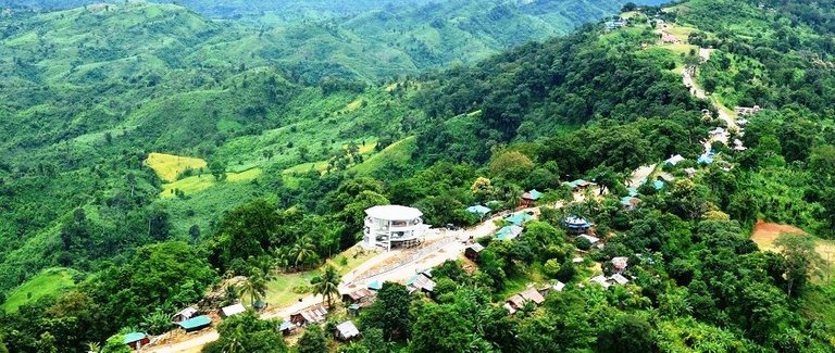
The white cloud cover surrounds the peak of the green hills of 'Sajek', which consists of Ruili Para and Konglak Para. The vast valley of horizons has been mixed in the Blue Hills of Mizoram (Blue Mountaine). In the rainy season, small clouds of white cotton sticks roam around the mountain. Standing in front of the valley will feel that this extravagant beauty! This wonderful scene of Sajek was enjoyed from these two neighborhoods.
The white clouds covered Ruili Para, Kunglak Para and Sajek Valley hill peaks. If you go there, the team of clouds will also soak you. Rainfall of rain in the sky, in the sky, in the sky, from the pitch of the clouds.
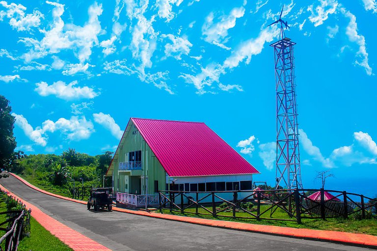
There is a helipad at the Sajak Point of Ruili. Road transport and construction minister Obaidul Quader inaugurated the 'Sajayak Point' plaque in front of the helipad. Also here is the last border post of army camp and Border Guard Bangladesh (BGB).
Ruului Para has two reports named Sajak Resort and Runey Resort, run by the army. Apart from lighting facilities, NGOs are also conducting lighting, and there are more than 15-20 resorts in the residents. There are three gardens named Harjison Garden, Stone Garden and a Pied Picnic Spot. Each garden entry price is 20 taka.
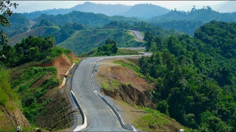
The conglomerate peak of two kilometers away on the 25-minute walk from Ruului Para, the last village of Sajek. This village of Sajek, about 2,200 feet above sea level, is a village of Sajak. The state of the whole cloud can be seen from Kanglak Para. According to Lusayed, Konglak hills are the highest peak in the country.
The scenes are best viewed in the rainy season during the rainy season. Because at this time there is more rain in the hills. Gorgeous greens flooded in the rain! After the rain is over, the form starts to appear. The white cloud coil grew wide deep valleys. The white cloud covers the whole valley, it is like the valley of clouds.
The residence of the indigenous Lusay in the Ruillui Para, standing in a huge stone block. Headman Red Thanga Lusai is headed by them.
Tripura of India on the north, Langadu of Rangamati on the south, Mijoram of India on the east and Dighinala upazila of Khagrachari upazila on the west. Sageku's Ruili is about 1,800 feet high above sea level. Here lives in Lusai, Pankhwa and Tripura.
The first settlement of Sajeck established in 1885, 'Ruilu Para' According to the 2014 data, 607 square miles of the population is about 60 thousand. The distance between Sajak and Mizoram from India is about 10 kilometers.
nice, hi dear i follow you and vote you please follow me and give me votes.
Nice pictures! I am always amazed how people live in such remote areas of the world like that. I am so used to living in a city where I can get so many things within walking distance or just a few minutes of driving.
thanx for ur view inside thinking
i am upvoted and reply your post plz visit me
upvoted,reply,follow and resteem when you work in steemit thanks alot,
my id = https://steemit.com/@pranashroy