This is my second article from the same series. In the first one, i have shared a video. I will re-share it at the end of this story.
I'll keep the words to minimum and let you enjoy the picture story.
Me along with my friends left for Khunjerab Pass via Besham/Dasu/Chillas/Gilgit/Hunza/Sost. As we had to drive all day, we made sure that car is in perfect condition. A day before we hit the road, we made sure that the car is trouble free and did preparation for the trip. The journey Started from my home city Mansehra in the early morning as we had to drive all day.
We targeted Karimabad, Hunza for our first night stay. We (Me, Khurram and Ejaz) hit the road at 5 AM and drove until Shinkyari where we picked up another friend (Saad). The day started getting hotter as it was just a few days ago and summer is at its peak. We decided to stop for breakfast at Besham.
After breakfast, we checked the tire pressure and filled the fuel from a petrol station and we hit the road again.
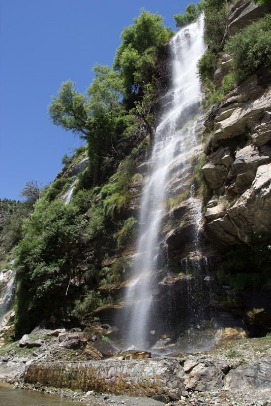
The day was getting warmer but we soon started seeing waterfalls right beside the road. There is a series of some beautiful waterfalls near Pattan , Kohistan.
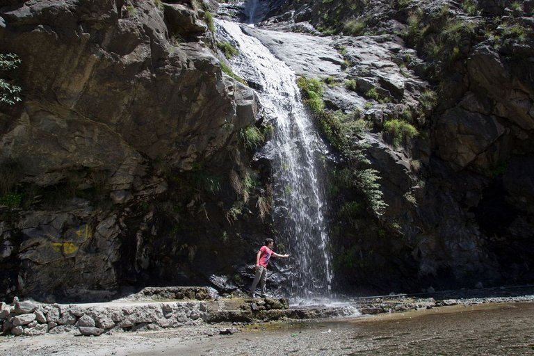
And another one here
Traveling in Kohistan gets boring when you cross Dasu city. They are building a Hydro Power plant in Dasu and there is Diamir Bhasha Dame on River Indus. The Road is in rough condition because they are building another road at the top of the mountain as the current road is going to be under water soon.
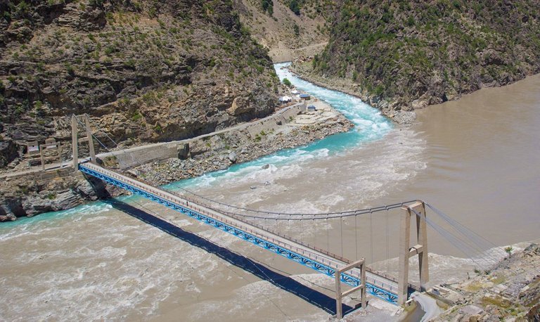
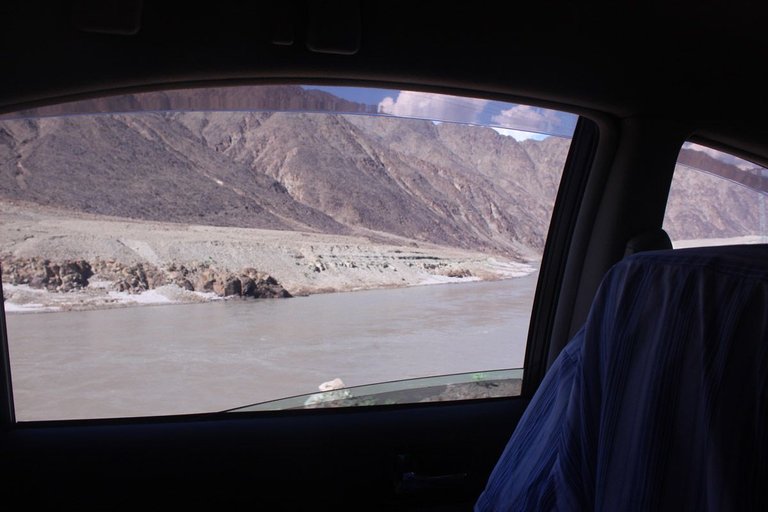
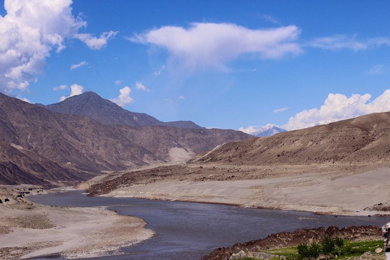
The water of Indus River was not clean but muddy due to some rain Gilgit/Skardu. But we could see the crystal clear water of glacier mixing in the river. Check that out in these pictures.
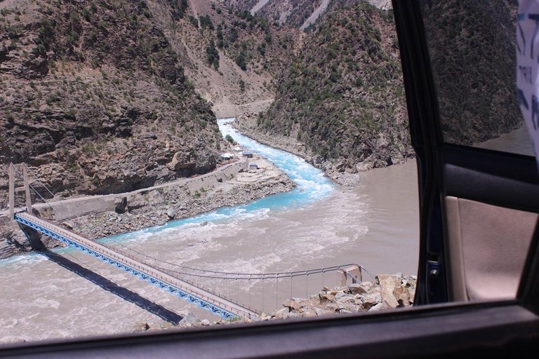
Here is another one
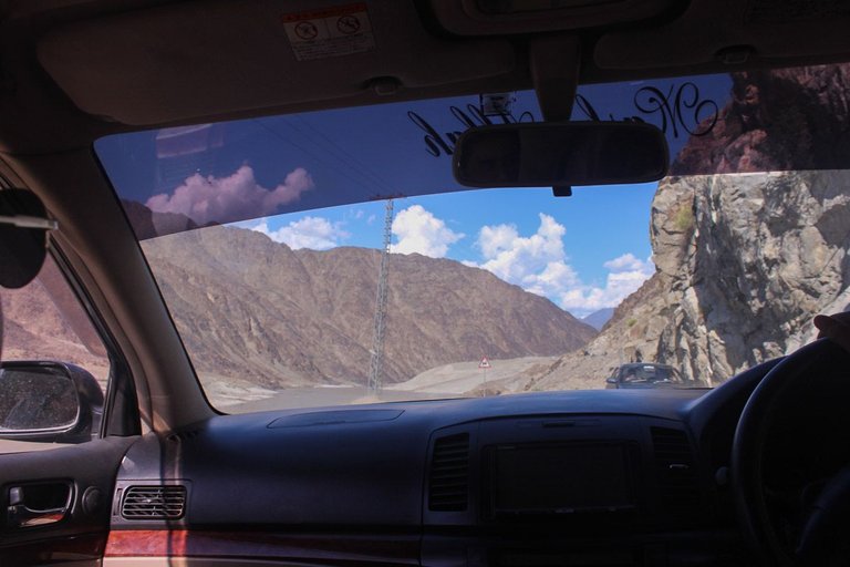
The road is in bad condition from Chillas to Raikoat bridge. But as soon as we cross Raikoat Bridge. Its beautiful Metaled road
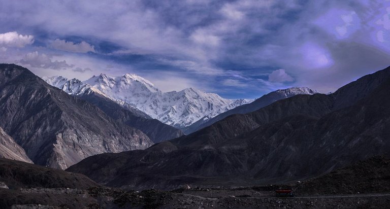
As soon as you enter in Hunza Valley , you are welcomed by the giant Rakaposhi right beside the road. It is 25,551 ft above sea level, ranked 27th highest in the world and 12th highest in Pakistan, but it is more popular for its beauty than its rank.
Spending the night in Ali-Abad, and breakfast in Karimabad, we hit the road again and the target was to stop in sost , pick a friend, and then reach Khunjerab Pass.
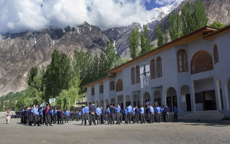
It was a beautiful sunny day and the school timing has just started. The kids of Hunza are very pretty as they got the most impressive facial features.
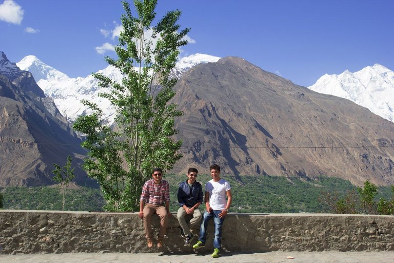
And here are we, me with my friends, right in front of the mighty Rakaposhi.
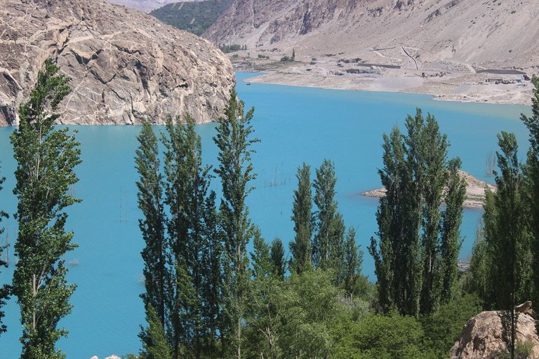
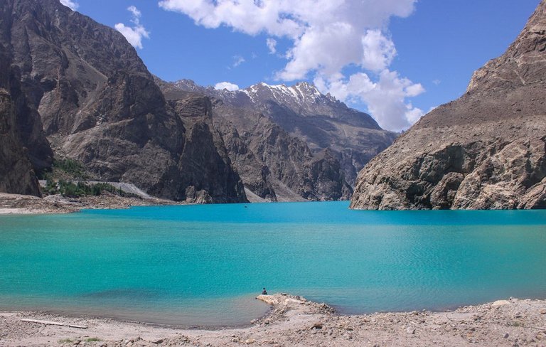
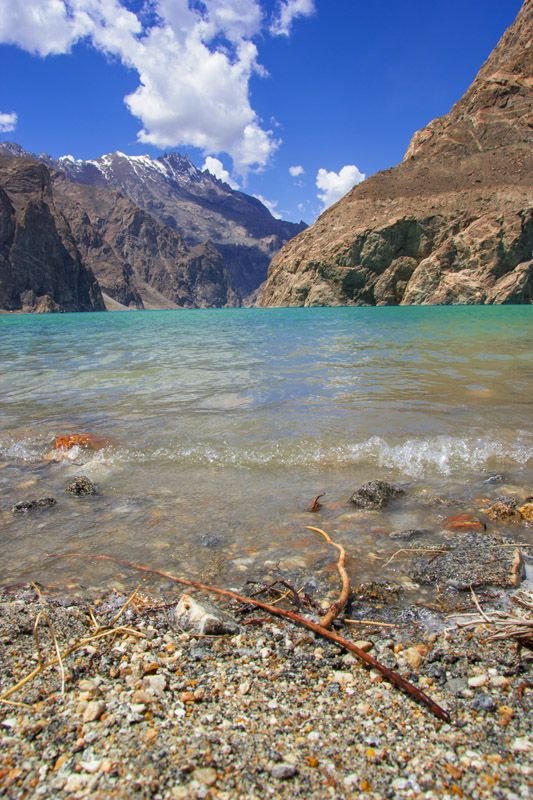
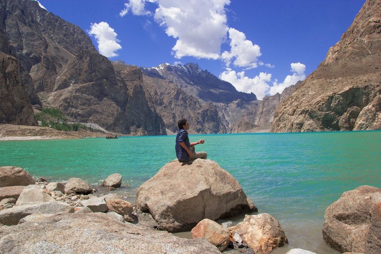
We started our journey towards Khunjerab Pass again. Crossing Attabad lake.
Attabad Lake inGojal Valley, also known as Gojal Lake, is a lake in Gojal created in January 2010 by a landslide dam.
The lake was formed due to a massive landslide at Attabad village, 9 miles upstream of karimabad that occured on 4th January, 2010. It killed twenty people and block the flow of Hunza river for five months. The flooding displaced more then 6 thousand people from upstream villages, and further 25,000 and inundated over 12 miles of Karakoram highway.
The lake reaches 13 miles long and over 100 meters in depth by the first week of June 2010, when it began flowing over the landslide dam, completely submerging lower Shishkat and partly flooding Gulmit. The residents also had bad shortages of food and other items due to blockage of Karakoram Highway.
Water level continued to rise in 18 June 2010 caused by a difference in the outflow and inflow of the new lake.
Since the lake was formed the only means of crossing was by loading vehicles onto wooden boats. This changed when a road tunnel was built and it opened for traffic in September 2015.

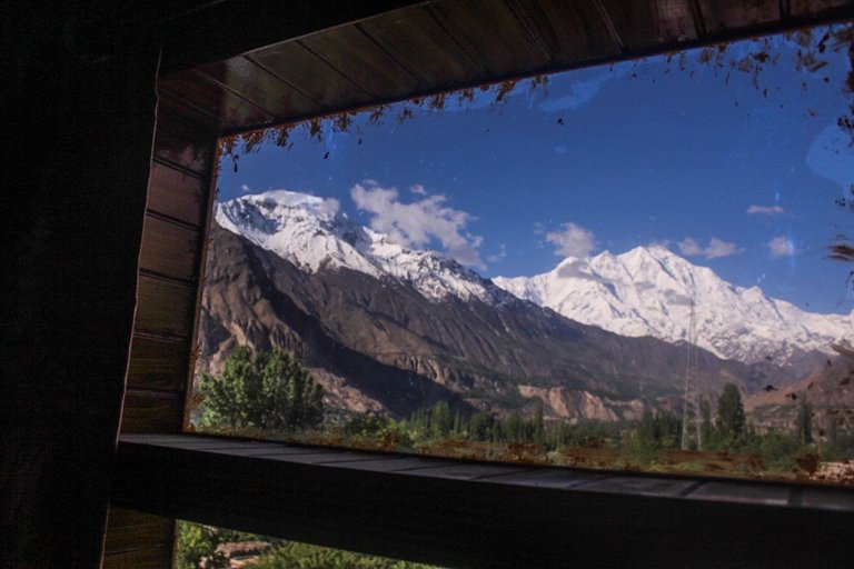
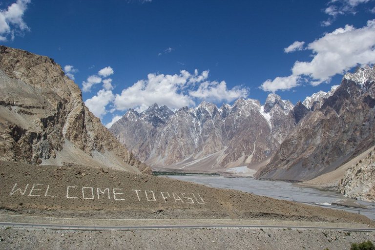
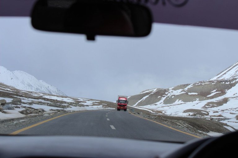
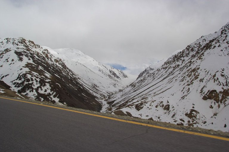
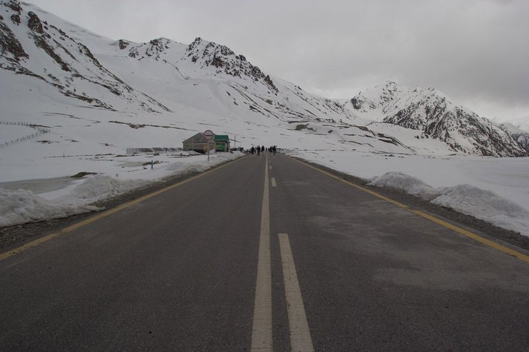
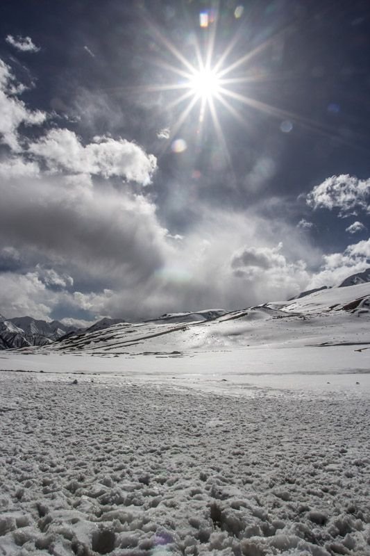
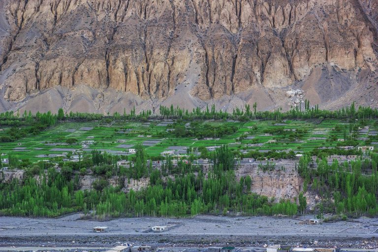
The road is in very good condition. You have to pass 3 tunnels of around 20 kilometers long. The landscape is different from other parts of Pakistan as you can see plenty of snow covered mountains all around and it has a majestic appeal to it.
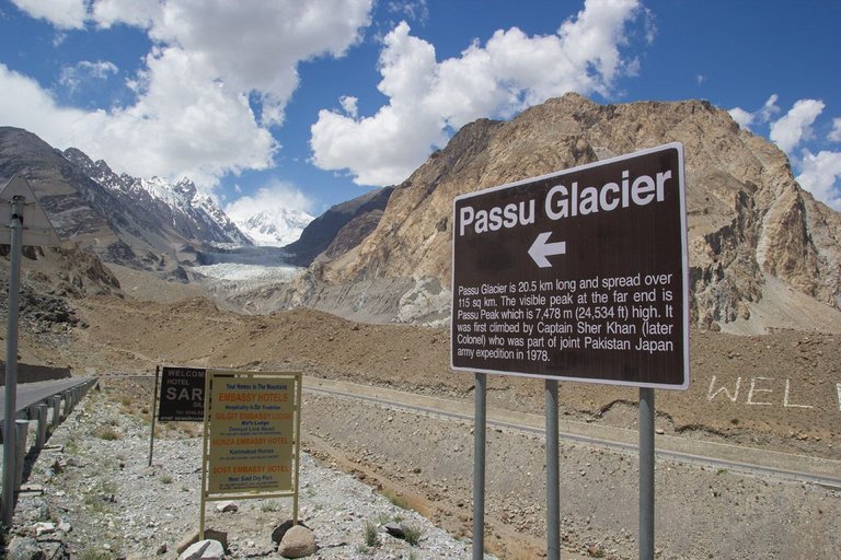
Passu Glacier is situated in the south side of Passu village. Passu Peak is situated in the back side of the glacier. This glacier is linked with Batura Glacier and many other glaciers of the region.

We had to stop in Sost which is the last town before entering in Khunjerab National Park. A friend , Qudratullah is local resident of Sost. I was in touch with him since the beginning of the journey and picked him up.
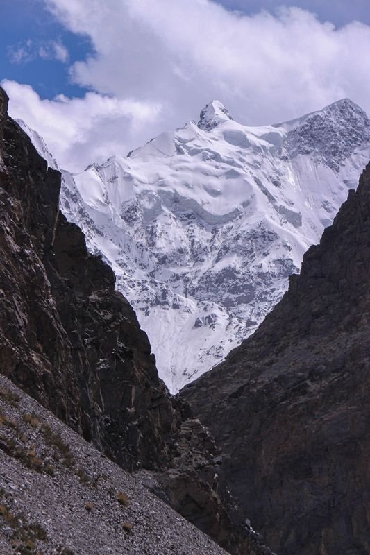
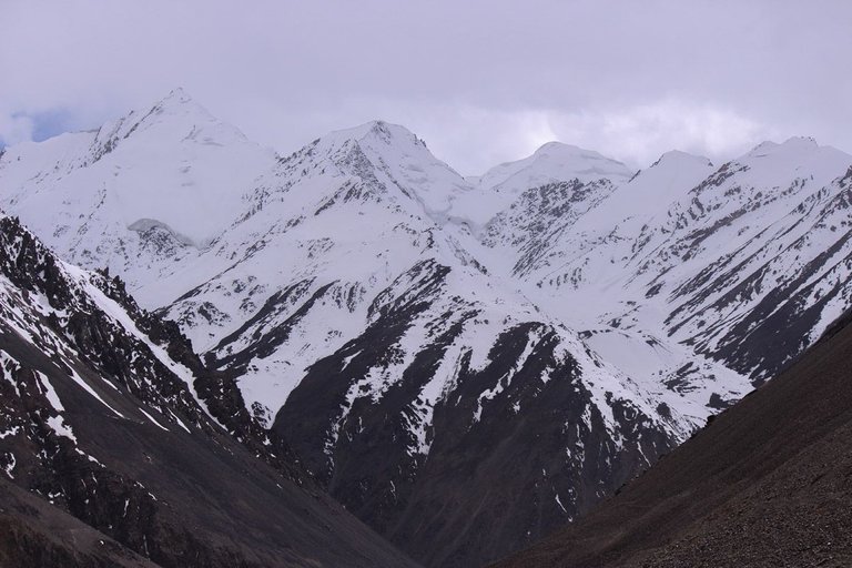
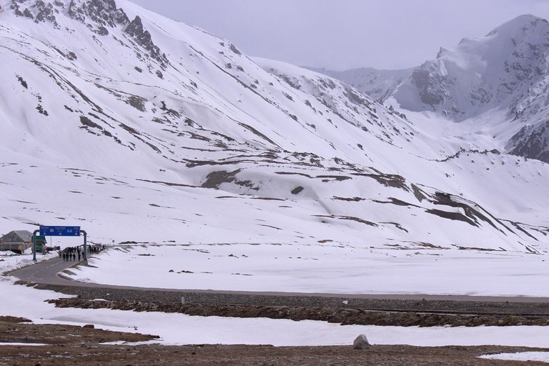
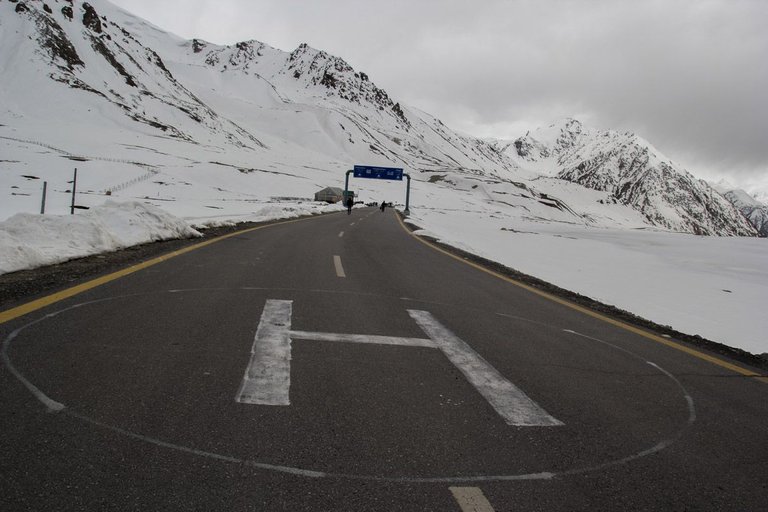
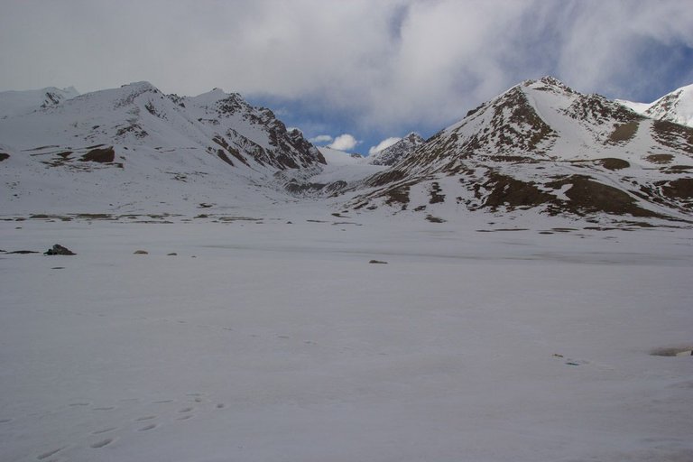
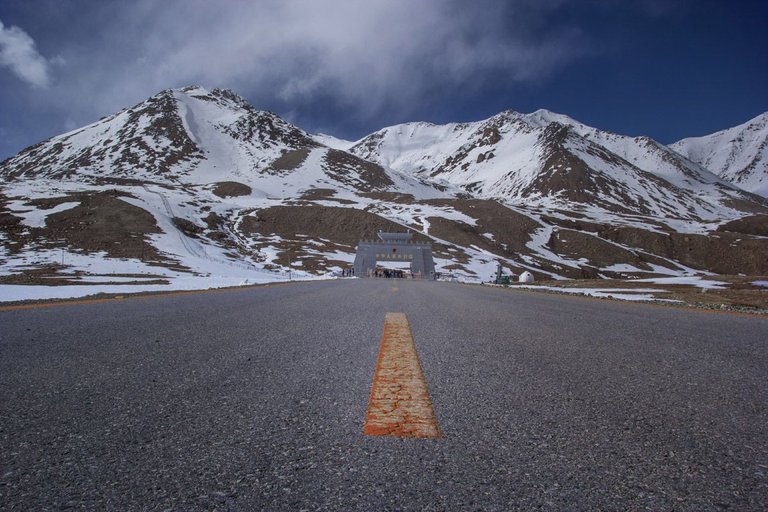
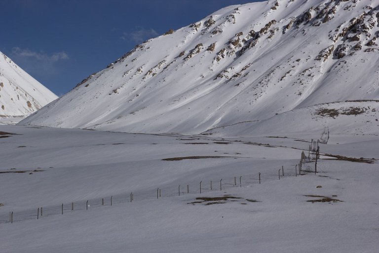
As soon as we enter in Khunjerab National Park, The landscape changes. we started seeing more snow around. There are a few tunnels on the road to protect the landslide damage to the road.
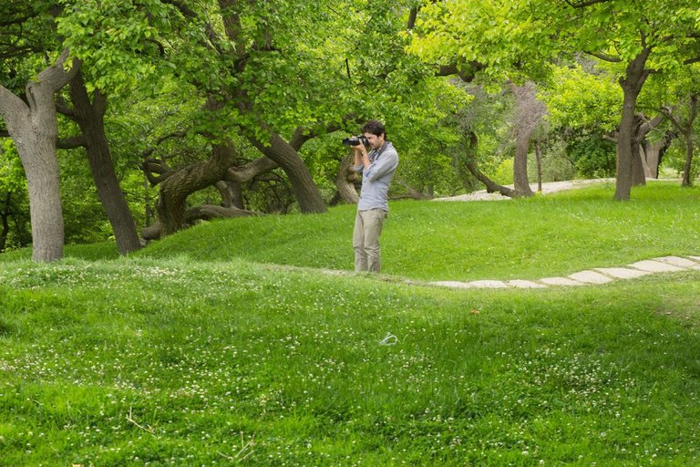
I have made plenty of short and long footage and made a composite video including some time lapses as well , The composite of my videos is attached at the bottom of this page.
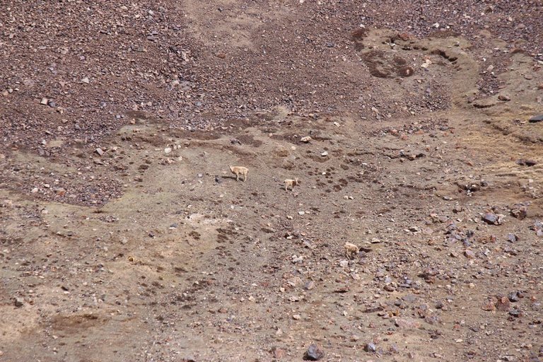
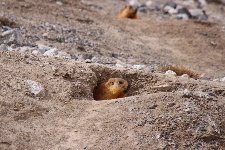
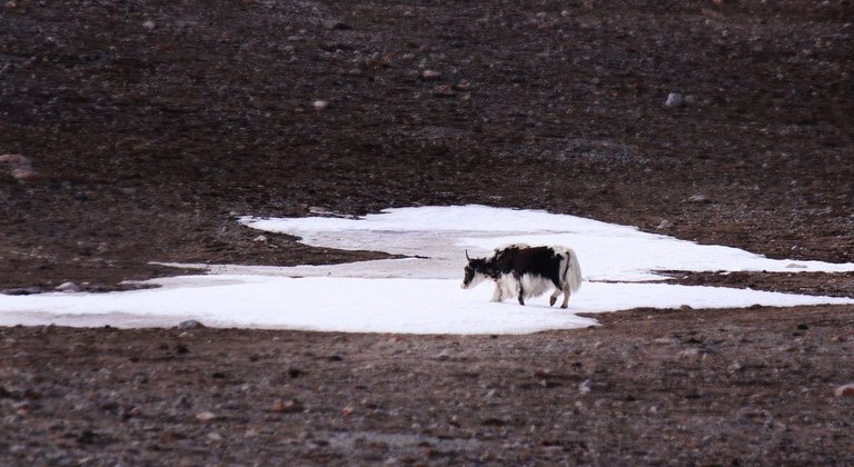
So , how many Ibex you can see in this picture?

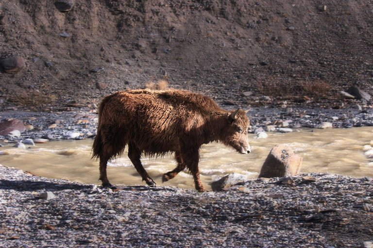
The primary purpose of this park was to provide protection to the endangered Marco Polo sheep, which is only found in this area in Pakistan. According to the Mir of Hunza, the population of sheep was around 400 but had dropped to below 180 by the time of the completion of the Karakoram Highway. A herd of almost 75 Marco Polo sheep was recorded in the spring of 1984 and park staff saw at least 50 crossing the pass in May 1989.
The park is also famous for its snow leopards. Some reports say that it might contain the highest density of these beautiful cats in the total Himalayan ecosystem, which is the natural habitat of these cats. Over 2,000 Siberian ibex, widely distributed and abundant in the park but absent from neighbouring China, are also present here.
The rare species including Snow leopard, Himalayan ibex, Himalayan brown bear, Red Fox, Tibetan wold, Blue sheep and Long tailed Marmot etc can be found in the Khunjerab Park.
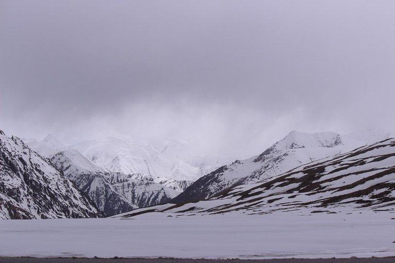
As soon as we get near the border, the weathers gets colder.
It was so cold for the first half an hour and almost unbearable. But it got better in some time.
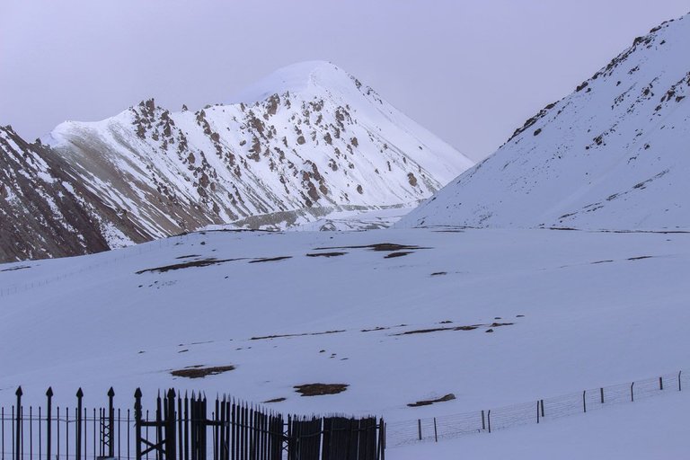
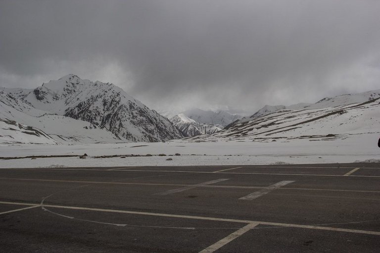
At the elevation of 15,397 ft above sea level, This place is called Roof top of the world.
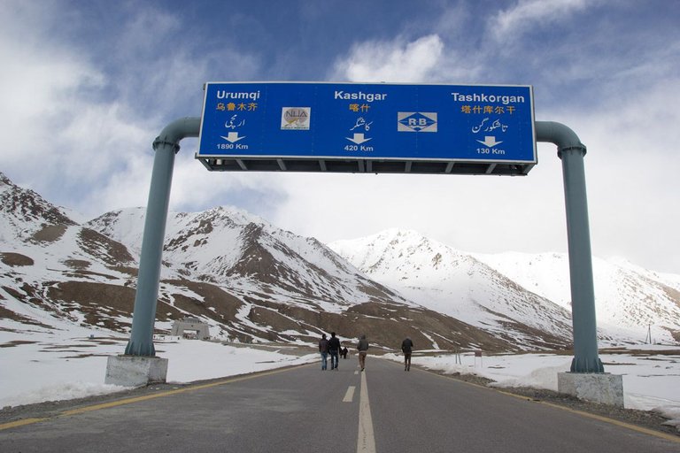
The N-35 or National Highway 35 known more popularly as the Karakoram Highway and China-Pakistan Friendship Highway, is a 1300 km national highway in Pakistan which extends from Hasan Abdal in Punjab province of Pakistan to the Khunjerab Pass in Gilgit-Baltistan, where it crosses into China and becomes China National Highway 314.
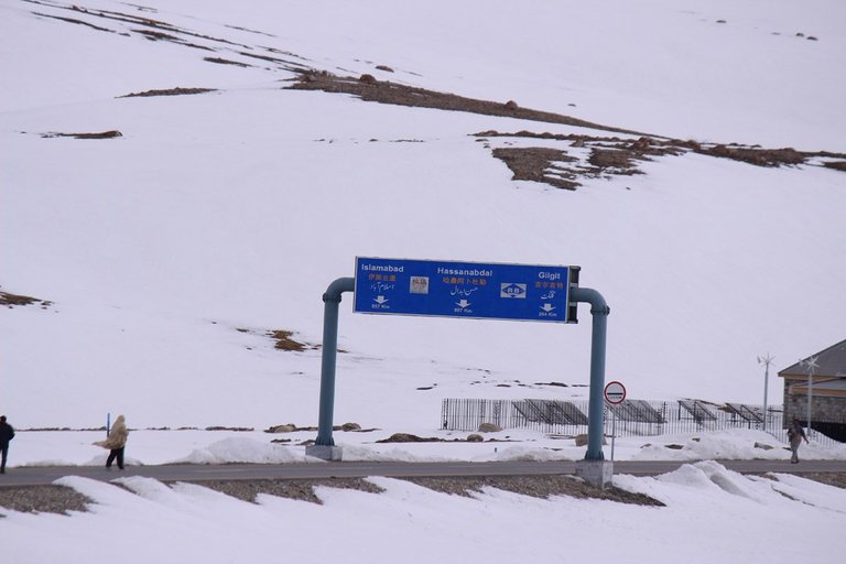

The highway connects the Pakistani provinces of Punjab, Khyber Pakhtunkhwa and Gilgit-Baltistan with China's Xinjiang Uyghur Autonomous Region.
The highway is a popular tourist attraction, and is one of the highest paved roads in the world, passing through the Karakoram mountain range, an elevation of 4,714 metres (15,466 ft).
Due to its high elevation and the difficult conditions in which it was constructed, it is referred to as the Eighth Wonder of the World. The highway is also a part of the Asian Highway AH4.
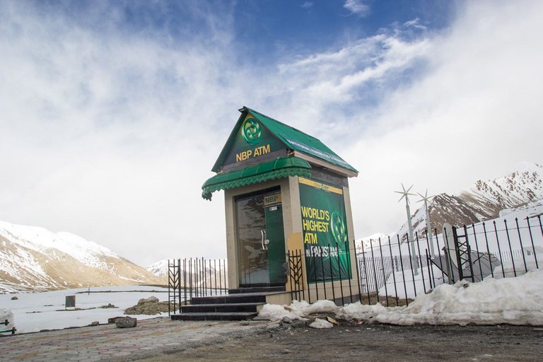
Self explanatory - The highest ATM in the world is here.

I was finding new perspective for a picture here

And here is what i have got. Not bad right.
I was requested by a group of tourist to take their picture.
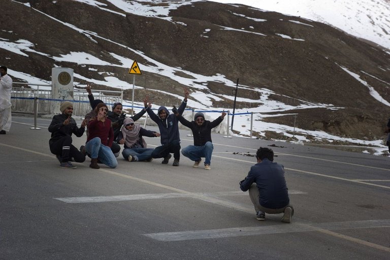
That fence is said to be the border.
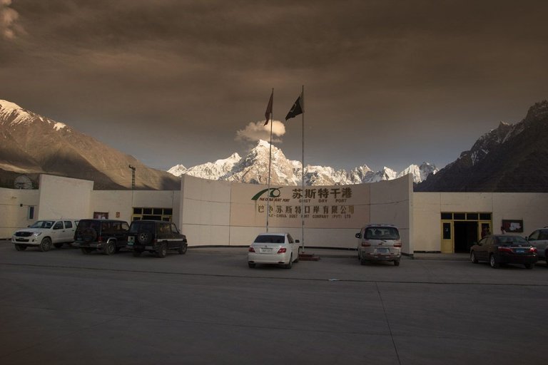
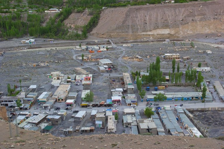
After spending almost the day at the Border, we hit the road again and came back to the town of Sost. Our host, took us to the dry port. Sost dry port is the first formal port at the China-Pakistan border, facilitating customs clearance and other formalities for goods moving from the Chinese regions of Kasghar and Sinkyang to the commercial centers of Pakistan.
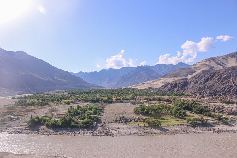
Sost is easily one of my favorite towns of North because i have spent plenty of time there in the past and i really like the calmness in the landscape of surroundings.
After spending some time in Sost, we decided to stay the night in Hunza. So we left for Hunza from Sost. At first we made a plan to spend the night at Borat Lake but as my friends had to reach early due to office work, we decided to stay the night again in Aliabad, Visit Hunza tomorrow and then leave for Chillas as a friend invited us to come and visit him there.
Hunza has literacy rate of over 90 percent. As growing up in Karachi and Abbottabad, I always had class fellows and friends from Hunza. They travel all over the country to study as there are not enough schools, colleges and universities in Hunza valley. So i know many nice people from there.
As soon as we wake up, we went to Karimabad again to have some breakfast and meet and greet some friends.
It was the first trip of my friends , so i had to guide them and i took them to Baltit fort, which is located right in the center/top of Karimabad. We get to meet some locals on the way.
They are so humble and kind. This guy had a stroke a few months back and he just walks a lot and he was resting there.
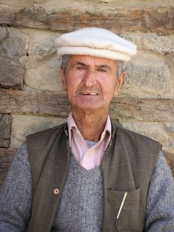
They are the most humble people ever.

From the top of baltit fort, One can easily see the other fort of Hunza, The Altit Fort.
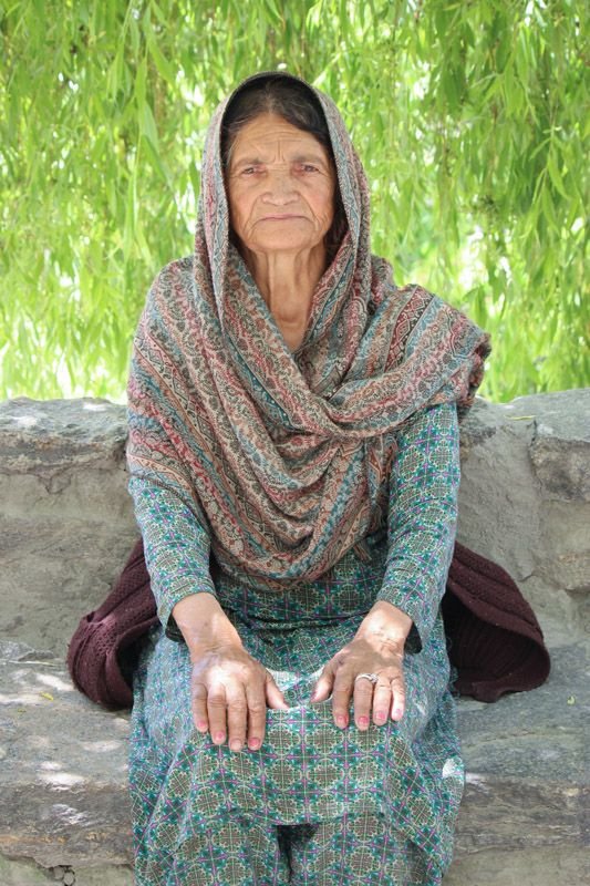
I was sitting there and talking to some people, and i had no idea that this old woman i am talking to is the mother of my best friend Ejaz who is working in Karachi. I took some pictures of her. She is the most humble person.

And she looks graceful - right
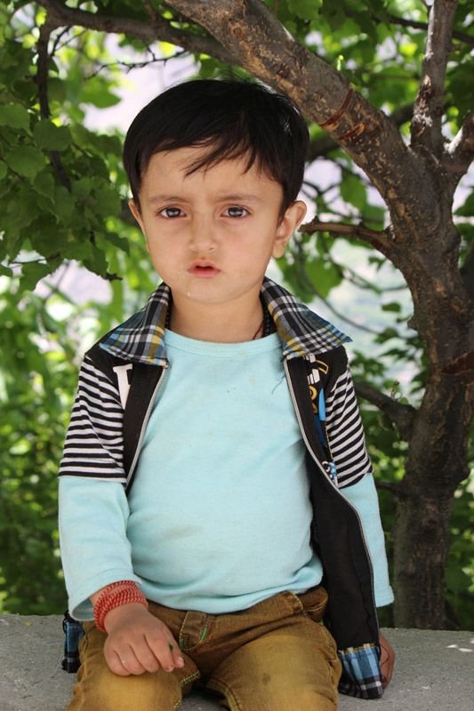
This kid was hanging out with his father who came from Islamabad to meet him.
The view of Baltit Fort
 !
!
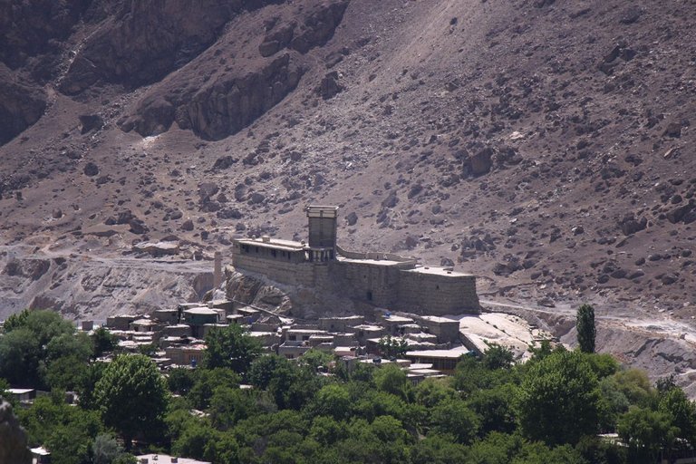
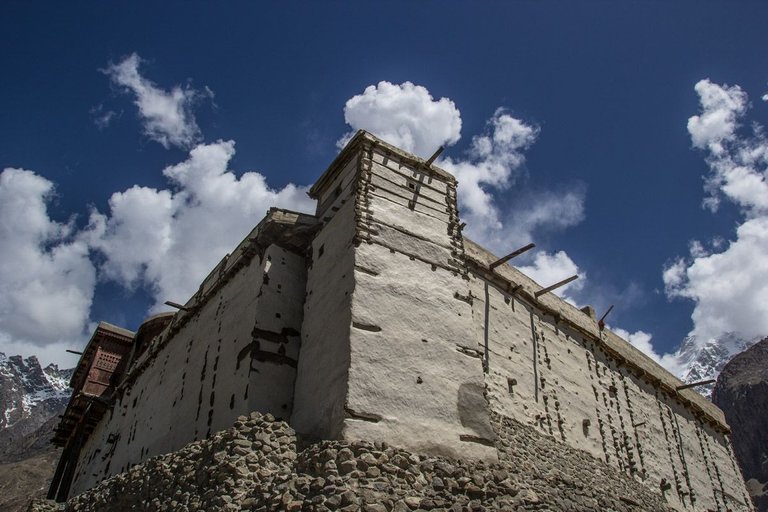
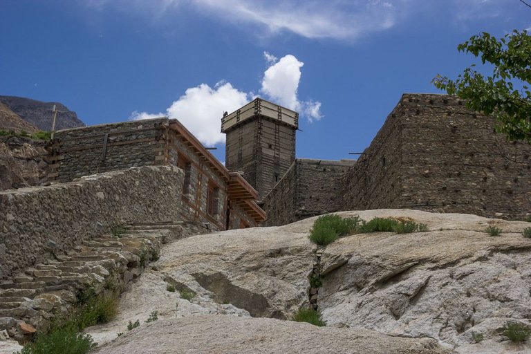
Baltit Fort is an ancient fort in the Hunza valley in Gilgit-Baltistan, Pakistan. Founded in the 8th CE, it has been on the UNESCO World Heritage Tentative list since 2004,
In the past, the survival of the feudal regime of Hunza was ensured by the impressive fort, which overlooks Karimabad. The foundations of the fort date back to 700 years ago, with rebuilds and alterations over the centuries. In the 16th century the local prince married a princess from Baltistan who brought master Balti craftsmen to renovate the building as part of her dowry.
And you can see many shops that sells the famous dry fruit of Hunza.
After seeing Baltit fort, we headed towards the Altit Fort.
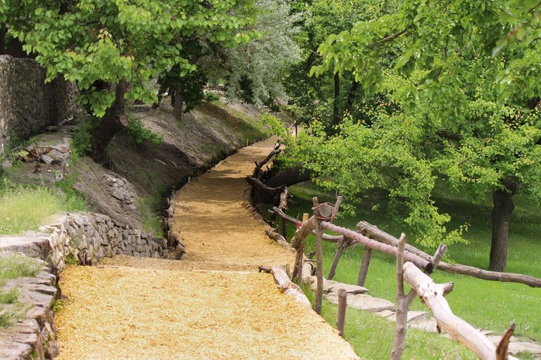
The royal garden in front of Altit fort if one of my favorite place to spend a few hours in Hunza. Its beautiful , its lush green and there is a calmness in the landscape there.
And the management takes good care of this garden.


So Here is the Fort of Altit , an ancient fort at Altit town in the Hunza valley in Gilgit Baltistan, Pakistan. It was originally home to the hereditary rulers of the Hunza state who carried the title Mir, although they moved to the somewhat younger Baltit fort nearby three centuries later. Altit Fort and in particular the Shikari tower is around 1100 years old, which makes it the oldest monument in the Gilgit–Baltistan.
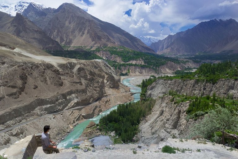
This is me , watching the whole landscape which shows Hunza River, Karakurram Highway , the mighty Rakaposhi and the beautiful sky.
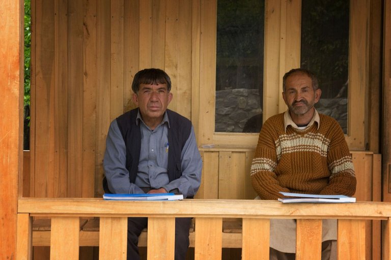
The ticket seller and the guide of Altit Fort.
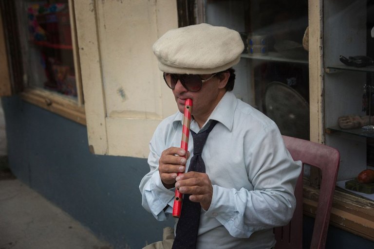
This guy is so talented, You can watch him playing int he video.
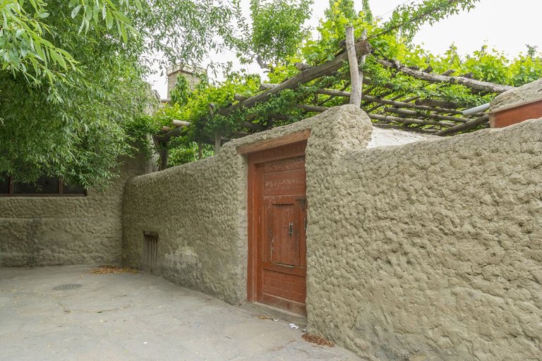
A beautiful house of a local in Altit.
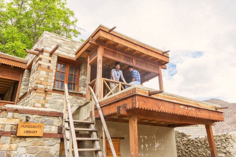
This is me and my friend Ejaz at Hunzukut library in the locality of Altit.
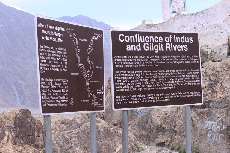
When we were entering in Gilgit Baltistan territory, we wanted to stop by the junction where three mountain ranges meets. And there is Nanga Parbat Viewpoint, but it was getting dark and we could not see anything. But we exited from Hunza valley soon so that we could reach The viewpoint and see the mighty Nangaparbat (The killer mountain).
So we hit the road after having lunch with a friend Moiz Baig who is a local and runs a nice Cafe in Karimabad, Hunza. We reached Jaglot at 4 PM and we stopped by the junction of three mountain ranges.
Juglot or Jaglot is a town in Gilgit District, Pakistan, situated 45 km south east of Gilgit on the Karakoram Highway. It is located at the junction of three mountain ranges, the Karakoram, Hindukush, and Himalayas. It is also a junction point between Skardu and Gilgit
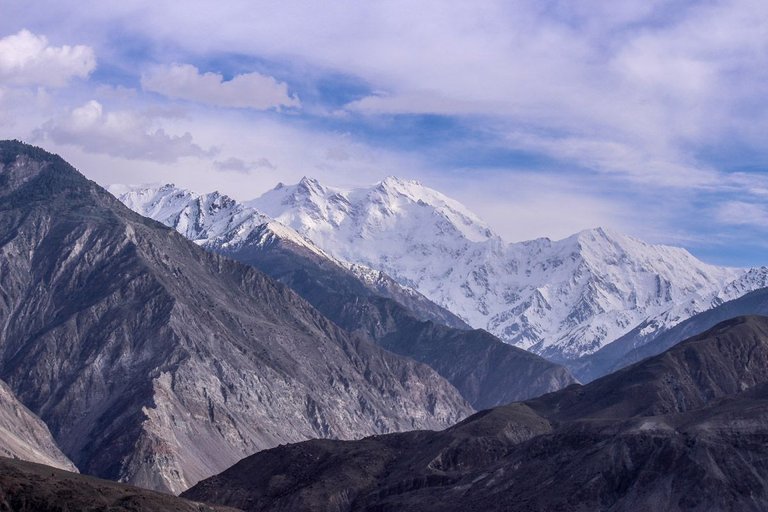
The next stop was at Nangaparbat viewpoint. Its near to the junction.
Thalichi - Nanga Parbat View Point on KKH On KKH (karaKoram Highway) between Raikot and Jiglot, the beautiful snow covered Killer Mountain "Nanga Parbat" can be seen. This place is Thalichi, also known as "Nanga Parbat View point".

Nanga Parbat is the ninth highest mountain in the world at 8,126 metres above sea level. It is the western anchor of the Himalayas around which the Indus river skirts into the plains of Pakistan.
Nanga Parbat is one of the eight-thousanders, with a summit elevation of 8,126 metres (26,660 ft). An immense, dramatic peak rising far above its surrounding terrain, Nanga Parbat is also a notoriously difficult climb. Numerous mountaineering deaths in the mid and early 20th century lent it the nickname "killer mountain".
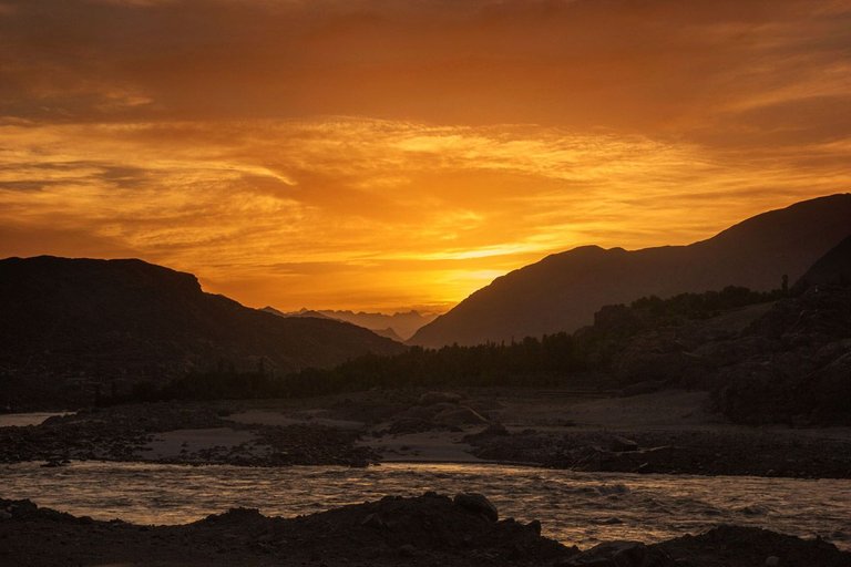
After spending some time at Nangaparbat View point in Thalichi, we hit the road again. This time , the destination was Chillas where we had to meet a friend Orangzeb , who lives in Thor - 60 kilometers away from Chillas.
Here is a sunset shot near Chillas.
We met Orangzeb in Chillas and had some nice tea at a local tea shop and we started travelign towards Thor.
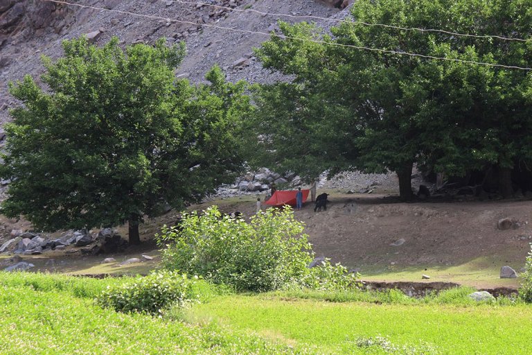
The road to Thor is in rough condition. We reached at our friend's house at 9PM. We rested and enjoyed the hospitality and some great local food.
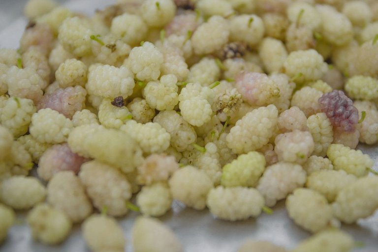
The next morning , we got up early and we wanted to leave but our hosts wanted us to taste some of the famous Mulberries.
This picture shows how they take the fruit off of the tree
And here are some delicious Mulberries also knows as Shahtoot in local languages.
So, we started our journey back home, There was plenty of landsliding near Dasu Kohistan that wasted some time but we reached back home in Mansehra by 10 PM.
Here is the video composite of the trip.
If you like my journey, Please RESTEEM - UPVOTE and COMMENT.
Follow me for more of my travel stories.
Beautiful post. Thank you for sharing.
Oh thanks - Please follow
Congratulations @khan101! You have completed some achievement on Steemit and have been rewarded with new badge(s) :
Click on any badge to view your own Board of Honor on SteemitBoard.
For more information about SteemitBoard, click here
If you no longer want to receive notifications, reply to this comment with the word
STOPI am thankful :D
Really wonderful.
Thank you Buddy - Please follow as well
Good Khan sahb,...........
Thanks buddy
nice photos! I like the view
Thank you buddy
welcome!
Wow!! really nice footage!
thank you
Congratulations @khan101! You have completed some achievement on Steemit and have been rewarded with new badge(s) :
Click on any badge to view your own Board of Honor on SteemitBoard.
For more information about SteemitBoard, click here
If you no longer want to receive notifications, reply to this comment with the word
STOPthank you steemitboard