Hello steemians!
I was always asked by my mother why I love hiking up in the mountains and my answer would always be because it makes me feel alive. You get what I mean? When I'm on top, looking at the panoramic view below makes me think, makes me question things, and makes me assess myself and the things around me.
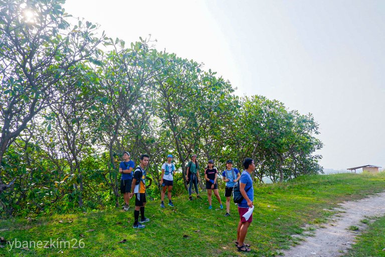
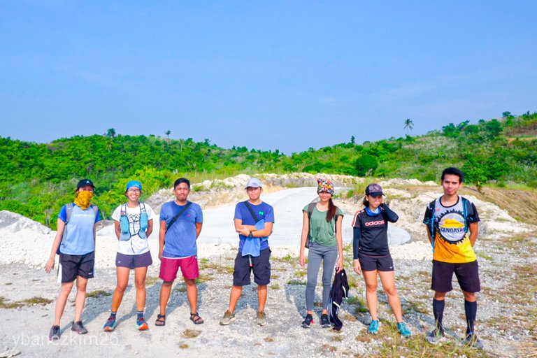
I am preparing for a major climb this November, but I don't have the gears yet. Maybe I'll buy in the coming paydays, but I'm already conditioning myself for a 3 days hike. So, together with my workmates, we decided to have a hike last weekend and the most established trail in Cebu is Banawa-Pamutan Trail or commonly known as Spartan Trail.
Cebu is relatively low in elevation compared to the other islands in the Philippines, with the highest peak of about 1000 MASL. If you're planning to have a major climb and if you're in Cebu, the best option is to hike in Spartan Trail. And the reason for that is because its proximity to the city proper and of course, because of its terrain. Aside from accessibility, the terrain is very diverse. You'll find out later why I said it's very diverse, so read on.
Here we go!
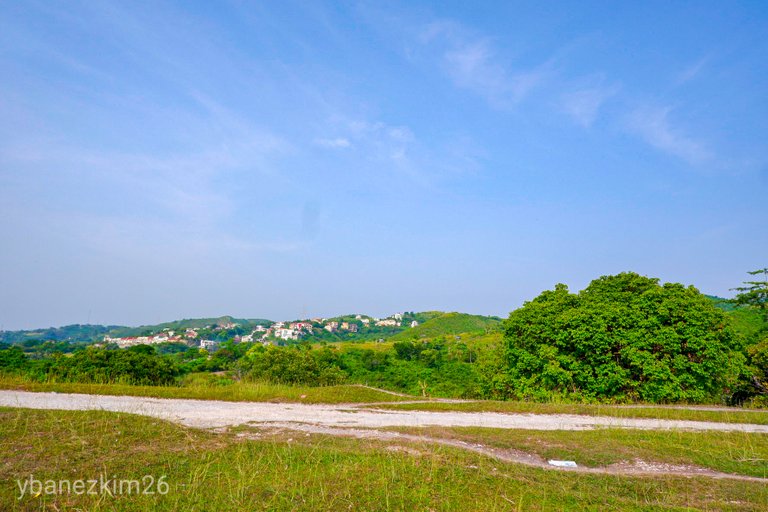
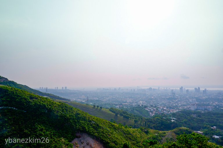
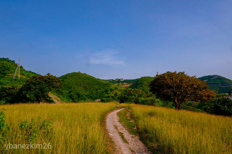
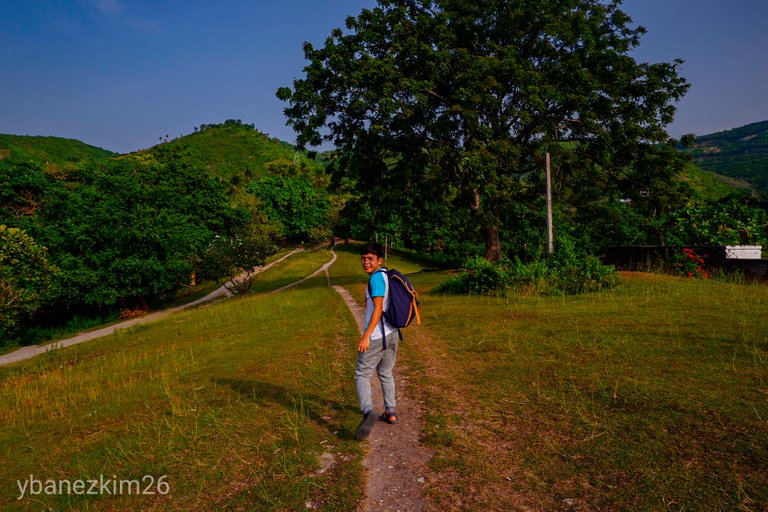
We decided to meet at Paceo Arcenas at 6:00 AM and had breakfast at McDonald's Banawa before starting the hike at around 7:30 AM. The trail officially starts at Good Shepherd, Banawa where the stations of the cross and a Chinese mausoleum is located.
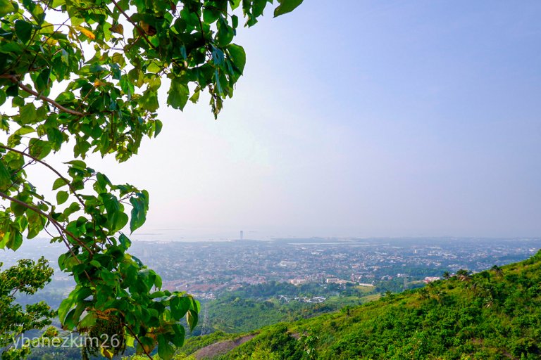
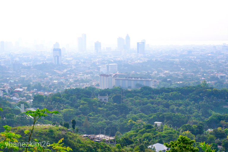
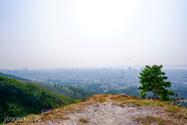
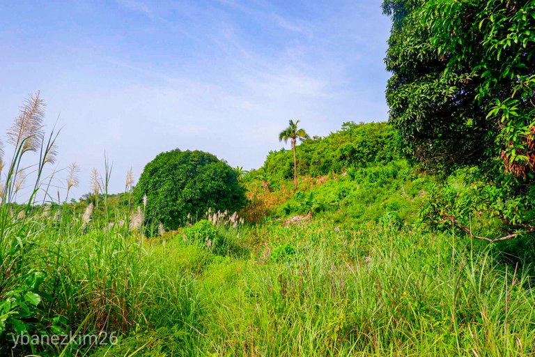
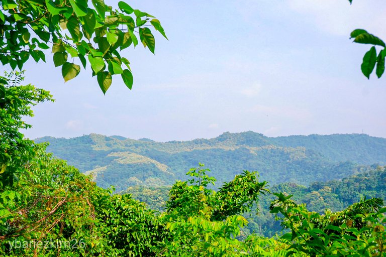
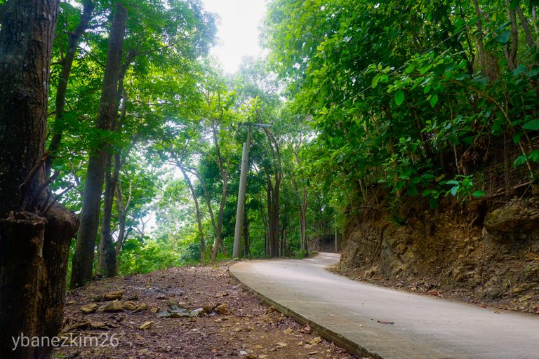
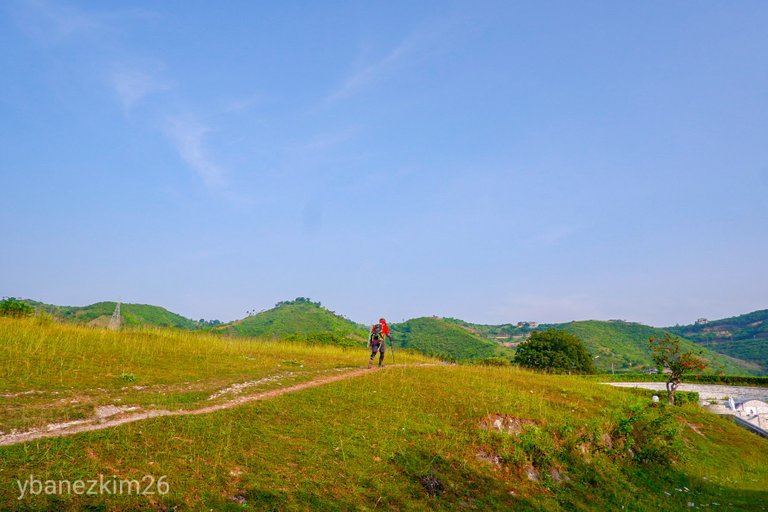
From Good Shepherd, you can already see parts of the panoramic view of the city. It was already blazing hot at 8:00 AM and the trail was just starting. If you're planning to trek, it's better to bring an umbrella or anything that could protect you from the heat of the sun. This part of the trail is an open grassland with no trees that could provide shade.
It will continue until the peak at Monterazzas de Cebu is reached. It's good to bring enough water to stay hydrated. I once tried to climb faster than my usual pace because it was so hot and I didn't have any protection, but I ended up being light-headed the moment reached the peak. Good thing I just recovered and continued with the trek.
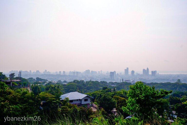
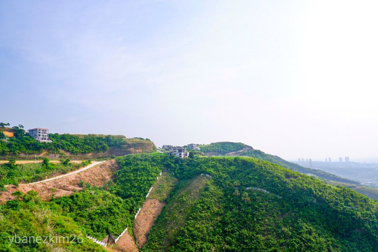
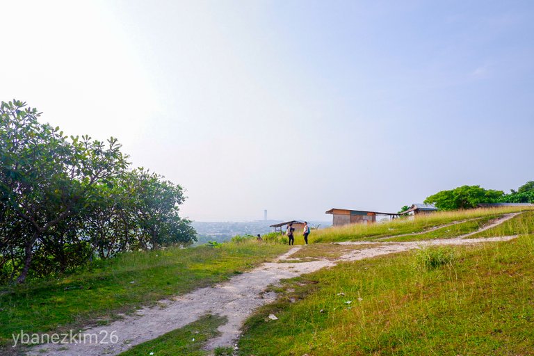
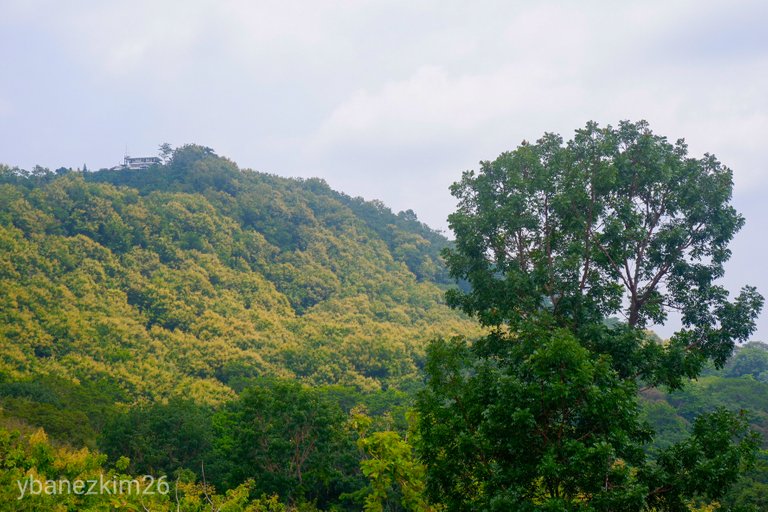
I have been trekking Spartan Trail numerous times already, but we chose to start at dawn to avoid the blistering heat of the sun. It was also a very good view of the city during sunrise. Monterazzas de Cebu is a high-end subdivision with its ongoing development, so the trail might be closed soon. An alternative route might be opened, but the main trail is still open for now.
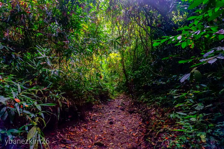
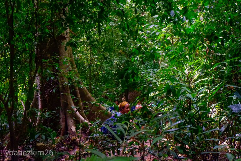
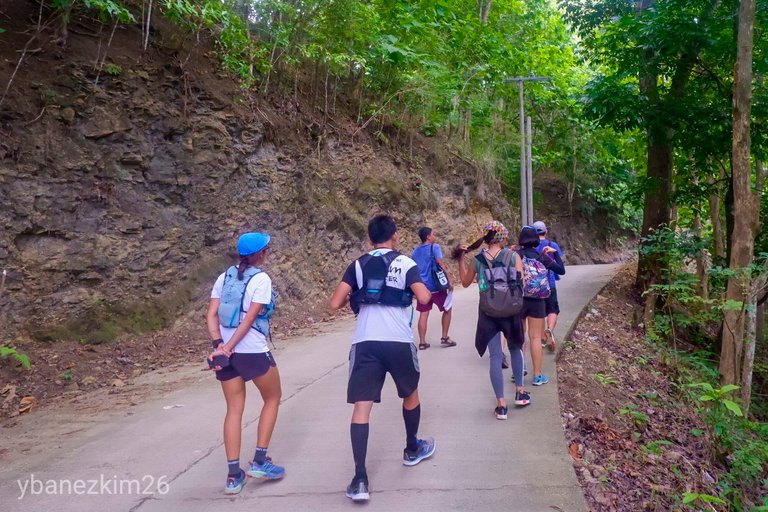
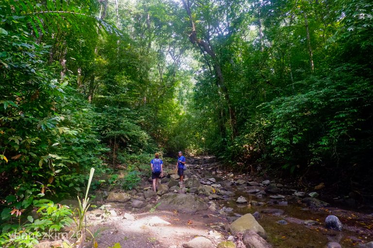
After reaching the peak, the trail will continue along the path with thick shrubs and grass so it's advisable to protect yourself from being cut. A large mango tree signifies the end of a flat trail with lush vegetation. From that mango tree, it will be a downhill traverse towards a small stream.
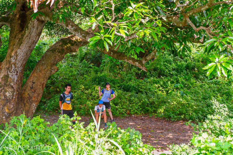
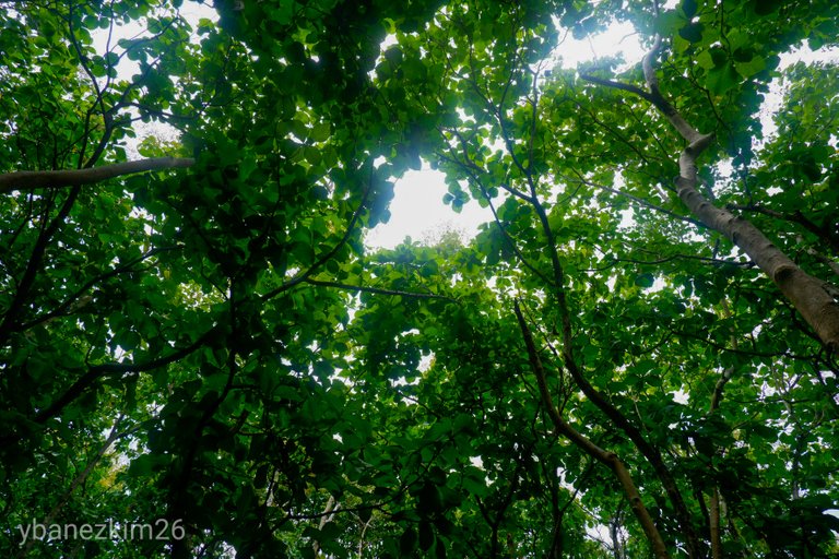
Along the way, it will be a canopy of different kinds of trees so it will be much cooler and comfortable with the shade of those trees. There will be a well along the way that's a source of potable water. Before reaching the river, we passed by a lot of rattan vines so, we were extra careful with its thorny leaves.
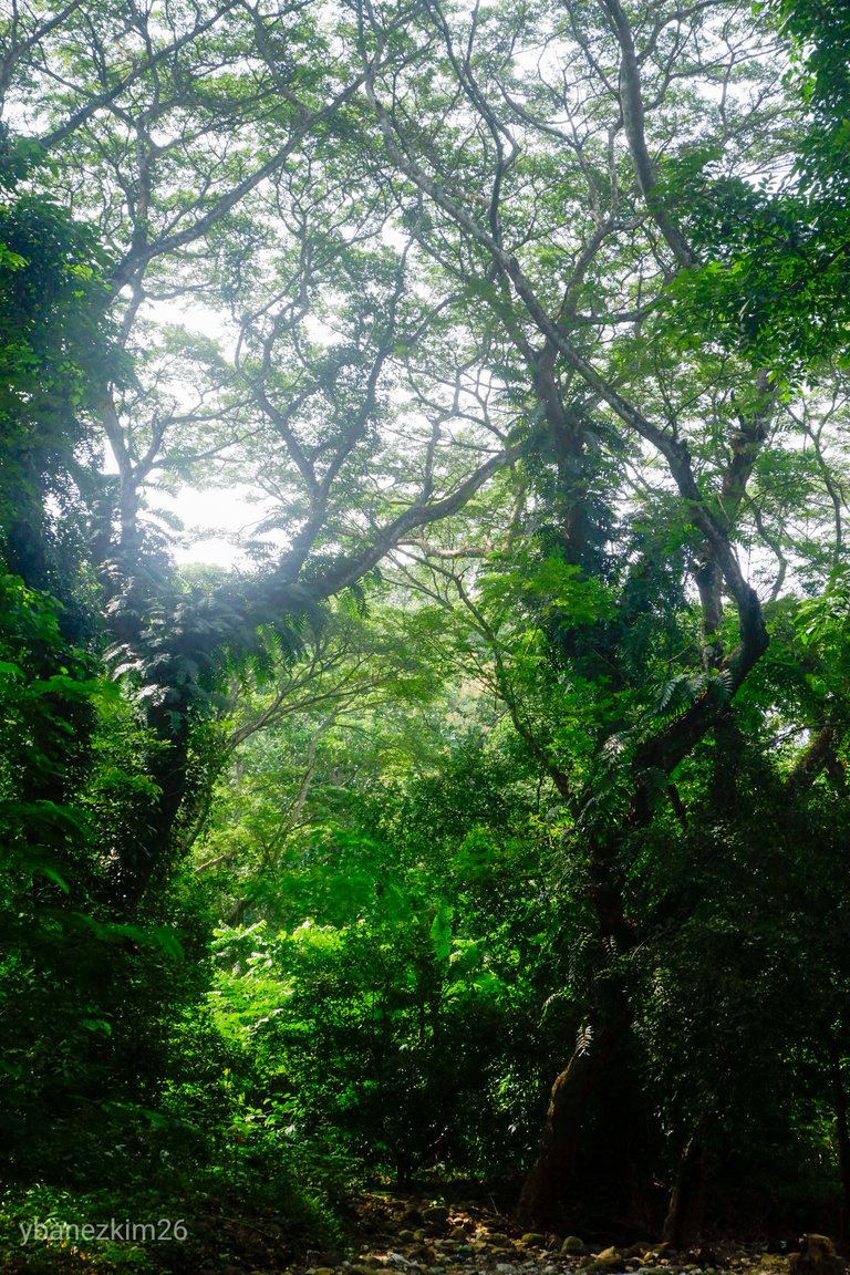
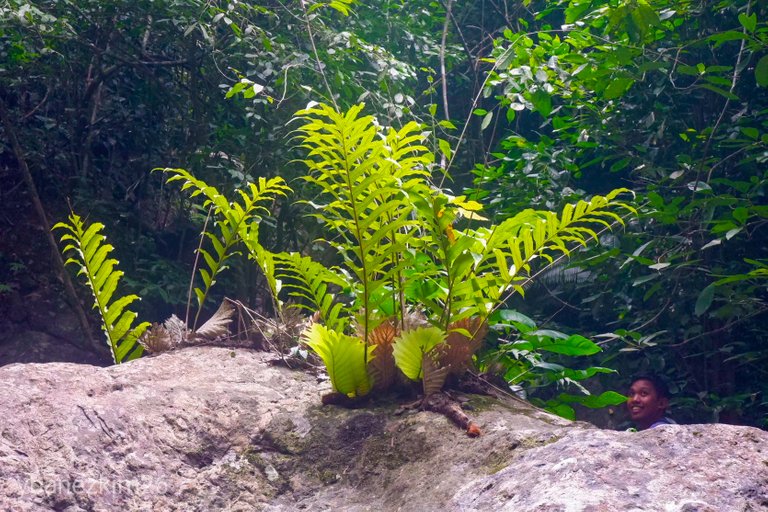
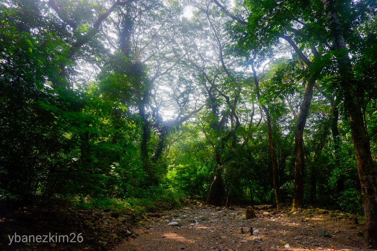
A few minutes later, we reached a dried stream that's one of the tributaries of Buhisan Watershed. During rainy season, the stream will be ankle to knee-deep with clear water. From the dried stream, the dome of big trees can be reached via a small trail under the forest of Buhisan Watershed Forest Reserve. That dome of trees is actually a waterway to Buhisan Dam. It's dry most of the time, but it becomes flooded during the rainy days.
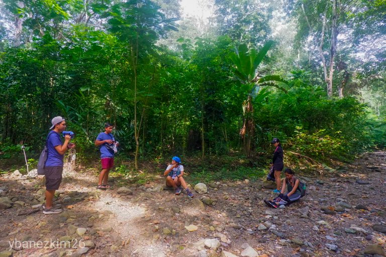
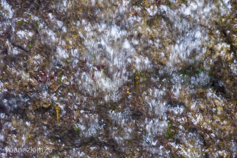
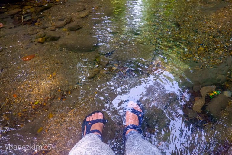
If you are to follow that dried river upstream, you will reach a point where there's water. This is what I like about Spartan Trail. We already have done an uphill trek and then downhill, and then in the dried river. Next will be a point where there's water that you can take a dip if you want to. Some dubbed it as the jacuzzi. The water is clean and cold. It's actually refreshing after the trek. I doubt there's the same place as this near the city where you can take a bath in a clean stream water.
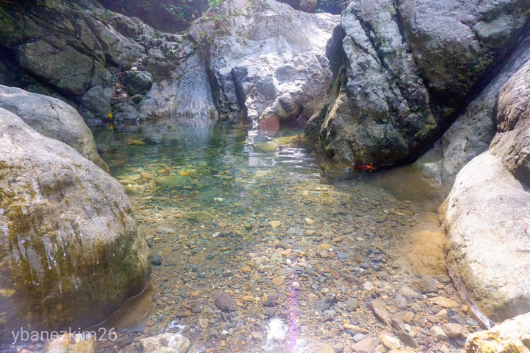
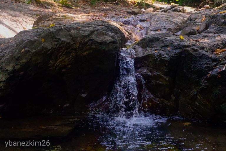
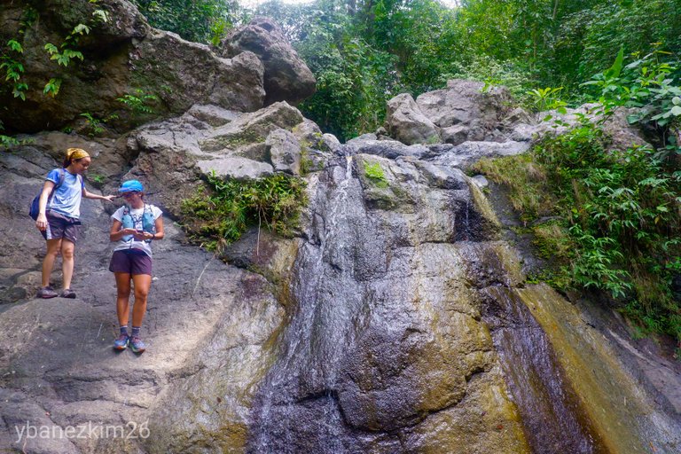
After a few minutes to an hour of resting at the jacuzzi, the trail will continue upstream until we reached a small waterfall. If you're adventurous like me, you can opt to go up along the side of the waterfall. It's like rock climbing, without safety gear, but it's relatively safe if you know where to place your hands and feet on the rock wall.
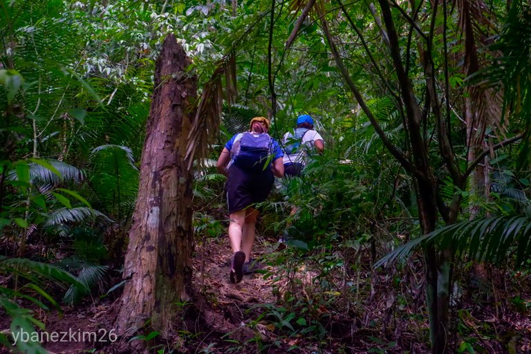
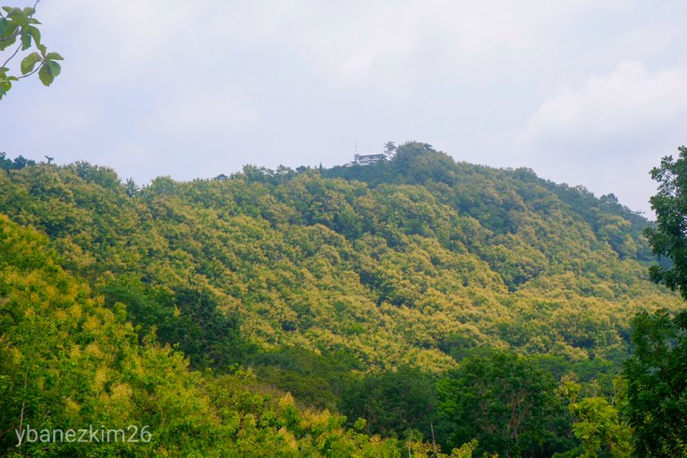
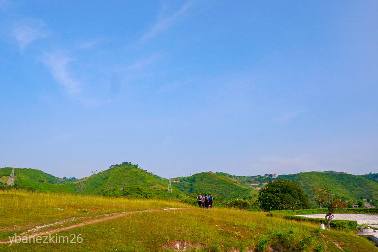
The river trail will end at the point where it will be another uphill trek again, but this time, under the canopy of different trees. Since it's part of the Buhisan Watershed Forest Reserve, most of the trees are planted years ago. From that point, it will be all uphill until the barangay road of Pamutan is reached.
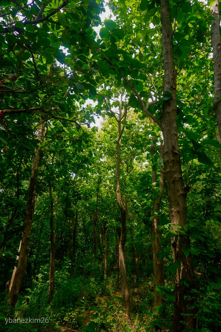
There are parts of the trail where only one species of tree grows. They said it's teak tree, but I don't really know it's name. All I know is that they're not native species. This means that they don't support the native undergrowth. Although there are trees, the area looks dry because those trees are water demanding. This happens when you plant exotic species of trees.
I think the local government and the Department of Environment and Natural Resources have already learned their lesson because I observed new and different species (some are native like narra and molave) of trees that are being planted on the later part of the trail. Being under the canopy is actually refreshing, despite the exhausting uphill trek. Don't underestimate this part of the trail because if you're a beginner, it will feel as if it's endless.
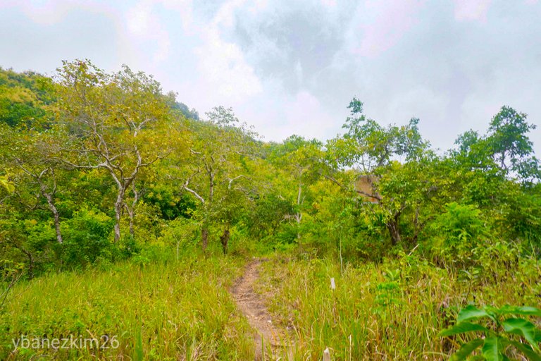
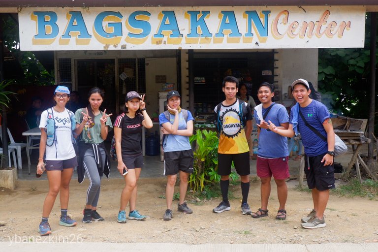
An hour and a half after of grueling uphill hike, a clearing can be seen which signifies the end of the trail. The clearing is most cogon grass with sporadic sprouts of duhat tree. A little bit further up was the barangay road going to Pamutan/Guadalupe on the right and to Toong/Buhisan/Punta Prinsesa on the right.
A few meters is the Bagsakan Center where we took our lunch. We arrive in Bagsakan Center at 11:30 AM, so it was four hours worth of hike. Lunch at Bagsakan Center was a well-deserved treat after the hike. Home-cooked meals are available with lumpia and pinakbet (pork and vegetable dish that was sauteed in garlic and onion and then added with soy sauce) as their best seller. Ice cold soft drinks after the meal would certainly quench your thirst.
At around 12:30, we decided to head home via habal-habal to Punta Princesa. Overall, the hike was enough to have a great weekend. It was enough to make my legs sore, but it was all worth it.
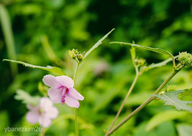
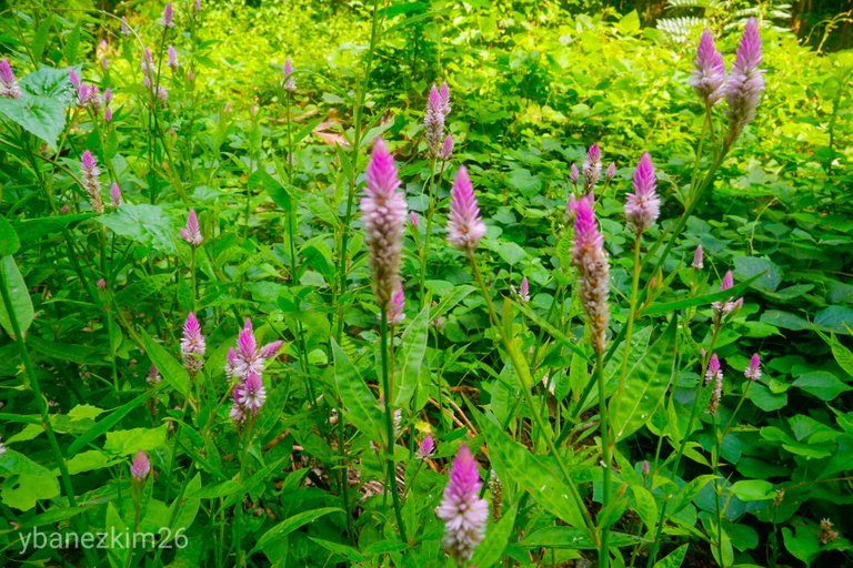
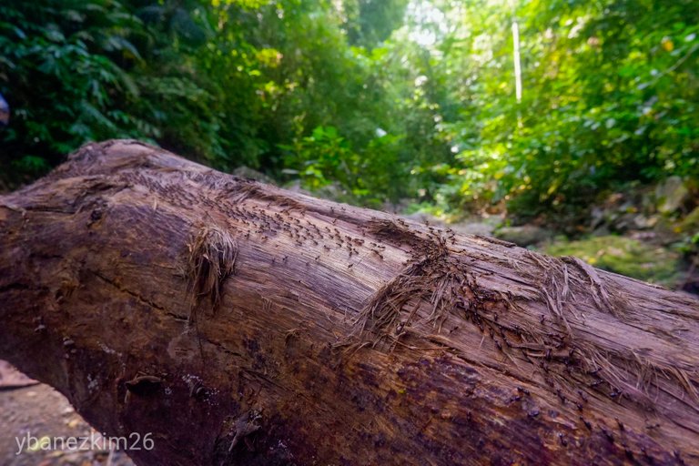
Some Flowers and Critters Along the Way
A Few Reminders
Buhisan Watershed Forest Reserve is a protected landscape and we're privileged enough to have access to the area. The whole reserve is crucial to the stability of the water source of Cebu City. Please let's help make the watershed and the forest free from trash.

My friend and workmate @xaydtrips has been very active in raising awareness and conducting clean up drives in the area. As the seasoned mountaineers have continued to have their practice climb in the area, its preservation is of utmost importance.
There are amateur hikers who happened to be irresponsible with their trash. They just leave their trash along the trail. If you want to hike in Spartan Trail, please bring your own trash with you. Also, as much as possible, avoid having camp fires along the river. The ashes from the camp fires will contaminate the river.
Note: All photos are mine unless otherwise stated. They're taken using my Fujifilm X-T100 and edited using Adobe Light room.
Thank you in advance for your encouraging comments and upvotes! It takes a lot of effort to write and edit travel blogs, so I don't post as often as I wanted to. See you in my next quest!
Have a great week everyone!
Best Regards,
Kim
Beautiful walk, dressed with excellent photos.
It is unfortunate that the pollution completely covers the city.
The next time you reach the mango tree add a mango leaf to your water bottle, it will avoid any muscle pain. :-)
Congratulations on a Curie vote.
Thank you, @mariita52! I think the haze was gone now. It rained last weekend so the sky is now clear.
I didn't know that mango leaf can prevent muscle pain. I will try it next time.
A wonderful post with excellent photos. Thank you for all the technical aspects you share in each photograph. The ride was great and really enjoyed it. A big hello @ybanezkim26
Hi, @marcybetancourt! I felt compelled to share technical aspects since I'm still learning this photography thing. I may revisit this blog in the future to assess how far I've improved. Thanks for stopping by! Have a great day!
Congratulations, Your Post Has Been Added To The Steemit Worldmap!
Author link: http://steemitworldmap.com?author=ybanezkim26Post link: http://steemitworldmap.com?post=kim-s-quest-11-weekend-hike-at-spartan-trail-or-discover-cebu
Want to have your post on the map too?
Hi ybanezkim26,
Visit curiesteem.com or join the Curie Discord community to learn more.
Yay! Thank you so much, @curie!
Hello Hello!
Wow the photos are beautiful, I see that this tour was well done, enjoyment is the main thing in our lives :)
Thank you, @iamsaray! Have a great day!
upvote and a resteem. Your work really stands out! Your article now has a chance to get featured under the appropriate daily topic on our TravelFeed blog.
Thank you for being part of the TravelFeed community!Congratulations! Your high-quality travel content was selected by @travelfeed curator @worldcapture and earned you a reward, in form of an
Did you know that you get larger upvotes when posting through TravelFeed.io? That is not all, we are also giving away a ticket to Steemfest to one lucky TravelFeed user. Make sure to read the announcement and opt in! Also, thanks to the travel writing contest by @invisusmundi you can now earn up to 100 STEEM on top of the post rewards when posting through our new platform TravelFeed.io! Read the contest announcement for more information on how to participate.
We are continuously working on improving TravelFeed, recently we introduced EasySignUp and EasyLogin, our first step to make TravelFeed ready for mass adoption.
Learn more about TravelFeed by clicking on the banner above and join our community on Discord.
Thank you! Very much appreciated.
Happy you liked it!!!
congratulations on your curie voteehy dear @ybanezkim26, you made a great post! I must confess that I had to go to google maps to see where this wonderful place to visit was! your photos are great, I really liked the second part in the forest with the river !! a magical trekking and a well-deserved pig at the end :-))
Thank you so much for your kind words, @road2horizon! I bet you like the one that looked like a dome of big trees. That one is my favorite because it's enchanting to watch the rays penetrating the canopy into the forest floor.
Thanks for checking out this post! Have a great day!
you really guessed it !! when the light passes between the leaves, a fairytale atmosphere is created :-))
Daily Travel Digest #647.
 Hiya, @LivingUKTaiwan here, just swinging by to let you know that this post made into our Honorable Mentions in Your post has been manually curated by the @steemitworldmap team. If you like what we're doing, please drop by to check out all the rest of today's great posts and consider upvoting and supporting us.
Wow! Hi there, fellow Cebuano! I didn't know there could be something like this just near the city. I was planning of just visiting Good Shepherd for the simple city view but who knew there was a better one a bit further!
Great blog! And definitely an awesome guide too! Now I know what I'll be doing this weekend. Keep it up!
Hi, @tangatraveller! I think Monterrazas de Cebu is closing the trail because the development is ongoing. There's another trail on the other side of the mountain, but I haven't tried that yet.
It's good to know there's a fellow Cebuano here. How did you know about Steem?