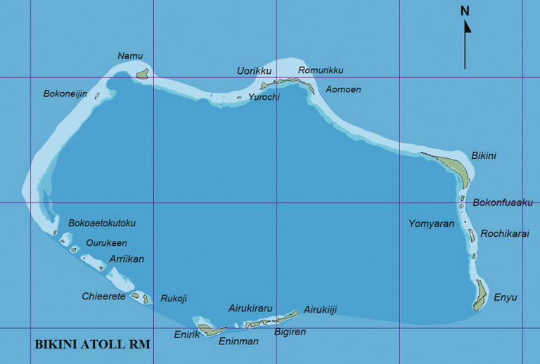
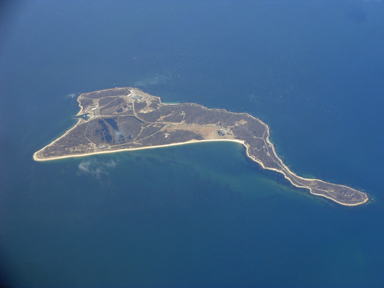
1.Bikini Atoll
Bikini Atoll is an atoll in thwe Marshall Islands which consists of 23 islands totaling 3.4 square miles (8.8 km2).
Between 1946 and 1958, 23 nuclear devices were detonated by the United States at seven test sites located on the reef, inside the atoll, in the air, or underwater. They had a combined fission yield of 42.2 Mt. The testing began with the Operation Crossroads series in July 1946. Prior to nuclear testing, the residents initially accepted resettlement voluntarily to Rongerik Atoll, believing that they would be able to return home within a short time. Rongerik Atoll could not produce enough food and the islanders starved. When they could not return home, they were relocated to Kwajalein Atoll for six months before choosing to live on Kili Island, a small island one-sixth the size of their home island. Some were able to return to the Bikini Island in 1970 until further testing revealed dangerous levels of strontium-90. The islanders have been the beneficiary of several trust funds created by the United States government which as of 2013 covered medical treatment and other costs and paid about $550 annually to each individual.
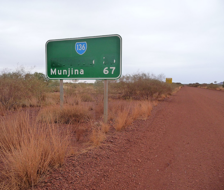
2.Wittenoom
Wittenoom is a ghost town 1,106 kilometres (687 mi) north-north-east of Perth in the Hamersley Range in the Pilbara region of Western Australia.
The area around Wittenoom was mainly pastoral until the 1930s when mining began. By 1939, major mining began in Yampire Gorge, which was subsequently closed in 1943 when mining began in Wittenoom Gorge. In 1947 a company town was built, and by the 1950s it was Pilbara's largest town. During the 1950s and early 1960s Wittenoom was Australia's only supplier of blue asbestos. The town was shut down in 1966 due to unprofitability and growing health concerns from asbestos mining in the area.
Today, three residents still live in the town, which receives no government services. In December 2006, the Government of Western Australia announced that the town's official status would be removed, and in June 2007, Jon Ford, the Minister for Regional Development, announced that the townsite had officially been degazetted. The town's name was removed from official maps and road signs and the Shire of Ashburton is able to close roads that lead to contaminated areas.
The Wittenoom steering committee met in April 2013 to finalise closure of the town, limit access to the area and raise awareness of the risks. Details of how that would be achieved were to be determined but it would likely necessitate removing the town's remaining residents, converting freehold land to crown land, demolishing houses and closing or rerouting roads. By 2015 six residents remained; in 2016 the number dropped to three.
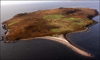
3.Anthrax Islands
Anthrax Island may refer to one of three sites for hazardous biological disease testing:
• Gruinard Island, a Scottish island in the United Kingdom used in World War II. In 1942, biological warfare test started on island. The Anthrax strain, which has been used, was called "Vollum 14578". In 1981, govenment decided to decontaminate island ("operation Dark Harvest").
On 24th April 1990, after 48 years of quarantine and four years after the solution was applied, junior defence minister Michael Neubert visited the island and announced its safety by removing the warning signs. On 1st May 1990, the island was repurchased by the heirs of the original owner for the original sale price of £500. As of October 2007 there have been no cases of anthrax in the island flock.
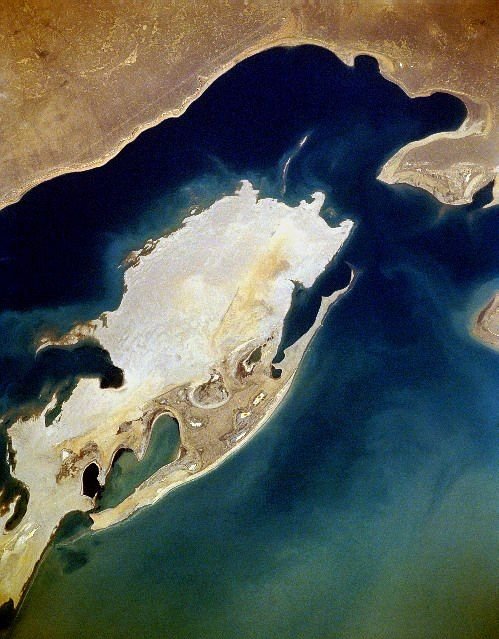
• Vozrozhdeniya Island, an island in the Aral Sea used by the Soviet Union in the Cold War. In 1954, the Soviet Union constructed a biological weapons test site called Aralsk-7. In 1971, an accidental release of weaponized smallpox infected ten people, of whom 3 died. Aralsk-7 was closed in November 1991. The main town on the island, Kantubek, today is a "ghost" town. Many of the containers holding biological agents were not properly stored or destroyed, and over the last decade many of these containers have developed leaks.
In 2002, through a project organized and funded by the United States with the assistance of Uzbekistan, 10 anthrax burial sites were decontaminated.
• Plum Island (New York), an island off Long Island, New York in the United States, the location of a testing lab for hazardous livestock diseases. The island is the site of the Plum Island Animal Disease Center (PIADC) which was established by the United States Department of Agriculture (USDA) in 1954. The Island is also the site of the former U.S. military installation Fort Terry (c. 1897), and the historic Plum Island Light (c. 1869), and its automated replacement.
Plum Island is owned in its entirety by the United States government, which was considering sale of the island as part of a debt-reduction package but suspended the plan in February 2012. Access to the island is controlled by the United States Department of Homeland Security (DHS).
On August 29, 2013, the United States General Services Administration (GSA) and United States Department of Homeland Security (DHS) announced a final "Record of Decision (ROD): Public Sale of Plum Island, New York".
4.Picher
Picher is a ghost town and former city in Ottawa County, Oklahoma, United States. This was a major national center of lead and zinc mining at the heart of the Tri-State Mining District.
More than a century of unrestricted subsurface excavation dangerously undermined most of Picher's town buildings and left giant piles of toxic metal-contaminated mine tailings (known as chat) heaped throughout the area. The discovery of the cave-in risks, groundwater contamination, and health effects associated with the chat piles and subsurface shafts resulted in the site being included in 1980 in the Tar Creek Superfund Site by the US Environmental Protection Agency. The state collaborated on mitigation and remediation measures, but a 1996 study found that 34% of the children in Picher suffered from lead poisoning due to these environmental effects, which could result in lifelong neurological problems. Eventually the EPA and the state of Oklahoma agreed to a mandatory evacuation and buyout of the entire township.
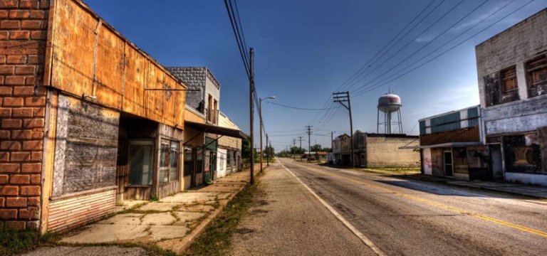
A 2006 Army Corps of Engineers study showed 86% of Picher's buildings (including the town school) were badly undermined and subject to collapse at any time. The destruction of 150 homes by an EF4 tornado in May 2008 accelerated the exodus. On September 1, 2009, the state of Oklahoma officially dis-incorporated the city of Picher, which ceased official operations on that day.
5.Chernobyl
Chernobyl is a city in the restricted Chernobyl Exclusion Zone situated in the Ivankiv Raion of northern Kiev Oblast, near Ukraine's border with Belarus. Chernobyl is about 90 kilometres (56 mi) northeast of Kiev. The city was the administrative center of Chernobyl Raion (district) from 1923 until it was disestablished in 1988. Before its evacuation, the city had about 14,000 residents. As of 2017, the city has a population of 690.
The city was evacuated on 27 April 1986, 30 hours after the Chernobyl disaster at the Chernobyl Nuclear Power Plantwhich. Reactor No.4 exploded and created most disastrous nuclear accident in history. The power plant was within the Chernobyl Raion district. Pripyat, a city larger and closer to the power plant than Chernobyl, had been built as home for the power plant workers.
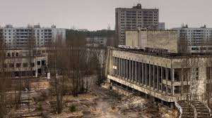
Today Chernobyl is mostly a ghost town, but a small number of people still reside in houses marked with signs stating: "Owner of this house lives here". Workers on watch and administrative personnel of the Zone of Alienation are stationed in the city on a long-term basis. There are two general stores and a hotel for tourists.