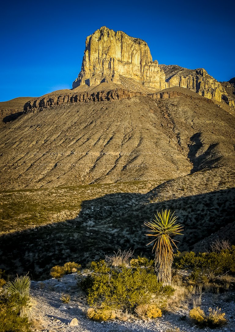
The Guadalupe Mountains are one of the earth’s best examples of an ancient marine reef. Geologists come to these mountains from all around the world to marvel at their natural beauty. Most believe these formations formed approximately 250 million years ago in the geologic period known as the Permian.
From the 17th to the 19th century, the Guadalupe Mountains were the exclusive domain of a small group of Mescalero Apaches known as the Nde. The Nde roamed these lands hunting mule deer, elk, and bighorn sheep, as well as harvesting plants like agave and bear grass. The nomadic Mescaleros ranged over vast areas and followed the changing seasons. That is until 1858 when the U.S. Army began an aggressive campaign to rid the Nde from these highlands, which they eventually did 30 years later.
With the added security of the armed forces, the U.S. Government began its first transcontinental mail route including a run through the Guadalupe Mountains and the barren Chihuahuan Desert on the Butterfield stagecoach. The Butterfield operated semi-weekly runs, covering 2,800 miles in 25 days. And, it was known that a stop in the Guadalupe highlands was a favorite amongst travelers and drivers alike.
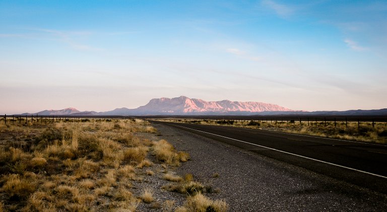
The Chihuahuan Desert, which extends south for hundreds of miles into Mexico, surrounds the Guadalupe Mountains and is sparsely populated. This region receives only 10”- 20” of rainfall a year and in the summer, temperatures can rise to 90° F (32.2° C) and higher. Although it may look barren, the desert is truly full of life and might provide an encounter with flora and fauna unknown to many. This might include agaves, prickly pear cacti, walking-stick chollas, yuccas, lizards, snakes, coyotes, and mule deer. All hikers are encouraged to keep watch, as there have also been sightings of mountain lions.
Set aside as a National Park in 1972, the Guadalupe Mountains includes over 86,000 acres with 85 miles of hiking trails. These trails vary in length and difficulty and offer a wide range of opportunities to fit anyone’s activity level so make sure and read up on each to fully determine which fits your ability. Trails leading to the high-country are steep and rough, with ascents going up as much as 3,000 feet in as short as 3 miles. These trails are rated strenuous because of their steep inclines and should be avoided during high winds or thunderstorms.
Guadalupe Peak is the highest point in Texas and the trail leading to its summit can offer those who reach its crest at 8,749 ft (2,667 m), a truly spectacular view. The trail is 8.4 miles round-trip from the Pine Springs trailhead and the ascent leads up 3,000 feet from the campground. As you start your ascent, you will immediately realize why this trail is rated strenuous. Zigzagging up a series of switchbacks on the face of the peak nearest the campground, you will encounter narrow trails and sheer drop-offs. Your knees might go weak as you try to keep your head down only looking at the trail in front of you.
Making the turn to the backside of the first peak, you start to realize what this trail is all about. As you check your GPS for the 4th time, you realize the miles to the destination are actually getting longer as you zigzag up the back side of the peak to join another peak at its shoulder. The switchbacks require that you traverse further on the second peak than you did on the first. Moving up its summit, you see the third peak off to your right. It looks high enough, could this be the end? As you round the backside of the second peak, you come to a bridge constructed of heavy timbers and stout railroad spikes. This bridge was put in place because of the broken and eroded cliff face that would impede your ascent if it were not there.
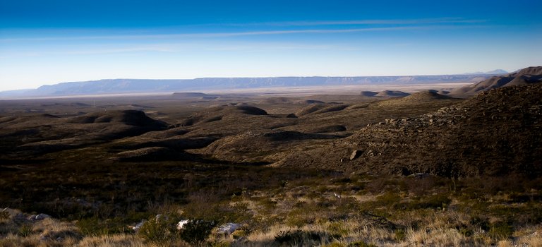
Crossing the bridge, you realize the third peak is not your target. There is a fourth peak just behind and almost completely hidden from view. As you head up another series of switchbacks, you are starting to clear the terrain around you and have an unobstructed view your surroundings. You can see for hundreds of miles, including many other trails in the Park and the Salt Basins out to the west. Still, you continue up.
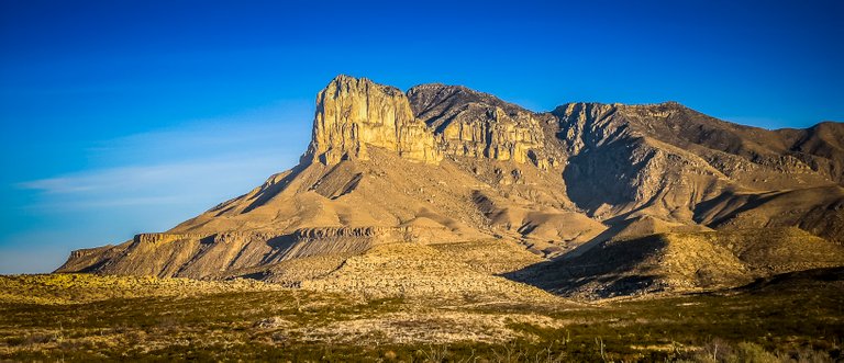
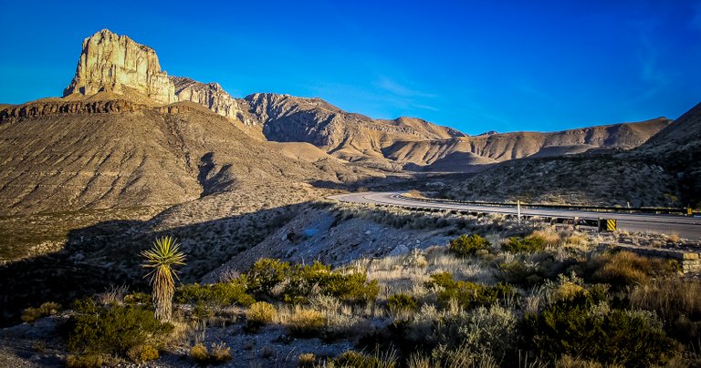
When you get to the top of the 3rd peak, you finally see get a glimpse of your final destination. Several hundred feet above, you can see where the trail leads. Nothing around you is as high. Nothing around you can give you the satisfaction of making that last step up. In fact, there is a monument where you can confirm your ascent with a picture. From here, you can see El Capitan just below. This limestone formation is one of the most recognizable features in the park and what many come to see. Still, it is below you and the Guadalupe Peak by almost 700 ft.
After resting and taking several photos, it is time to start your descent. Although it is easier, you still need to be careful. You have traveled 4.2 miles, almost straight-up, and you will probably be tired. It would be all too easy to trip and fall and don’t forget about those sheer drop-offs. They will be there waiting for you on your way back down so be careful.
Once you return to the campgrounds, you will feel a great sense of accomplishment. You will be tried but very grateful you did not give up the 20 times you wanted to during the hike. Glad it is over, but glad you made it.
Camping is available year-round and is run on a first-come, first-served basis, at the Pine Springs campground. This campsite is where you will stay if attempting to climb Guadalupe Peak. It has running water, fully accessible restrooms, tables, and sites for tents and RVs but no dump station or electric hook-up. The cost for camping is a mere $8.00 a night.
Getting There…
The Pine Springs campground is located in west Texas on U.S. 62/180, 110 miles east of El Paso and 55 miles southwest of Carlsbad, New Mexico. The Pine Springs Headquarters is open daily except December 25th and you can find restrooms, drinking water, brochures, books, trail guides, maps, exhibits, a slide program, and activity schedules at the headquarters. The nearest motel, restaurant or gas station is located 35 miles northeast on U.S. 62/180 in White’s City. If you need more options, you will have to travel to Van Horn, Texas which is 67 miles south or Carlsbad, NM which is 51 miles away. Other than that, plan to bring all of your own supplies. The Guadalupe Mountains are fairly isolated but offer you a remote experience unlike any other in the State.
.jpg)
Enjoying my content? Please help support my ongoing efforts by resteeming.
Thanks So Much - Liquidtravel
The architecture of the rocks is pure art. Congratulations for the article and I love the pics! :)
Thank you very much. I appreciate it.
Congratulations, Your Post Has Been Added To The Steemit Worldmap!
Author link: http://steemitworldmap.com?author=liquidtravelPost link: http://steemitworldmap.com?post=have-you-ever-been-to-the-top-of-texas-i-have
Want to have your post on the map too?
Great post, will plan to climb this peak, I recently moved to S Texas. I lived most of my life in Colorado and climbed most of the 14,00' peaks. This is at a lower elevation but looks like a beautiful climb.
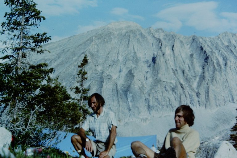
Photo is of a climbing partner and me to the right with Capitol Peak in the background on my 1st attempt - my favorite 14ner
Thanks for the comment. It is not that hard compared to many I have made. For some, the 3,000 ft ascent in such a short duration will be challenging but for others who have done tougher climbs, this would just be a great day...
sounds like a steep hike up, no technical climbing, should be beautiful from the top
3000 verticle is a good climb, no affects from the altitude on this one
True, this is not a technical climb at all and no effects from altitude. Just a great view from the top.
@Originalworks
You got a 50.00% upvote from @spotlight courtesy of @resteemable!
Your Post Has Been Featured on @Resteemable!
Feature any Steemit post using resteemit.com!
How It Works:
1. Take Any Steemit URL
2. Erase
https://3. Type
reGet Featured Instantly � Featured Posts are voted every 2.4hrs
Join the Curation Team Here | Vote Resteemable for Witness