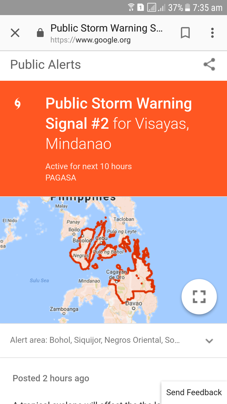
All level no class here in Southern Leyte, Philippines!!! "BASYANG" CONTINUES ITS THREAT OVER CARAGA REGION.
Location of eye/center : At 4:00 AM today, the center of Tropical Storm "BASYANG" was estimated based on all available data at at 175 km East of Hinatuan, Surigao del Sur (08.1, 127.9).
Strength : Maximum winds of 65 kph near the centerand gustiness of up to 80 kph.
Forecast movement : Forecast to move West Northwest at 25 kph
Forecast position :
• 24 Hour(Tomorrow morning): 115 km West of Dumaguete City, Negros Oriental(9.3°N, 122.3°E)
• 48 Hour(Thursday morning):125 km West of Puerto Princesa City, Palawan(9.8°N, 117.6°E)
• 72 Hour(Friday morning): 60 km West Southwest of Pagasa Island, Palawan (OUTSIDE PAR)(10.8°N, 113.6°E)
• 96 Hour(Saturday morning):295 km West Northwest of Pagasa Island, Palawan (OUTSIDE PAR)(11.7°N, 111.5°E)
Scattered to widespread moderate to heavy rains will prevail in the next 24 hours over Visayas, Caraga, Northern Mindanao, Zamboanga Peninsula and the provinces of Davao del Norte, Davao Oriental, Compostela Valley, and Lanao del Sur. Meanwhile, scattered light to moderate with at times heavy rains is expected over Bicol Region, MIMAROPA, and the rest of Mindanao. Residents of these areas must continue monitoring for updates, take precautionary measures against possible flooding and landslides, and coordinate with their respective local disaster risk reduction and management offices.
Expected to make landfall in Caraga Region this morning.
Sea travel remains risky over the seaboards of areas under Tropical Cyclone Warning Signal (TCWS), the seaboards of Northern Luzon and of Visayas, the eastern seaboards of Central Luzon, and the eastern and southern seaboards of Southern Luzon due to the approaching Tropical Storm and the surge of the Northeast Monsoon.

Source:Public Alerts