Independence pass其实是一条hiking trail,是美洲大陆分界线(continental divide)的一个部分。美洲大陆分界线从白令海峡一直延伸到南美大陆最南端的麦哲伦海峡。美国境内从蒙大拿的冰川国家公园开始,纵贯的落基山脉把全美分成2个水系,分界线以西的都流入太平洋,以东的都流入大西洋。(听到同行的朋友说在这儿上小号还挺有意义的😂)
分界线山脉一路从蒙大拿往南延伸,贯穿黄石公园,在科罗拉多州达到最高点,4352米。由于地势较高,大陆分界线通常都在林木线以上(感觉自己在上地理课?),山都是光秃秃的,其实不怎么好看,但比较有历史意义。开车到independence pass的时候是9月,一路看着金黄的白杨树渐渐消失,直到看见光秃秃的已被大雪覆盖的大山。
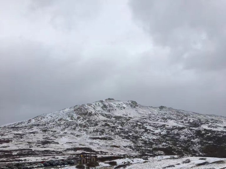
Independence pass is one of hiking trails of the Continental Divide of America in Colorado. The Continental Divide in the US begins at the northwest of Montana and reaches its highest point in Colorado(14278ft). It separates the watersheds flowing into Pacific Ocean and Atlantic Ocean. Due to the height of the mountains, most of the continental divide is above tree line. The view is okay because mostly what you'll see is bare mountains. But I think it's very meaningful to stand at the peak of the continental divide.
Thank you for reading and welcome to comment!
哈哈哈 最爱地理课 总是满分 我每次发文也恨不得狂侃地理
哈哈哈 我也是来了科州之后被慢慢科普的
👨 I prefer mountains in the East. (with dense forest, rugged cliffs, waterfalls and fog) 🌄
🐶That's cool! I can meet a snowman!
👩I love waterfalls!
🐶 me too!!