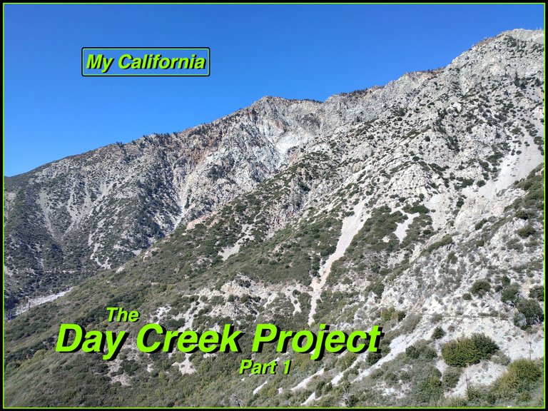
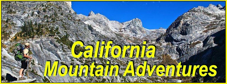
For this weeks Show Us Your California contest by @thesocalhive I head up into the San Gabriel mountains for an attempted trip to...
Day Creek!!

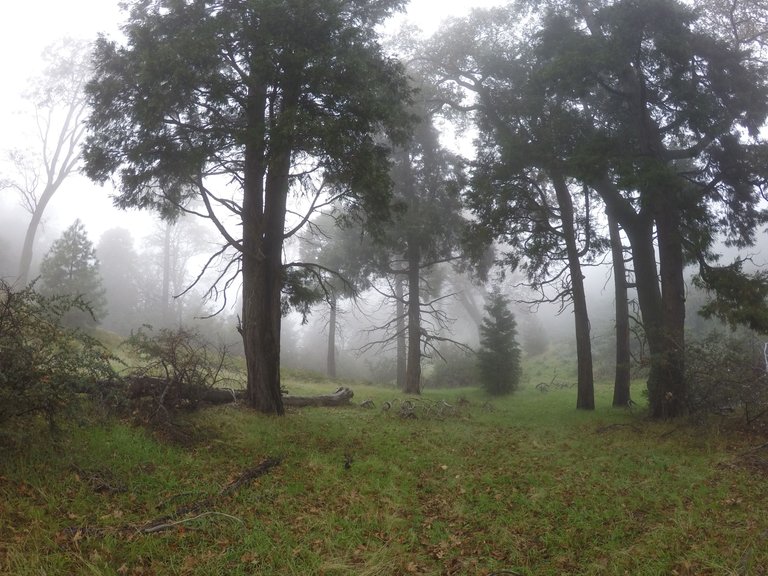
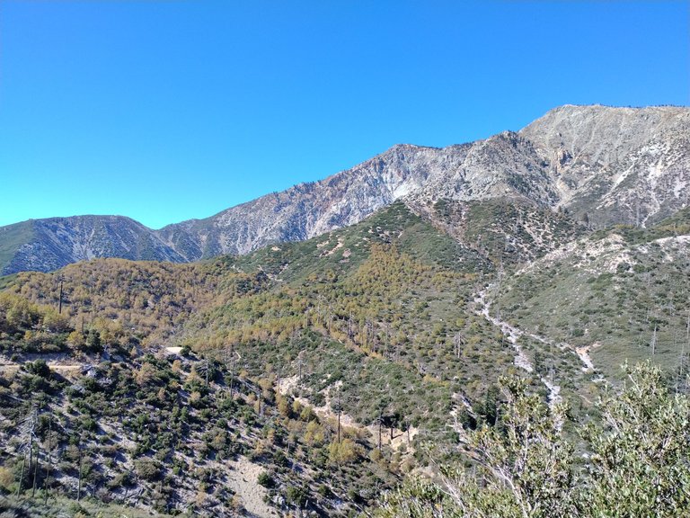
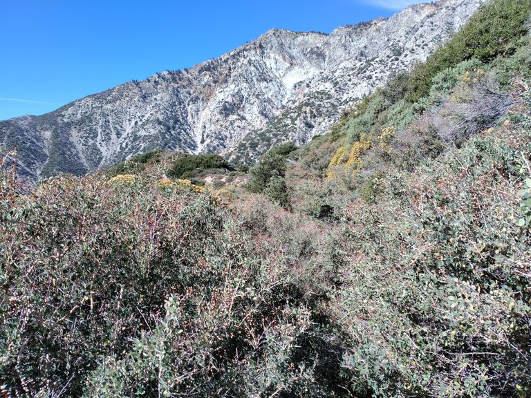
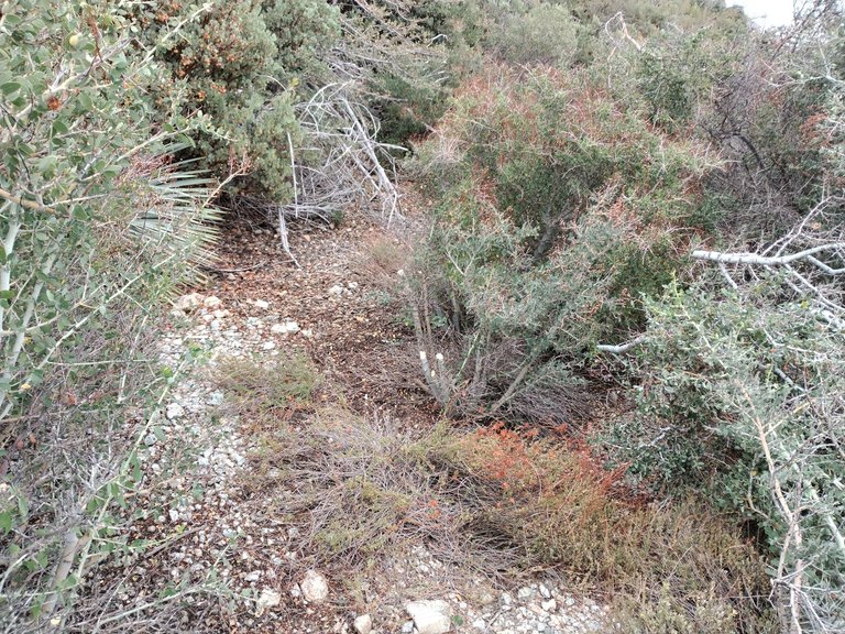
At the far eastern end of the San Gabriel mountains, below Cucamonga and Etiwanda peaks, is an area of wilderness that is fairly inaccessible. Mainly because the road that leads through it, the old Cucamonga truck trail, is almost always closed. And even when it's open it's still a 20+ mile drive on a rough and rocky dirt road. Which is an adventure just in itself. But to me this area is really spectacular and so when I recently saw that the gate for the road was unlocked I started making plans for a trip. About a mile or so passed where the road is permanently closed, just above the Joe Elliot camp, is where the crisp cold waters of Day creek flow out from the northeastern cliffs of Cucamonga peak. I've camped there a few times before and I really enjoyed it. It's really spectacular yet no one ever goes there. And one of the reasons why is because of overgrown buckthorn and other brush that has taken over the trail. The last time I camped there was quite a few years ago and it was already getting pretty overgrown even then. So I knew it was probably going to be bad. So I planned on making a trip up there with a handsaw to try to cut a path through the brush down to Day creek.
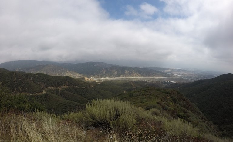
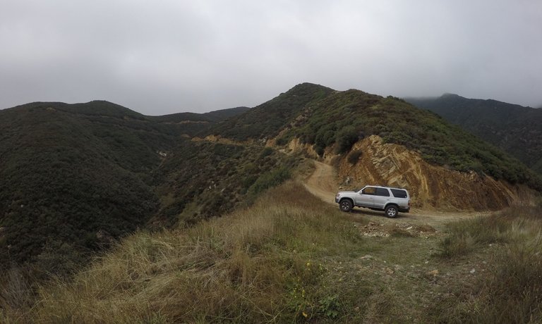
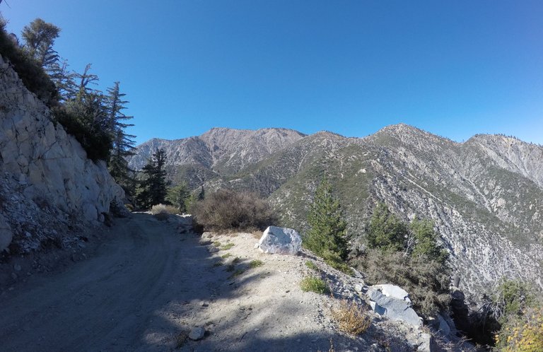
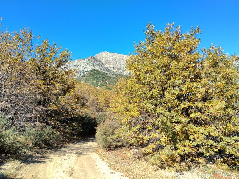
The day came for the trip and I loaded up my truck with all my camping/bushwhacking gear and headed out. The dirt road starts near the mouth of Lytle creek and goes right passed an old hydraulic mining area known as "Texas Hill". From there it climbs and climbs switchbacking several times passing a few nice fresh water springs along the way and eventually reaching the plateau known as San Sevaine Flats which is a beautiful area full of little meadows shaded by big oaks, cedars, and pine trees. From the flats I took a quick detour up to the radio towers that are just above the flats. All morning I had been driving through the clouds and I had just broke through and gotten above them so I stopped for a little bit at the towers and enjoyed the views overlooking the sea of clouds that filled the valley. But I couldn't stay long because I still had a lot more dirt road to go and I knew I had some work ahead of me. So I got back down on the main road and continued on. Through the flats, up and over a big saddle, and then down around Buck point and into the Joe Elliot camp area which greeted me with a bunch of nice oak trees in their fall colors. Passed the camp the road climbs up just a short distance before coming to and end at a locked gate on the ridge just above the campground. And this is where the second part of the adventure started.
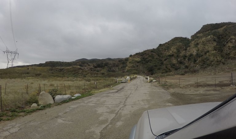
The gate that is almost never open
Driving through the clouds
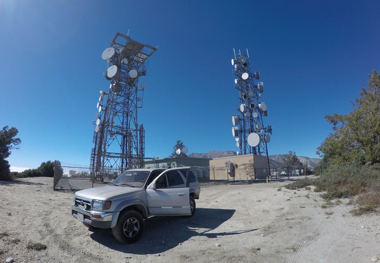
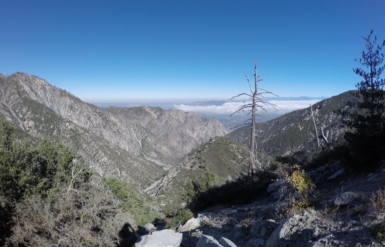
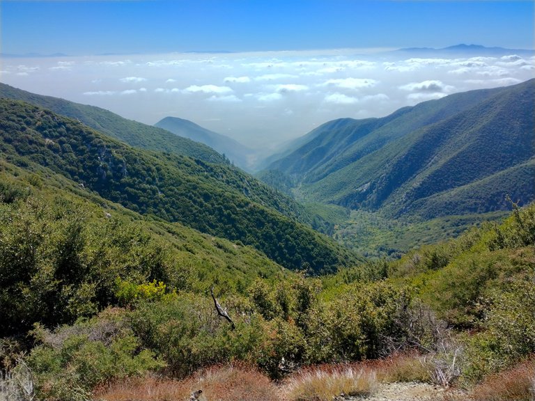
Arriving at the radio towers with clear blue skies
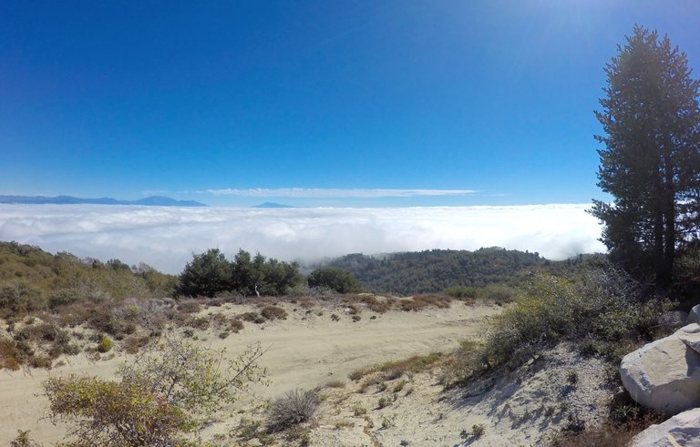
Overlooking the sea of clouds
Dropping down towards the Joe Elliot camp
Driving through some fall colors at Joe Elliot
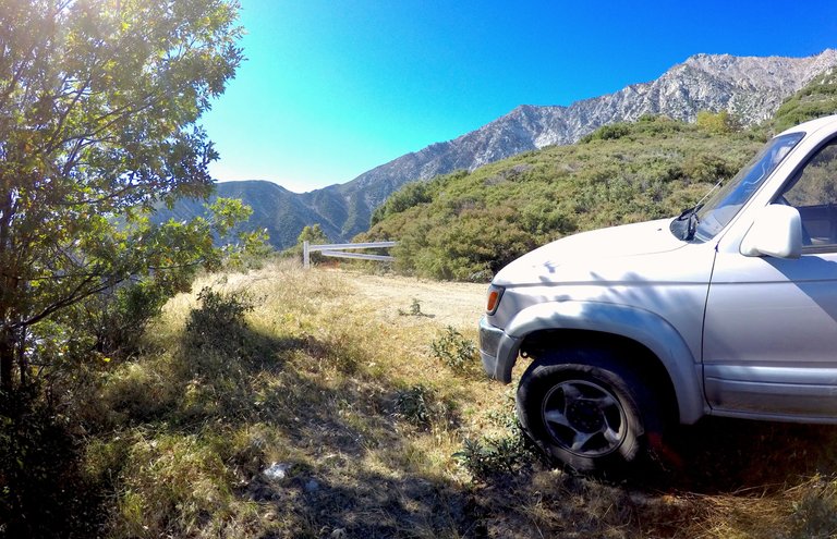
Arriving at the end of the road
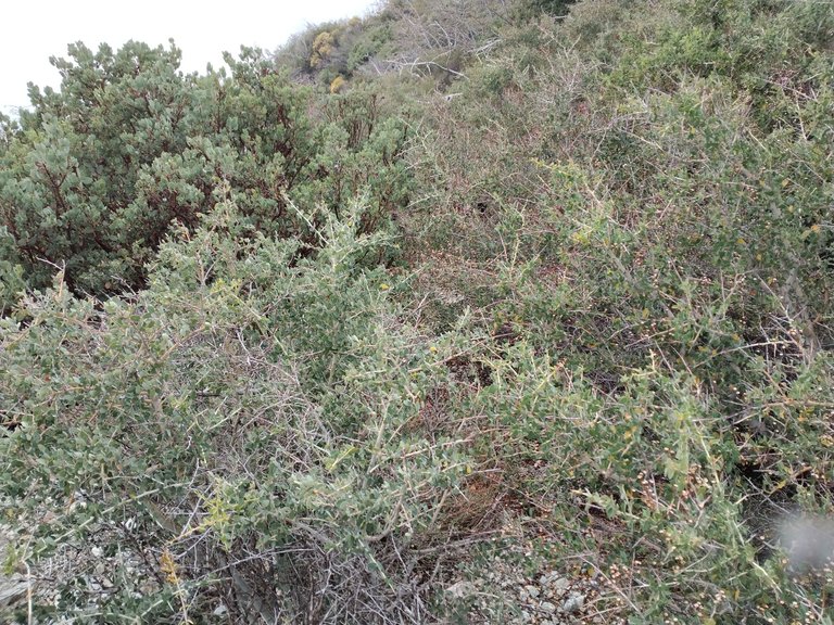
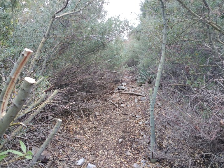
Since it's only about a mile or so to the creek I was optimistic that I was going to make it there to camp so I loaded up my pack with all my camping gear, grabbed my handsaw and started down the trail. Right away I realized that the overgrowth was much much worse than I had anticipated and my optimism quickly started to diminish. But I decided to push on and only took time to chop back the brush where absolutely necessary due to only having so much time left in the day. I was getting relentlessly poked and scratched pushing through the spiky brush. At a couple points I was literally crawling on the ground attempting to get through underneath the bushes. Eventually I was sitting there in a tunnel of brush with the daylight starting to fade and seemingly no end to the bushwhacking and I had to make the decision to turn around and head back to my truck to camp. So I headed back up the trail, doing some more brush trimming along the way and arrived back at my truck just before dark. I was all scratched and poked up and completely exhausted from my failed attempt. But I wasn't giving up. So I had some dinner and then laid my sleeping bag out in the back of the truck and went to sleep early to get plenty of rest because I knew the next day I was going to need it.
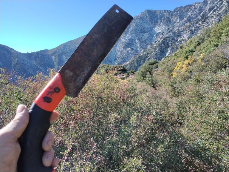
Starting down the trail with my cheap Harbor Freight hand saw
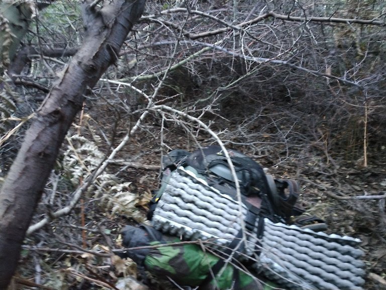
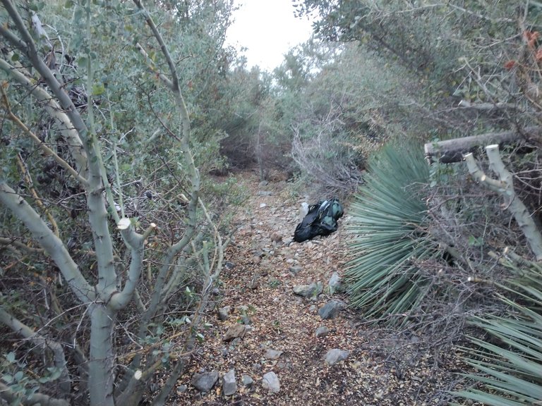
My backpack in a tunnel of brush
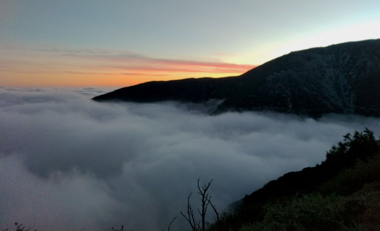
Sunset
In the morning I woke up to a beautiful sunrise over the sea of clouds. I got up and made some breakfast and got myself ready for the day. Now, having a more accurate assessment of the challenge, I left my camping stuff at the car and just loaded up a day pack. Then once again I headed down the trail with my hand saw. This time taking my time to cut a good wide path through the brush as I went. I chopped and chopped and chopped all day long. It was quite tiring, but I relentlessly pushed on. And although it was tough work I actually was really enjoying it. Towards the end of the day unfortunately the handle broke off my cheap hand saw. But I wasn't going to let that stop me. So although it was a bit tougher I kept chopping away just holding the saw blade itself in my hand. I ended up making it about 80% of the way to the creek and once again was starting to lose daylight. So I had to call it a day and head back. But at least now I had a nice trail chopped out to make the hike back much easier and much less painful. Getting back to camp I was pretty beat, but it felt good. I made my dinner and enjoyed the now clear view down on the city lights for awhile before heading off to bed.
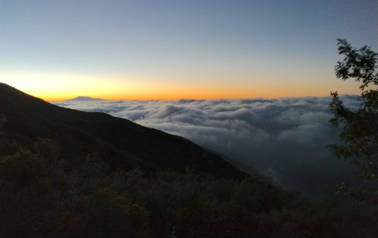
Sunrise
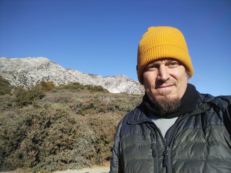
Morning selfie with Etiwanda peak behind me
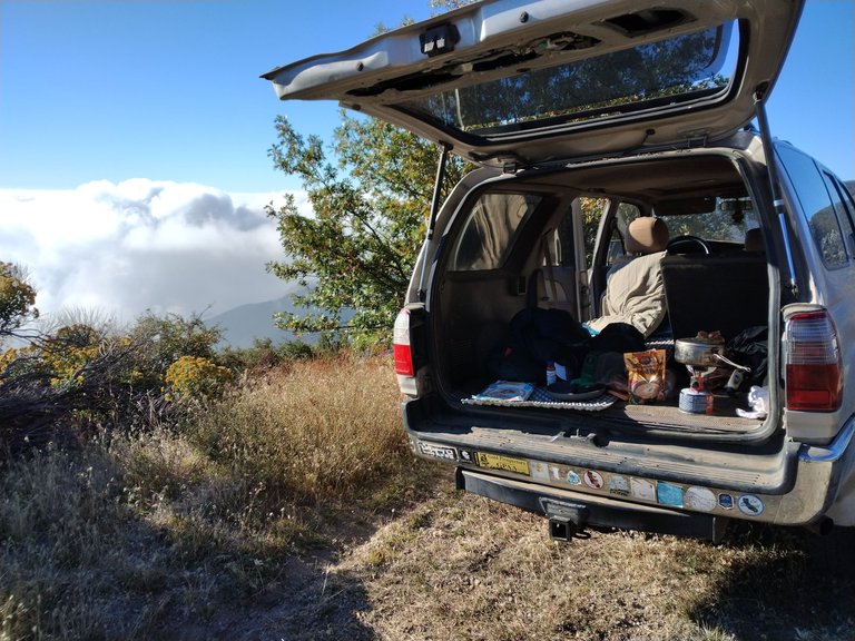
Making breakfast in the truck
Back to the bushwhacking
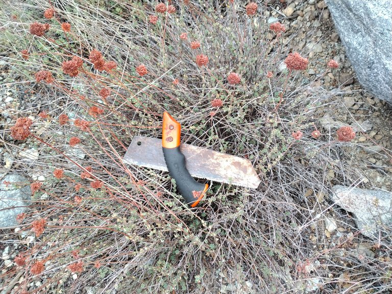
My broken handsaw on a buckwheat bush
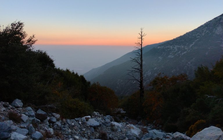
Watching the sunset from the trail
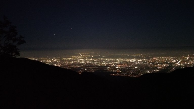
City lights
The next morning I took my time getting up. I had my breakfast and enjoyed a slow lazy morning. While I was eating breakfast I saw two hunters pass by. I said hello, but didn't talk to them any further. I decided to do a little more brush chopping on the first part of the trail just to get it a little wider. But I knew that I was going to have to come back for another trip if I wanted to get the trail chopped out all the way to Day creek. So after doing my last little bit of trail work I packed up the truck and headed back down the long bumpy road. Now I just have to get back up there before the road closes again. Because next time I'm sure I'll be able to get the last 20% of the trail opened up and finally be able to once again reach Day creek. So stay tuned for The Day Creek Project Part 2!!
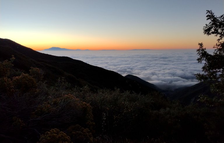
Another stunning sunrise
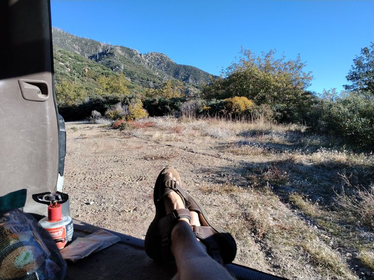
Relaxing in the back of my truck
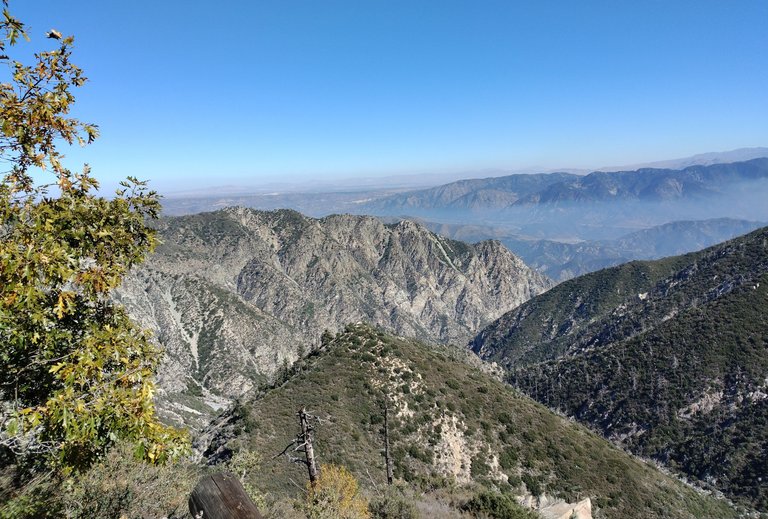
Looking down on Day creek canyon with Saddleback mountain in the distance rising out of the clouds
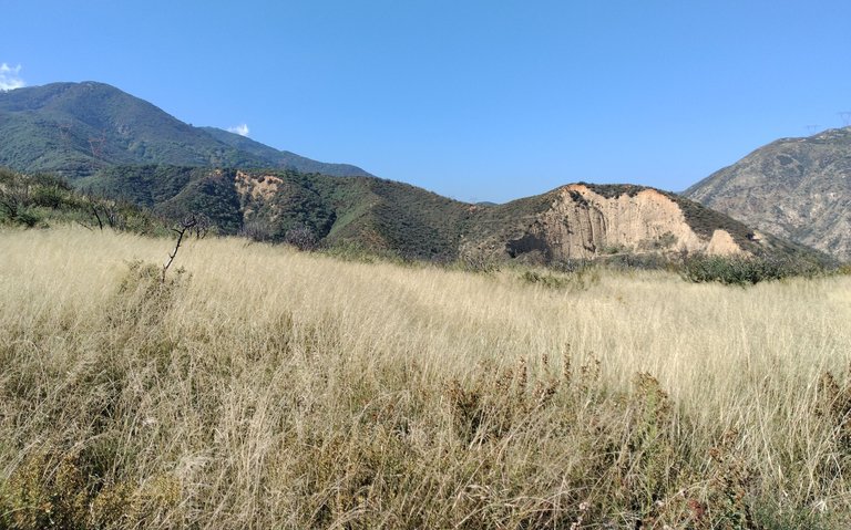
Views on the drive out
Getting back down to Texas Hill
And so until next time...
I hope you have enjoyed this glimpse into
My California!!

#SoCalHive is building and supporting the Hive Blockchain community in Southern California. If you are from SoCal and are into creating quality content here on Hive, we'd love for you to follow us @theSoCalHive and join our group on Discord


Pinmapple
Sounds like a painful and bloody adventure but glad you are taking on the project… sounds like an awesome place! 😃
Those are really awesome views you were able to see. It is hard to choose which one I liked best, but I am thankful you shared it here.
Why do I feel like you're in a Walking Dead scene trying to hunt zombies in the wilderness. 😂
Anyways, are you travelling alone? California wilderness is enchanting. I have dreamed of driving on my own and seeing those different beautiful sights. I would feel like I'm on an apocalyptic survival journey hahah.
Hiya, @choogirl here, just swinging by to let you know that this post made it into our Honorable Mentions in Travel Digest #2048.
Your post has been manually curated by the @pinmapple team. If you like what we're doing, please drop by to check out all the rest of today's great posts and consider supporting other authors like yourself and us so we can keep the project going!
Become part of our travel community:
Congratulations, your post has been added to Pinmapple! 🎉🥳🍍
Did you know you have your own profile map?
And every post has their own map too!
Want to have your post on the map too?