Day 299.
Russian Army & DPR forces are slowly advancing inside the forest area north of Bakhmut city and at the eastern outskirts of Miasokombinat district, where troops are trying to get a more advantageous position to take Pidgorodne/Підгородне town.
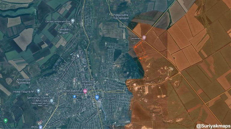 Current situation in Bakhmut
New video footage provided by Russian drone shows mine factory in the eastern outskirts of Bakhmut city, which was taken by Russian Army & DPR forces some weeks ago, which refutes reports of an Ukrainian Army counterattack yesterday.
Video: https://t.me/Suriyak_maps/139
Geolocation: 48.599403, 38.058820
On the other hand, video footage at Marinka/Мар'їнка in one of the buildings behind Druzhby avenue, which confirms Ukrainian Army still present in the center of the town despite many new of Russian forces taking control over it
Video: https://t.me/Suriyak_maps/138.
Geolocation: 47.942340, 37.503048
In addition, during the last three days Ukrainian Army regained momentum in Luhansk front & managed to clean and secure the forest area south of Dibrova/Діброва & Kreminna/Кремінна towns.
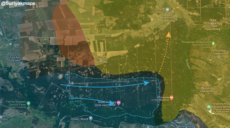 Latest Ukrainian army advance in Luhansk oblast
300 days of war summary:
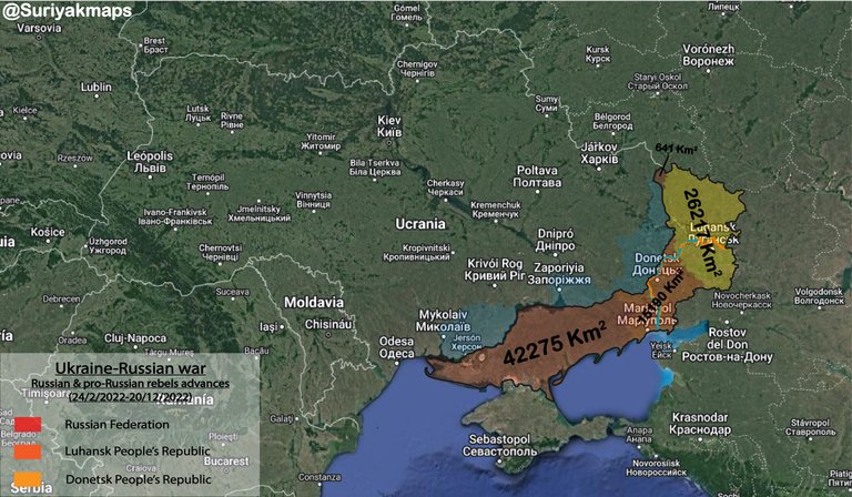
After 300 days since Russian-Ukrainian War began Russian Army & pro-Russian rebels currently control 84323 Sq Km, which corresponds to 13,96% of Ukraine:
- Donetsk People's Republic forces controls 15190 Km^2 (57,28% of Donetsk oblast)
- Luhanks People's Republic forces controls 26217 Km^2 (98,25% of Luhansk oblast)
- Ukraine recovered 9539 Km^2 after the successful offesives in Khakov, northern Donetsk and Kherson oblasts.
Legend of the maps:
- Blue: Area of Donbas under the control of Ukrainian Government
- Yellow: Area under the control of DLuhansk People's Republic
- Orange: Area under the control of Donetsk People's Republic