Last Sunday, I took a tour to go on an excursion to Galipán in El Ávila. I went with a friend as the husband did not want to join because the first part of the excursion and what I'm going to tell you in this post was to do the hiking route from the Boca de Tigre sector to Picacho de Galipán.
Picacho is the fifth highest point of the Cordillera de la Costa, the mountain range that borders Caracas to the north and separates it from the coast of the Caribbean Sea. It is located at an altitude of 1978 meters above sea level. I had been wanting to do this route for several weeks, so at the first opportunity, my friend and I signed up for an excursion organized by Cima Venezuela.
We went in a 4x4 jeep to Boca de Tigre climbing up to the mountain from a sector in the city called Cotiza. Once there, we started the hike up to Picacho.
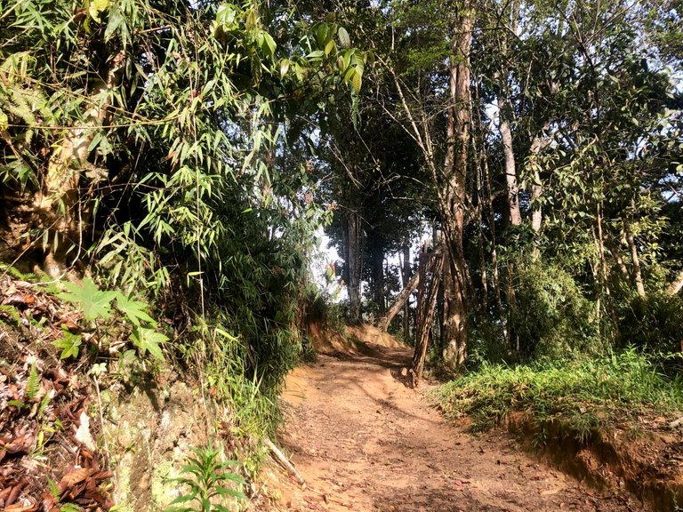
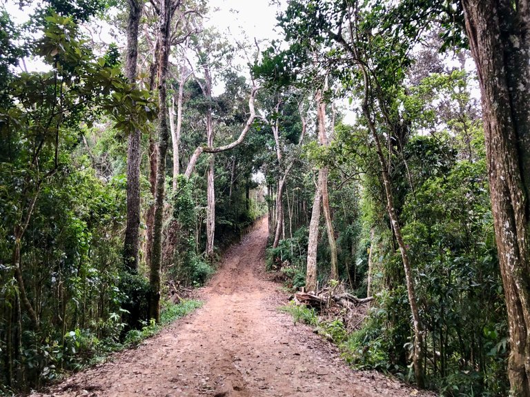
The first part of the route, although it has some slopes, is very pleasant to walk. It goes through a small forest. The vegetation at this point is humid tropical rainforest.
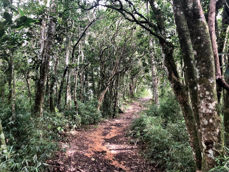
So although the day was hot, this part of the hike was cool thanks to the vegetation.
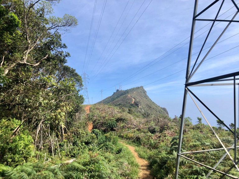
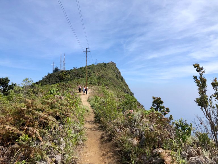
At one point we suddenly left the wooded area and the vegetation began to change. As we passed by one of the electric towers placed on the mountain, we could see our destination in the distance.
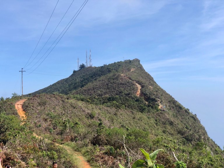
There were a couple of groups of hikers ahead of us, and we could see them in the distance approaching the rocky summit.
The vegetation on this section of the route was more arid.
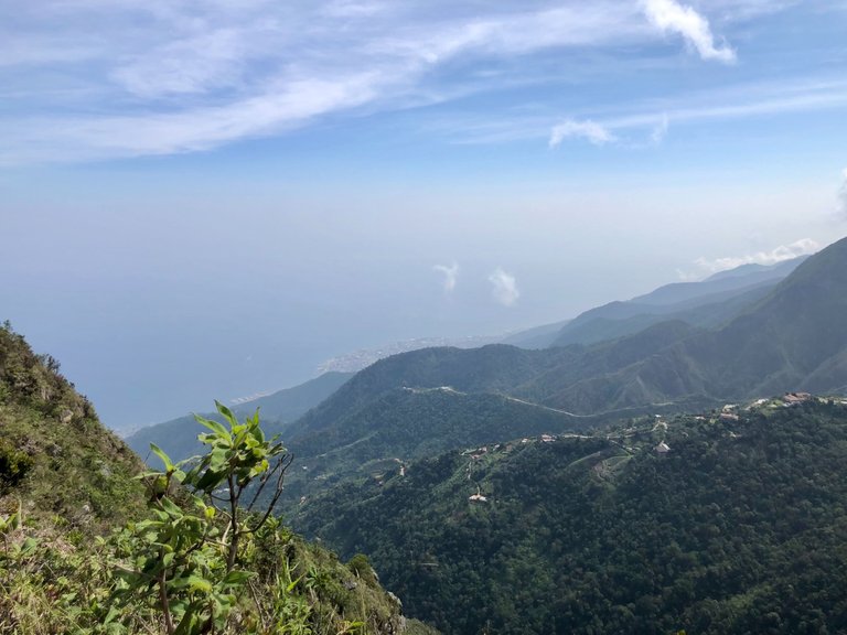
From this point, as we were closer to the Picacho, we could already see an amazing view of the coast.
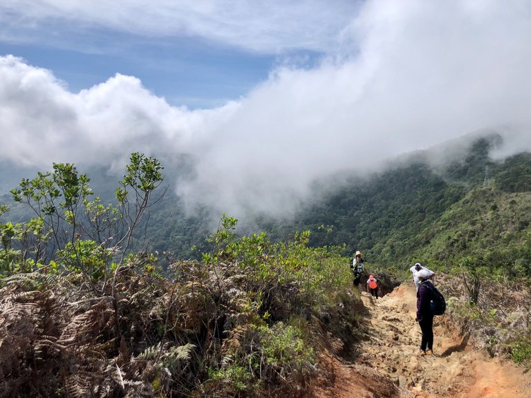
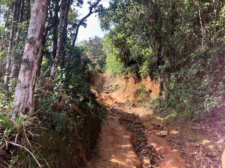
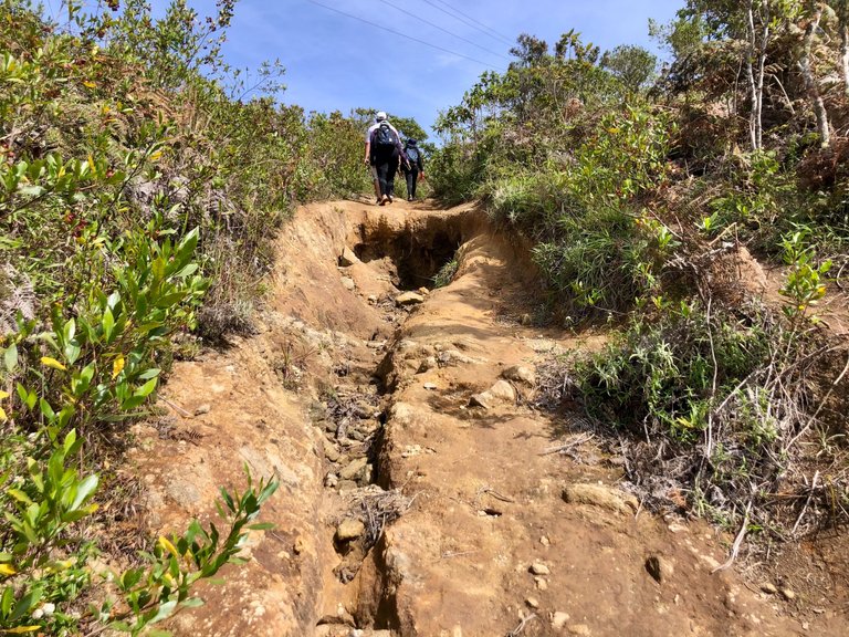
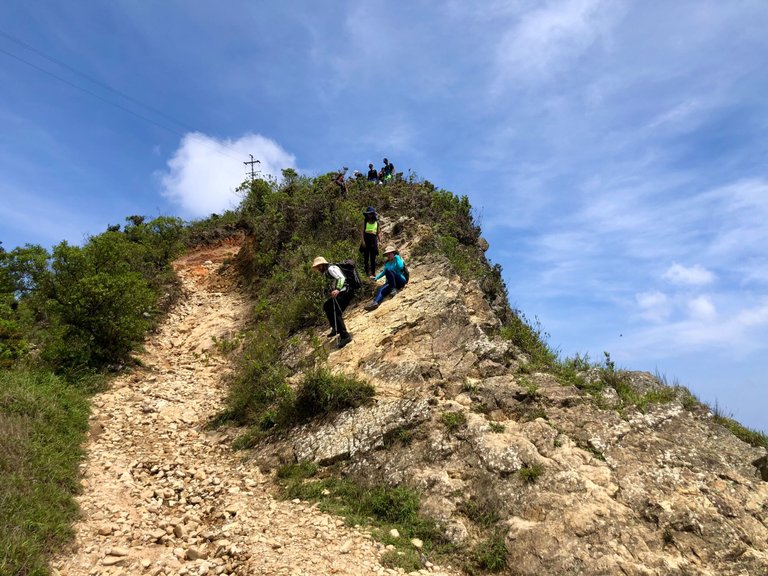
As we were getting closer, there were some steep slopes, and the terrain here was very eroded with lots of rocks.
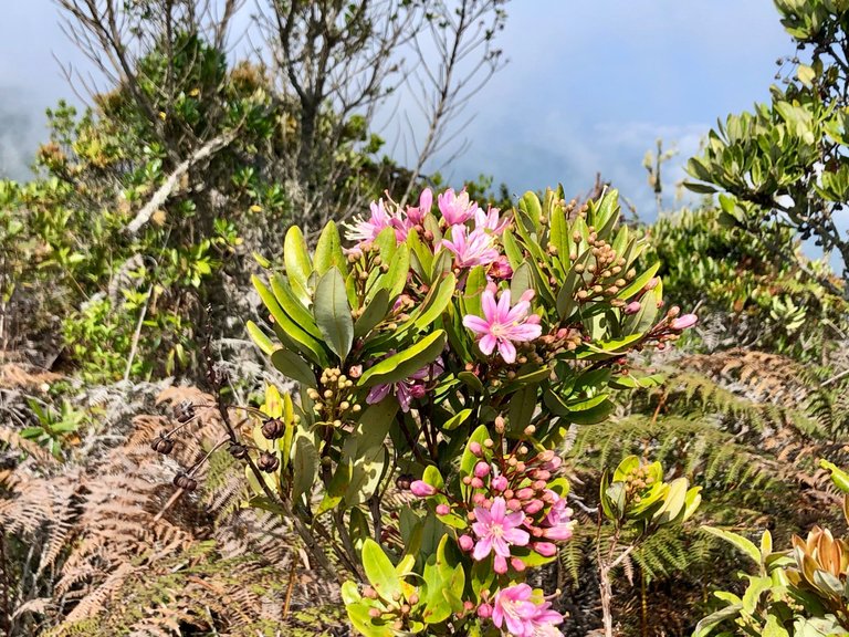
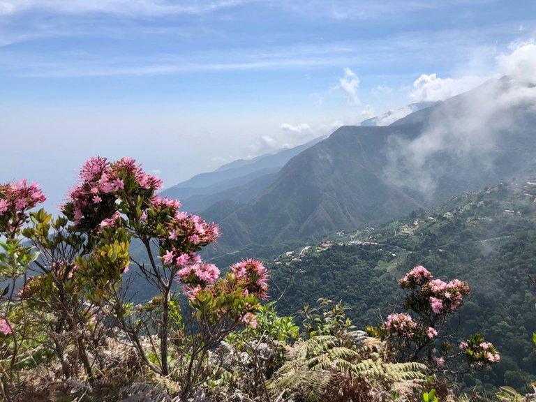
But also, in a good part of this section of the trail, we could see these beautiful pink flowers.
We were getting closer and closer.
And after a few more stretches of rough terrain, we reached the summit.
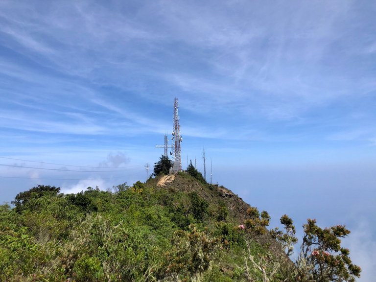
Already at the top, some telecommunication antennas can be seen very close.
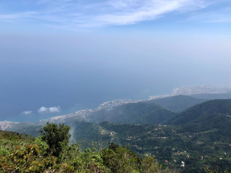
The view of the coast from the Picacho is breathtaking. Luckily, when we arrived the sky towards the coast was very clear.
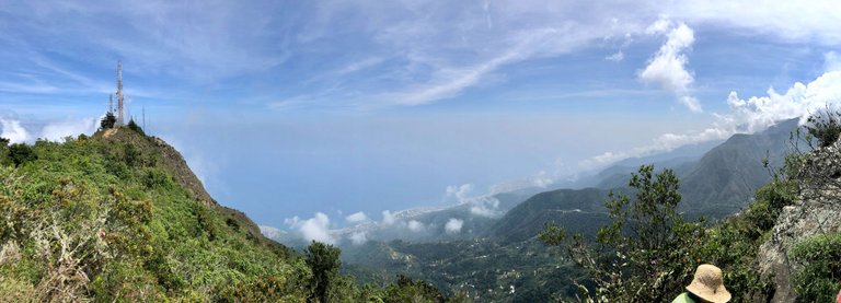
This is a panoramic view from the Picacho, and I took it while sipping a freshly brewed coffee. It was a great moment to have a coffee so near the clouds.
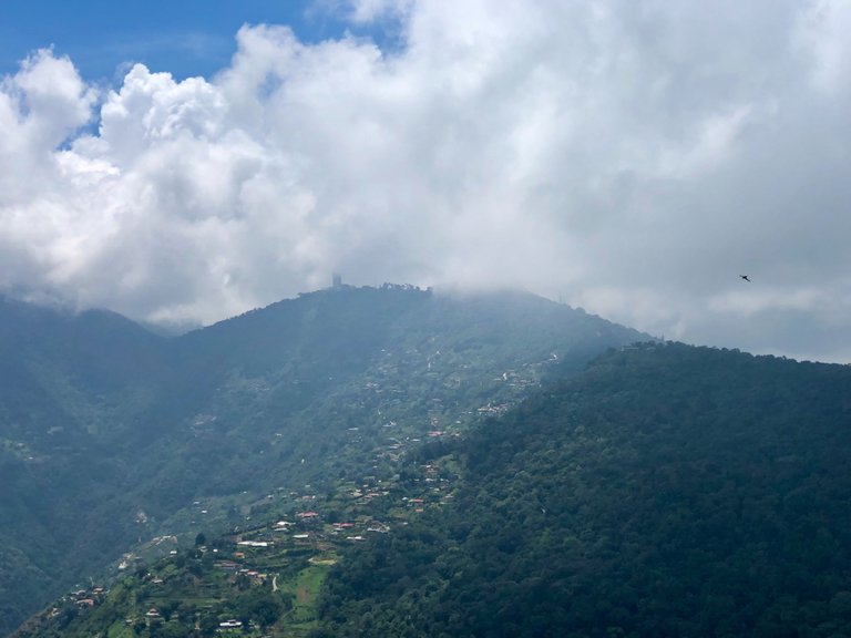
The view towards Galipan. You can barely see a bit of the Hotel Humbolt, a 5-star hotel on the top of the mountain built in the 50s that after many years of closure is now back in operation. But this time, the clouds were faster than me and blocked the view.
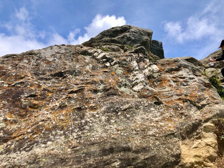
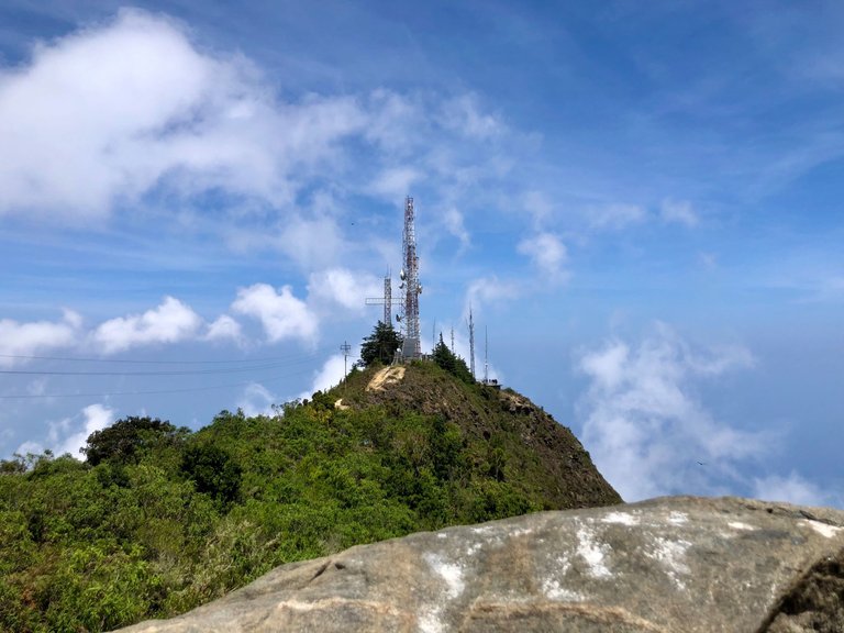
The Picacho is a rocky peak, and this is what the highest point looks like. And the view of the antennas from there.
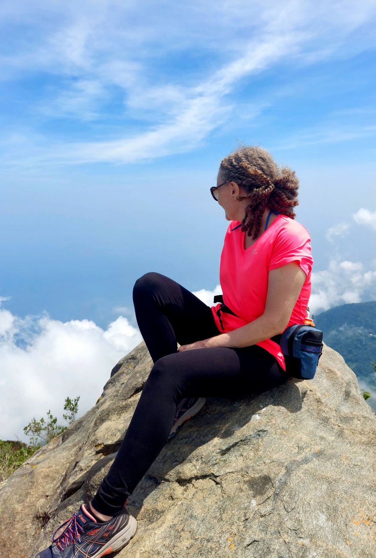
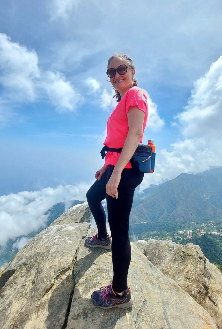
And here I am at the top.
These pictures were taken by Fernanda, one of the guides of Cima Venezuela.
At first, I was a little reluctant to stand at the top of the Picacho. At that point, the wind blows a lot, and the currents change in a second.
But the feeling of being there was wonderful, and I'm glad I finally dared to stand on the top of the Picacho.
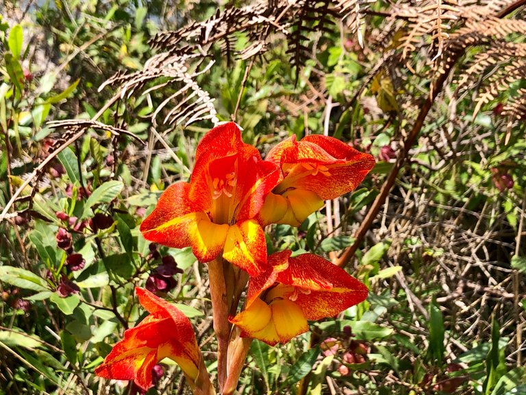
Satisfied, we began our return trip along the same route. And very close to the base of the big rock, I saw these beautiful flowers.
Some downhill sections where the terrain was very eroded were a bit difficult, and we had to walk close to the edge of the mountain.
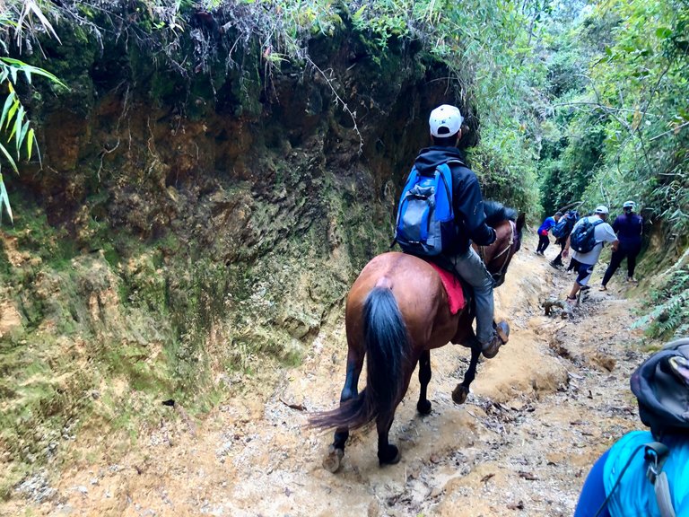
Also, at some point, we had to move aside to make way for some people coming on horseback.
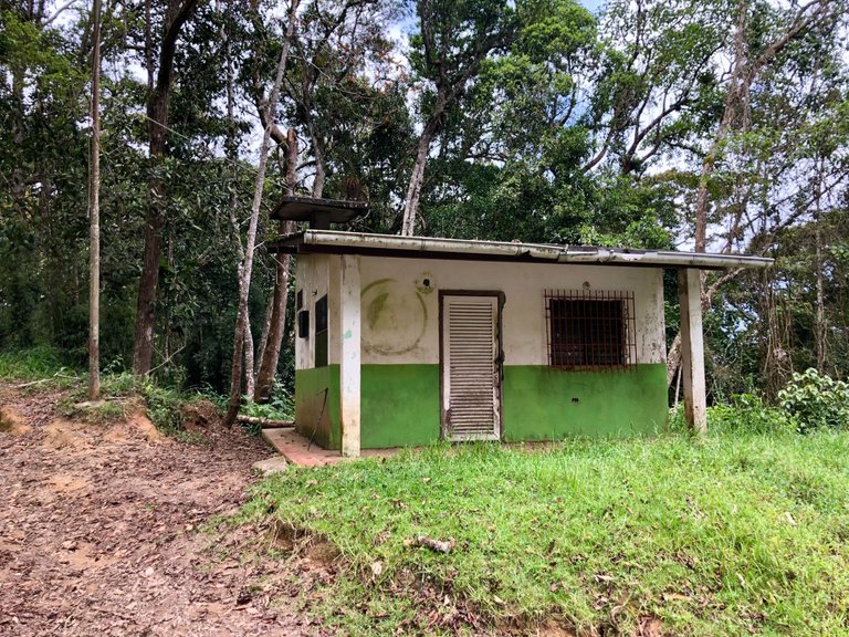
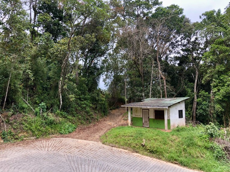
But in much less time than it took us to go to the Picacho, we were back to the point where we started the route where this little white and green house was.
From there, we walked to the Boca de Tigre sector where the jeep was waiting to take us to the next stage of the adventure. But I'll tell you about that another day.
If you are in Caracas and want to do this hike or any other in El Avila, I recommend Cima Venezuela. We had a great time with them, and we are planning to do other routes soon.
This is also my post for this week's #wednesdaywalk challenge hosted by @tattoodjay in collaboration with #makemesmile hosted by @elizacheng.
Thank you for reading.
If you're reading this and you are not on Hive yet, I invite you to join through my referral link. And I could delegate some resource credit to help you get started.
You're husband really missed out by not going, it looks gorgeous up there, if there were no antennas, it would have been perfect.
As to the horse.... not a big fan of that. I'm sure it puts a lot of stress on the poor animal to go up and down and carry a person. It's a hike!! People should be doing exercise!!!!
Yes, he missed it, but it was better that he didn't go. He has recently had arrhythmia problems and probably would have had a hard time going up or even had to turn back.
About the horses also seemed irresponsible to me. Apparently, they are local people from what I was told, but they should not be ridden at least on weekends when there are people on the trail.
Seeing the road to reach the peak is enough to make me feel exhausted. But, the wall was surely worth it as you get to witness such beautiful sceneries above, woth those beautiful pink flowers. And seeing you at the top on that rock makes me feel so anxious. Gosh, what if you slip, goodness w(°o°)w. Reacting this way, i'm not sure if I can also do this kind of thing even though I also wanna try some adventure (≧▽≦).
Wow! This is a great hike and a great experience. You are really fit that you were able to reach at the top.
It was great!! Thank you 😄
Super Eli is a mountain goat I think, look at you clambering up the rock face!
That is wonderful and I initially thought you were riding a horse too!
Wonderful pictures and well done you conquering your worries about the wind etc!
Jaja!!! So now I look like a goat, Super Ed 😂😂
On horseback? I don't think so. My rearguard is no longer up to that 🤣🤣
Have a terrific Thursday! 🌀
Not look, but climbing up those rocks Super Eli with no fear like that goat!
Jeje, ok ok 😉
I always wonder why women refer to their husbands as "the" not "my" 😂 it puzzles me since I see it is like a general thing.
The view of that mountain is truly breath taking. This took only a few hours to Hike? I wonder how photographers get that Panoramic view. Is it a feature that comes with the camera?
I really enjoyed reading the stories on this one. If I had my way, I would be living in that place. I have so many questions about Hiking. Do hikers sleep on trail? I saw a bag pack on one of the hikers. What exactly do you take along with you?
I would be scared shitless to stand at the pinnacle of anything. Heights freak me out...
Maybe because with the years of marriage, we start looking at them as that thing, haha. Just kidding. I don't know
Yes, the panoramic view is a feature, my phone has it in the camera.
You can go on trails to camp. I'm not interested in doing that, haha. I'm too old to have to go piss on a bush 😂 In the bag, I had food, plenty of water (very important), and a small towel because after that hike we went to a creek.
I am not usually scared of heights, but it was so windy that I almost didn't do it.
🤣🤣🤣🤣🤣🤣🤣🤣… oh I nearly choked on my food. We don’t want you peeing in bushes 😂
what an amazing hike, the scenic views are breathtaking
when I was younger i would have loved to be there with you, but now at my age my knees are aching just thinking of hiking up some of those slopes
Thanks or joining the Wednesday Walk :)
Don't think I didn't, my knees bothered me a bit, not so much going up as going down, hehe
Always a pleasure to join the Wednesday Walk :)
OHh yeah for sure going down can be the worse
Cheers
Esa ruta es hermosa los paisajes, la vegetación y la satisfacción de llegar a la cima, muy buenas fotos y lindos recuerdos, se nota que lo disfrutaron mucho.
Sí fue un bonito paseo y vale la pena ir. Gracias por pasarte por aquí:)
Good morning dear friend @coquicoin how are you?
What a beautiful place you have taken us on this occasion, I love steep paths, as exercise for the body it is something great, not so for the fatigue you have when you reach the top, but the effort is worth it if you get these beautiful views
I love the shots you took, excellent shots. Congratulations
Thank you very much for sharing with us the experience of this beautiful place.
Have a beautiful morning
Congratulations, your post has been added to Pinmapple! 🎉🥳🍍
Did you know you have your own profile map?
And every post has their own map too!
Want to have your post on the map too?
No me canso de decirlo mi Venezuela es hermosa, y galipan es un sitio hermoso y relajante, cada vez que puedo voy allí, es maravilloso y sus fresas con crema son riquísimas, saludos.
It seems to be a good climb, but rewarded with a superb view of the ocean at the top... and the icing on the cake, a cup of coffee at the top, pretty cool!
Wow, this tour looks like it was a lot of fun. I love taking trails through nature, I would definitely love it. Thank you for sharing with us 😊
Hiya, @livinguktaiwan here, just swinging by to let you know that this post made it into our Honorable Mentions in Travel Digest #1998.
Your post has been manually curated by the @pinmapple team. If you like what we're doing, please drop by to check out all the rest of today's great posts and consider supporting other authors like yourself and us so we can keep the project going!
Become part of our travel community:
Beautiful Highland
!LOL
lolztoken.com
If you're not there, then I assume you're not a round.
Credit: reddit
@coquicoin, I sent you an $LOLZ on behalf of phillarecette
(4/10)
ENTER @WIN.HIVE'S DAILY DRAW AND WIN HIVE!