Hello, Hive friends! 😄
After a very beautiful 10 days of vacation, I am here telling one of the adventures that we live with my friends. On this occasion, we did a somewhat complex trek to one of the highest mountain refuges that can be found in the vicinity of Bariloche, Argentina.
Bariloche, in itself and, apart from being a beautiful city, has a mountain range very close, which makes it an ideal place if you want to carry out sports activities such as climbing or trekking. Being very large distances to cover in a single day, shelters have been installed at the top of different hills and mountains so that, after hours of effort, one can rest, eat and even stay to sleep if desired.
There are several well-known and popular shelters among hikers, but we can name four that are the most representative:
- Jakob Refuge
- Frey Refuge(I did too! I will comment on that adventure in another post!)
- Otto Mailing Refuge
- Lopez Refuge
⛰️Trekking travesy to Jakob Refuge ⛰️
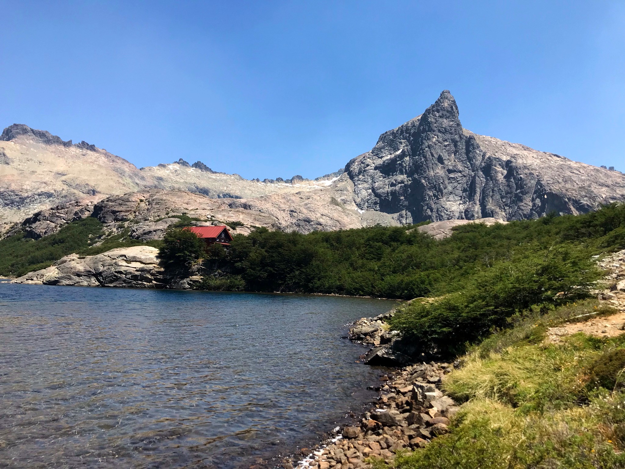
That little house that can be seen in the background, in reddish tones, is the refuge. It seems infamous, but the reality is that it is lost in the incredible landscape that the Jakob lagoon offers at the top of that mountain.
The Jakob Refuge (Or San Martin, better said) is located at a total height of 1,600m above sea level, making it quite complex when climbing. It is not one of the hardest that can be found in the area, but its total journey from Tambo Baez (the starting point that I use), gives a total journey of 14km one way and another 14km back, with more than 800m of positive slope that one must climb.
It is stipulated that the total rise time for the summer months is 5 or 6 hours, which increases to 7 or 8 during the winter months. Something of merit for my friends and for me, that we completed it in 3.15hs!
Starting the day...
We wake up around 5am, to be able to go out on our adventure around 7am. The reality is that the last few days, in this part of the world, the heat has been oppressive and we could not risk going out late and suffering the rays of the sun in its entirety.
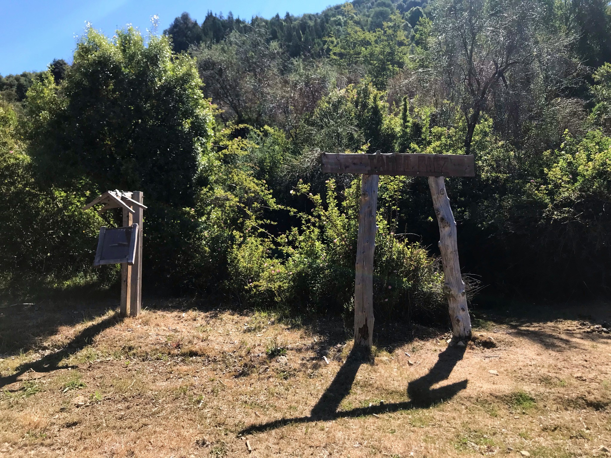
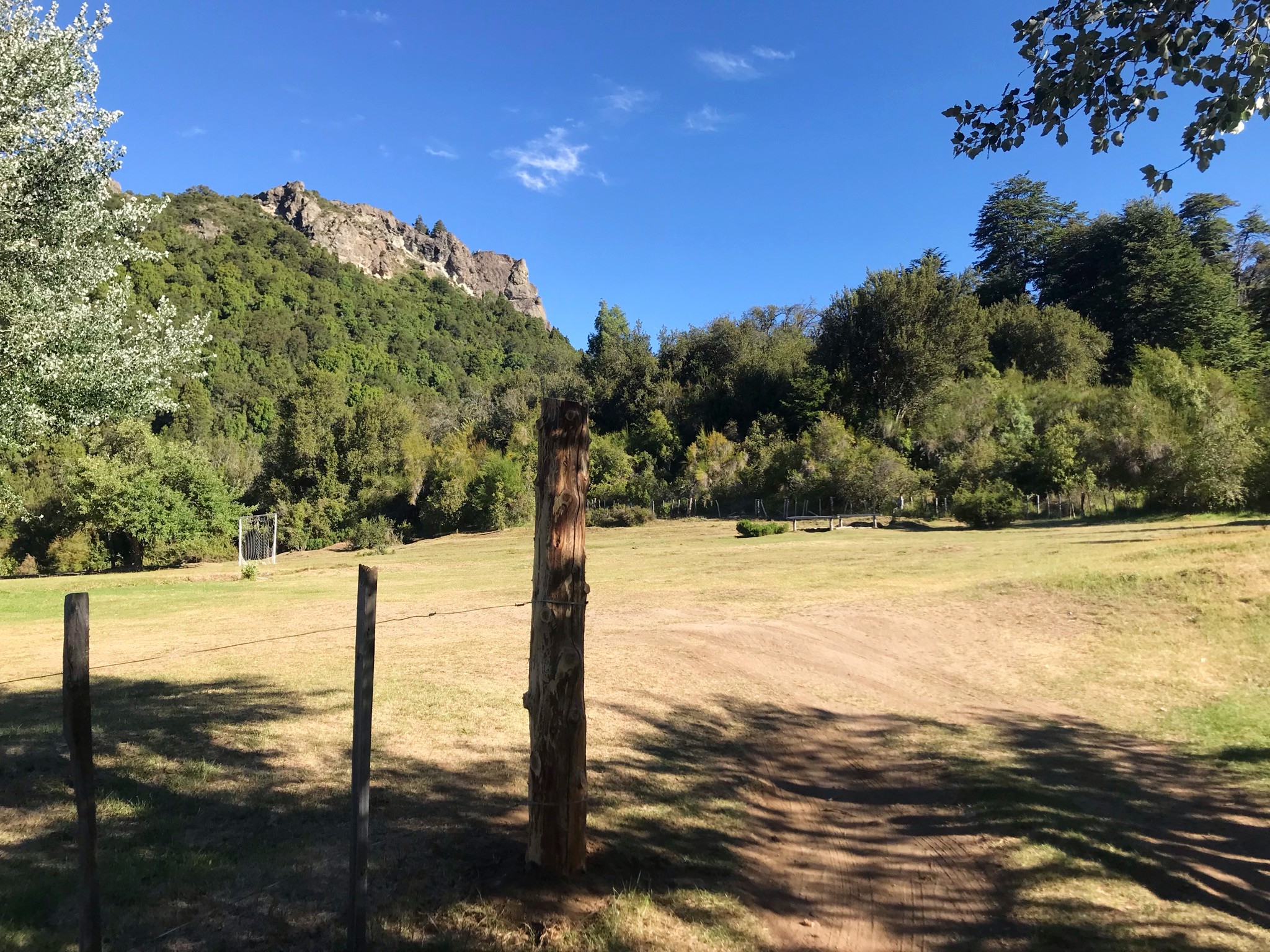
We start from Tambo de Baez, the base of the trail. There was absolutely no one there and it didn't give the feeling of being a dairy ... we only saw a few chickens, a very small cabin and that's it ... But we weren't there to focus on that.
We began the first part of the trek that could be divided into three very clear sections:
- Semi-plain, there were only small ups and downs, which lasted about 8km
- Small gains in elevation gain, from km 8 to 11 approximately. They were not climbs that left you breathless, but they did require a greater physical effort
- The famous spiral staircase: upon reaching the base of the hill, one would go up in a spiral, causing that in the remaining 2km, everything is stairs and climbing stones to be able to climb.
Of trails and more trails
The first km went incredibly well. We were talking, trying to wake up and it was still fresh, so it was ideal to start early.
The vegetation is lush and very green, it makes you want to continue and the tranquility of nature is almost a call to get lost among the small bushes.
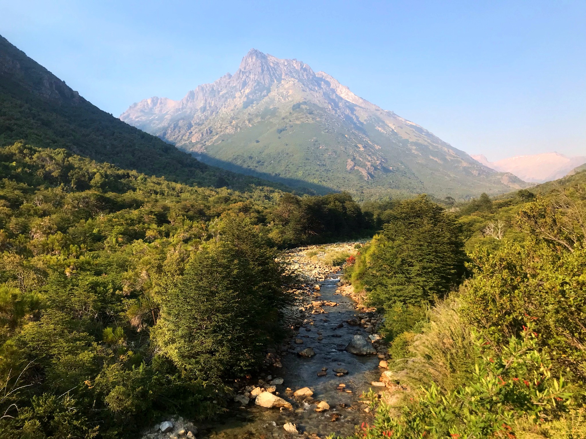
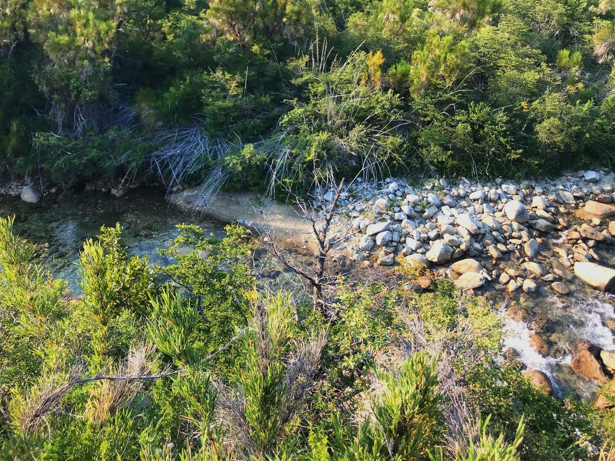
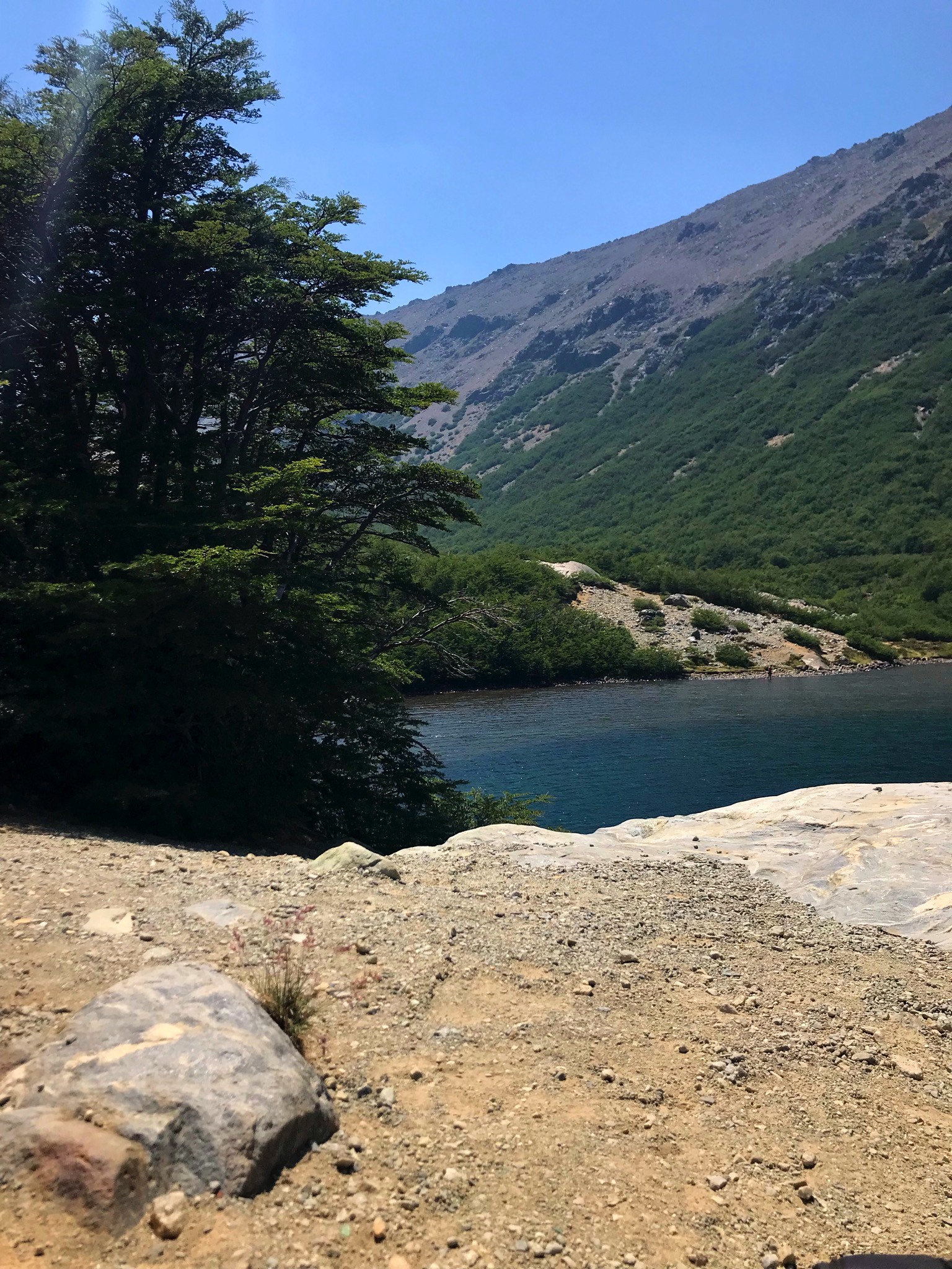
For 8km, we went parallel to a stream that, on the way back, when the sun was already in our heads, helped us a lot. It was really relaxing to be able to enjoy the sound of running water as we continued on our adventure.
That stream, which you will see in many photos, is the one that runs with the water of the lagoon to which we were ascending. Nothing more beautiful than nature in its purest form!
Start of the truly challenge
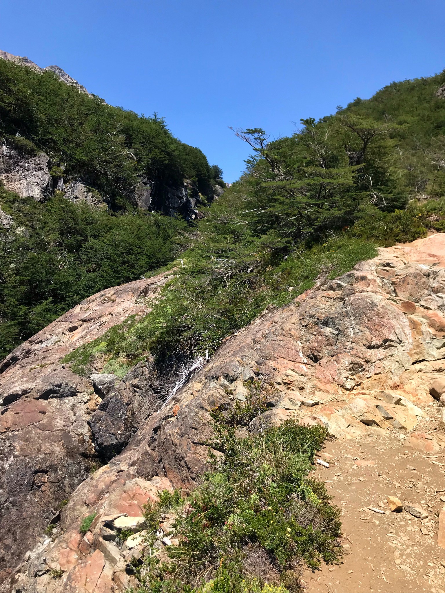
At the end of the stretch of trail, the truly challenging thing arrived, if we speak in terms of the physical. It was time to start the climb and then we found out about the subsequent climb.
The meters of unevenness were going up more and more, making it very demanding on the body. Still, it was all pleasantly rewarded with the beautiful views we had.
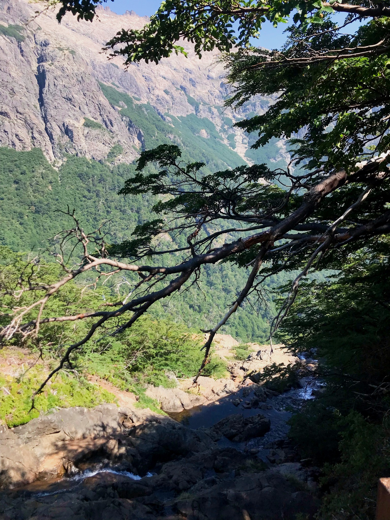
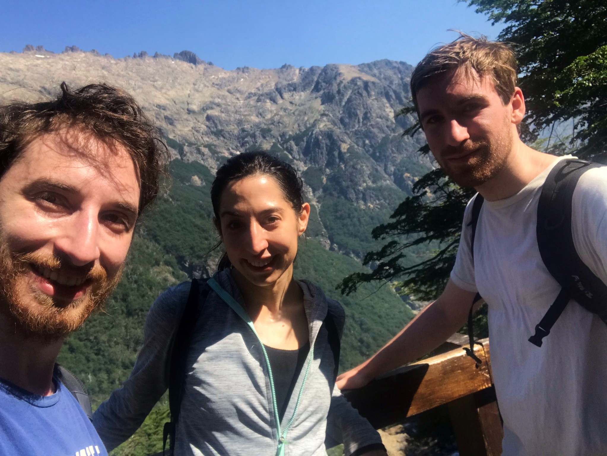
The vegetation was becoming sparser, everything became more arid and there was a great presence of rocks everywhere. We made a technical stop to drink water, eat something and, thus, continue. Obviously, not before taking a photo of our faces of suffering! 🤣 We could barely see with all the sun on our faces ...
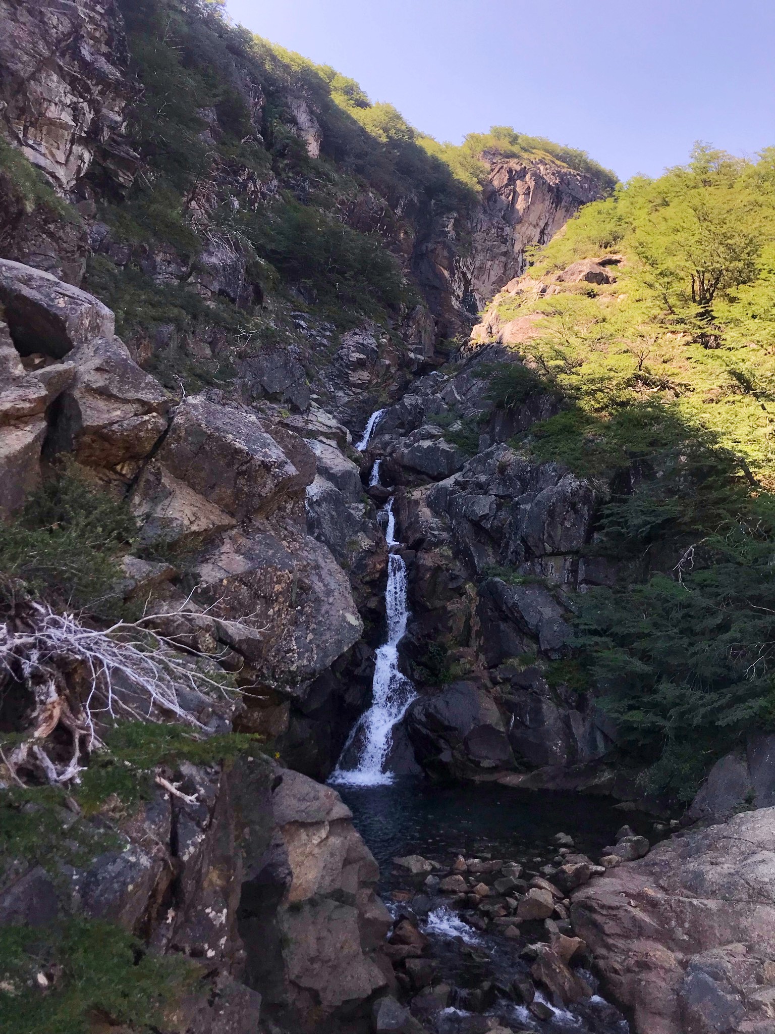
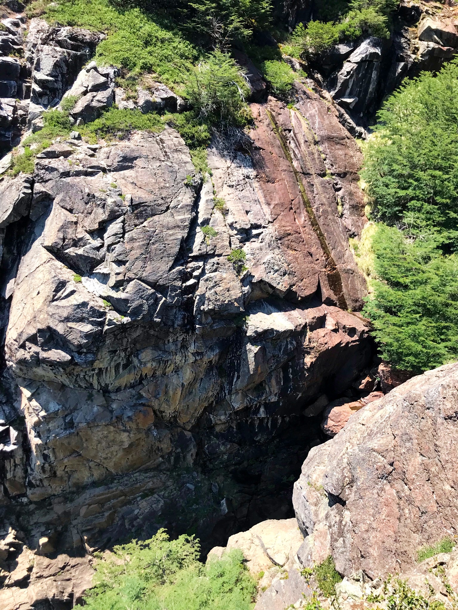
We continue climbing among rock formations and the sound of the stream in the background. More than a stream, at this point, it had already become the beautiful waterfall that is in photos!
Just a little more till we reach the Refuge!
The last kilometer was incredibly challenging. And fun, above all!
From one moment to the next, everything turned to rocks:
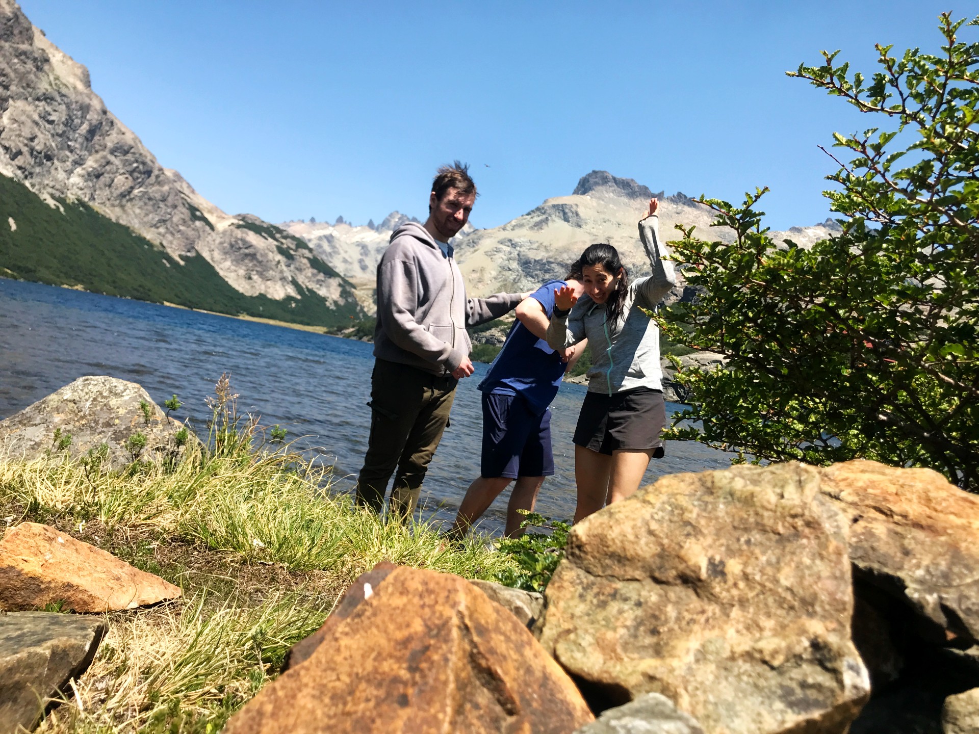
We ascended by climbing, climbing and being very careful what we did. We were on a cliff and any wrong move could be a disaster. Even so, we could already see the refuge in the distance, as well as these incredible views:
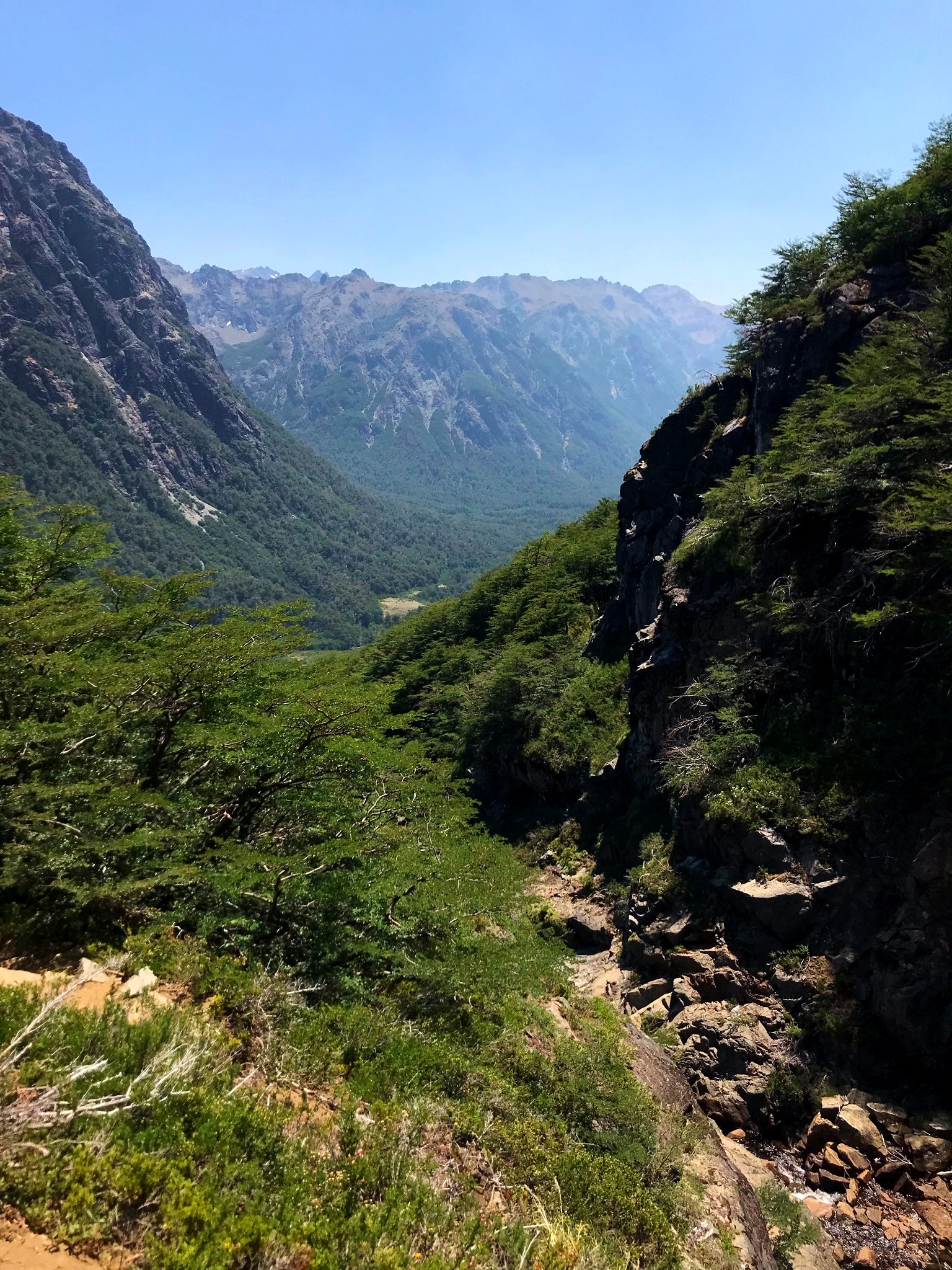
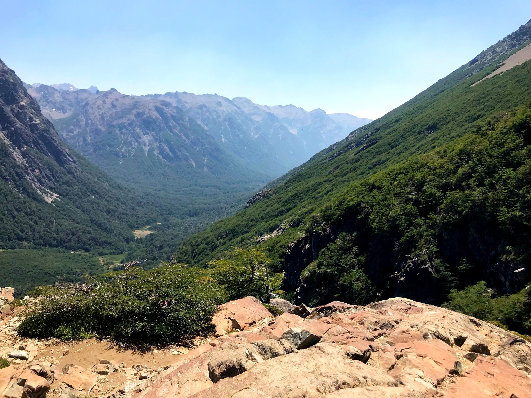
At this point, we were already around 1,500 masl. There was very little to go to the refuge.
.jpg)
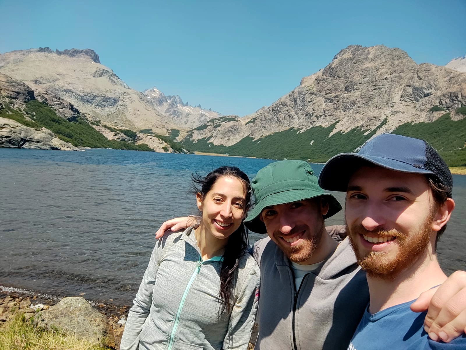
We did it!
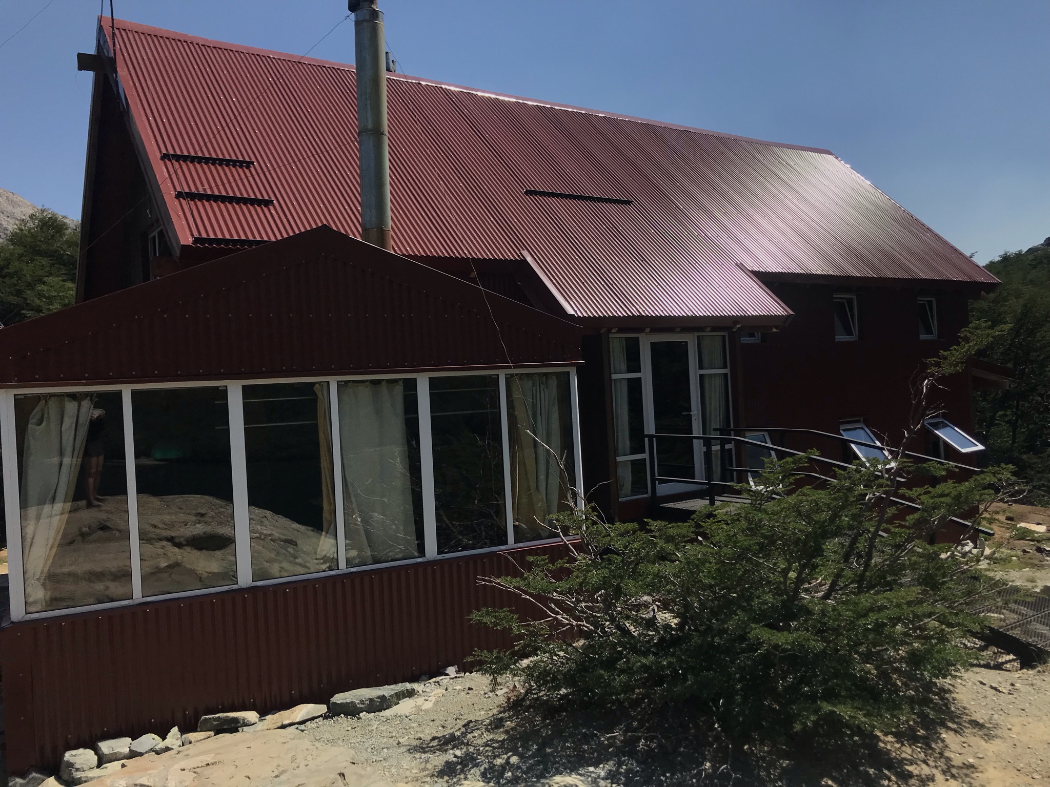
After 3 hours and 15 minutes of crossing, we arrived at the beautiful Jakob refuge! Compared to the other shelters, this one is much newer and more modern, it was built in 2016 after the original shelter caught fire. It is made in the range of reds, which makes it contrast beautifully with the surrounding landscape. Seen from afar, it looks like a typical mountain photo, with its chalet lost in the middle of nowhere.
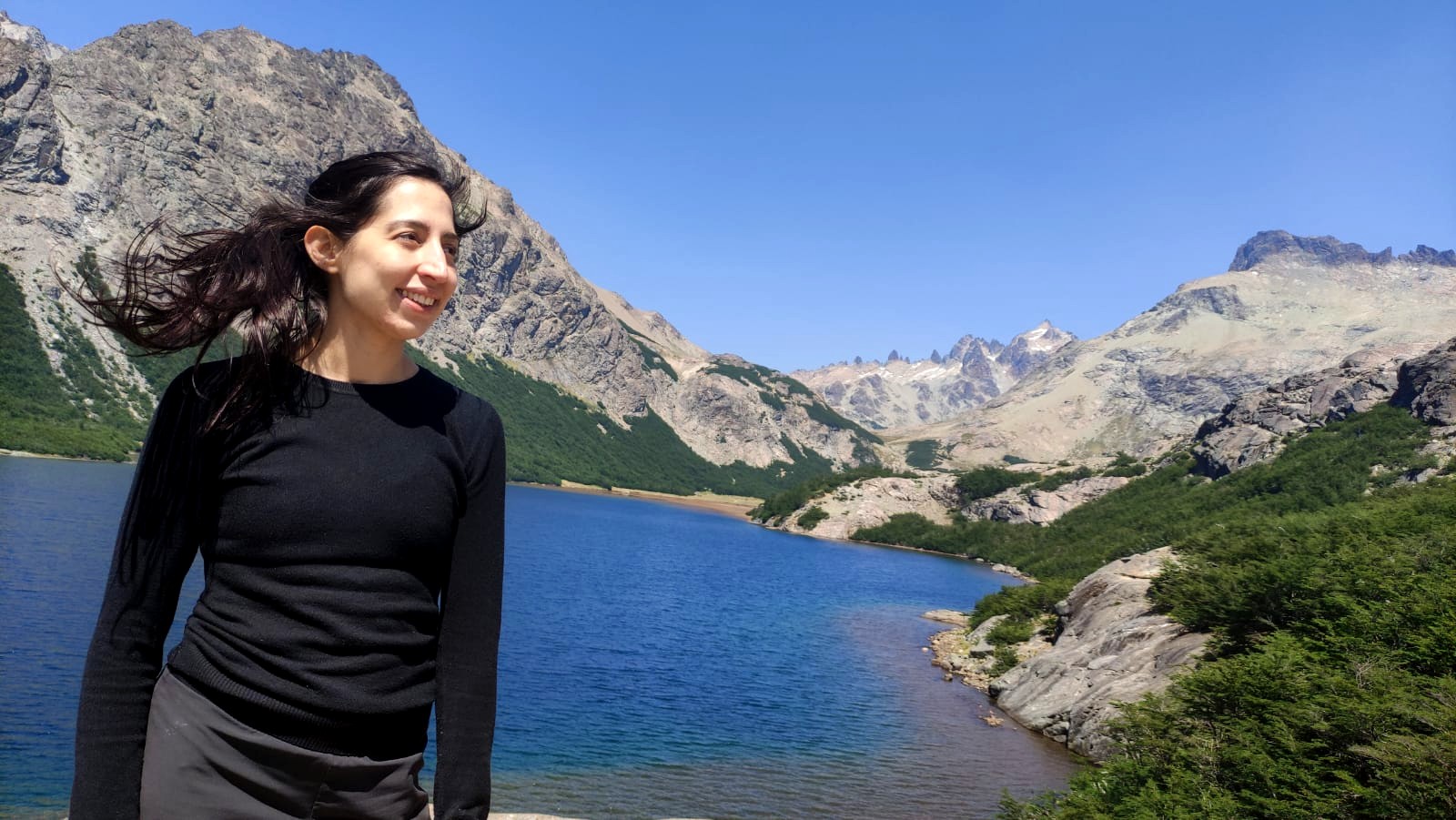
Beautiful views of the lagoon that we can find at the summit:
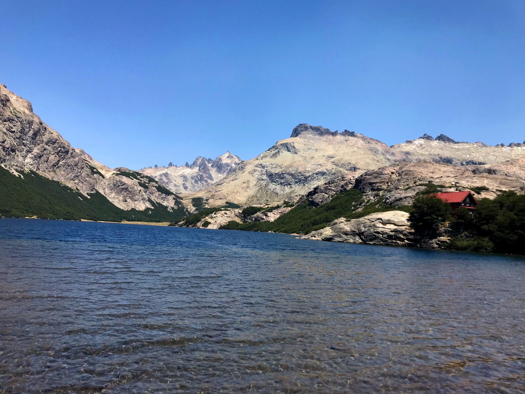
The Refuge:
And we are happy to finish ... but being attacked by a horde of horsefly! 🤣🤣🤣

[Spanish]
Hola, amigos de Hive! 😄
Luego de unos muy bellos 10 dias de vacaciones, me encuentro aqui contando una de las aventuras que vivimos con mis amigos. En esta ocasion, hicimos un trekking algo complejo hastauno de los refugios de montaña mas altos que pueden encontrarse en las cercanias de Bariloche, Argentina.
Bariloche, de por si y, aparte de ser una ciudad bellisima, tiene una cadena montañosa muy cerca, que la convierte en un lugar ideal si se busca llevar a cabo actividades deportivas como la escalada o el trekking. Al ser distancias muy grandes para cubrir en un unico dia, se han instalado en la cima de distintos cerros y montañas refugios para que, tras horas de esfuerzo, uno pueda descansar, comer y hasta quedarse a dormir si asi lo desea.
Existen varios refugios conocidos y populares entre los senderistas, pero podemos nombrar a cuatro que son los mas representativos:
- Refugio Jakob
- Refugio Frey (tambien lo hice! Ya comentare esa aventura en otro post!)
- Refugio Otto Mailing
- Refugio Lopez
⛰️ Travesia de Trekking hasta Refugio Jakob ⛰️
Esa pequeña casita que se puede ver al fondo, en tonos rojizos, es el refugio. Parece infima, pero la realidad es que se pierde ante el paisaje increible que ofrece la laguna Jakob en la cima de esa montaña.
El Refugio Jakob (O San Martin, mejor dicho) se encuentra a una altura total de 1.600m sobre el nivel del mar, haciendolo bastante complejo a la hora de subir. No es de los mas harduos que se pueden encontrar en la zona, pero su trayecto total desde Tambo Baez (el punto de salida que yo utilice), da un trayecto total de 14km de ida y otros 14km de vuelta, con mas de 800m de desnivel positivo que uno debe subir.
Esta estipulado que el tiempo total de subida para los meses de verano sea de 5 o 6 horas, lo cual incrementa a 7 u 8 durante los meses invernales. Algo de merito para mis amigos y para mi, que lo completamos en 3.15hs!
Comienzo del dia...
Despertamos alrededor de las 5am, para poder salir en nuestra aventura alrededor de las 7am. La realidad es que los ultimos dias, en esta parte del mundo, el calor ha sido agobiante y no podiamos arriesgarnos a salir tarde y sufrir los rayos del sol en su totalidad.
Partimos del Tambo de Baez, la base del sendero. No habia absolutamente nadie y tampoco daba la sensacion de ser un tambo... solo vimos unas pocas gallinas, una cabaña muy pequeña y eso es todo... Pero no estabamos ahi para enfocarnos en eso.
Comenazamos la primera parte del trekking que se podia dividir en tres tramos muy claros:
- Semi-llanura, solo habia pequeñas subidas y bajadas, lo cual se extendio por unos 8km
- Pequeñas ganancias de desnivel, del km 8 al 11 aproximadamente. No eran subidas que te dejaban sin aire, pero si requerian un esfuerzo fisico mayor
- La famosa escalera de caracol: al llegar a la base del cerro, se subia en espiral por el, haciendo que en los 2km restantes, todo sea escaleras y treparse de piedras para poder subir.
De senderos y mas senderos
Los primeros km transcurrieron increiblemente bien. Ibamos hablando, intentando despertarnos y aun estaba fresco, con lo que fue ideal empezar temprano.
La vegetacion es frondosa y muy verde, dan ganas de seguir y la tranquilidad de la naturaleza es casi un llamado a perderse entre los pequeños arbustos.
A lo largo de 8km, fuimos en paralelo a un arroyo que, a la vuelta, cuando el sol ya estaba en nuestras cabezas, nos ayudo muchisimo. Era realmente relajante poder disfrutar del sonido del agua corriendo, mientras seguiamos en nuestra aventura.
Ese arroyo, que lo veran en muchisimas fotos, es el que corre con el agua de la laguna a la que estabamos ascendiendo. Nada mas lindo que la naturaleza en estado puro!
Inicio de lo verdaderamente desafiante
Al finalizar el tramo de sendero, llego lo verdaderamente desafiante, si hablamos en cuanto a lo fisico. Era hora de comenzar la subida y, luego nos enterariamos, de la posterior escalada.
Los metros de desnivel iban subiendo mas y mas, haciendo que sea muy demandante para el cuerpo. Aun asi, todo fue gratamente recompensado con las hermosas vistas que tuvimos.
La vegetacion se iba haciendo mas escasa, todo se ponia mas arido y habia una gran presencia de rocas en todos lados. Hicimos una parada tecnica para tomar agua, comer algo y, asi, seguir. Obviamente, no sin antes tomar una foto de nuestras caras de sufrimiento! 🤣 Apenas podiamos ver con todo el sol en la cara...
Seguimos escalando entre formaciones rocasas y el sonido del arroyo de fondo. Mas que arroyo, a esta altura, ya se habia convertido en la hermosa cascada que esta en fotos!
A pocos metros del refugio
El ultimo kilometro fue increiblemente desafiante. Y divertido, por sobre todo!
De un momento a otro, todo se torno en rocas:
Ascendimos escalando, trepandonos y teniendo muchisimo cuidado con lo que haciamos. Estabamos en un risco y cualquier movimiento en falso podia ser un desastre. Aun asi, ya podiamos ver el refugio a lo lejos, asi como estas vistas increibles:
En este punto, ya estabamos alrededor de los 1.500msnm. Faltaba muy poco para el refugio.
Lo logramos!
Tras 3 horas y 15 minutos de travesia, llegamos al tan hermoso refugio Jakob! En comparacion a los otros refugios, este es mucho mas nuevo y moderno, fue construido en 2016 tras haberse incendiado el refugio original. Esta hecho en la gama de los rojos, lo cual hace que contraste de una forma hermosa con el paisaje que tiene a su alrededor. Visto desde lejos, parece una tipica foto de montaña, con su chalet perdido en el medio de la nada.
Vistas hermosas de la laguna que podemos encontrar en la cumbre:
El refugio:
Y nosotros felices por terminar... pero siendo atacados por una horda de tabanos! 🤣🤣🤣
Separadores obtenidos de este sitio


Hola querida amiga @phendx buen día
Que bellos lugares tiene nuestro pais. Me hace feliz saber que pudiste visitarlos y has disfrutado mucho.
aprecio que nos dieras a conocer la travesía de la visita y las hermosas fotografías
Que disfrutes de un hermoso dia
Hola amigo!!
Si, la verdad que tenemos suerte de tener un pais con tantos paisajes tan lindos y variados!
Muchisimas gracias por tus palabras, espero que tengas un hermoso dia vos tambien!! :-)
Congratulations, your post has been added to Pinmapple! 🎉🥳🍍
Did you know you have your own profile map?
And every post has their own map too!
Want to have your post on the map too?
Hiya, here, just swinging by to let you know that this post made it into our Top 3 in Daily Travel Digest .
Your post has been manually curated by the @pinmapple team. If you like what we're doing, please drop by to check out all the rest of today's great posts and consider supporting other authors like yourself and us so we can keep the project going!
Become part of our travel community:
Thank you <3
Congratulations @phendx! You have completed the following achievement on the Hive blockchain and have been rewarded with new badge(s):
Your next target is to reach 4000 upvotes.
You can view your badges on your board and compare yourself to others in the Ranking
If you no longer want to receive notifications, reply to this comment with the word
STOPCheck out the last post from @hivebuzz: