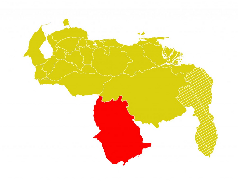
Si había un sitio de mi país que tenía muchas ganas de conocer por la fama de sus paisajes naturales, ese era el estado Amazonas, el segundo más grande de Venezuela. No fui hasta allá porque lo haya planificado, todo sucedió improvisadamente.
One day my friend Zoraibeth sent me a message on my cell phone: “Hey, do you want to go to Amazonas? I have a friend from work who is from there and he is inviting me, he told me that I could bring more people if I wanted”. I was surprised and excited at the same time, at that time (as now) I didn't have a permanent job, so I could have as many days as I wanted and my friend had a few days off.
Un día mi amiga Zoraibeth me mandó un mensaje a mi celular: “Epa, ¿quieres ir al Amazonas? Tengo un amigo del trabajo que es de allá y me está invitando, me dijo que podía llevar más gente si quería”. Me sorprendí y emocioné a la vez, en ese momento (tal como ahora) yo no tenía un trabajo fijo, así que podía disponer de los días que quisiera y mi amiga tenía unos días libres.
I thought for a moment, but I had to decide quickly, the trip was barely a few days away and we had to organize ourselves, although everything was going to be easier because we would go in Zoraibeth's car, so we didn't have to worry about bus tickets or none of that and we also had lodging at the home of Douglas's mother, the guy who invited us.
Me quedé pensando un momento, pero tenía que decidir rápido, apenas faltaban unos días para el viaje y teníamos que organizarnos, aunque todo iba ser más fácil porque iríamos en el carro de Zoraibeth, así que no teníamos que preocuparnos por los pasajes de autobús ni nada de eso y también teníamos hospedaje en la casa de la mamá de Douglas, el muchacho que nos invitó.
So the preparations for the trip consisted of buying some things, food more than everything, and doing a little research on the Internet about this enormous state, which I didn't know much about. Another advantage is that we went with a guide, because Douglas knew the area, anyway I made my list of interesting places to visit and it was really useful during the six days we were in this beautiful place in southern Venezuela, where the Amazon rainforest is located, the world's plant lung.
Entonces los preparativos del viaje consistieron en comprar algunas cosas, alimentos más que todo, e investigar un poco en Internet sobre este enorme estado, del que yo no conocía mucho. Otra ventaja es que íbamos con guía, porque Douglas conocía la zona, de todas formas yo hice mi lista de sitios interesantes para visitar y realmente nos fue útil durante los seis días que estuvimos en este hermoso lugar del sur de Venezuela, donde se encuentra la selva amazónica, pulmón vegetal del mundo.
In this first part of my trip, which I did five years ago, I will show you how we got there, a very interesting journey, you will see...
En esta primera parte de mi viaje, el cual hice hace cinco años, les mostraré cómo llegamos hasta allí, un recorrido bastante interesante, ya verán…
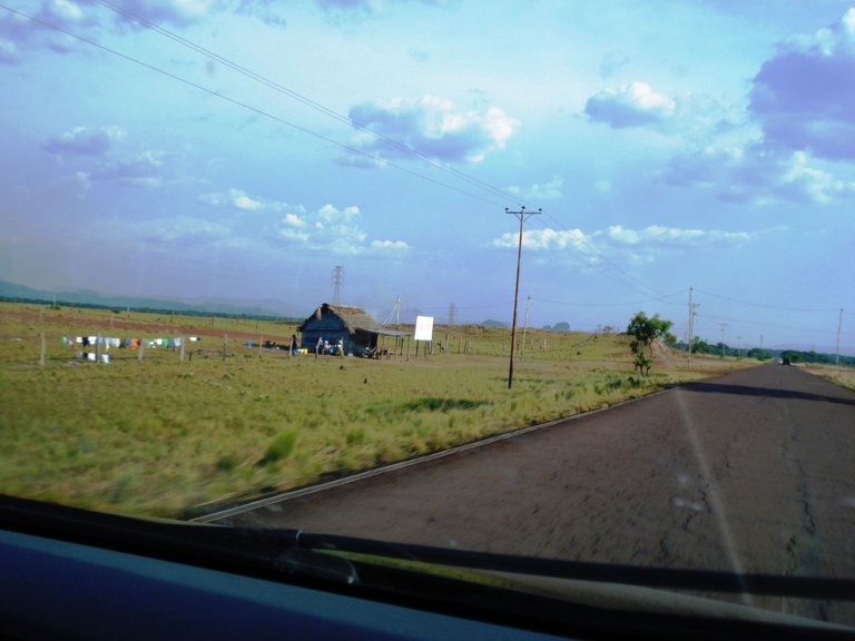
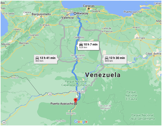
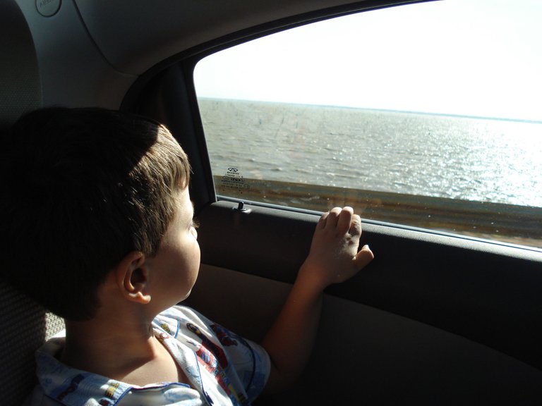
We leave on a Saturday from the city of Maracay, very early, at 5:00 in the morning, to be able to arrive before dark at Puerto Ayacucho, capital of Amazonas state, we must bear in mind that the distance is long, more than 600 km. As I wasn't going to drive, Zoraibeth and Douglas took care of that, alternating the wheel, I had no idea of the route, I didn't investigate what it was like or where we were going to go, so the route surprised me, I love that it happens, not knowing what I'll see along the way.
Salimos un sábado desde la ciudad de Maracay, muy temprano, a las 5:00 de la mañana, para poder llegar antes del anochecer a Puerto Ayacucho, capital del estado Amazonas, hay que tener en cuenta que la distancia es larga, más de 600 km. Como yo no iba a manejar, de eso se encargaron Zoraibeth y Douglas alternándose el volante, no tenía idea del recorrido, no investigué cómo era ni por dónde íbamos a pasar, entonces la ruta me sorprendió, me encanta que eso ocurra, no saber qué veré por el camino.
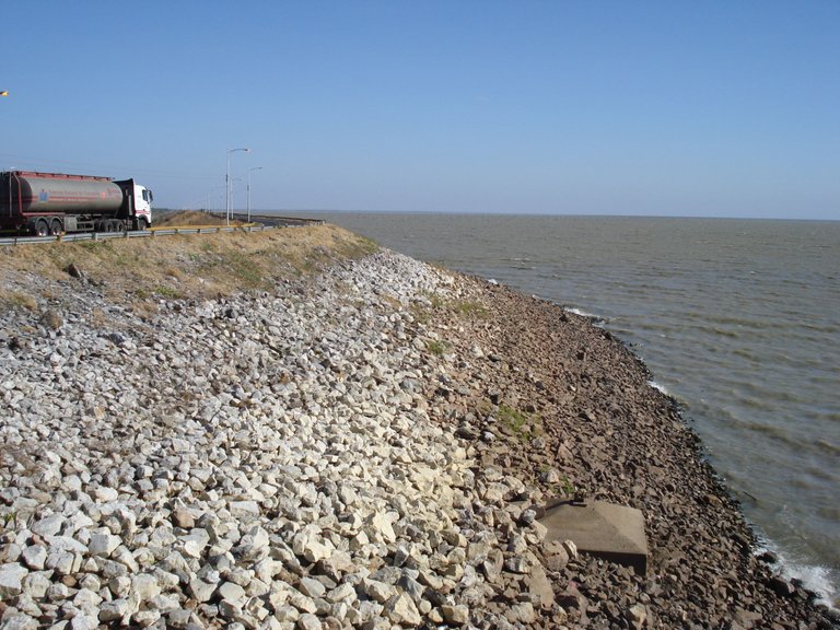
When we had already driven for about a couple of hours and were in Calabozo, in Guárico state, we began to see a large expanse of water on both sides of the road, it was the Río Guárico reservoir and dam, whose official name is “Ingeniero Generoso Campilongo”, a huge work inaugurated in 1957 and used for the irrigation system of a large area of rice and other food production and also to supply water to the population of the state. In total it has a flooded area of 23,140 hectares.
Cuando ya habíamos rodado más o menos un par de horas y estábamos por Calabozo, en el estado Guárico, comenzamos a ver una gran extensión de agua a ambos lados de la carretera, era el embalse y represa Río Guárico, cuyo nombre oficial es “Ingeniero Generoso Campilongo”, enorme obra inaugurada en 1957 y que se usa para el sistema de riego de una gran zona de producción de arroz y otros alimentos y también para surtir de agua a la población del estado. En total tiene un área inundada de 23.140 hectáreas.
We stopped for a while because this landscape is impressive, and there is also a tourist viewpoint and some food sales.
Nos detuvimos un rato porque es impresionante este paisaje, además allí hay un mirador turístico y algunas ventas de comida.
Our next stop about two hours later, was San Fernando, capital of Apure state, there we got off the car for a while to buy some things and we took the opportunity to go around a vial that is there at the entrance of the city, which has a fountain, a statue and a flag. The fountain is what most caught my attention and its name is Fountain of the Alligators or Fountain of Abundance, the work of a great Venezuelan artist: Alejandro Colina.
Nuestra próxima parada unas dos horas después, fue San Fernando, capital del estado Apure, allí nos bajamos un rato del carro para comprar unas cosas y aprovechamos para dar una vuelta por una redoma que está allí en la entrada de la ciudad, la cual tiene una fuente, una estatua y una bandera. La fuente es lo que más me llamó la atención y su nombre es Fuente de Los Caimanes o Fuente de la Abundancia, obra de un gran artista venezolano: Alejandro Colina.
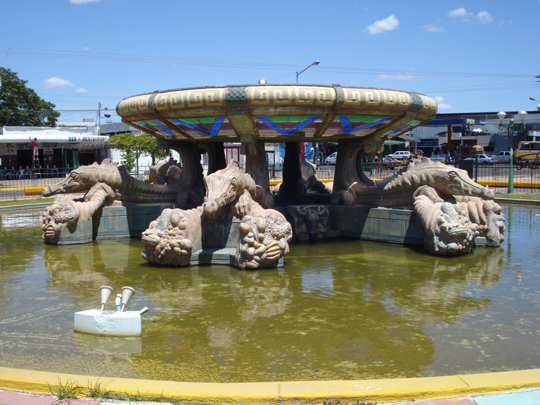
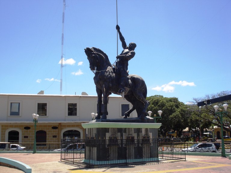
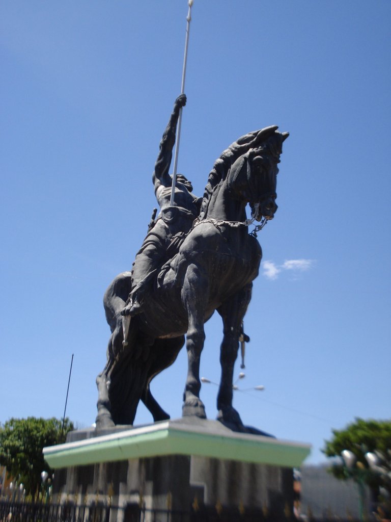
There is also another work of Colina, the statue entitled "Man on horseback", a monument that represents the llaneros, very brave people who fought for the independence of Venezuela.
También está ahí otra obra de Colina, la estatua titulada “Hombre a caballo”, un monumento que representa a los llaneros, gente muy aguerrida que luchó por la independencia de Venezuela.
Back in the car we continued advancing and after crossing the bridge over the Arauca River, we arrived at a place with wide horizons and with an enigmatic monument...
De vuelta al carro continuamos avanzando y después de cruzar el puente sobre el río Arauca, llegamos a un lugar de amplios horizontes y con un enigmático monumento…
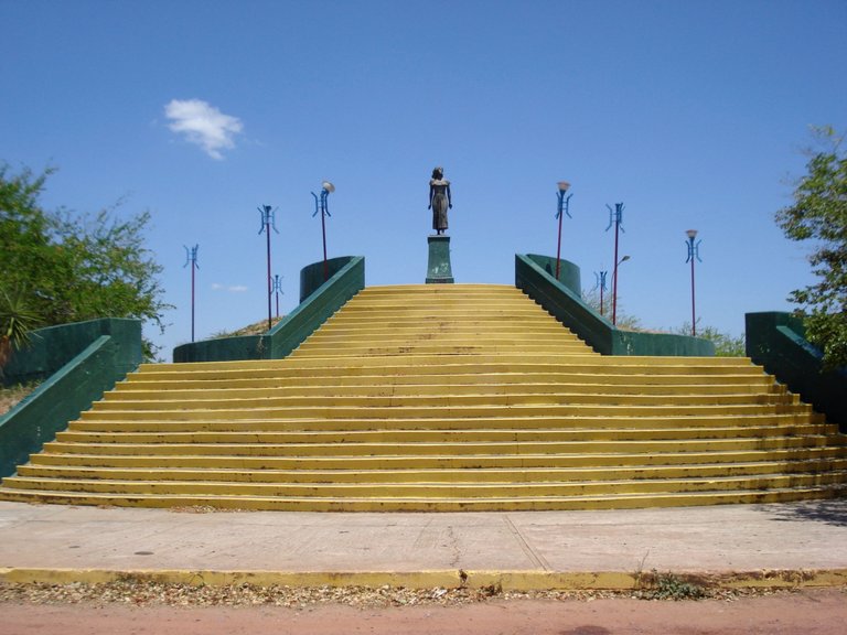
Who is this woman? What is she doing in this lonely place? You had to get closer to see the plaques that the statue has, one of them says:
rescued from barbarism
by virtue of love and
the civilizing will”
¿Quién es esta mujer? ¿Qué hace en este lugar solitario? Había que acercarse para ver las placas que tiene la estatua, una de ellas dice:
“A Marisela,
rescatada de la barbarie
por virtud del amor y de
la voluntad civilizadora”
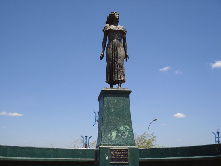
She is an important character in the novel Doña Bárbara, by the Venezuelan writer Rómulo Gallegos, a classic of Latin American literature inspired by these landscapes and the culture of the plains.
Ella es un personaje importante de la novela Doña Bárbara, del escritor venezolano Rómulo Gallegos, un clásico de la literatura latinoamericana inspirado en estos paisajes y la cultura de los llanos.
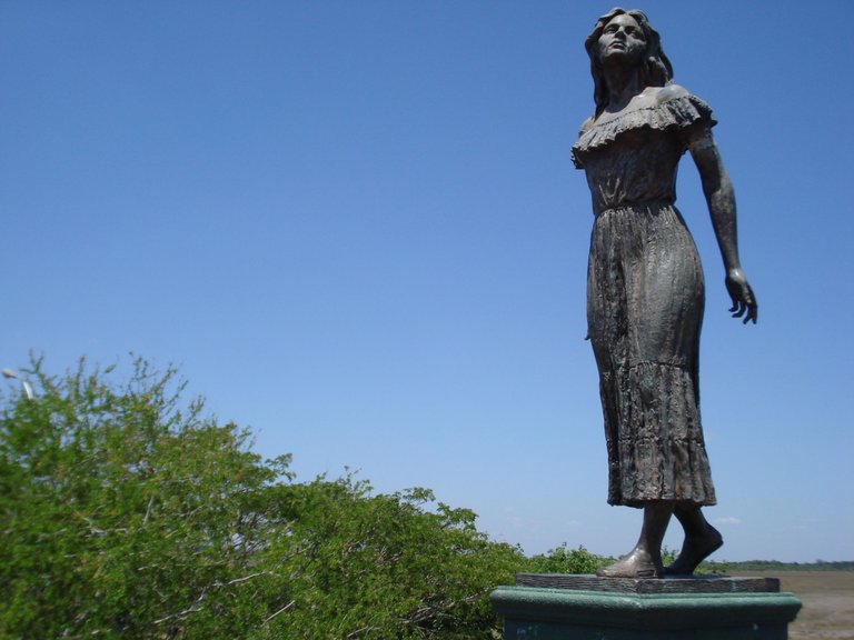
Marisela is the daughter of Doña Bárbara and this part of the Apure state where her statue stands is part of the Santos Luzardo National Park, named after one of the protagonists of this novel, although it is also known as Cinaruco-Capanaparo National Park.
Marisela es la hija de Doña Bárbara y esta parte del estado Apure donde se erige su estatua, forma parte del Parque Nacional Santos Luzardo, nombrado así como homenaje a uno de los protagonistas de esta novela, aunque también se le conoce como Parque Nacional Cinaruco-Capanaparo.
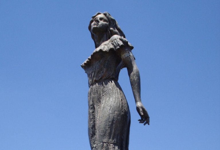
This viewpoint is part of "The Gallegos route" in Apure, a journey of more than 200 km between San Fernando and Puerto Páez, to see the natural settings that appear in the writer's novel.
Este mirador es parte de la “La ruta de Gallegos” en Apure, un recorrido de más de 200 Km entre San Fernando y Puerto Páez, para ver los escenarios que aparecen en la novela del escritor.
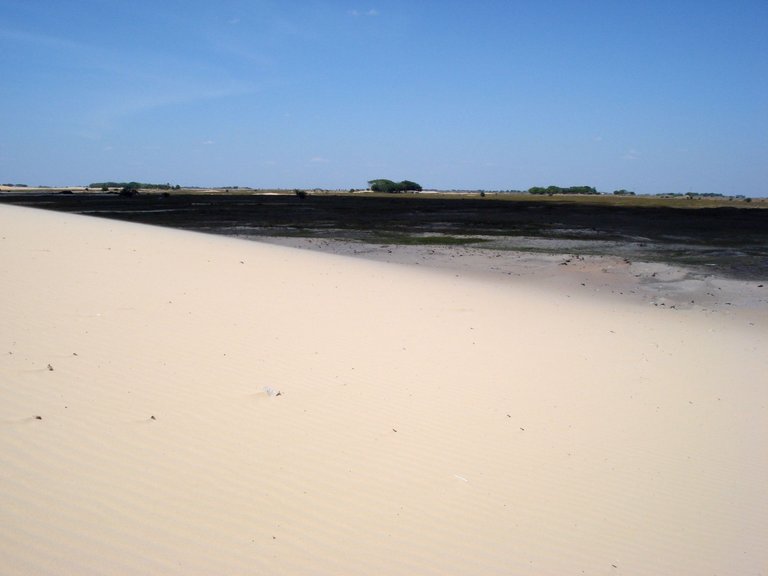
After this stop, let's say literary, we continued and a little further my eyes were almost blinded by a desert light, what is this? Wooow!... Well, they are the Capanaparo Dunes, said Douglas, also known as Dunes of Loneliness.
Después de esta parada, digamos literaria, seguimos y un poco más allá mis ojos quedaron casi cegados por una luz desértica, ¿qué es esto? ¡Uaaao!... Pues son las Dunas del Capanaparo, dijo Douglas, también conocidas como Médanos de La Soledad.
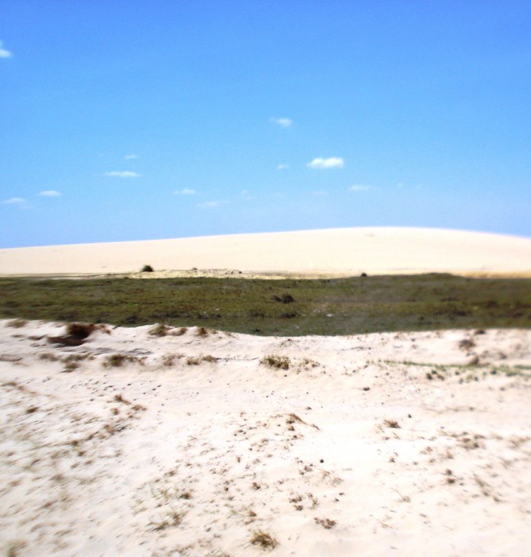
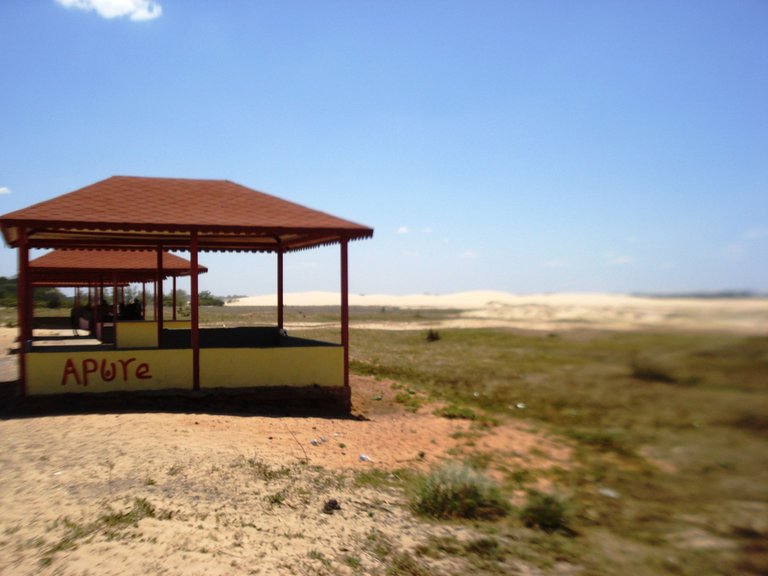
The most famous desert in Venezuela are the dunes of Coro, in Falcón state, so these sands in the middle of the Apure plains were a real surprise to me, I hadn't heard of them. They told us that in the rainy season they fill with water, thus forming “beaches”, where many people go to enjoy and cool off.
El desierto más famoso de Venezuela son los médanos de Coro, en el estado Falcón, así que estas arenas en medio de los llanos de Apure fueron una verdadera sorpresa para mí, no había escuchado de ellas. Nos dijeron que en época de lluvia se llenan de agua formándose así “playas”, donde mucha gente va a disfrutar y refrescarse.
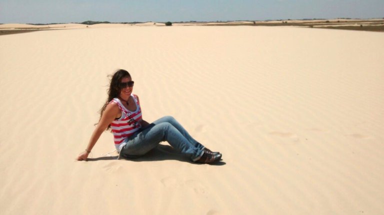
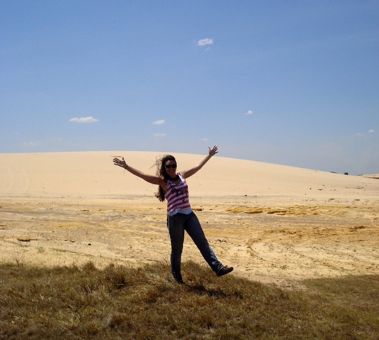
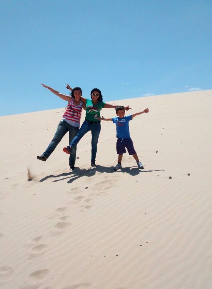
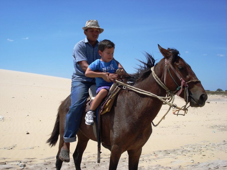
We had a good time under the inclement rays of the sun, climbing the dunes and taking photos, also, my friend's son took a horse ride, although at first he was a bit scared...
Nos divertimos un buen rato bajo los inclementes rayos del sol, subiendo por las dunas y tomando fotos, también, el hijo de mi amiga dio un paseo a caballo, aunque al principio estaba algo asustado…
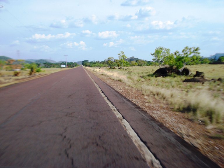
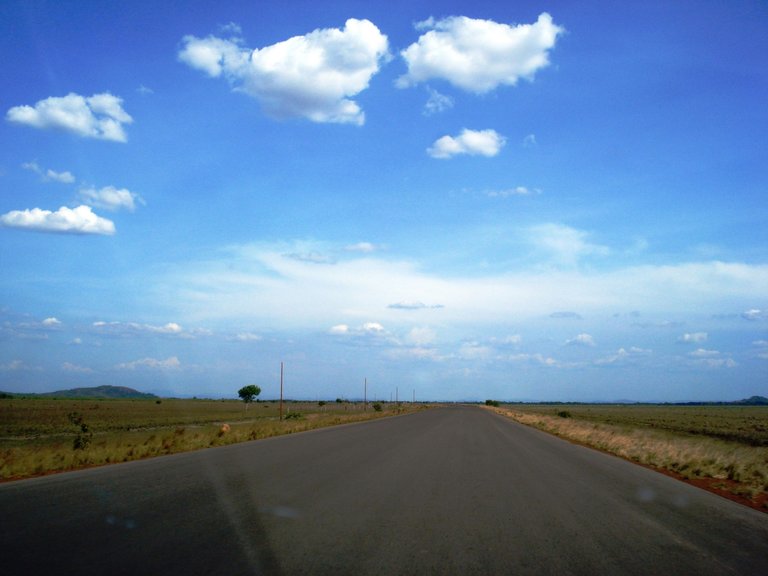
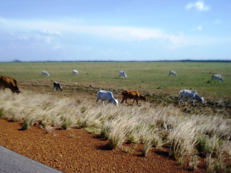
Now the last leg of our trip to Puerto Ayacucho awaited us, we got on the car leaving the desert behind. On this road there were many cattle grazing.
Ahora nos esperaba el último tramo de nuestro viaje a Puerto Ayacucho, nos montamos en el carro dejando el desierto atrás. Por esta vía había mucho ganado pastando.
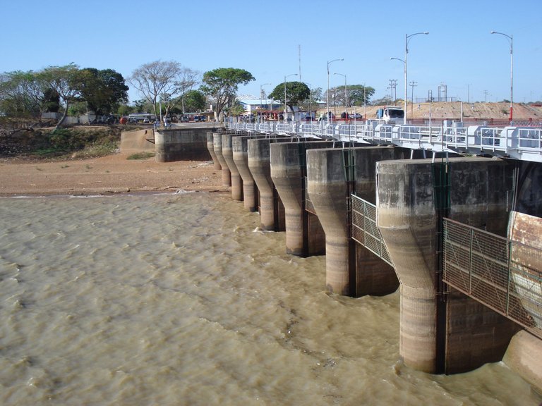
About an hour and a half later we arrived in Puerto Páez, a town on the border with Colombia where we were going to cross the Orinoco River to continue our journey.
Más o menos una hora y media después llegamos a Puerto Páez, población fronteriza con Colombia en donde íbamos a cruzar el río Orinoco para seguir nuestro trayecto.
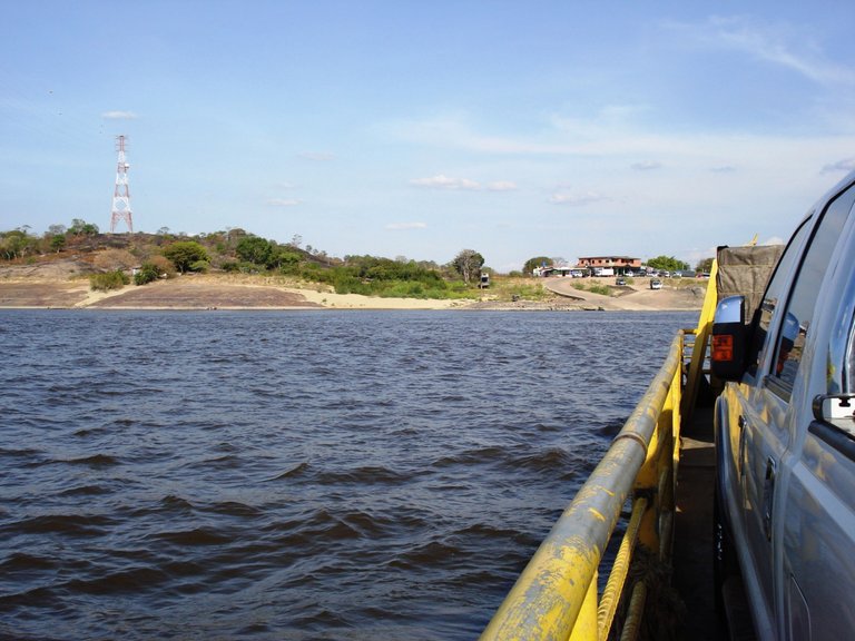
Going down to the river we saw a huge chalana, a boat where cars and people ride to cross the waters and connect with Amazonas state.
Bajando hacia el río vimos una enorme chalana, embarcación donde montan los carros y a la gente también para cruzar las aguas y conectar con el estado Amazonas.
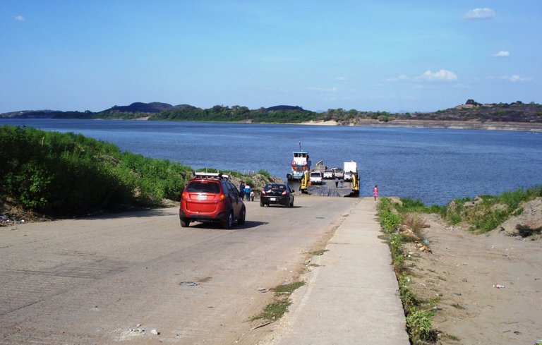
You pay a fee, you ride the car there and you can get out of it to see the landscape, obviously we did, not every day you sail the Orinoco, the largest river in Venezuela and the third in South America.
Se paga una tarifa, montas el carro allí y puedes salirte de él para ver el paisaje, obvio que así lo hicimos, no todos los días navegas por el Orinoco, el río más grande de Venezuela y el tercero de Suramérica.
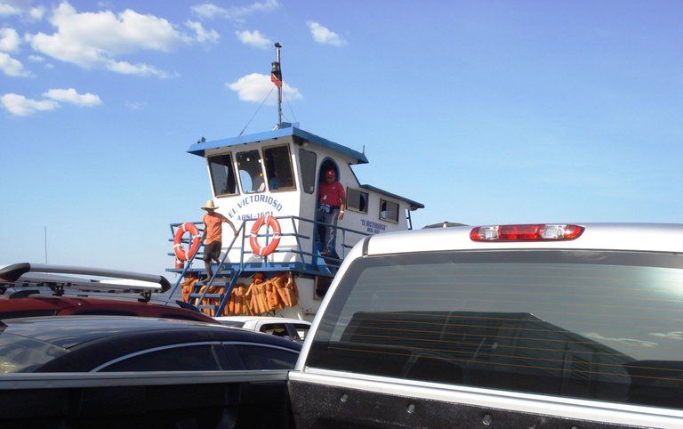
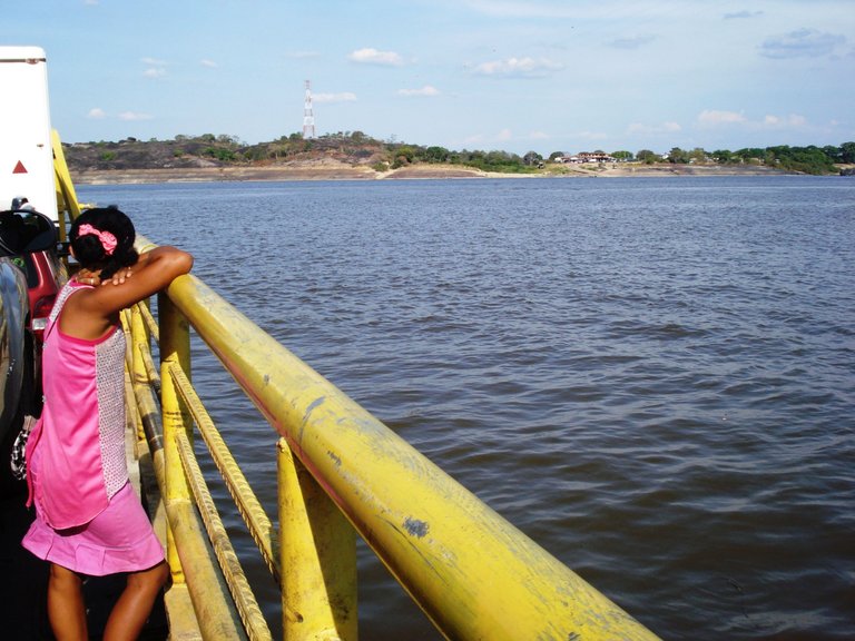
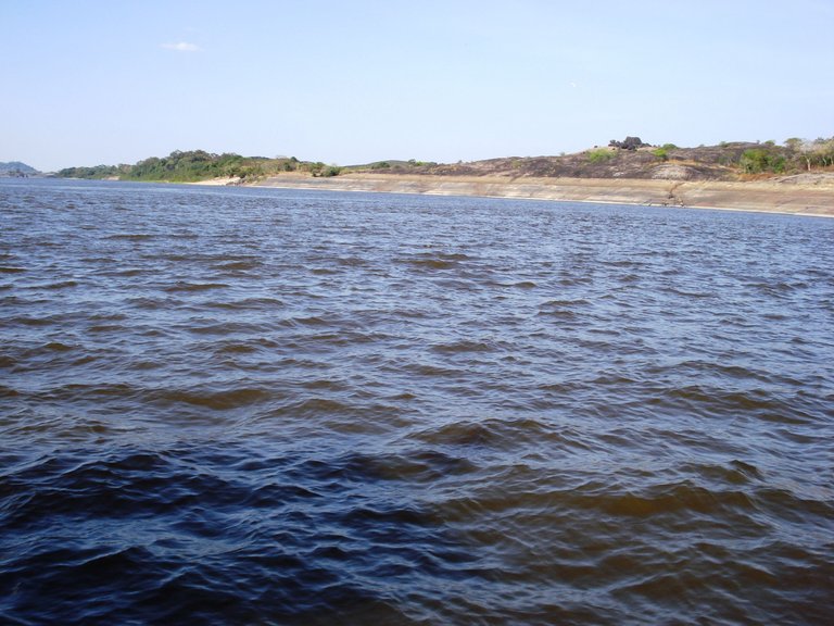
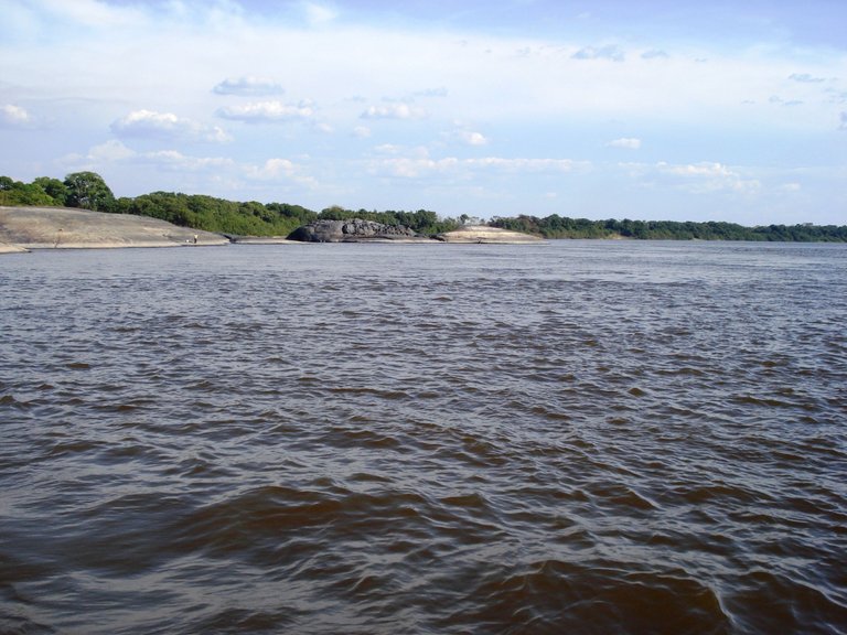
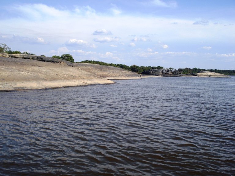
The crossing lasts only about 15 minutes, but there is time to observe the huge stones that characterize this mighty river and that show the mark of the water level when it is in the dry or summer season.
El cruce dura apenas unos 15 minutos, pero hay tiempo para observar las enormes piedras que caracterizan a este caudaloso río y que muestran la marca del nivel del agua cuando se está en temporada de sequía o verano.
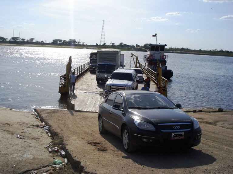
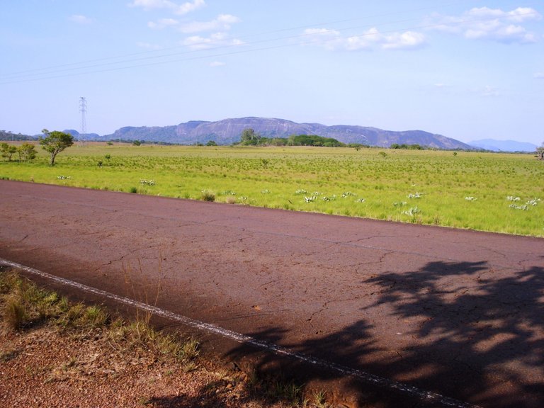
Stepping on land again in El Burro, we continued going south and closer to our destination, we had a little more than 80 km to go to reach Puerto Ayacucho.
Pisando tierra otra vez en El Burro, seguimos yendo al sur ya más cerca de nuestro destino, nos faltaban poco más de 80 Km para llegar a Puerto Ayacucho.
On the road the landscape was changing little by little, everything became greener and some elevations of earth and many black stones appeared.
En la carretera el paisaje fue cambiando poco a poco, todo se volvió más verde y aparecieron algunas elevaciones de tierra y muchas piedras negras.
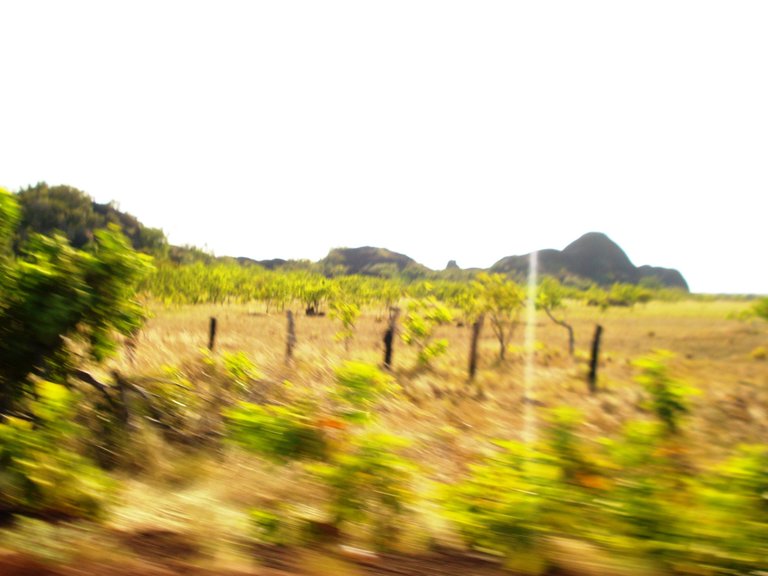
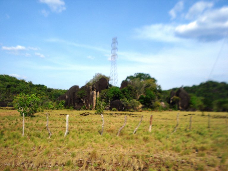
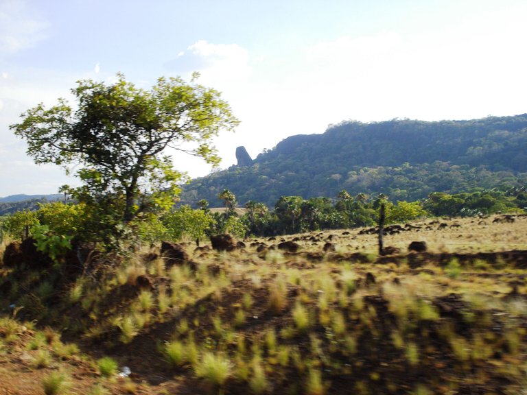
Amazonas state is located on the Guiana Massif, the oldest geological formations in the world, we already felt the magical energy of this land...
El estado Amazonas se encuentra sobre el Macizo Guayanés, las formaciones geológicas más antiguas del mundo, ya sentíamos la mágica energía de esta tierra…
To be continue…
Continuará...
All photos are my property / Todas las fotos son de mi propiedad
Nice trip! You got to see and experience a lot :) Btw we have a similar statue in Prague :D
Thanks @phortun! Nice statue and pic! Prague is a city that I want to visit someday 🙂
Congratulations, your post has been added to Pinmapple! 🎉🥳🍍
Did you know you have your own profile map?
And every post has their own map too!
Want to have your post on the map too?
Interesante viaje, largo recorrido. Tienen una naturaleza muy diversa
Hola, así es, la diversidad está garantizada por aquí, gracias por comentar 🙂
Hermosa tierra! No sabía que a marisela le habían hecho una estatua. Debo admitir que no leí el libro de Doña Barbara sino que vi la adaptación que hicieron en novela en la TV xD es la unica que he visto y mi favorita. Muy buena la informacion y fotos @sofathana!
¡Gracias @ceparl! Me alegra que te haya gustado 🙂, cuando tengas chance lee también el libro, yo no he visto la novela jeje, me gustaría
HTTP is in use instead of HTTPS and no protocol redirection is in place. Be careful and do not enter sensitive information in that website as your data won't be encrypted.
It's also a good habit to always hover links before clicking them in order to see the actual link in the bottom-left corner of your browser.
This auto-reply is throttled 1/20 to reduce spam but if it still bothers you reply "OFF HTTP". Or reply REVIEW for manual review and whitelisting.
OFF HTTP
Great post! Discovering hidden Venezuela destinations! What is your connection to Maracay? Do you live there?
Thank you! Yes, Amazonas is a hidden gem! No, I don't live in Maracay, but I have friends there