Hello steemians!
How are you? If you're reading this, I hope you're doing fine. I am and always will be grateful for your support to my two series: Kim's Quest and Definitely Cebu. Here's another entry for my relatively new series Definitely Cebu. It will be about a famous mountain in the south of Cebu.
Before I'll go to the main part, let me share the first two entries of this series. You can read them here if you have time:
I would really appreciate it if you let me know you read my posts by leaving a comment. You can tell me what you like or don't like about my posts.
This post will be about our trek to Mt. Lanaya via Legaspi Trail which is said to be one of the most difficult trekking sites in Cebu. I decided to split it into two parts. The first part will be from Alegria's Coast to Mt. Lanaya Base Camp. The second part will be about the assault to the peak of Mt. Lanaya.
From Cebu City, you can ride a bus to Alegria at Cebu City South Bus Terminal via Bato-Barili route at around Php 210.00. Some would choose to start the trek in the afternoon to have an overnight camp at the base camp and then continue with the assault early in the morning the next day. Others would prefer a day trek since it's really possible, but the heat of the sun could be unbearable. We chose the later so we leave at South Bus at dawn. Travel time to Alegria would be about 4 hours.
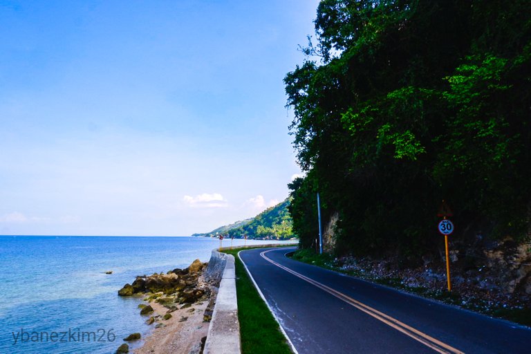
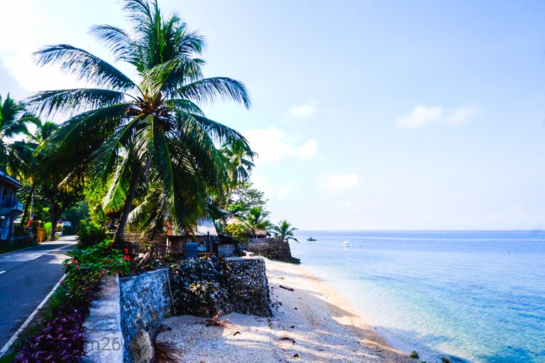
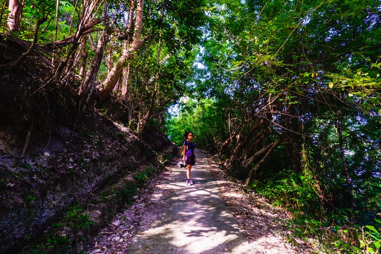
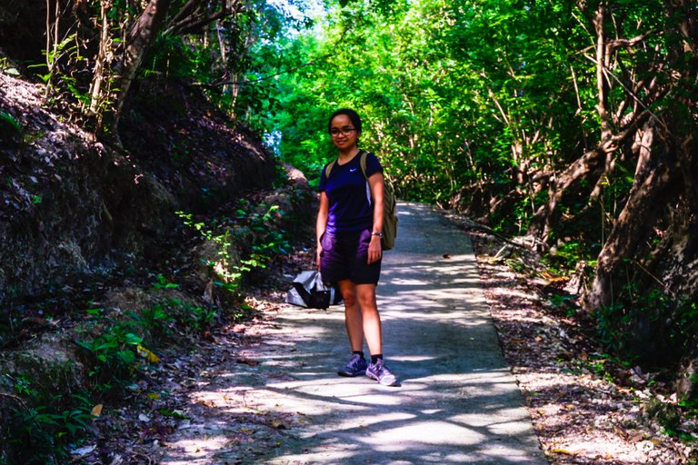
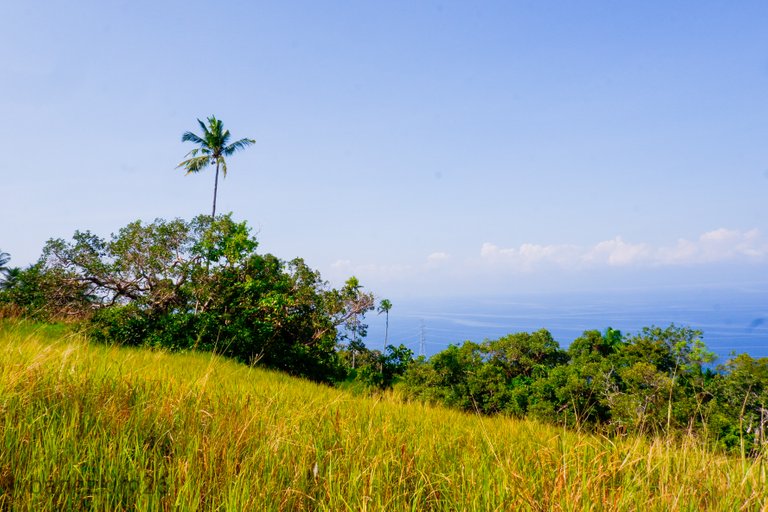
We arrived in Alegria at around 7:30 AM and had breakfast at the town proper. We bought some supplies and snacks and then rode a motorcycle to Barangay Legaspi. We asked for a guide and paid some fees before starting the trek. While Vanessa was processing the fees, I got out from the multipurpose hall and took photos at the coast.
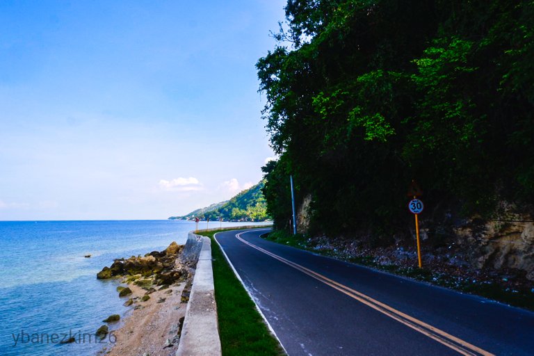
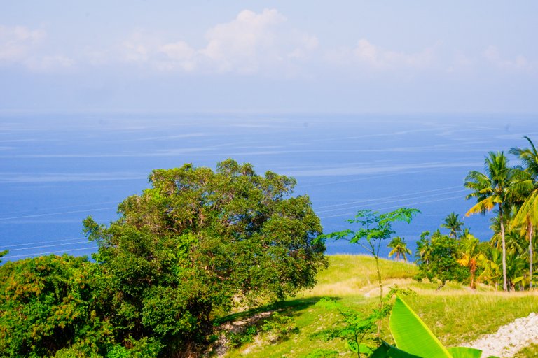
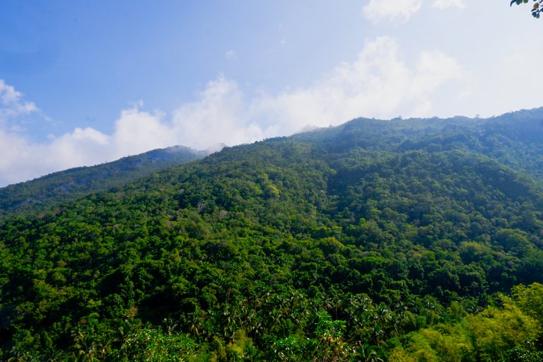
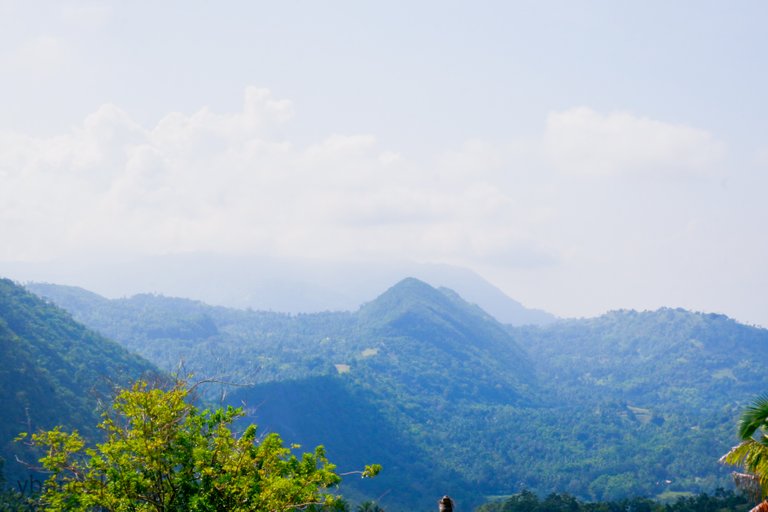
Alegria's Coast
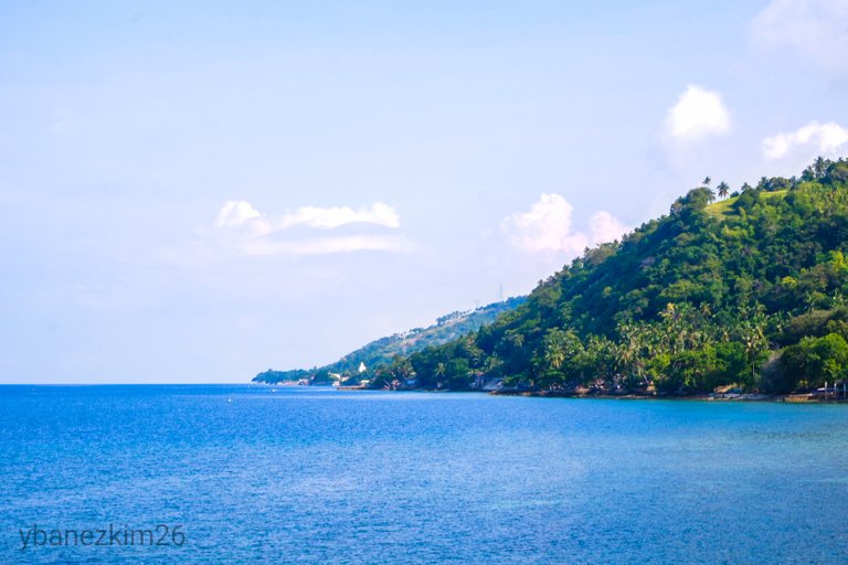
It was one sunny morning and you know you're on the countryside when cars are not frequent even in a national highway. The sea, the sky, the mountains, and the empty street embued a sense of serenity that could not be found anywhere in the city.
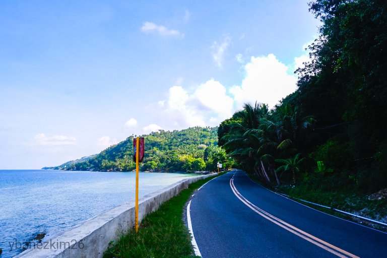
One thing that's noticeable in Alegria or in any town down south of Cebu is its drastic change in landscape. There's no gradual change in elevation and there's almost no flat ground. It's almost mountain immediately after the sea.
While I was there, I can't help but imagine how slow and peaceful life would be if I wake up every morning with that kind of scenery. Memories of my childhood in the province flooded on me. I wished I could back there for good, but times have changed. So much with the sentimental moment, I head back to the multipurpose hall to prepare for the trek.
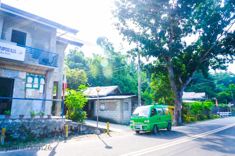
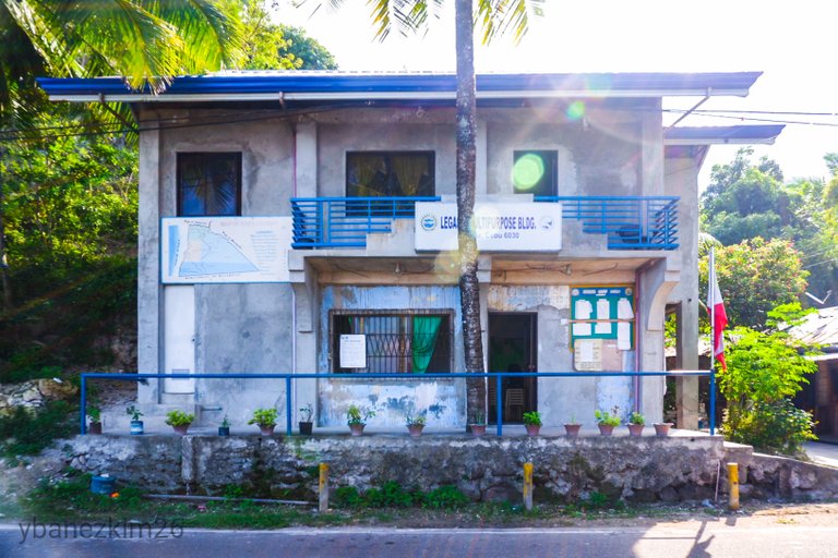
Guide fee is Php 500.00 for groups of 5, but Php 150.00 each if you're less than 4 in a group. Environmental fee is Php 50.00 per person. The plan was to traverse Mt. Lanaya via Legaspi Trail then exit via Lumpan Trail. After some arrangements to have a motorcycle to fetch us at Alegria gas field, we head on to start the trek at 8:30 AM.
Trek to Base Camp
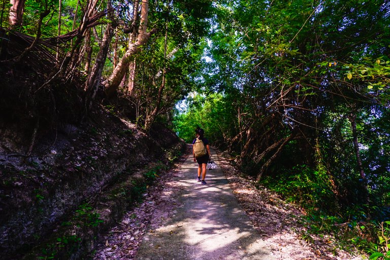
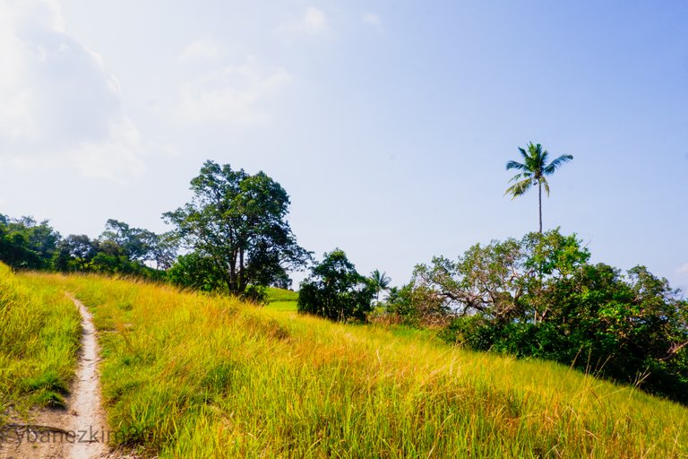
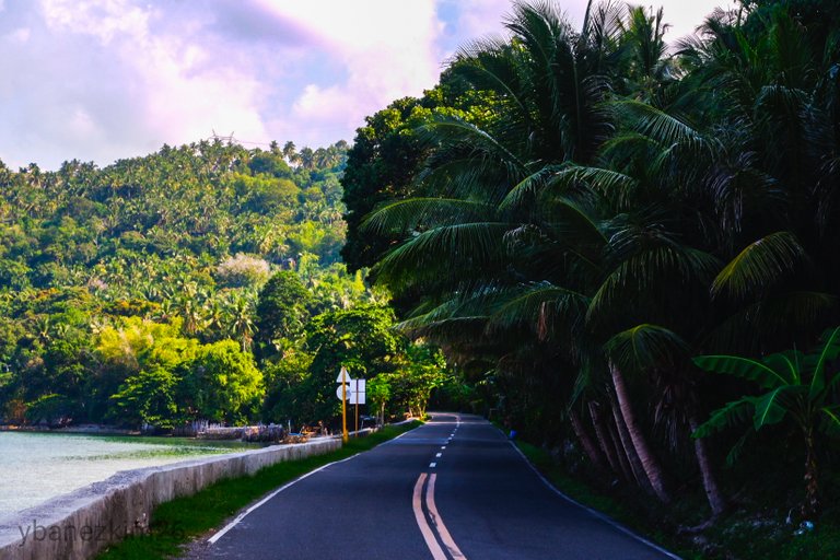
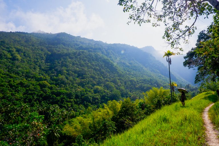
I think one of the reasons why mountaineers often say that Legaspi Trail is one of the most difficult trekking trails in Cebu is because the trek started at the national highway. At first it will follow a small paved path where motorcycles often pass. Shade and cover is provided by coconut trees and banana leaves.
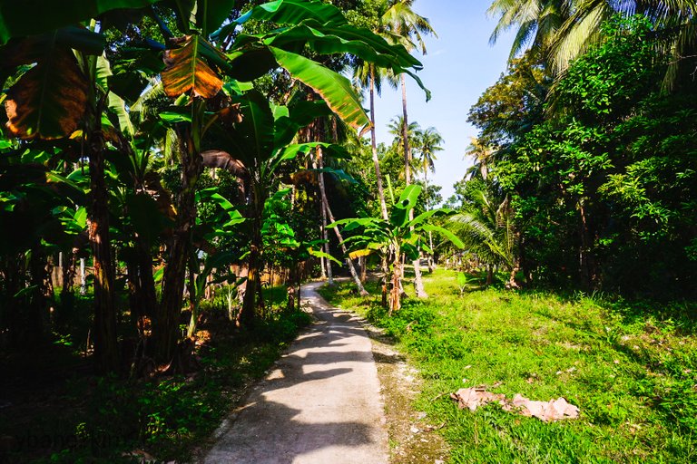
There are some patches in the paved road that crosses a forested area, but majority are under the coconut trees and cogon grass are abundant along the road.
A few moments later, our guide told us that we were already in the starting point of the trek. We were shocked to know that we were already slightly exhausted from walking that paved road and yet we haven't officially started the trek.
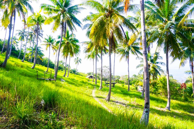
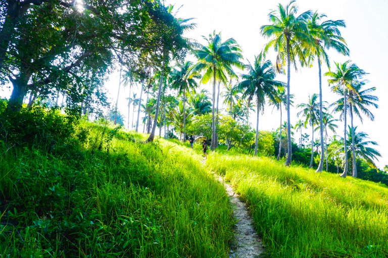
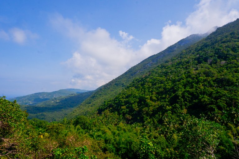
He then explained that the official starting point is when you veered off from the paved road. The trail is along the grassland and sometimes under coconut trees.
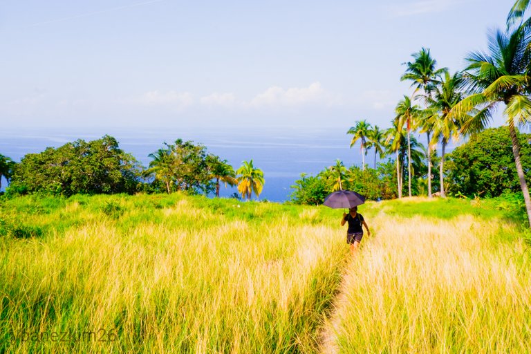
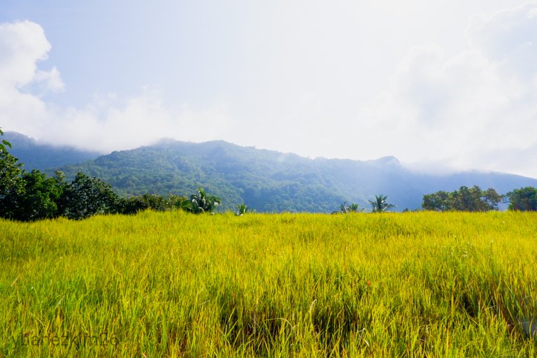
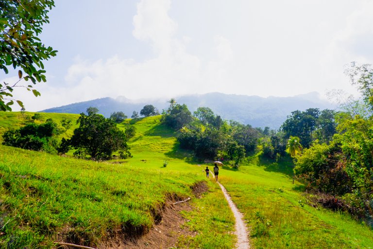
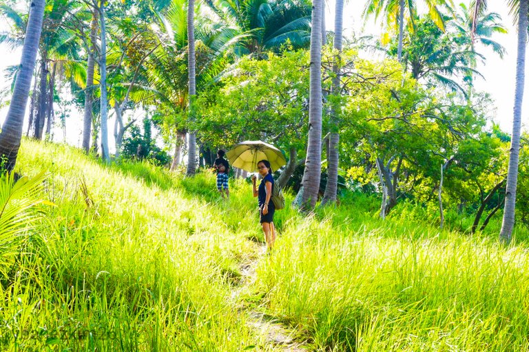
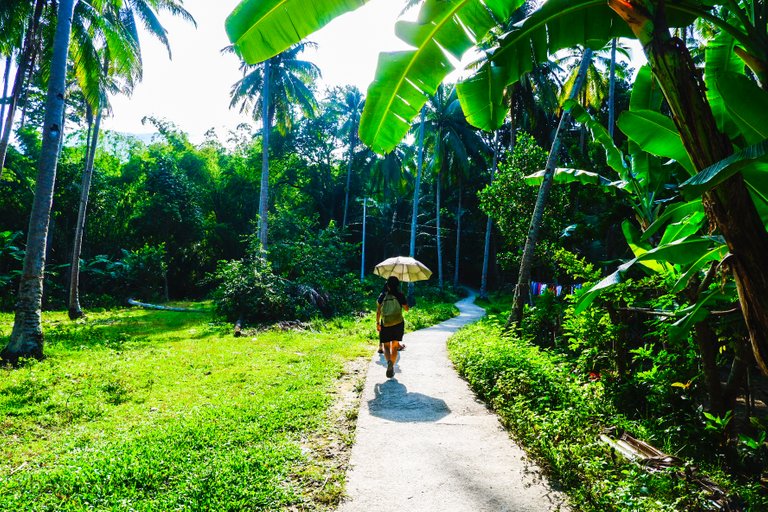
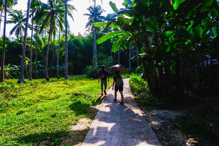
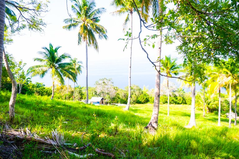
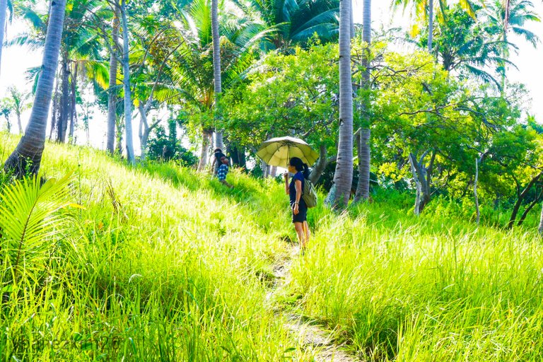
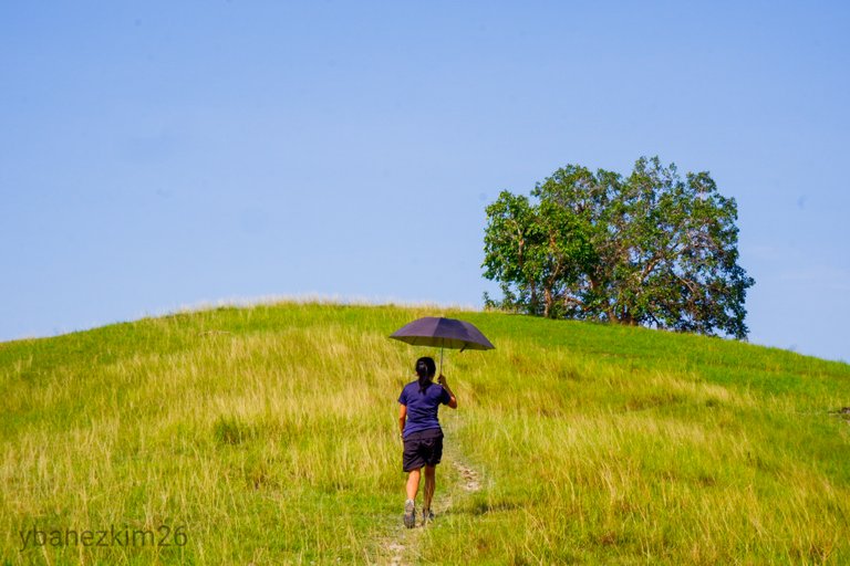
The sun was already blistering at 9:00 AM. We were prepared though as we brought umbrella with us. The ascent was slow because we still have enough time, but we didn't have stops to rest. It was a continuous trek until Mt. Lanaya became visible to us.
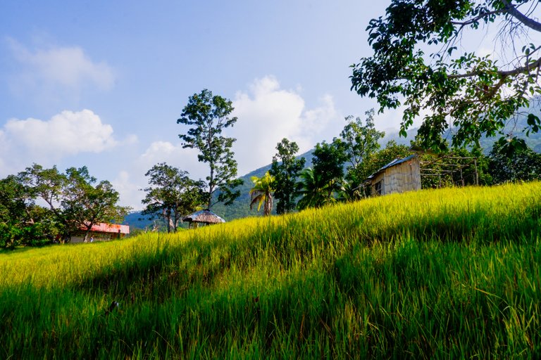
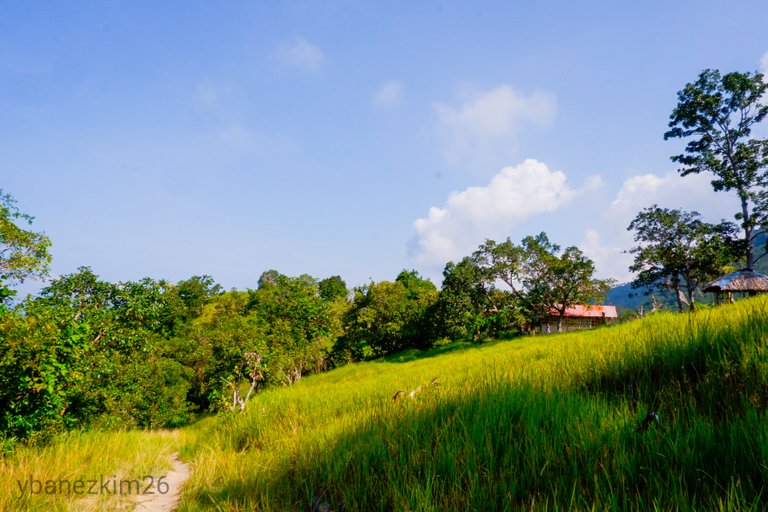
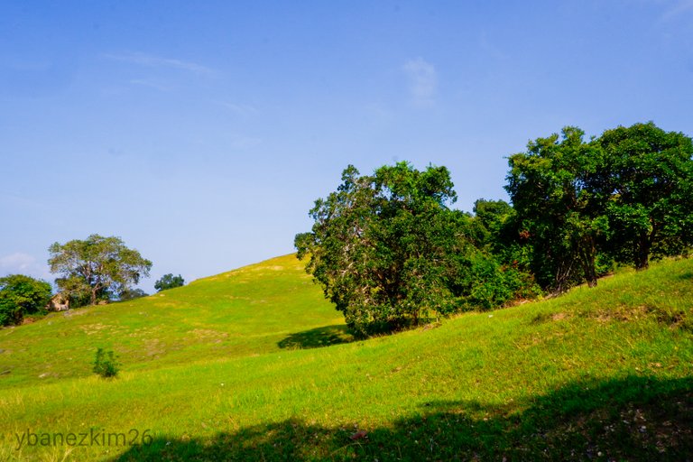
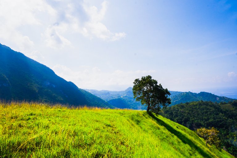
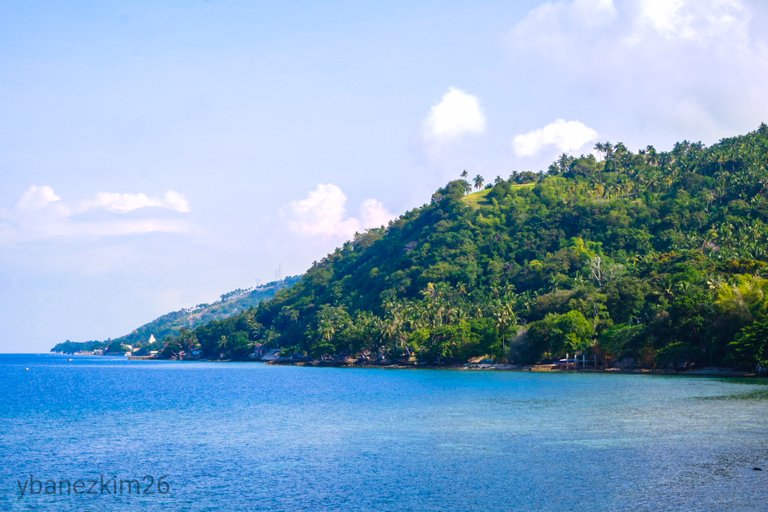
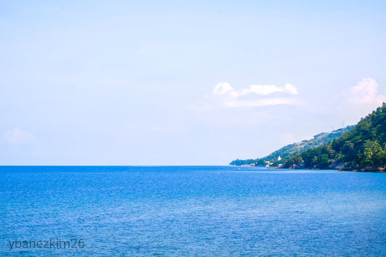
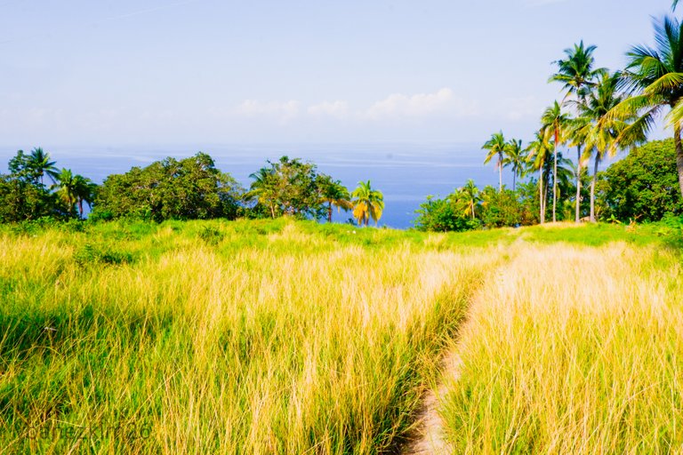
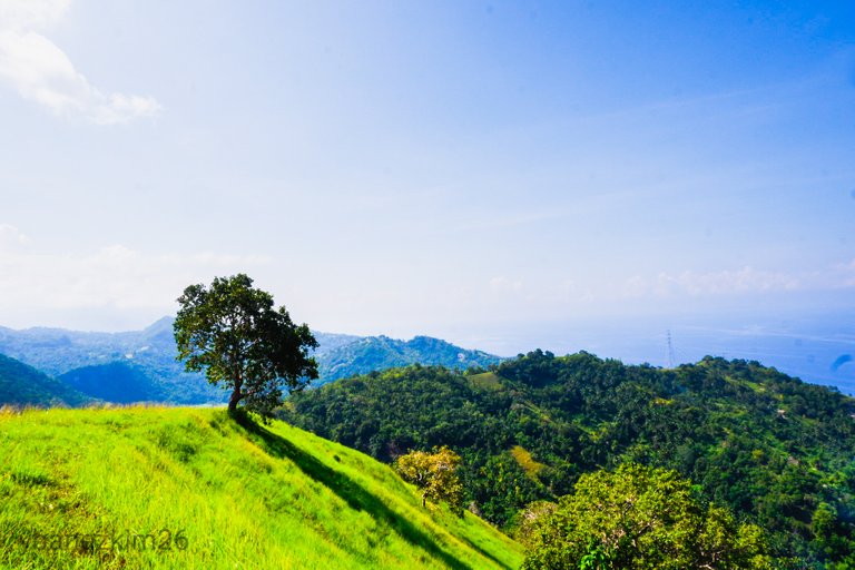
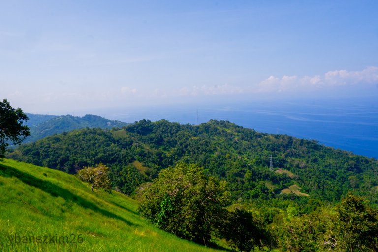
We passed by a few houses along the trail. Tañon Strait was very calm below. No visible waves can be seen as it was a sunny morning, but Negros Island was not visible. The trail is generally characterized as open grassland with sporadic trees.
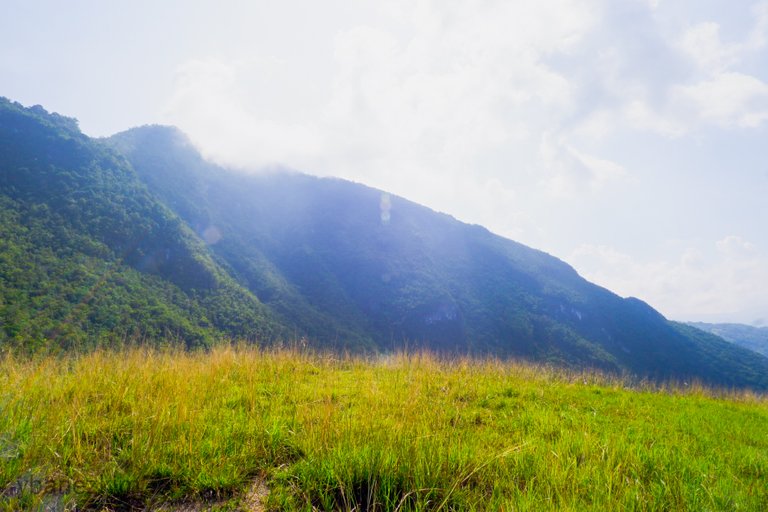
You will know you're near the base camp when you're at the foot of Mt. Lanaya already. As shown in the photos above, we need to scale that massive mountain range.
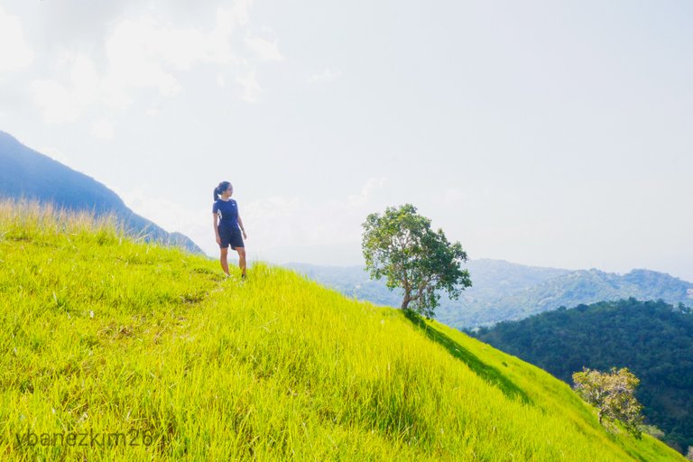
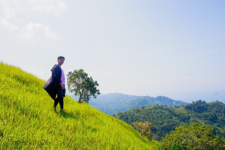
Windows XP (Base Camp)
After 1 hour and 30 minutes, we reached the base camp at around 10:00 AM. The base camp is often called "Windows XP" by the mountaineers because of its slight resemblance to the famous wallpaper of Windows XP.
We rested for a bit under the tree and then have some photoshoot for social media. You know, the classic activities.
I guess that's all for this post. I hope you'll like it. If you do, leave a comment down below and show some love. Next post under this series will be the second part of our Mt. Lanaya trek. Stay tuned, folks!
Kim Ybañez
Welcome to Kim's small corner in the Steem blockchain. He is a chemical engineer by profession, but a blogger by passion. He is a wanderlust and an adventure seeker. Join his quests as he visits secluded destinations, climbs mountains, tries new and exotic dishes, and explores his country (The Philippines) and the rest of the world even if he's still a poor corporate slave with tons of bills to pay and two siblings to support in college.
Looks like an awesome trip filled with sublime beauty. It looks like it must have been very hot, especially being so near to the equator. Some pics seem over-saturated but it really does add to the exotic tropical feeling.
Thank you for sharing your experience! I'm glad you got a little bit of curation from OCD. Your post formatting is also very good.
You're right, @crytosharon, it was really hot and humid that time. I just realized that I tend to over-saturate when I edit my photos, but I tend to do it unconsciously. Sometimes I just let it be, but other times I re-edit it if it becomes too much.
I'm really grateful to the OCD community for their support. Actually, I'm a little bit pressured to continue posting the same level of quality, but I'm really thankful for the curators who believed in my work.
As for the formatting, that's one I could be proud of so thank you for the compliment. I worked on that for a long time and still continuing to experiment with what's good. It takes almost 1/3 of the time to do the formatting, but I'm enjoying every bit of it.
Thanks for stopping by! Have a great day!
That's something I've struggled with as well, getting curated and then wanting to get curated again, doing big posts and spending a lot of time and energy on it. I got too stressed out, and it was not my thing. I decided to relax, take it slow and make one small post per day.
Getting a lot of money at a time can be stressful lol. I'm too frugal. Dealing with big numbers gives me anxiety. I do hope to keep seeing your awesome photography. I'll be following you to see what you come up with next time :P
Wow! Thank you! Following you now, too! Now I'm anxious to give my best. Be warned though, I'm still a noob when it comes to photography. I got my camera last year and I didn't have enough practice.
I'm sure that most of us here can relate to that sentimentality when we visit our hometowns. I haven't visited mine in about 22 years, since I was young, but I still think about the small town where I was raised up and dream about the place all the time. Even if things cannot be as they once were, it's good to still have the memories.
I totally agree with this, @aur. Memories of my childhood are still very vivid to me because it was one of the most colorful moments of my life.
Great post, I was very laughing about Windows XP!
Yeah! Tourists here in the Philippines love giving nicknames to places even if its just a slight resemblance.
hehehe very funny!
What, for real? What are some other funny nicknames they give to stuff? :D
They call this garden here in Cebu "The Little Amsterdam" or "Holland of Cebu". It's just Sirao flower garden. I haven't featured it yet, but I'm planning to.
Congratulations, Your Post Has Been Added To The Steemit Worldmap!
Author link: http://steemitworldmap.com?author=ybanezkim26
Post link: http://steemitworldmap.com?post=definitely-cebu-3-mt-lanaya-via-legaspi-trail-algeria-s-coast-to-base-camp
Want to have your post on the map too?
Poshed on Twitter. #posh
great photos!
Thank you! Glad you liked it!
Congratulations @ybanezkim26!
Your post was mentioned in the Steem Hit Parade in the following category:
Hiya, @LivingUKTaiwan here, just swinging by to let you know that this post made into our Honorable Mentions in Daily Travel Digest #767.
Your post has been manually curated by the @steemitworldmap team and got an upvote from @blocktrades to support your work. If you like what we're doing, please drop by to check out all the rest of today's great posts and consider supporting us so we can keep the project going!
Become part of the Haveyoubeenhere community:
Thank you @steemitworldmap and @livinguktaiwan! Always been so supportive of my posts! Thank you! I guess words won't be enough to express how grateful I am.
Amazing pictures, really makes me wanna visit asap.
Thank you, keep on posting.
Thank you for the compliment @kr0daking! Rest assured that I won't stop posting anytime soon.
Lol I tought it was Algeria in the northen of Africa lol thank you for sharing
I feel you there, @kdair! 😂
My auto-correct keeps on suggesting Algeria when I was typing this post. I had to add Alegria because it gets annoying. 😂
Ooooppss! Someone downvoted for no apparent reason. Care to explain @transisto?
Saya ucapkan banyak trima kasih atas postingan anda, keindahan Al- Jazair hampir sama dengan Indonesia, hijau merona sejuk dilihat mata, damai di hati.
What a beautiful place to visited..