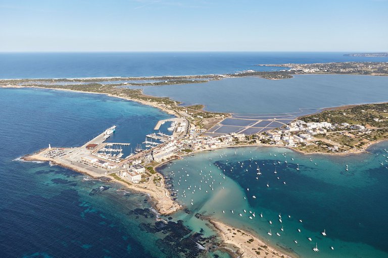
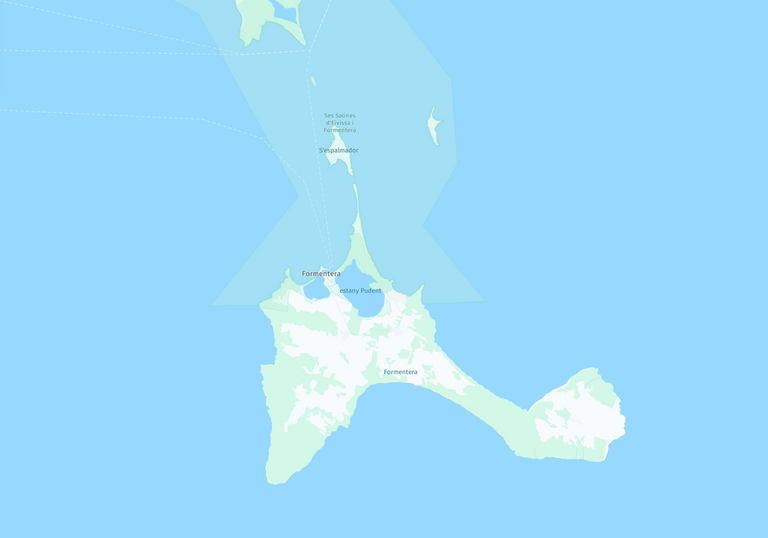
The port of La Savina is the entrance to the small island of Formentera, the southernmost of the Balearic Islands. The island is just over 12km long if we take the theoretical diagonal, being just over 1km at its narrowest part. It is a paradise for its crystal clear waters and leisurely pace of life.
In the aerial image you can see the harbour surrounded by two lagoons, one closed and the other open to the sea. The maritime connection is almost exclusively with neighbouring Ibiza and during the summer it is also connected to the mainland with a daily trip to the Alicante town of Denia.
The photo was taken from a Robinson R-44 helicopter for a report commissioned by the local government.
ESP
El puerto de La Savina es la entrada a la pequeña isla de Formentera, la más al sur de las Islas Baleares. La isla tiene poco más de 12km de largo si tomamos la teórica diagonal, siendo poco más de 1km en su parte más estrecha. Es un paraíso por sus aguas cristalina y por su ritmo de vida pausado.
En la imagen aérea se puede ver el puerto rodeado por dos lagunas, una cerrada y la otra abierta al mar. La conexión marítima es casi en exclusiva con la vecina Ibiza y en durante el verano también está conectada con la península con un trayecto diario a la localidad alicantina de Denia.
La foto está tomada desde un helicóptero Robinson R-44 para realizar un reportaje por encargo del gobierno local.
Unless stated otherwise, all the pictures and the words are mine.
Do not use this image without my written permission.
Proudly free of AI.
Thanks for stopping by and taking a look.
Camera: Canon EOS5 MkIII
Lens: Canon 24-70 f:2.8
Helicopter: Robinson R-44
Processed with Capture One
The aerial view makes the beauty of the harbor stand out :-)
!LUV
using #aroundtheworld
@xaviduran, @bucipuci(3/5) sent LUV. | connect | community | HiveWiki | NFT | <>< daily
! help(no space) to get help on Hive. InfoThis was taken on an aeroplane, it looks so very genuine and beautiful, a true geographic can be able to read this view and points areas from roads.. me can't even find or read this map