Greetings friends of Hive and @fulldeportes, today I'm going to share with you my mountain hiking training on the route El Toquito - Country, in the community of Villa de Cura, Aragua state, Venezuela.
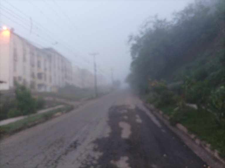
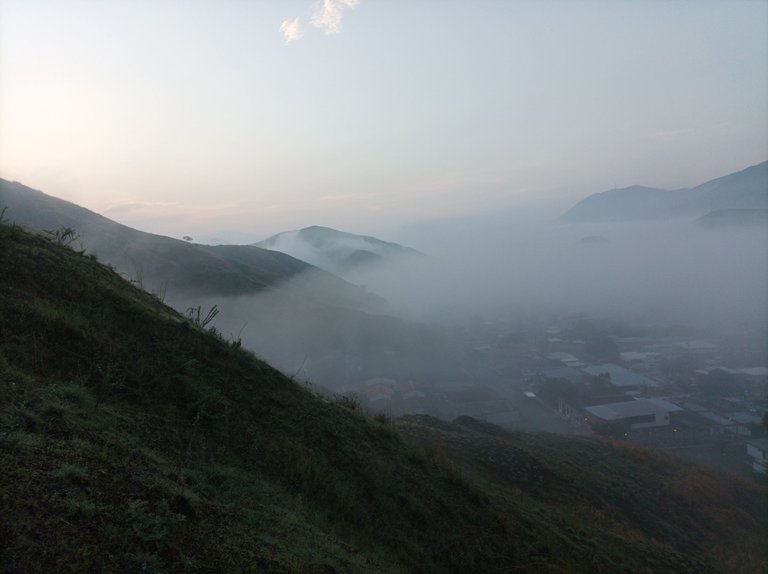
Cabe destacar que salí a las 5:56 am, activando la aplicación Strava para registrar este entrenamiento, el día de hoy amaneció con mucha neblina y un clima bien agradable como si estuviese en Mérida, debido a la lluvia de esta semana, al caminar por el centro las calles estaban cubiertas de neblina y se veía el cerro de Los Chivos totalmente blanco. Al comenzar a caminar un ritmo constante pero no rápido porque todavía no me siento bien del estómago y con las piernas un poco flojas.
It should be noted that I left at 5:56 am, activating the Strava application to record this training, today dawned with a lot of fog and very pleasant weather as if I were in Mérida, due to the rain this week, walking through In the center the streets were covered in fog and the Los Chivos hill could be seen completely white. When I start walking at a constant pace but not fast because my stomach still doesn't feel good and my legs are a little weak.
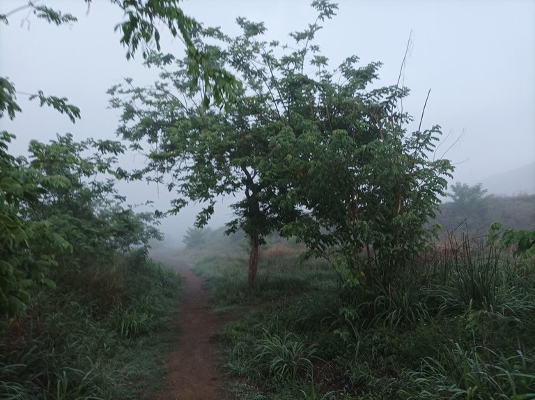
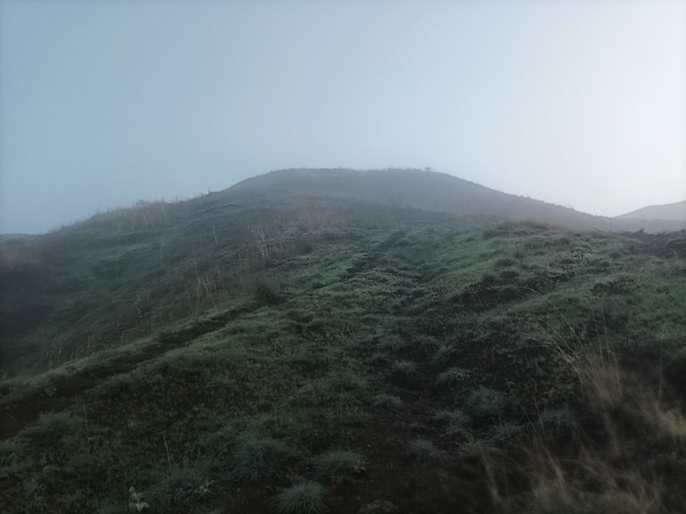
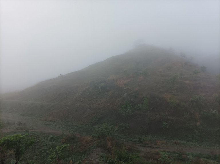
Después de pasar parte del centro de Villa de Cura, llegué a la parte final de la urbanización El Toquito con un tiempo de 20 minutos con 46 segundos, registrado eni cronómetro, la montaña se veía con un poco de neblina, comencé a subir la primera pendiente y traté de mantener el.mismo paso, a medida que iba subiendo me paraba algunos segundos para tomar algunas fotografías para mostrarla a ustedes.
After passing part of the center of Villa de Cura, I reached the final part of the El Toquito urbanization with a time of 20 minutes and 46 seconds, recorded on a stopwatch, the mountain was seen with a little fog, I began to climb the first slope and I tried to maintain the same pace, as I went up I stopped for a few seconds to take some photographs to show you.
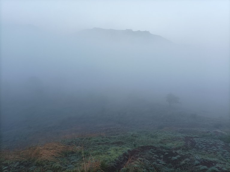
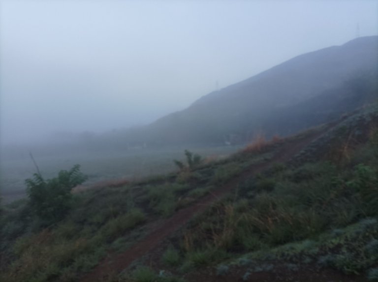
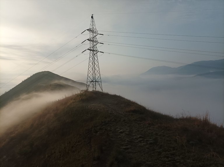
Asimismo, continúe avanzando en este bello paisaje lleno de neblina, en la segunda pendiente ya llevaba un registro de 25 minutos, y luego pude apreciar que el camino estaba un poco húmedo y con algunas escaleras realizadas por un amigo caminante que todo los sábados sube está montaña, en la tercera montaña ya estaba cerca de llegar a la cima con un tiempo de 34 minutos y una distancia de 2.85K.
Likewise, I continued advancing in this beautiful landscape full of fog, on the second slope I already had a record of 25 minutes, and then I could see that the path was a little wet and with some stairs made by a hiking friend who climbs every Saturday. mountain, on the third mountain I was already close to reaching the top with a time of 34 minutes and a distance of 2.85K.
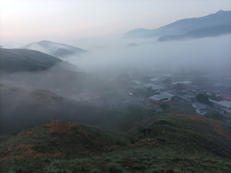
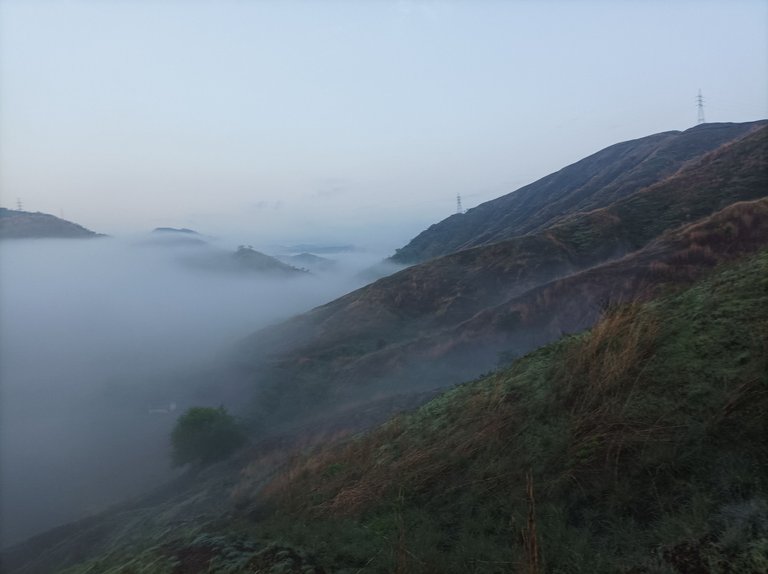
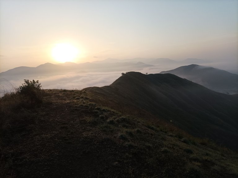
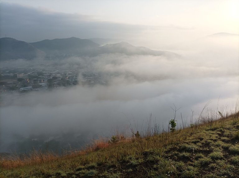
Desde la cima de esta montaña podemos ver toda la comunidad del centro de Villa Cura, cubierta de neblina, y también el sector del Toquito, después llegué al final del lado derecho y luego comencé a bajar por el lado donde está la pista de atletismo que no se veía debido a la neblina, termine de bajar y complete la distancia de 5K en 1 hora con 6 minutos, ahora me faltaba subir la montaña que está frente a la pista.
From the top of this mountain we can see the entire community of the center of Villa Cura, covered in fog, and also the Toquito sector, then I reached the end of the right side and then I began to go down the side where the athletics track is. It couldn't be seen due to the fog, I finished going down and completed the 5K distance in 1 hour and 6 minutes, now I needed to climb the mountain in front of the track
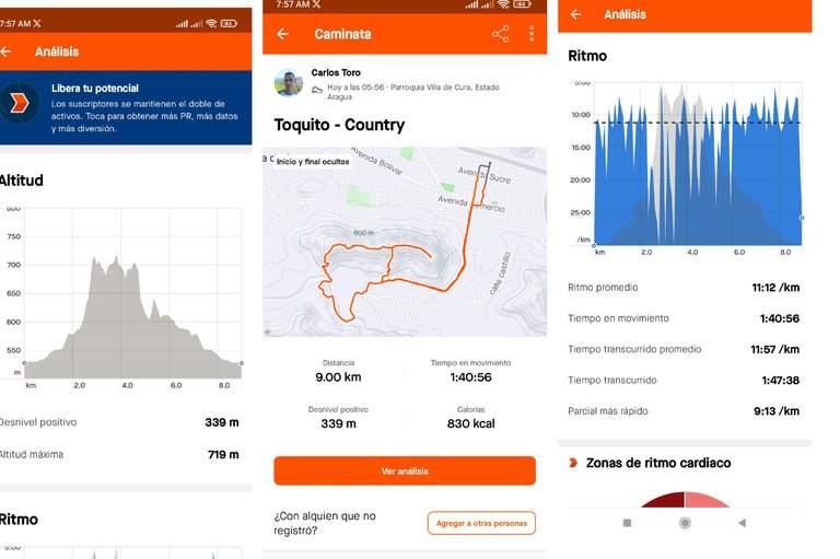
Ahora bien, luego de subir esta montaña, comencé a bajar y di la vuelta por la ruta El Country, para después pasar por la urbanización del Toquito, y luego llegar al centro de la comunidad y terminar mi recorrido con un tiempo 1 hora 47 minutos,con 38 segundos , una distancia de 9K y un desnivel positivo de 339 metros.
Now, after climbing this mountain, I began to go down and turned around along the El Country route, then passed through the Toquito urbanization, and then arrived at the center of the community and finished my route with a time of 1 hour 47 minutes. , with 38 seconds, a distance of 9K and a positive slope of 339 meters.
Espero que les haya gustado este entrenamiento de caminata de montaña, nos vemos en el próximo.
I hope you liked this mountain walking training, see you in the next one.
Fotografías: Teléfono Redmi Note 10
Portada realizada en APP GridArt
Logos utilizados de Hive y de fulldeportes
Traductor utilizado: Traductor de Google
Photos: Redmi Note 10 Phone
Cover made in The APP GridArte
Used logos of Hive and fulldeportes
Translator used: Translator used: Google Translate

Vote la-colmena for witness By @ylich

Mi amigo, felicidades por ese entrenamiento de caminata de montaña en la ruta El Toquito - Country, ese paisaje se ve hermosísimo lleno de neblina, así vale la pena salir a caminar y trotar por esa ruta, que agradable es esa vista, gracias por compartirla, ojalá todos los días amanezca así, para seguir entrenando con gran frescura, saludos 🤗🥰
Hola amiga, muchas gracias, si el clima es bastante agradable.
Qué lugar tan hermoso para hacer caminata y sobre todo esas fotografías bastante espectaculares yo aún no he estado en estas colinas del toquito pero me gustaría hacerlo sobre todo en la mañana y ver este espectáculo natural.
Si el clima estuvo muy agradable, para este entrenamiento, gracias por tu comentario.
From Venezuela, our witness drives decentralization and the adoption of Web3 technology, creating opportunities for the local community and contributing to the global ecosystem. // Desde Venezuela, nuestro testigo impulsa la descentralización y la adopción de la tecnología Web3, generando oportunidades para la comunidad local y contribuyendo al ecosistema global.
Sigue, contacta y se parte del testigo en: // Follow, contact and be part of the witness in:
Saludos, muchas gracias por el apoyo.
Amigo como siempre un gran trabajo con tus contenidos. El paisaje es una de las cosas que más me llaman la atención de senderismo, y en las fotografías que nos muestras en esta publicación se puede apreciar claramente.
Saludos.