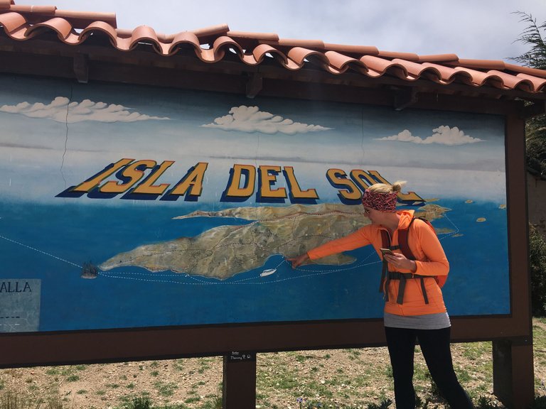
As I told you in my last post, we had just arrived at Isla del Sol. We had planned to stay one full day before we would go back to Copacabana.
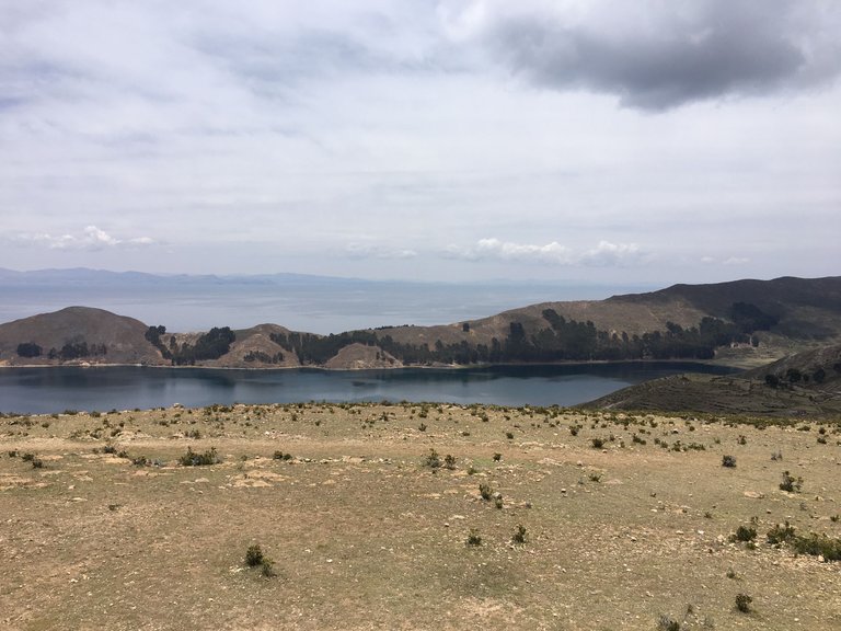
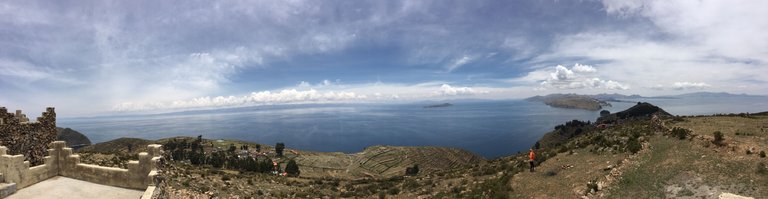
The island is about 14.3 km² big. With a length of 9.6 kilometers and a width of 4.6 kilometers, Isla del Sol is significantly larger than is sometimes assumed. - So we had one full day to discover as much as possible of it.
The highest point on the island (Cerro Checksan) is 4,075 m high (it rises 265 m above the level of Lake Titicaca). So it was not only a lot to explore in one day - but we would also have thin air :D
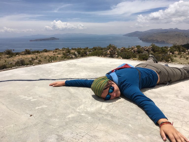
The result of this was, that we had to wake up super early to make the most out of it. Early means at sunrise!
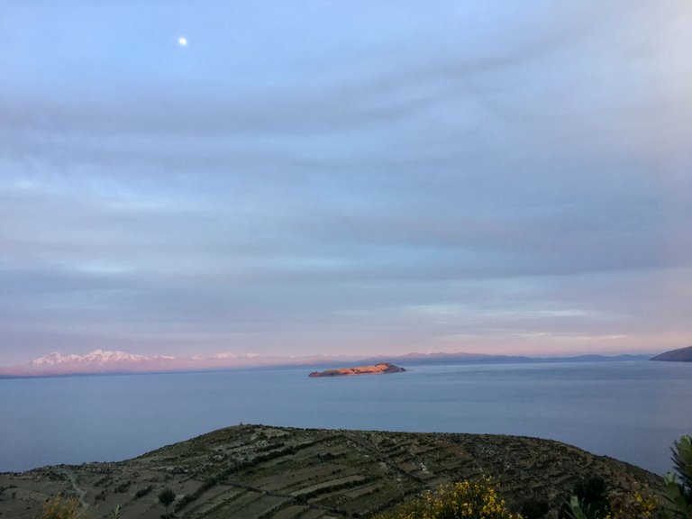
As the island is about 1km away from the land, it does in fact look like you are somewhere in the ocean. After sunrise, we got some breakfast and packed our things to do the hike.
The owner of the hotel told us that the original name of the island was Titicaca, after which Lake Titicaca was later named. The origin of the name is not certain. It is said to be based on two Aymara words: titi means "big cat" and kak means "rock". Translated it means "puma rock". So we would climb on Puma Rock today ;)
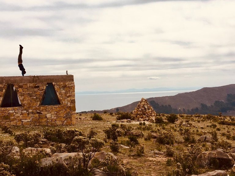
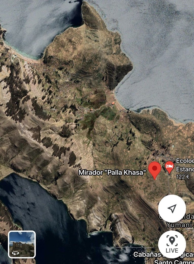
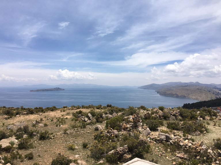
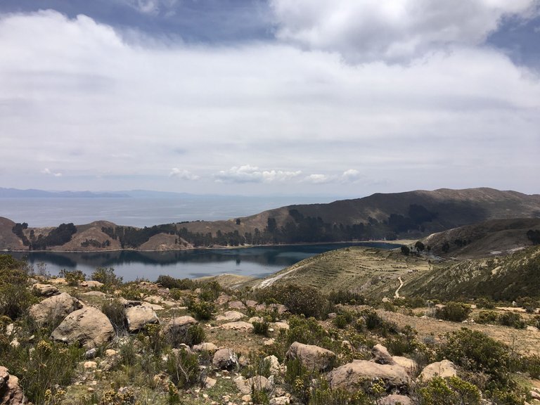
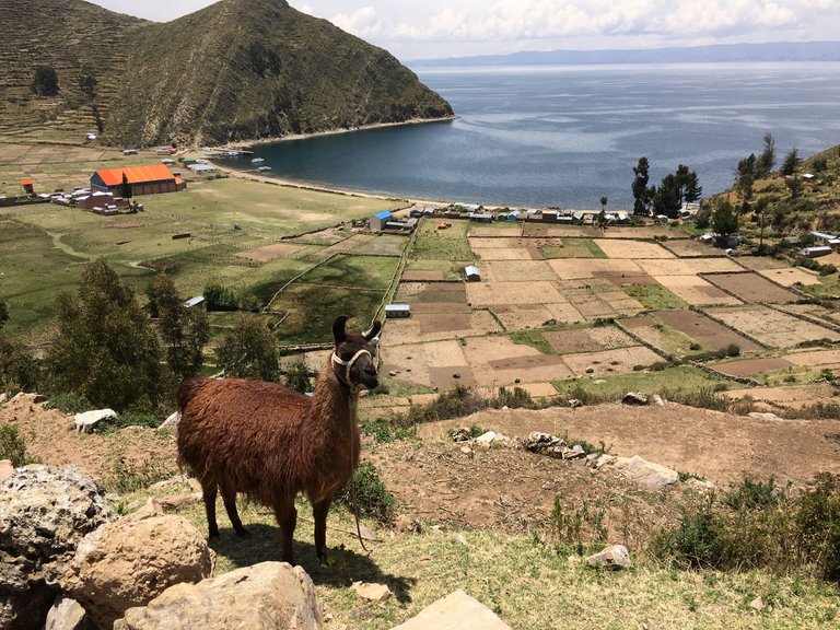
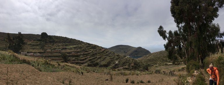
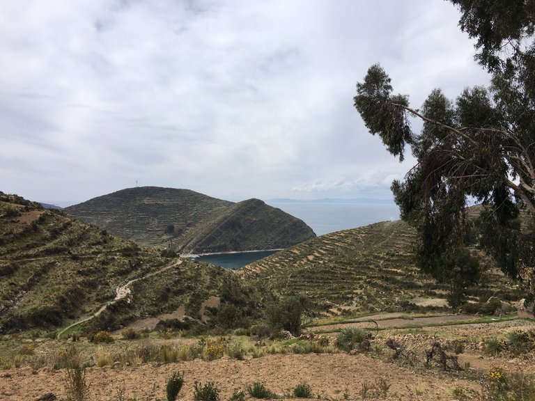
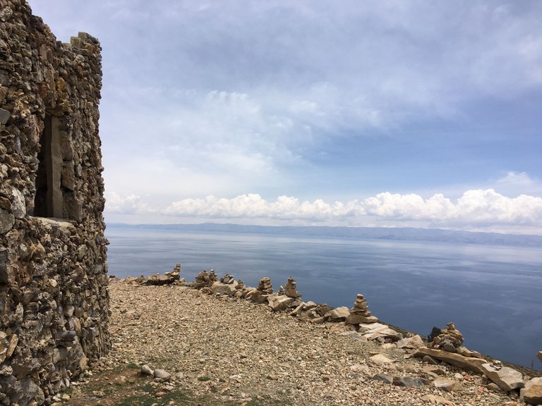
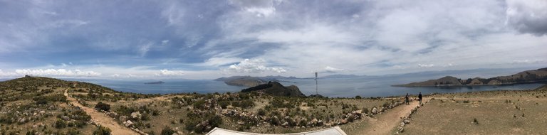
We started to walk to the Mirador Palla Khasa from where we would have the best overview to plan our next step.
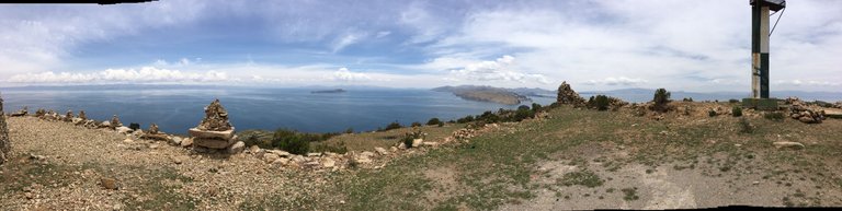
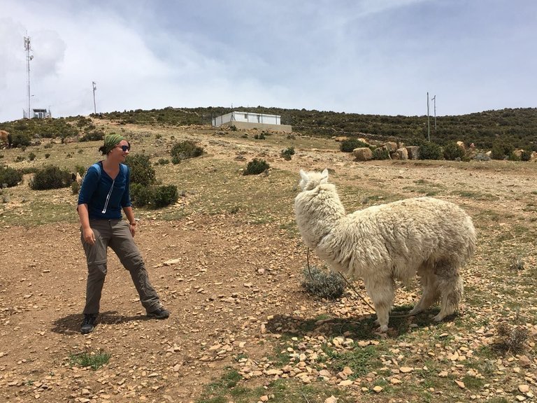
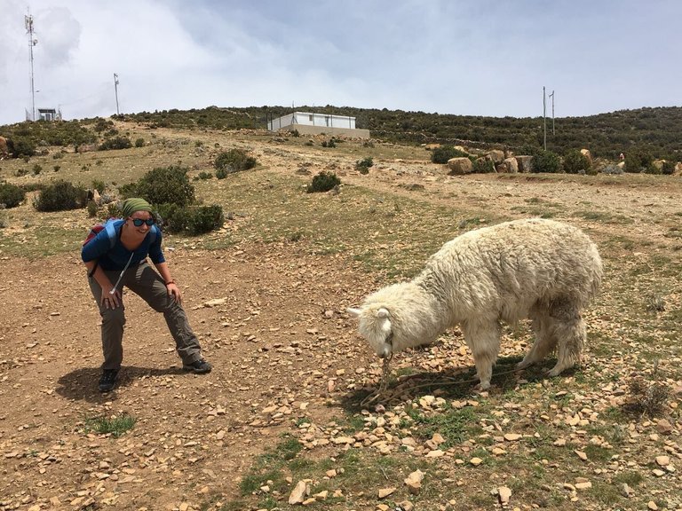
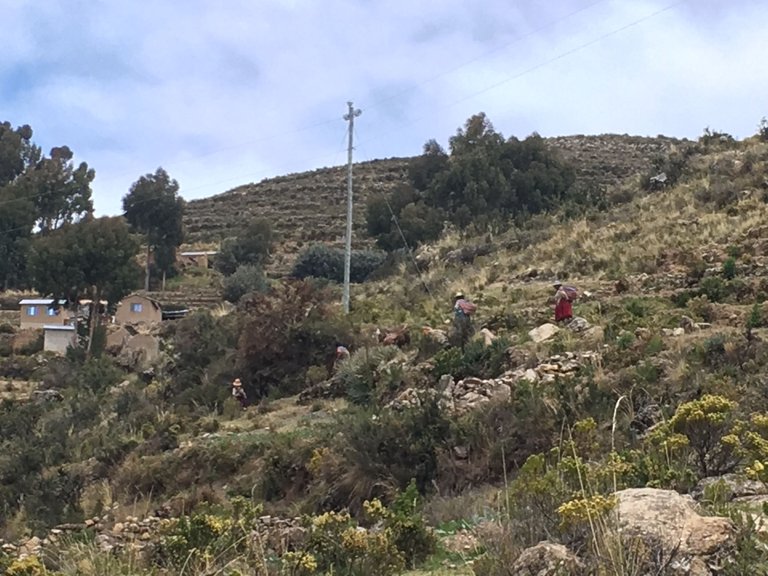
On the way we met a lama, that was huge and quite friendly.
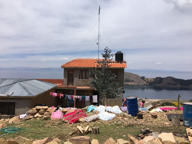
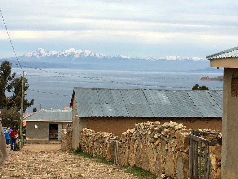
There are 3 villages with the name Yumani, Cha'llapampa, and Cha'lla on the island. They are mainly inhabited by people of indigenous descent who speak Quechua and Aymara. In total there are about 2000 people living on the island.
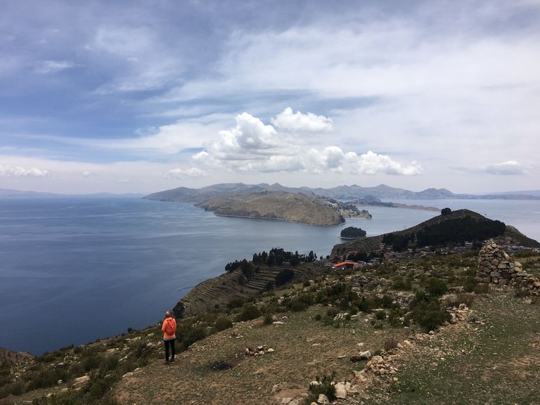
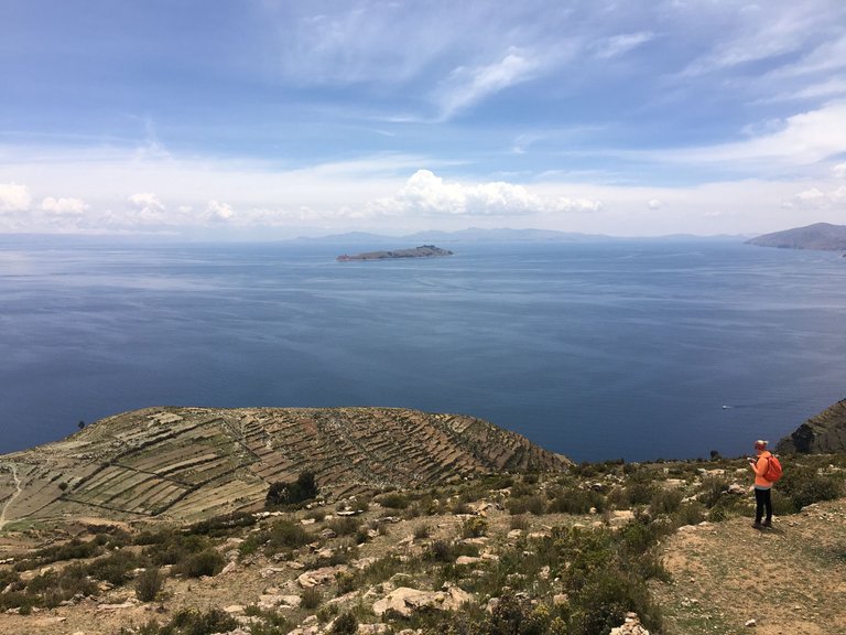
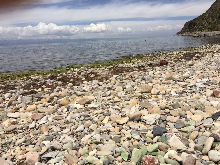
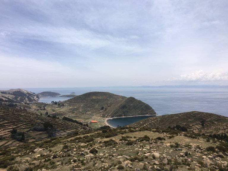
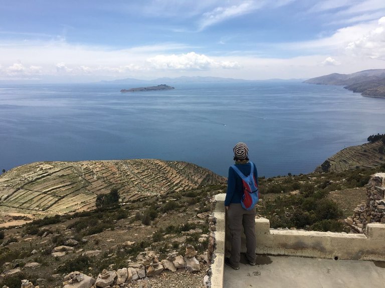
As we heard that the beaches on the island are super nice and Britta really wanted to visit the Roca Sagrada and the Chincana Labyrinth, we decided to walk towards Challapampa all the way down to the first bay.
From there we wanted to cross the land to the second bay and then go to the Labyrinth. It all didn't look too far away so we had a good feeling.
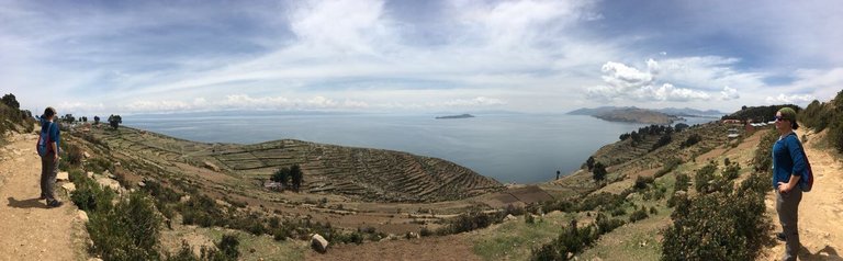
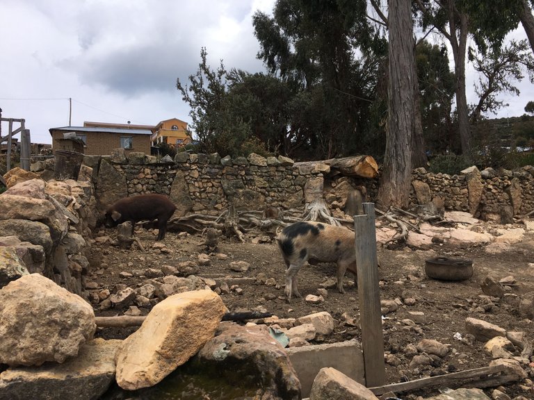
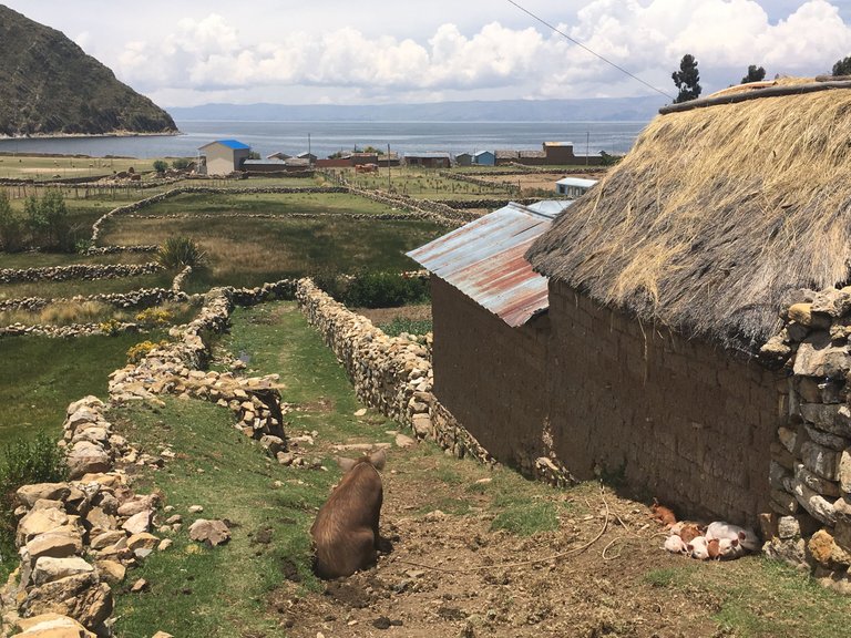
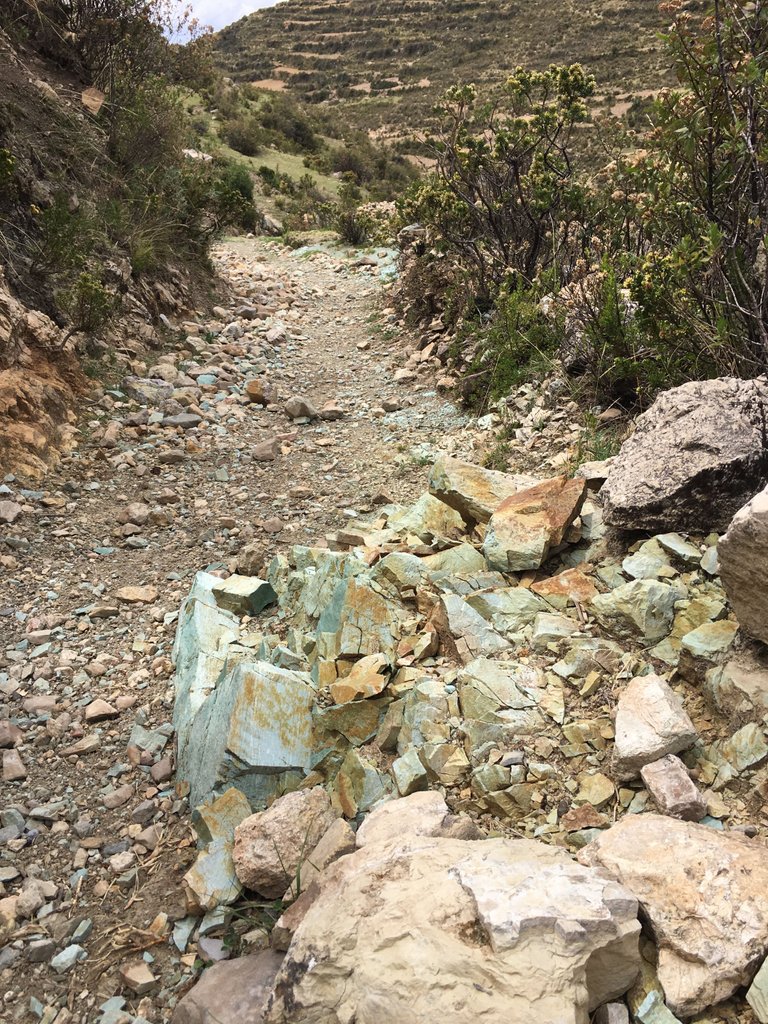
It was pretty steep to go downwards and there were fences, made out of stones everywhere. If the view would be different it could easily have been somewhere in Scotland. Of course, we were passing other houses, animals (donkeys and lamas), and stone walls.
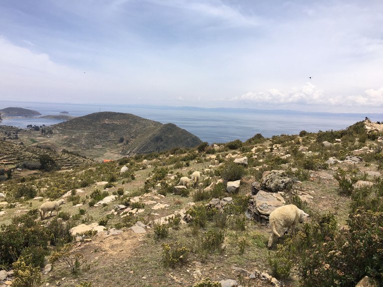
As we couldn't go straight down, it took quite some time to reach the first bay, but after about 1 hour we finally could see it coming closer. For the first time on our walk, we even saw some people and other animals (pigs, sheep etc.).
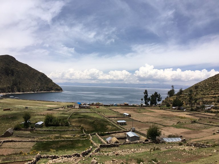
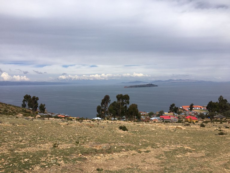
Once we entered the little village we were almost at the bay. Everything was way farther away and then smaller than expected. As we had taken so much time only for descending, we thought, maybe there is someone with a boat that can bring us from one bay to the other, so we can see all the famous places on the island and hopefully don't have to walk all the way back up :D
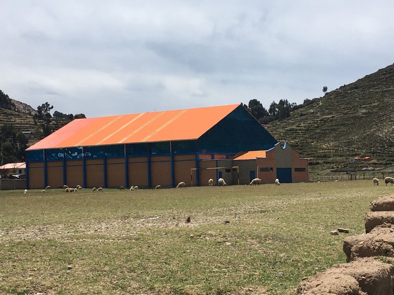
But when we finally arrived at the first bay the place was empty. On one side we could see sheep on a football field :D and on the other some houses.
There were some boats on the beach, but we didn´t know whom they belonged to.
Not far away all of the sudden we saw some village people sharing their food with each other. It seemed like a big picknick. One brought bread for everyone, the other soup and the next one drinks. I wasn´t sure if this was a one time thing or they maybe do it every day. - Would be nice.
We decided to go further to the next bay and ask again over there if they have a boat. We had seen on our map that some hostels where on that side so we were confident about the boat trip.
We went maybe half way when one of the guys at the picknick shoutet at us. He told me in Spanish that we shouldn't go any further because it is very dangerous.
Apparently the central and northern part of the island is closed to tourism due to a conflict between the communities of Ch'alla and Challapampa. The dispute broke out in February 2017 over huts that were built near the ruin complex and, according to the municipality of Ch'allapampa, endanger the ruins.
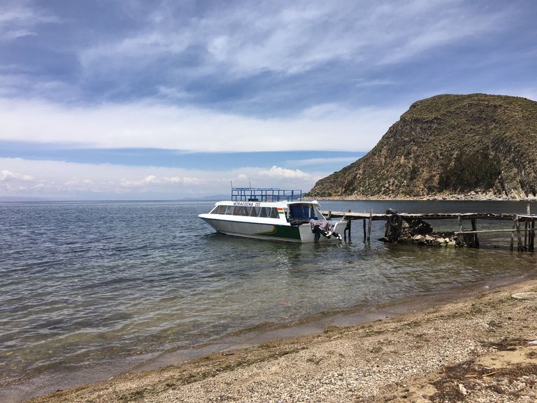
The hostels there got burned and tourists were hurt. As a result of the unresolved conflict, the Ch'alla community prevented tourists from reaching Ch'allapampa by boat or on foot. The boats for tourists land in the port of Yumani.
And right there we had our answers. not only wouldn't we get a boat and/or see the ruins - We also had to walk all the way.
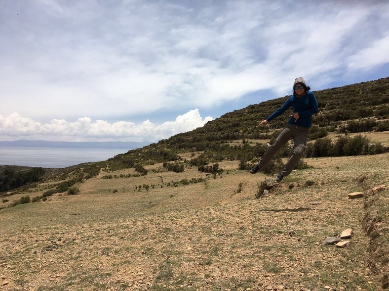
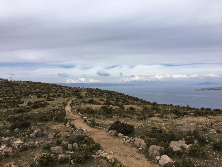
I thanked the guy for saving our lives and we turned around to go back up to the Mirador. As you can imagine it was very tough to get all the way back up at a hight of over 4000m. The air was pretty thin and we couldn't go very far without taking a break. - so we moved super slow on the rocky path.
About 2 or 3 hours later we had made it back to our starting point. We were physically finished - but happy to be back safely.
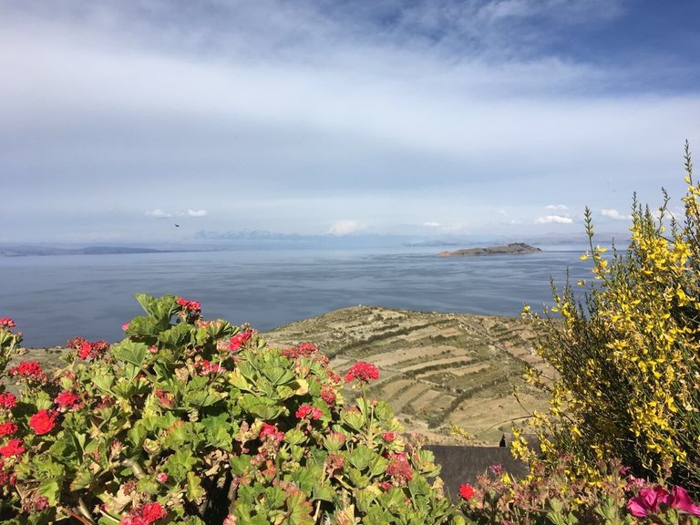
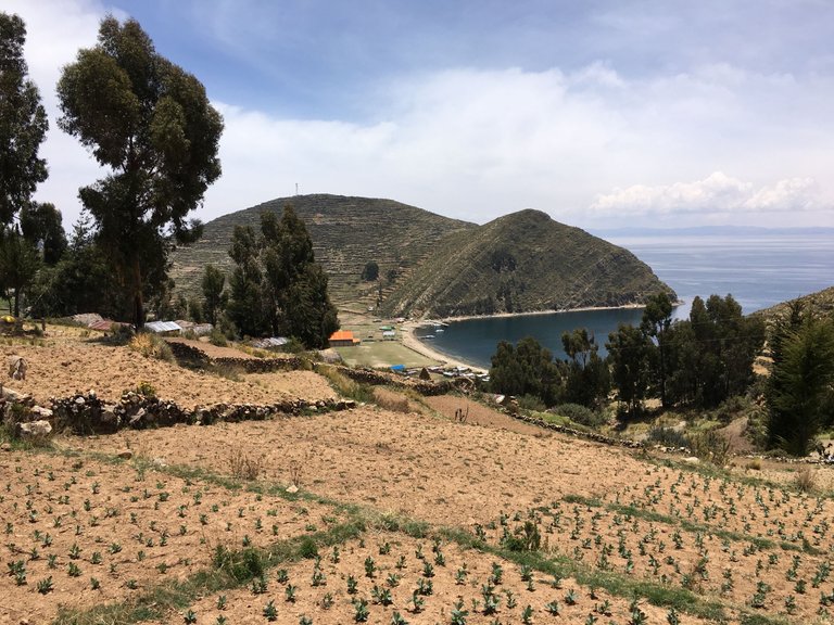
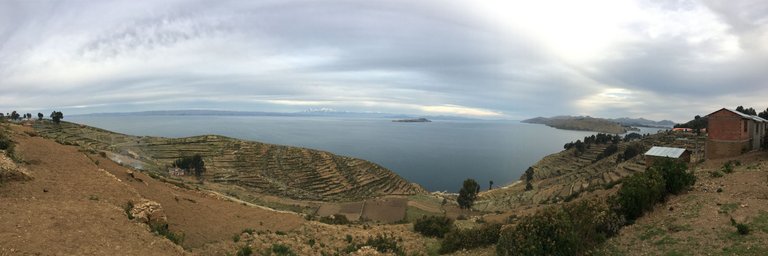
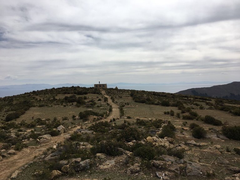
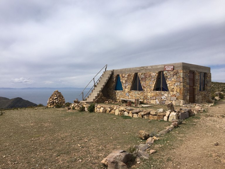
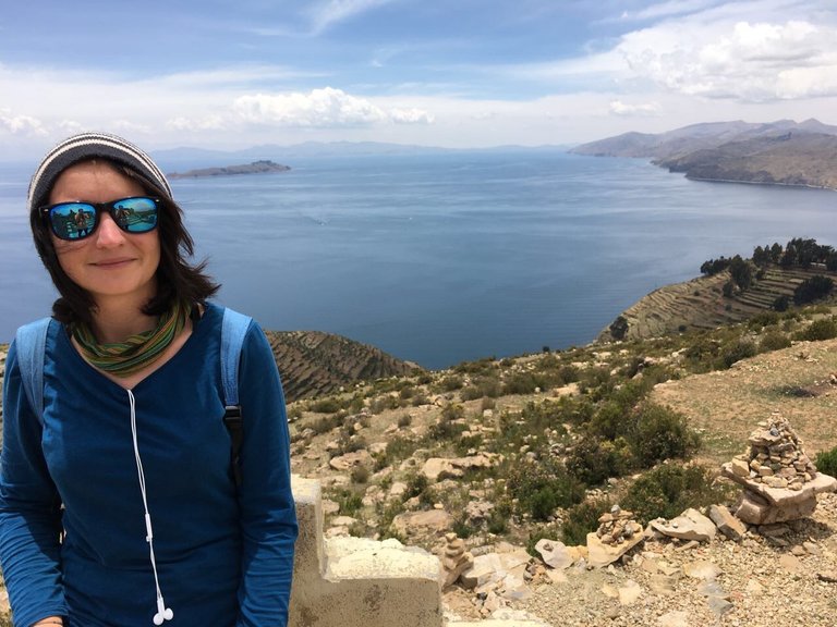
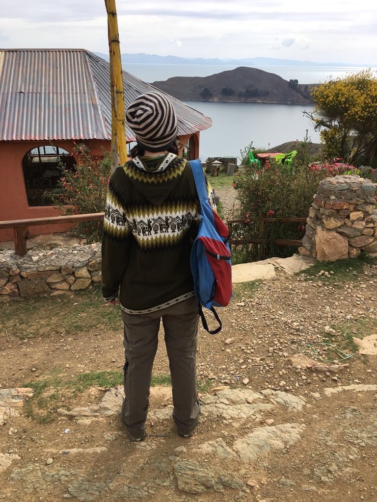
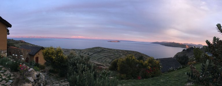
From there we walked a little bit further to a stone house called Pizaria Maya - which obviously wasn't a pizzeria :D but it was a perfect spot to look over the island.
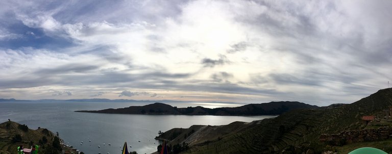
After a long break there to recharge our batteries we decided to head to the other side of the island and enjoy the sunset from the village. We both were very hungry after that long hike and also thirsty. Our lunchboxes were empty since forever.. so we started walking south.
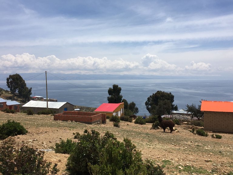
The village was not far away but the sun started to go down. Due to the location in the middle of the lake, a fresh wind often blows on the island, which is also explained by the average annual temperatures of just 9 to 11 degrees. At night, temperatures on Isla del Sol drop below freezing point. So it was time for me to get some warm cloth at the local shop.
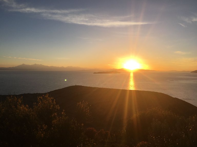
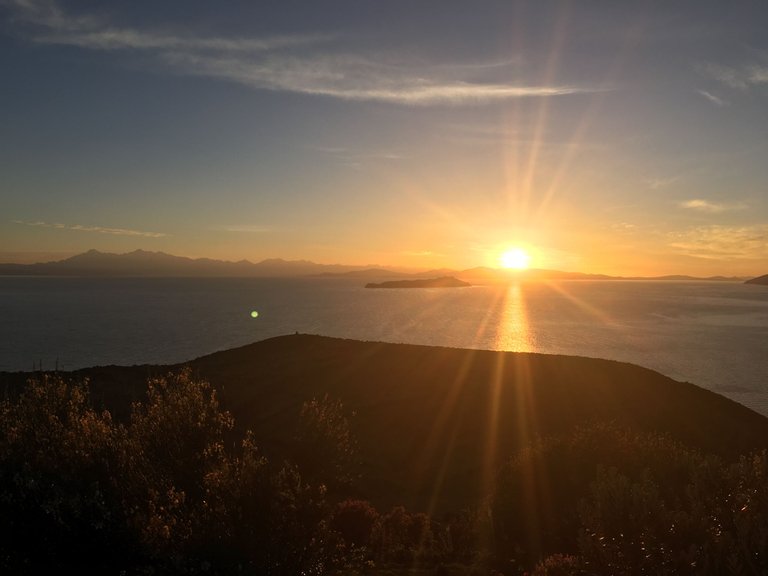
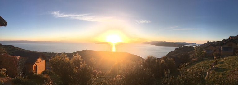
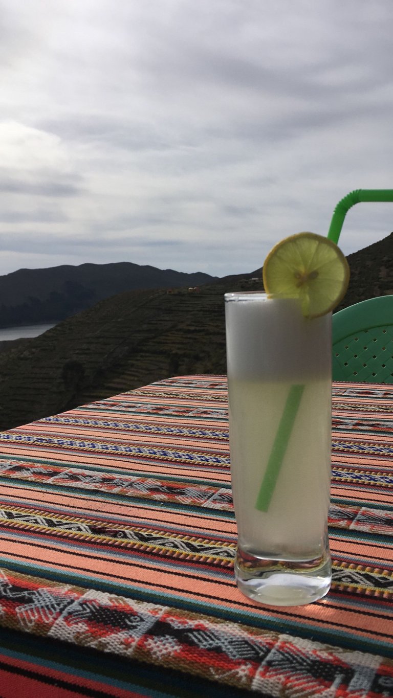
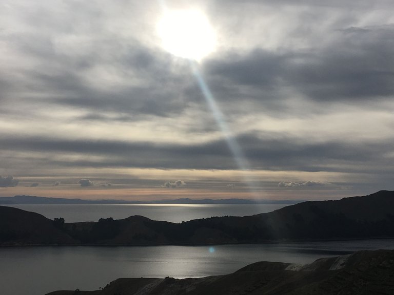
Just in front we had some drinks and then headed back to our hotel to see the sunset.
While we were watching the sunset the hotel owner told us the legend about Isla del Sol:
The sun god Inti plays a major role in the beliefs of the people of the Andes. The sun god was an important figure, especially among the Inca, and it was always said that the first ruler of the Inca was chosen by the sun god himself.
This famous legend begins on Isla del Sol. Because it is there that the first ruler of the Inca was deposed by the sun god Inti in order to improve the world. According to legend, Manco Cápac, who became the first ruler of the Inca, was the son of Inti and was born in the lake.
Together with his wife, he had the great task of finding a suitable place for the establishment of his empire. In order to be up to the task, he carried a golden staff with him, which should sink to the ground in a particularly fertile piece of earth.
Legend has it that this place is today's city of Cusco. But the beginning of the legend about the origin of the Inca was the Isla del Sol in Lake Titicaca. The Isla del Sol is an integral part of the Inca mythology, as the island played a very important role in the Inca beliefs.
The much smaller lunar island, the Isla de la Luna, in Lake Titicaca also plays a major role in the mythology of the Inca. This is a beautiful piece of earth that seems like a paradise and on site the legend suddenly seems not to be that far away. The inhabitants of the island and the people of Puno regularly celebrate the event that led to the great empire of the Inca.
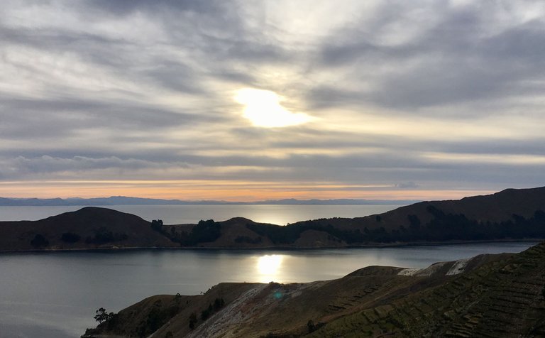
And that's how our last day on Isla del sol ended perfectly watching the sun /sol ;)
To get more of the islands vibe, check out the short video and enjoy:
Stay tuned - next time I tell you all about Copacabana.
Cheers,
Liz
Wow.. this is cool. Ich kriege Fernweh, sofort.
Congratulations, your post has been added to Pinmapple! 🎉🥳🍍
Did you know you have your own profile map?
And every post has their own map too!
Want to have your post on the map too?
That's a perfect rustic lifestyle out there, I actually didn't know that that the country life existed in Bolivia, from the look of the pictures and the sun it's probably going to be very hot. It seemed to be a thrilling experience, so much history with that place. I saw the video of the llama, lol were you expecting the llama to charge at you? 😅😅😅😅.
It is actually never really hot. Only about 15 degrees, but you can still get sunburned quite easily as it is at over 4000m high. Haha I wanted to see how the lama reacts, thought it is fixed with a rope... but then after I saw it wasn't - it was free and I was lucky :D
It was good to see that the llama was soft and gentle, I was thinking it would be agressive. With all that sun, I felt it would be hot. Glad that you both are enjoying a vacation.
How have you been?
That trip was already a few years ago, but yes we enjoyed it ;) I am good, hope you are too.
Beautiful… the photos and area you visited.
Must have been lots of fun. 😊
It really was a lot of fun! But also quite hard to hike that much at that high! I was happy to be back home in the end :D
I can imagine… 😉
So nice to read this and also the pics. In 1996 I hiked the across that island and spent many days exploring that region. Then I did a hike called El Camino D' Oro (not sure if that is the way to spell it). Bolivia is awesome and wish I could go back!
Sounds awesome! Sadly we didn't have that much time, as my friend Britta only had 3,5 weeks in total to discover all of Bolivia :D - so we took more time at other places I will tell more about later.
Dear @lizanomadsoul,
Your support for our previous proposal has been much appreciated but it expired end of December!
Do you mind renewing your vote to our proposal for 2022 so our team can continue its work!
You can do it on Peakd, ecency, or using HiveSigner.
https://peakd.com/me/proposals/199
We wish you a Happy New Year!
what a day exploring the island! It looks like there are lots of farms in the area.
Yes, the people living there had their own farms and grew their own food.
wow, I guess it's common for people living on an island. 😀
Thanks for sharing this. I really liked reading about the local tales about the Incan sun god and the connection to Isla del Sol. Your picture of the sunrise is really nice and your text reminds me how hard if often times is to get up early enough to take these pictures but how rewarding it equally is afterwards to have them in your library 😀
Thanks for stopping by @timoremoti :) Glad you liked it. Yes, I find it really hard to get up for sunrise! but most of the time it is really worth it! Especially on Isla del Sol as the name says - it is a must ;)
Me he quedado sin palabras, es un gran privilegio conocer esos lugares. Aun en la distancia, a través de tus ojos, pudimos llegara hasta allá. La cordillera de los Andes recorre varios países incluido el mío (Venezuela). Algunas de tus fotografías me recuerdan a uno de los estados andinos de aquí, que realmente me fascina y si cierro los ojos y tengo que escoger mi lugar preferido, mi corazón me lleva allí. Quizás en algún momento comparto algunos de sus paisajes. No solo los pasajes sino las leyenda que hay detrás, enriquecen tu publicación. Me encanta @lizanomadsoul 😍.
beautiful pictures, what other Latin countries have you visited?
Thank you for sharing this little piece of paradise with us ❤️ I wish I was there right now 😎
wow beautiful your video greetings and blessings for you
What beautiful pics!! Ohhh, so cute lamas!! 🤩🤩🤩
🥦 !LUV 🥦
@mizuosemla(3/10) gave you LUV. H-E tools | connect | <><
Look how cool, I'm meeting a part of Bolivia I've never seen before. Very cool the island, the local community, the animals. I love the drink, I'm a fan of caipirinha. hahah
Magnífica toma 👏👏