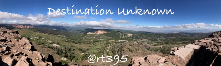
My wife hates it when I don't make plans and instead just get up and go, destination unknown. Usually there will be a general plan like the area we are visiting, where to stay and for how long, but the sightseeing details are often left unplanned. It's pure adventure and I love exploring this way. This past weekend was one of those destination unknowns.
Cedar City, Utah
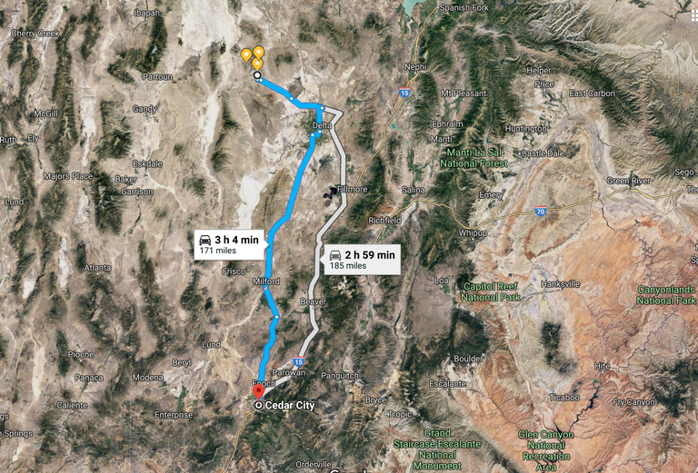
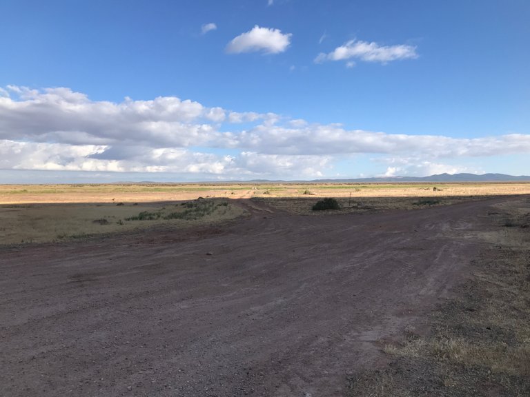
I was heading down a backcountry Utah highway on my way home from Topaz Mountain where I dug up some amazing topaz specimens, of which I'll get to in the last post of this series. My body was sore, I was filthy and I needed a place to stay. Cedar City was at the junction of the highway I was on and the 15 freeway which would take me home. It seemed like a good place to stay the night, especially since it was nearing 10pm. So I pulled over, opened Kayak and booked a room. I was about to find out Cedar City is a perfect crossroads all kinds of adventure in Utah!
Bro?
On the drive down I passed, among other things, a turn off to a petroglyph site that I have wanted to stop by since I first drove down this highway 3 years ago. It's one of those places that even though it's on the way home there's never the time to stop. I thought this time could be different though. I would be staying about 15 minutes away in Cedar City and I could just go back for some site seeing early the next morning.
After getting my hotel room, taking a much needed shower and getting ready to go to sleep I opened up my laptop to search for some rock collecting areas around Cedar City. I quickly found a great site called RockhoundingUtah that lists localities all over Utah. One of the localities happened to be in the mountains right next to Cedar City, Brian Head. Brian Head is actually a famous Skiing town in Utah. It also happens to be crowned with multi-colored agate! The route up to Brian Head was the same road I would take to the petroglyph site so it seemed like the stars were aligning!
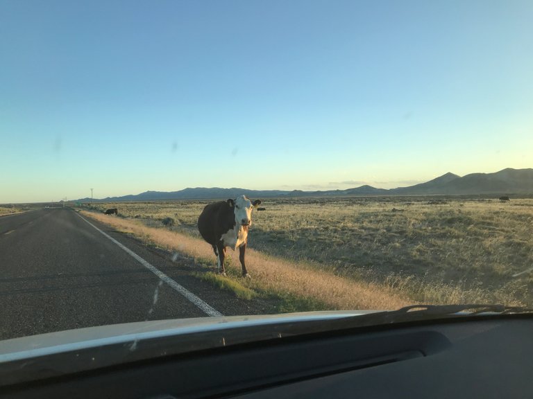
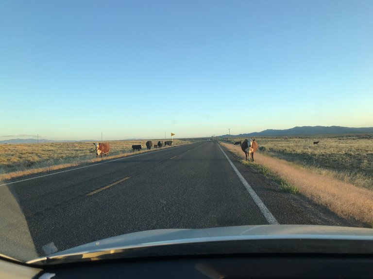
The next morning I woke up at 6:30am and quickly packed up. While checking out I grabbed my continental breakfast, yogurt, a danish and brown water labeled coffee. I jumped in the car, stopped at the gas station next door, picked up some slightly better tasting brown water and finally headed out to the petroglyphs, while blasting some Muzzy, Koven & Feint of course!
Parowan Gap
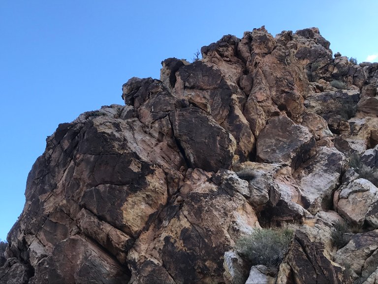
The petroglyph site is known as Parowan Gap about 15 minutes north of Cedar City. It's a large, rock uplift of foothills. Over millions of years a stream carved it's way through the area, exiting the petroglyph location. As the rock continued to rise over the millennia the path of the stream continued to cut the rock and made it look like it had opened a doorway into hidden foothills.
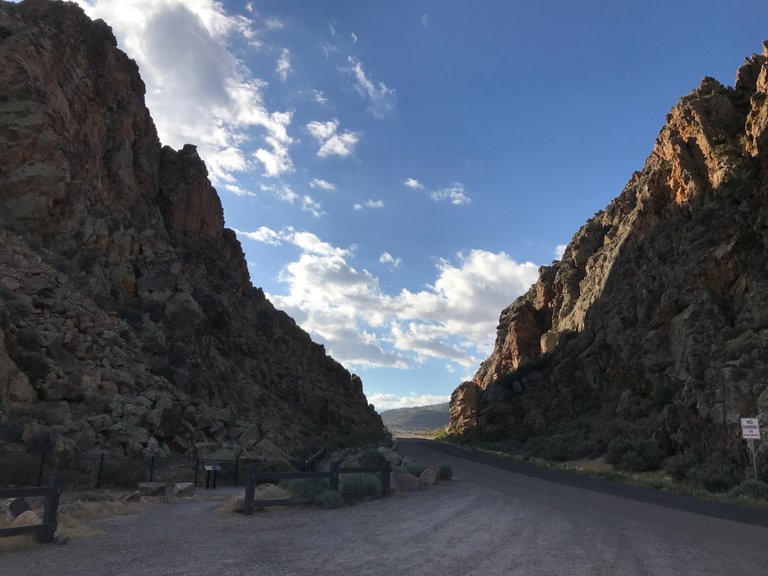
As I drove in from the west side the petroglyphs were at the opening of the canyon. I pulled into the dirt parking area and got out. The cut was a sight itself with high, intimidating walls of broken up rock. On a lot of the larger boulders you could see the incredible works by Native Americans carved into the them. Their exact age is unknown, but they are thought to be ancient.

When I walked up to the first boulders I remember feeling a sense of awe, not only of the petroglyphs, but at my surroundings. No one else was around for miles and I felt the spirits of these ancient people watching over me with pride in their creations. The birds in the area were putting on a performance for me with their songs and I wondered if they were the same songs the creators of these petroglyphs heard as they carved their works into stone.
I read that a Native American Chief told early explorers that the area was "God's Own House." It sure felt as if I had entered the front door and God would be greeting me throughout the rest of the day.
Walking east through the gap it appeared that there were more drawings and that they became more complex towards the end.
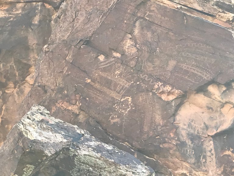
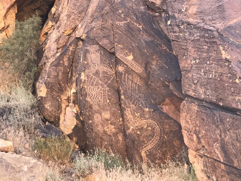

Most of the petroglyphs are on the northern side of the gap. The southern side of the gap did have it's own markings though. They were a bit more modern, with inscribed by a Clergyman in 1882. While this is illegal now I feel that it is an important part of history to the area no less.

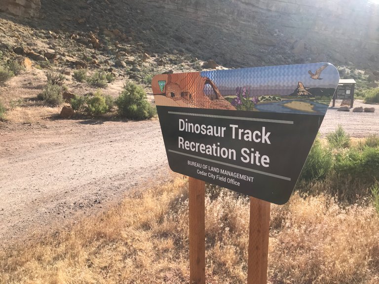
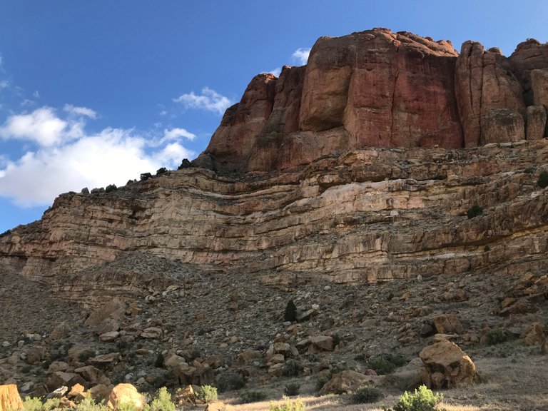
When I finished up exploring the petroglyphs I headed east down the road toward Brianhead. I had only rounded a few corners when I came up another archeological site, Dinosaur Tracks Recreation Site. I slammed on the breaks and turned into the parking area. This was amazing, two ancient archeological sites within a mile of one another and all before 8am! I could tell the day was going to be amazing!
As I walked down the trail to find the footprints preserved in stone I looked up at the towering outcrop from where these tracks came from. The top 100 feet of it was a conglomerate of river rock that had hardened into stone. Somewhere below that was the layer of sandstone rock that held the dinosaur tracks.

It was amazing to contemplate the geological history of the rock. At one time, some of that stone was mud that the dinosaurs walked through. Over millennia it was buried by over 100 feet of rock, then thrust into the air by tectonic forces and eroded by weather. It really makes you think about how brief our existence is compared to the Earth's.
Here is a boulder of the river rock that makes up the top portion of this rock outcrop and then a clearer picture of the rock face. The reddish sandstone is river rock conglomerate.

The first track I came upon was one that was shown on the information panel at the head of the trail. It belonged to a dinosaur called a hadrosaur which lived about 65 million years ago. The panel mentioned someone had vandalized the track, probably trying to steal it. The person had broken off about 1/3 of it and left the remainder. While it's sad there is some asshole out there that did this, it made me realize there are 10's of thousands of good people out there who haven't attempted to damage or steal them. Faith in humanity slightly restored.
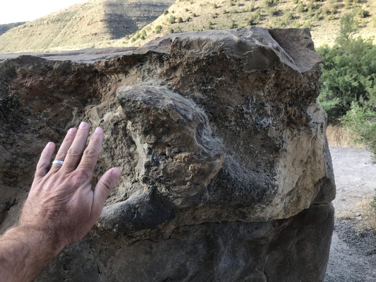

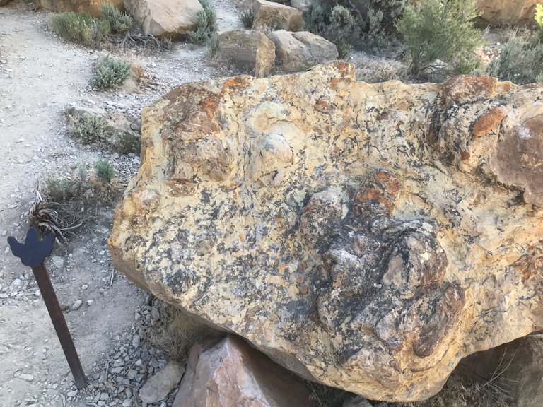
I continued down the trail trying to find more tracks. There were many boulders to look at, but I only found 3 that were marked with the BLM markers. The last set of them was amazing though. They were bigger than the first, damaged track you come across on the trail. This boulder actually contained two tracks, one on top of the other. They dwarfed the footprint of an elephant and the mind reels at how big these animals must have been. you can see them in the bottom, right corner of the photo below.
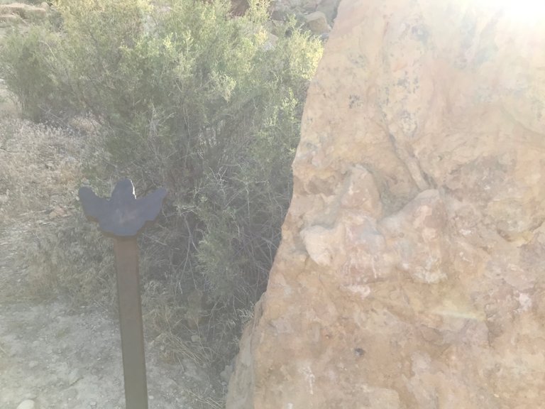
My imagination might have been working overtime, but I think I spotted the face of a dinosaur in one of the rocks nearby. Do you see it?

After taking some more photos it was time to move onto my next destination, Brian Head peak, 11,307' high. I was about to find out that the day would hold more amazing surprises for me!
Come back tomorrow for the continuation of this story, Destination Unknown P2 - Brianhead Peak Agates & The Orange Cliffs Of Cedar Breaks.
Thanks for reading! Here are some pictures that didn't make it above. Enjoy!


- Follow me for stories on Japan, Gems & Minerals, Crypto, DnB, Cali & living life!
- Follow my wonderful wife for her adventures! @tokyowomanslife
I am part of the @Steemit-jp Japan & @SoCalSteemit communities. Please consider supporting them with delegations and upvotes for unique & interesting content!


[//]:# (!steemitworldmap 37.908500 lat -112.981942 long Destination Unknown P1 - Petroglyphs And Dinosaur Tracks In Utah d3scr)
Congratulations, Your Post Has Been Added To The Steemit Worldmap!
Author link: http://steemitworldmap.com?author=rt395
Post link: http://steemitworldmap.com?post=destination-unknown-p1-petroglyphs-and-dinosaur-tracks-in-utah
Want to have your post on the map too?
Really, an incredible adventure.
Thank you @jubagarang. Tomorrow's post will be just as spectacular.
You received a 60.0% upvote since you are a member of geopolis and wrote in the category of "history".
To read more about us and what we do, click here.
https://steemit.com/geopolis/@geopolis/geopolis-the-community-for-global-sciences-update-4
Should have got ahold of me, that is close to my area. I could show you around or if you went up to the Wah Wah's my friend could show you where the Red Beryl is. I know Iron and Washington county really well though
Hey Puff, how can I get a hold of you? I am going to be coming back up around June. There is a mining spot outside of Cedar City I have to hit. Also, would be great if you could introduce me to your friends. Our Gem and Mineral business in Japan is growing fast and I need more material, especially from Utah. Thanks.
Woot, I will see you in June then. Is steemchat still around? I can send you my number on there, or find me on discord and add me.. and I will get ahold of my friend and see how the mountains have been and let him know. Good to hear from you rt
Ya, and I just saw I follow you on Twitter so I know I can get a hold of you.
I was thinking about contacting you, but I thought I would need more time to hang out. Next time I head up I will definitely reach out to you and allow some time. I plan on going up to Topaz Mountain again before it get's too cold.
Your area is incredibly beautiful man. So many natural sites to see and places to collect minerals. I was totally blown away by the Brian Head area. Coming down the mountain from Cedar Breaks I could clearly see Zion. Fuckin spectacular.
I know where the mine is, but it's owned by someone so no chance to dig there. I wonder if there are any nearby, secret spots though??
How happy you are! be able to look at these beautiful scenery.
Wait until you see today's post!
Badass dude! So much cool stuff out there. I'm looking forward to hearing about the Agates. When I was up in Wrightwood I met another rockhound who was looking for actonolite, but he wasn't sure where to look. I gave him a few tips and he pulled out a nice agate and gave it to me for my help!
lol, that's a serious rockhound. Even I don't carry around other rocks with me when I go digging. That's cool though. I always like to give away rocks to people I meet to encourage them to hunt. Kinda like promoting Steemit and bitcoin.
Which reminds me, I have been playing with my new topaz so much I forgot about the blue agates in my bucket. Need to go clean those for today's post.
Hiya, just swinging by to let you know that this post made the Honorable mentions list in the Travel Digest #239.
Please drop by to check out all the rest of today's great posts and consider upvoting the Travel Digest if you like what we're doing.
This post was chosen to be featured in this weeks SoCal Spotlight!! Thank you so much for being part of the #socalsteemit community.
Nice tour. I really recommend the painted rock site near Gila bend Oregon. A lot of similar drawings and quite a few White settler marks from the 19th century.
Thanks for the FYI. If I am ever rockhounding up in Oregon I'll keep it in mind.
Why did I write Oregon??? I meant Arizonastan...
lol dude I was going to mention a Gila Bend in AZ. I worked out near there in Casa Grande when I was young, but I didn't have any interest in history at that time. Spent lots of time in the Indian Casinos though!
Wow! I went to college in Salt Lake and I'm super bummed I never saw these!
There's still time! They aren't going anywhere.