
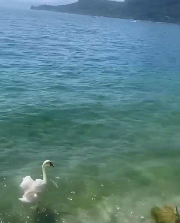
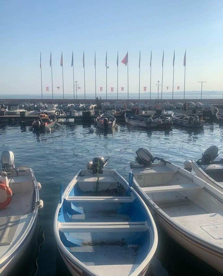
Nel lago c'è una descrizione che lo rende isolato dal cielo e dalla paura della montagna. Nel villaggio e nei suoi difetti vediamo un senso di bellezza e spesso abbiamo una costante riduzione della tensione, il mix di colori e il tempo passano in secondo piano. Qui vi offriamo alcune opportunità per "uscire dal quadro", o almeno per vederlo nel suo insieme. Idee per passeggiate, escursioni, escursioni e grandi spazi aperti. Il sentiero si ferma dove i tuoi occhi saranno pieni di panorami. I programmi sono sei, potrebbero essercene molti di più, ma in piscina si può sempre andare, e questo è il vantaggio da non ignorare per non fermarsi lì. 1. LAGO D'ORTA, DAL SACRO MONTE ALL'ISOLA DI SAN GIULIO.
In the lake there is a description that makes it isolated from the sky and the fear of the mountain. In the village and its flaws we see a sense of beauty, and often we have a constant reduction of tension, the mix of colors and weather take a back seat. Here we offer some opportunities to "get out of the picture," or at least to see it as a whole. Ideas for walking, hiking, hiking and the great outdoors. The trail stops where your eyes will be filled with views. There are six programs, there could be many more, but in the pool you can always go, and this is the advantage not to ignore not to stop there. 1. LAKE ORTA, FROM SACRO MONTE TO THE ISLAND OF SAN GIULIO.
Puoi iniziare il viaggio da Orta San Giulio a Novara, da Piazza Motta. Segui le indicazioni per la Chiesa dell'Assunta, quindi prosegui fino all'ingresso del Sacro Monte, un grande omaggio alla vita e all'opera di San Francesco. Il suo inizio risale al 1590. Nella vista mozzafiato sull'acqua, lungo il percorso, troverai chiese che commemorano la vita di Francesco d'Assisi.
You can start the journey from Orta San Giulio in Novara, from Piazza Motta. Follow the signs to the Church of the Assumption, then continue to the entrance of Sacro Monte, a great tribute to the life and work of St. Francis. Its beginning dates back to 1590. In the breathtaking water views along the way, you'll find churches commemorating the life of Francis of Assisi.
Una volta raggiunta la cima della montagna, i tuoi occhi possono allungarsi sull'acqua. Per il ritorno si scende dall'altro versante, compiendo un bel giro sul sentiero che costeggia il lago. Tornati a Orta San Giulio, potete prendere un battello per l'isola di San Giulio, per vedere il lago al tramonto da un'altra angolazione. - Orta San Giulio è una cittadina turistica con bandiera arancione: scopri di più nella scheda dedicata!
- Scopri il Piemonte su una carta stradale e turistica in scala 1:200.000, acquista a prezzo basso nel nostro negozio online e nel centro turistico! LAGO DI GARDA, SALTO DAL MONTE BALDO
Once you reach the top of the mountain, your eyes can stretch to the water. For the return trip, go down the other side, making a nice loop on the path that runs along the lake. Back in Orta San Giulio, you can take a boat to the island of San Giulio to see the lake at sunset from another angle. - Orta San Giulio is an Orange Flag tourist town: find out more in the dedicated tab!
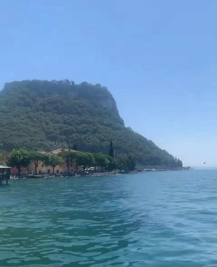
- Discover Piedmont on a 1:200,000 scale road and tourist map, buy at a low price in our online store and tourist center! LAKE GARDA, JUMP FROM MONTE BALDO
È la collina più bella del Veronese, una terrazza panoramica sul Lago di Garda, da cui partire per facili passeggiate o gite ad alto contrasto impegnative. Creste, piscine e camere affacciate sul sentiero del Monte Baldo. Sulla collina che scende in riva al lago si gode di una vista panoramica mozzafiato, e tra sentieri e mulattiere si può anche ammirare la natura che qui mostra una vera e propria mancanza di vegetazione.
It is the most beautiful hill in the Veronese region, a panoramic terrace overlooking Lake Garda, from which to set off on easy walks or challenging high-contrast hikes. Ridges, pools and rooms overlook the Monte Baldo trail. There are breathtaking panoramic views on the hillside down to the lake, and among the paths and mule tracks you can also admire the nature that shows a real lack of vegetation here.
Il modo più semplice e veloce per visitare il Baldo è prendere il bus panoramico che da Malcesine sale a Bocca Tratto Spino. Una volta in vetta, a quasi 1800 metri sul livello del mare, potrete scegliere tra una rete di tour e percorsi. Ce ne sono di facili e brevi (poco più di un'ora) che conducono tra alpeggi, rifugi e rifugi. C'è anche un sentiero lungo ed impegnativo, con dislivelli e dislivelli e un tratto ripido ed esposto, che dalla sommità della collina conduce attraverso prati e alberi fino a San Michele e anche alla stessa Malcesine.
The quickest and easiest way to visit Baldo is to take the panoramic bus from Malcesine up to Bocca Tratto Spino. Once at the summit, almost 1800 meters above sea level, you can choose from a network of tours and routes. There are easy, short ones (just over an hour) that lead between alpine pastures, refuges and shelters. There is also a long and challenging trail, with elevation changes and a steep and exposed section, leading from the top of the hill through meadows and trees to San Michele and even to Malcesine itself.
- Malcesine è una cittadina dalle potenzialità turistiche con il Padiglione Arancione: scopri di più nella scheda dedicata!
- Scopri la nuova Guida Verde Lago di Garda e Veneto, acquistarla scontata nel nostro store online e nel centro turistico! La vecchia strada del Ponale tra Riva del Garda e la valle di Ledro, scavata nella roccia a metà dell'Ottocento e abbandonata dopo la costruzione del lungo tunnel tra Riva del Garda e Molina di Ledro sotto la strada che passa 240 paesi, è Oggi. Il percorso pedonale circolare che collega il lago al lago, ha una vista spettacolare. Partiamo da Riva del Garda e, superato il porto del Ponale, iniziamo subito a salire sulla strada che si aggrappa al fianco della montagna, passando sotto piccoli tunnel, guardando bene e Garda sulla sinistra.
- Malcesine is a town with tourism potential with the Orange Pavilion: find out more in the dedicated tab!
- Discover the new Green Guide Lake Garda and Veneto, buy it discounted in our online store and in the tourist center! The old Ponale road between Riva del Garda and Ledro Valley, carved into the rock in the mid-19th century and abandoned after the construction of the long tunnel between Riva del Garda and Molina di Ledro under the road that passes 240 villages, is Today. The circular footpath from lake to lake has spectacular views. We start from Riva del Garda and, past the Ponale port, immediately begin to climb the road that clings to the mountainside, passing under small tunnels, looking well and Garda on the left.
Dopo 2 chilometri, poco più in alto, dove la strada prosegue per il monte Pregasina, giriamo a destra nella valle del torrente Ponale e seguiamo il sentiero (che separa questa zona da quella percorribile in mountain bike) prosegue. nel bosco della valle di Ledro. Attraverso un breve tratto di asfalto si supera l'abitato di Biacesa, poi si entra nel mezzo del Pré di Ledro e si è già sulla salita che porta a Molina e al Lago di Ledro. L'intero percorso è lungo quasi 10 chilometri e richiede circa 3 ore di cammino (con un dislivello di 660 metri). Nulla vieta di limitarsi al primo tratto affacciato sul Garda, per poi tornare sui propri passi, oppure proseguire fino a Pregasina e alla terrazza panoramica affacciata sul lago.- Ledro è una cittadina dal potenziale turistico con il Padiglione Arancione: scopri di più nella scheda dedicata!
- Scopri il Lago di Ledro nella Guida Verde del Trentino Alto Adige, acquistalo a prezzi bassi nel nostro negozio online e nel centro turistico!
After 2 kilometers, a little further up, where the road continues to Mount Pregasina, we turn right into the valley of the Ponale stream and follow the path (which separates this area from the one that can be traveled by mountain bike) continues. into the woods of the Ledro valley. Through a short stretch of asphalt, we pass the village of Biacesa, then enter the middle of Pré di Ledro and are already on the climb to Molina and Lake Ledro. The entire route is almost 10 kilometers long and requires about 3 hours of walking (with an elevation gain of 660 meters). Nothing prohibits you from limiting yourself to the first section overlooking Lake Garda, then retracing your steps, or continuing to Pregasina and the panoramic terrace overlooking the lake.- Ledro is a town with tourism potential with the Orange Pavilion: find out more in the dedicated tab!
- Discover Ledro Lake in the Green Guide of Trentino Alto Adige, buy it at low prices in our online store and tourist center!
Hello.
Welcome to Hive.
To confirm your authorship of the content, could you please add the link to your Hive blog to your well-established social media account like Facebook, Instagram, or Twitter (which has not been recently created).
After you add the link, please respond to this comment with the URL link to that website.
You can remove this mention, once we confirm the authorship.
Thank you.
Mas Info: Introducing Identity/Content Verification Reporting & Lookup
Hello.
Welcome to Hive.
To confirm your authorship of the content, could you please add the link to your Hive blog in your Instagram profile:
https://www.instagram.com/chanelgal26/?hl=en
You can remove this mention, once we confirm the authorship.
Thank you.
More Info: Introducing Identity/Content Verification Reporting & Lookup