About 12 miles northeast of the historic old western town of Tombstone lies a popular desert camping destination at the base of the Dragoon Mountains. Although quite popular, at least in the winter, the national forest road stretches for miles with dozens and dozens of potential campsite options, so for those willing to drive far enough, it’s almost guaranteed one will find a place to spend the night, weekend or even a week or two in this unique area, even when it’s pretty full.
I was a little surprised when I arrived in the mid-afternoon to find absolutely every single campsite along the first two-mile stretch of forest land I was familiar with inhabited - it was like sprawling camping city! Campers, vans, tents, horses, dogs, people everywhere, for a moment I was worried I wouldn’t find a place here to spend the night, but I continued up the road past the dry creek to terrain I was unfamiliar with. About another mile up the road and I felt really blessed to find a neat little spot tucked away in a large grove of mesquite trees at the end of a dead-end side road, a good half mile off of the main traveled way, so really secluded and private for this area!

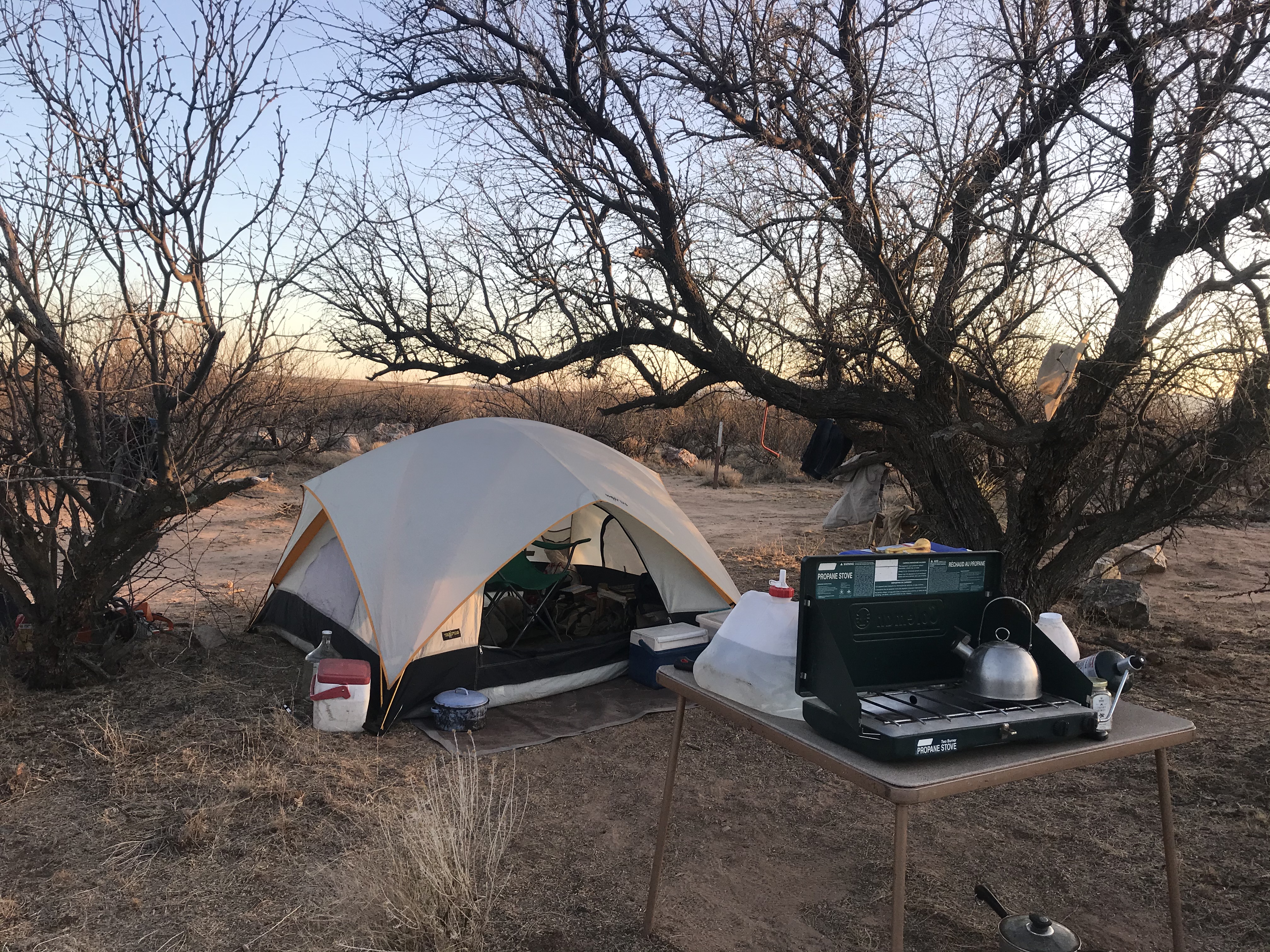
It’s always nice to have plenty of time to get the campsite set up before the sun goes down, which, after doing this for over 18 months, is a less common occurrence for me that one might imagine. But I had plenty of time to move at a relaxed pace, soaking in the unique desert beauty, building a fire ring, collecting firewood and taking Dakota for a quick evening bike ride before dark, with a big mesquite tree to camp under at least offering some decent afternoon shade to relax in, a nice respite from the desert heat.
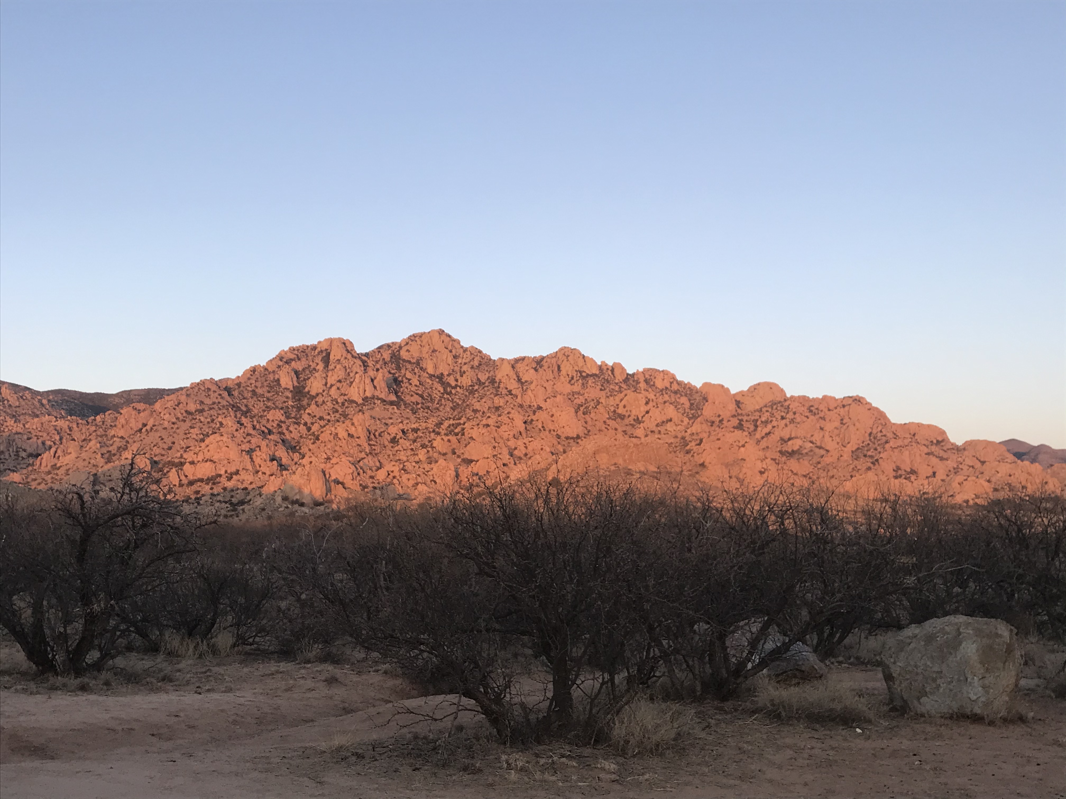
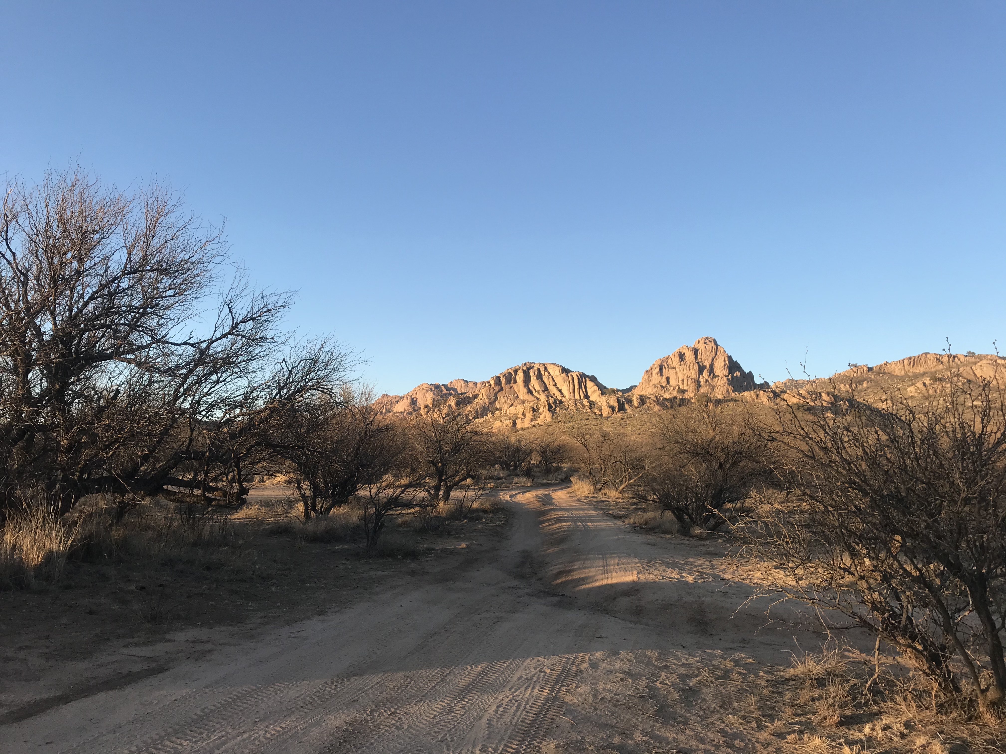
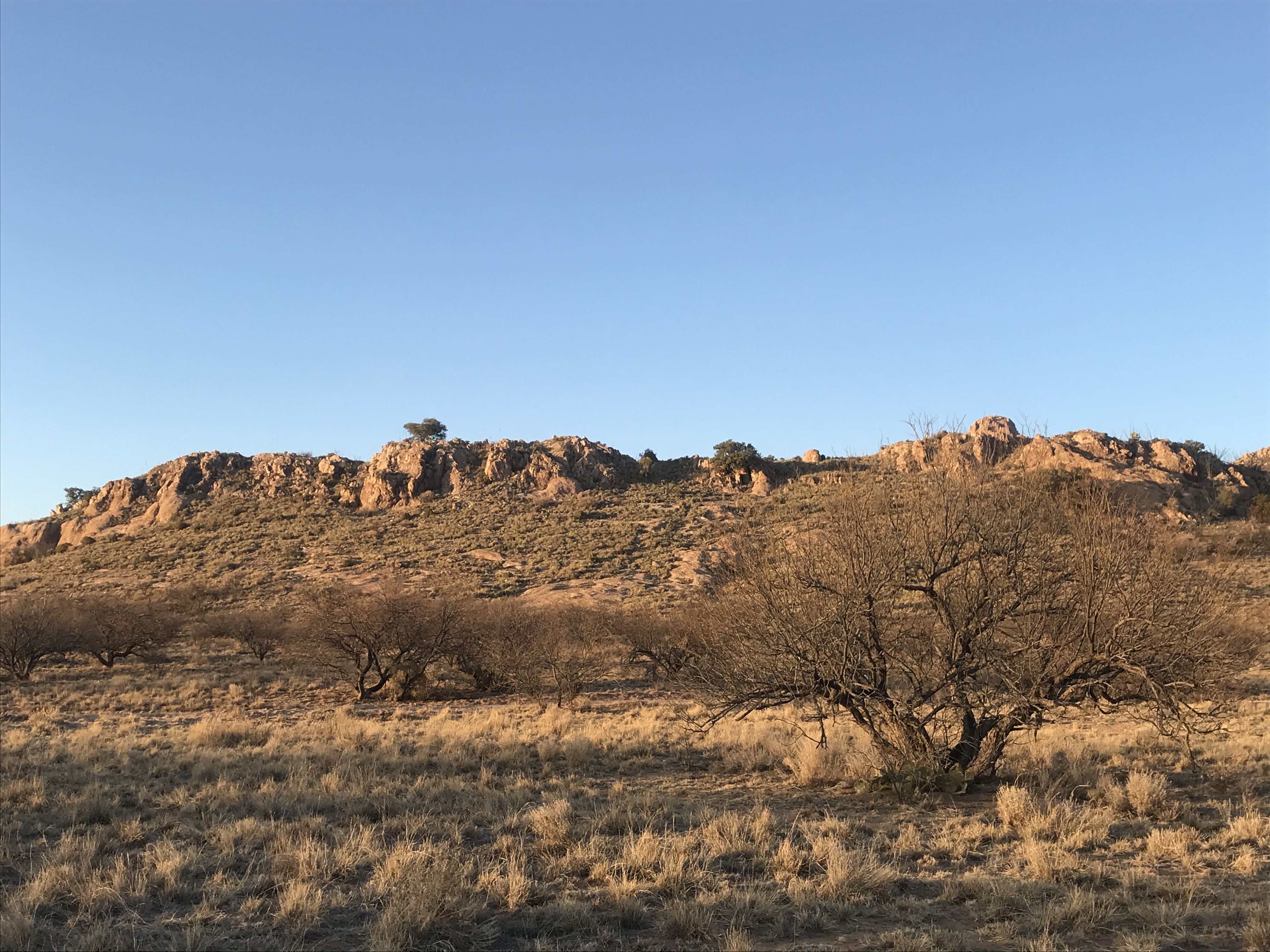
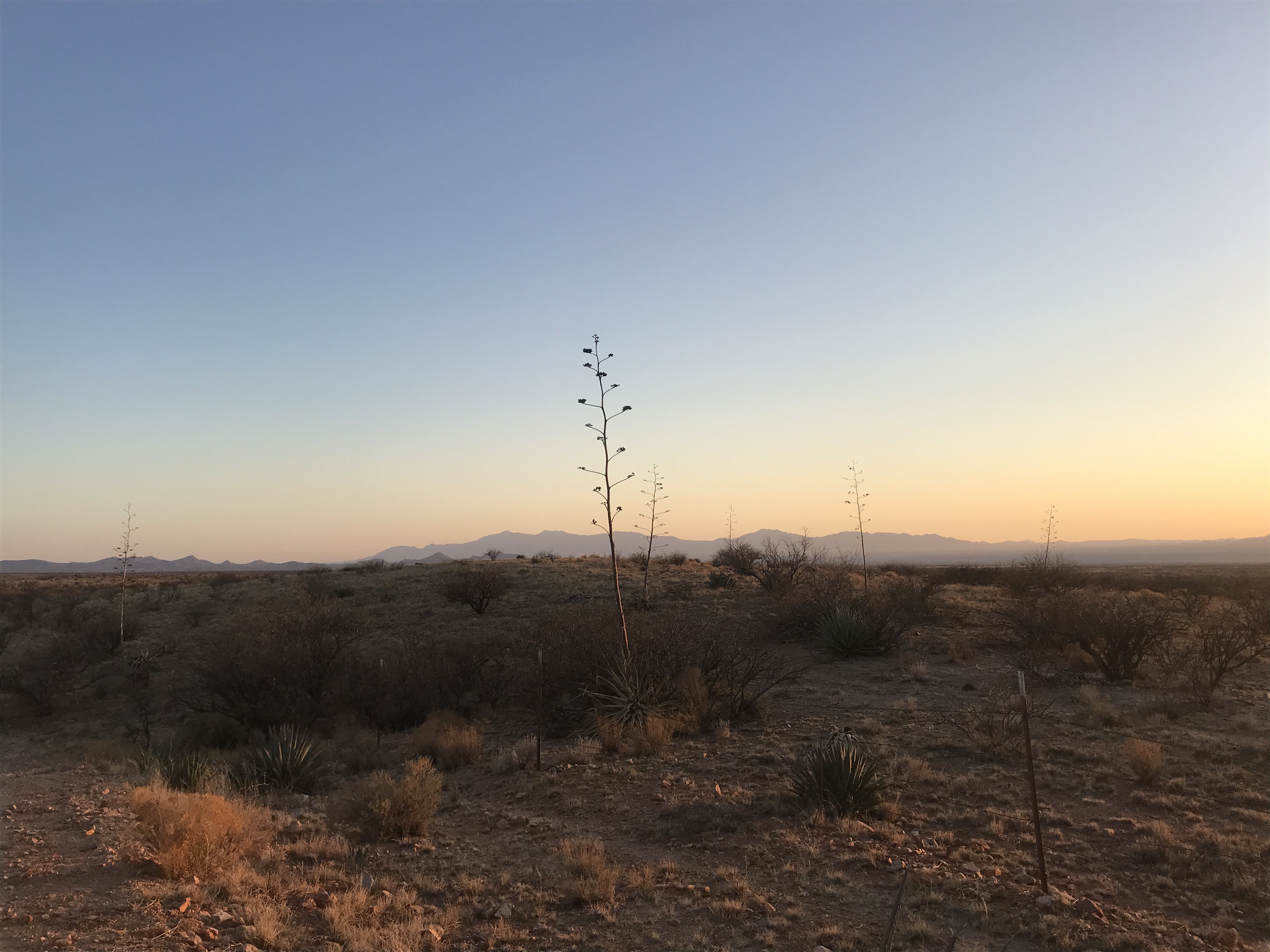
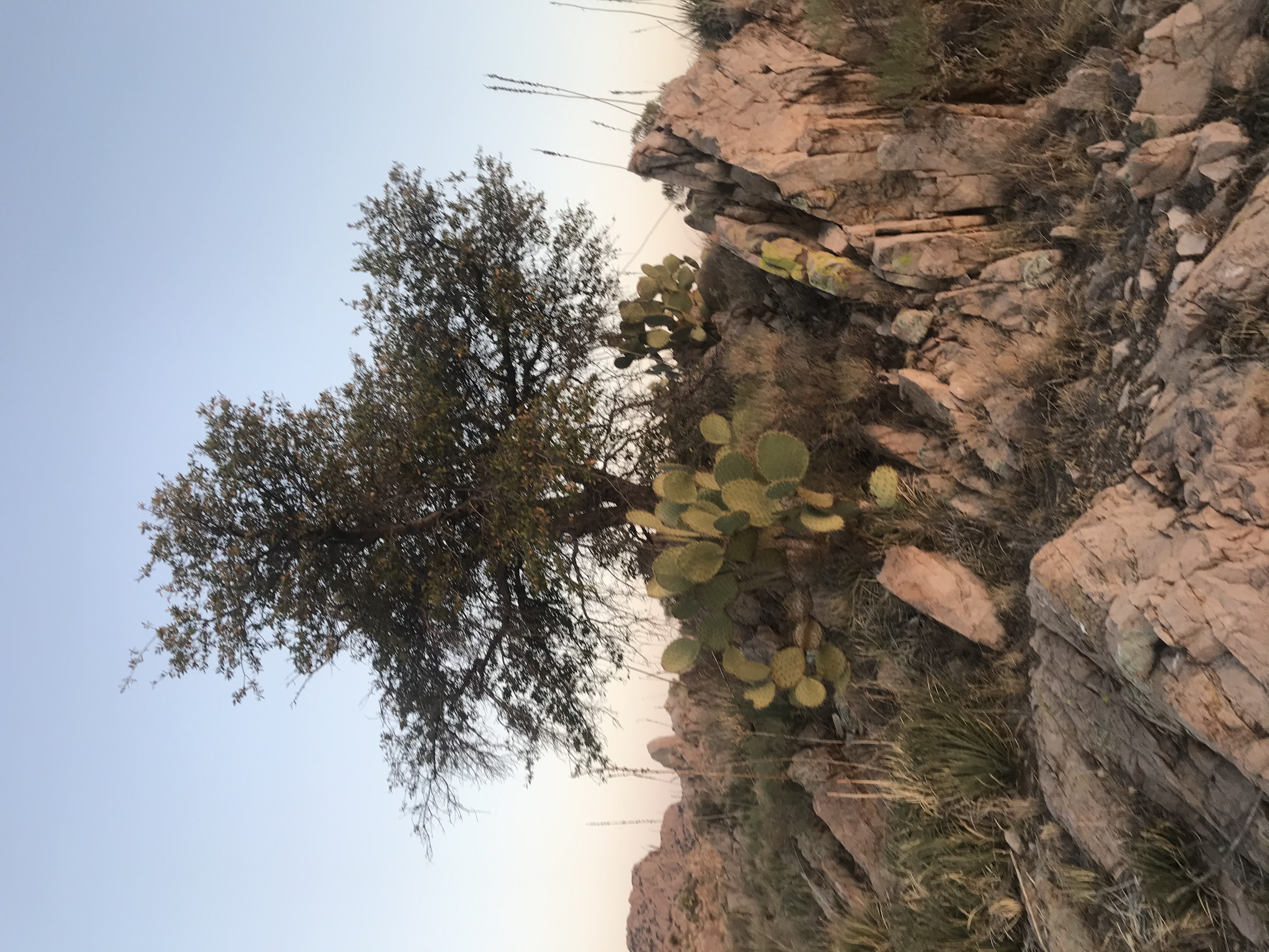
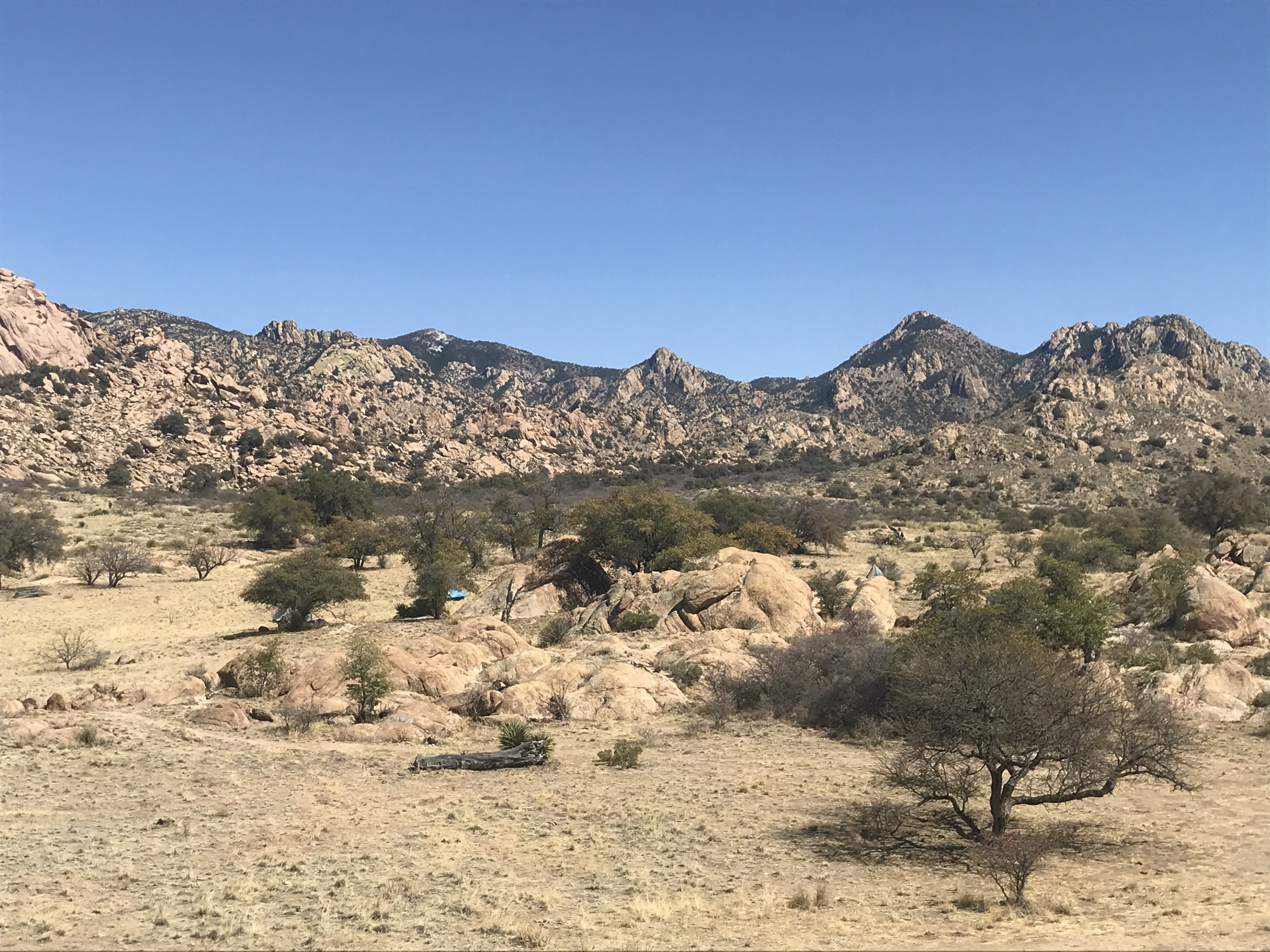
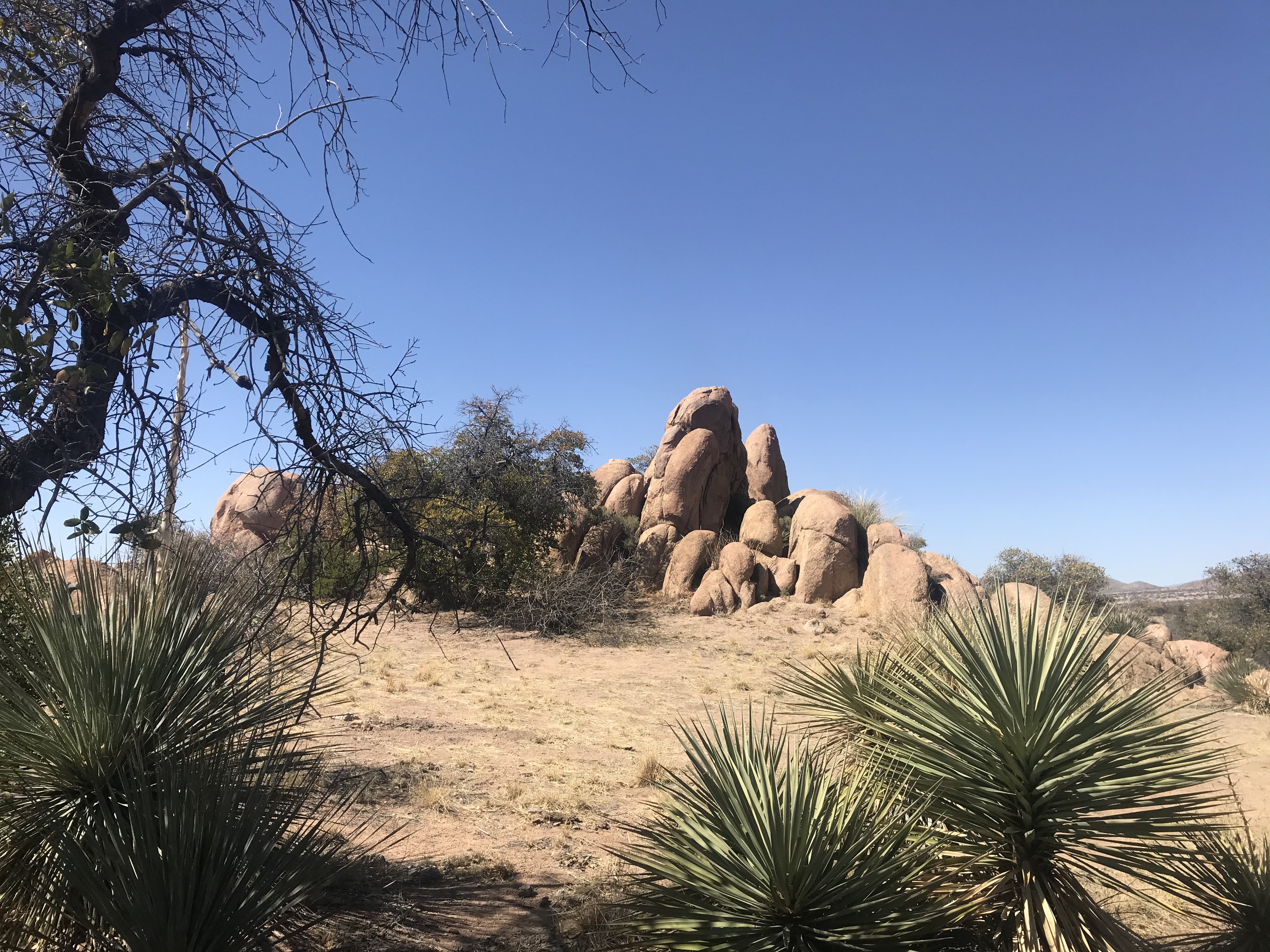
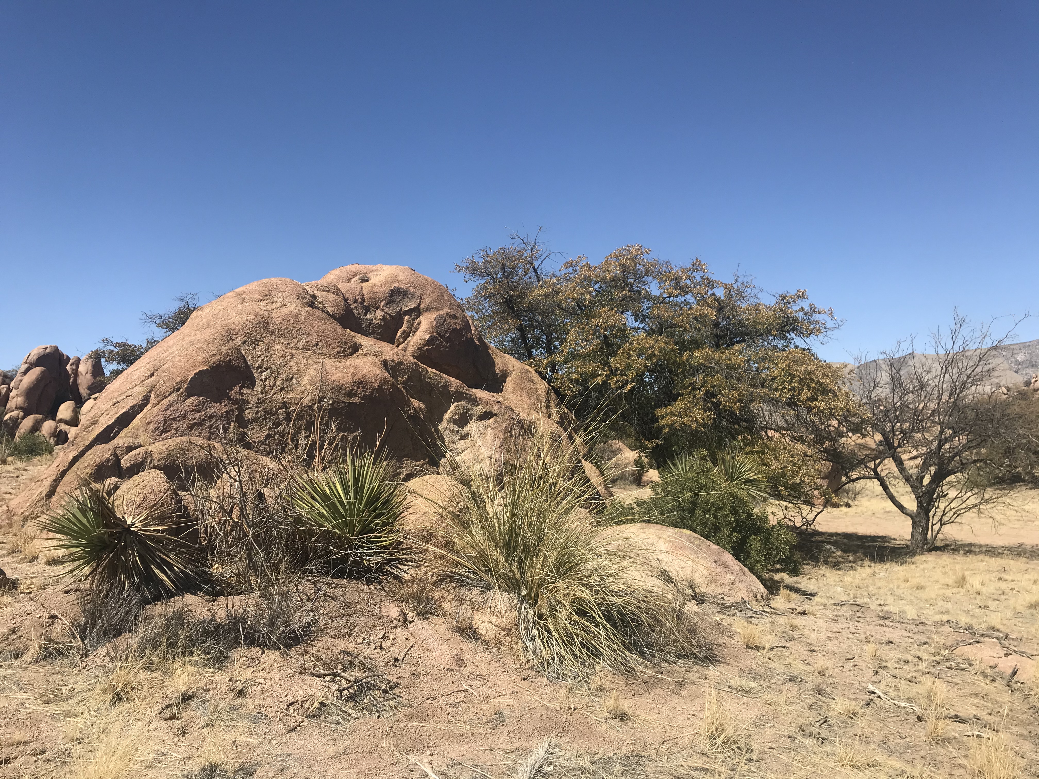
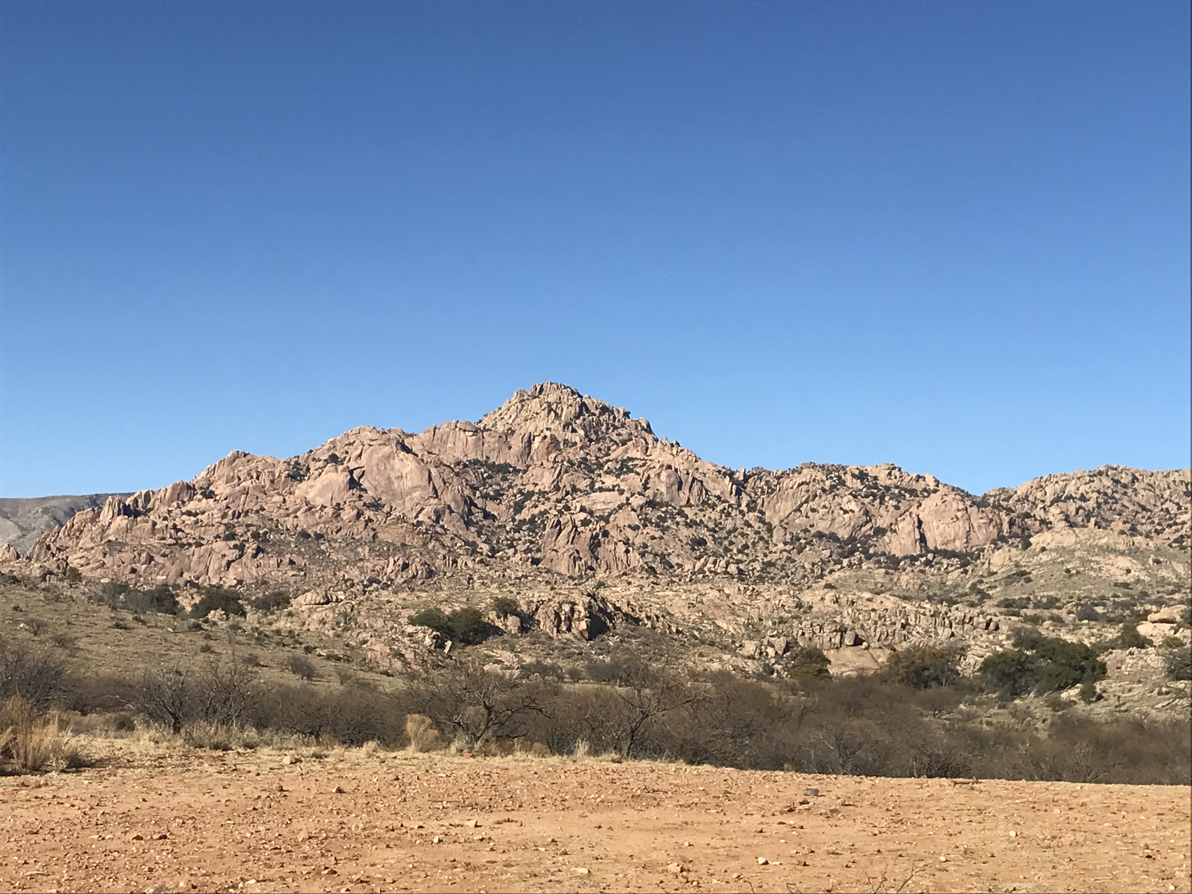
It’s one of the most unique and probably most beautiful places I’ve been as far as desert camping and scenery goes, with the Dragoon Mountains largely made up of a series of massive rock formations, with the desert terrain below a unique mix of oak and mesquite trees, open desert, and massive boulder formations offering some of the coolest campsites. No oak trees right where I’m at, although there are a few scattered around in the area, mostly just thick mesquite trees and amazing views of parts of the mountains not visible in the canyon below where most of the visitors stay, with a really cool mesa not far from my camp.
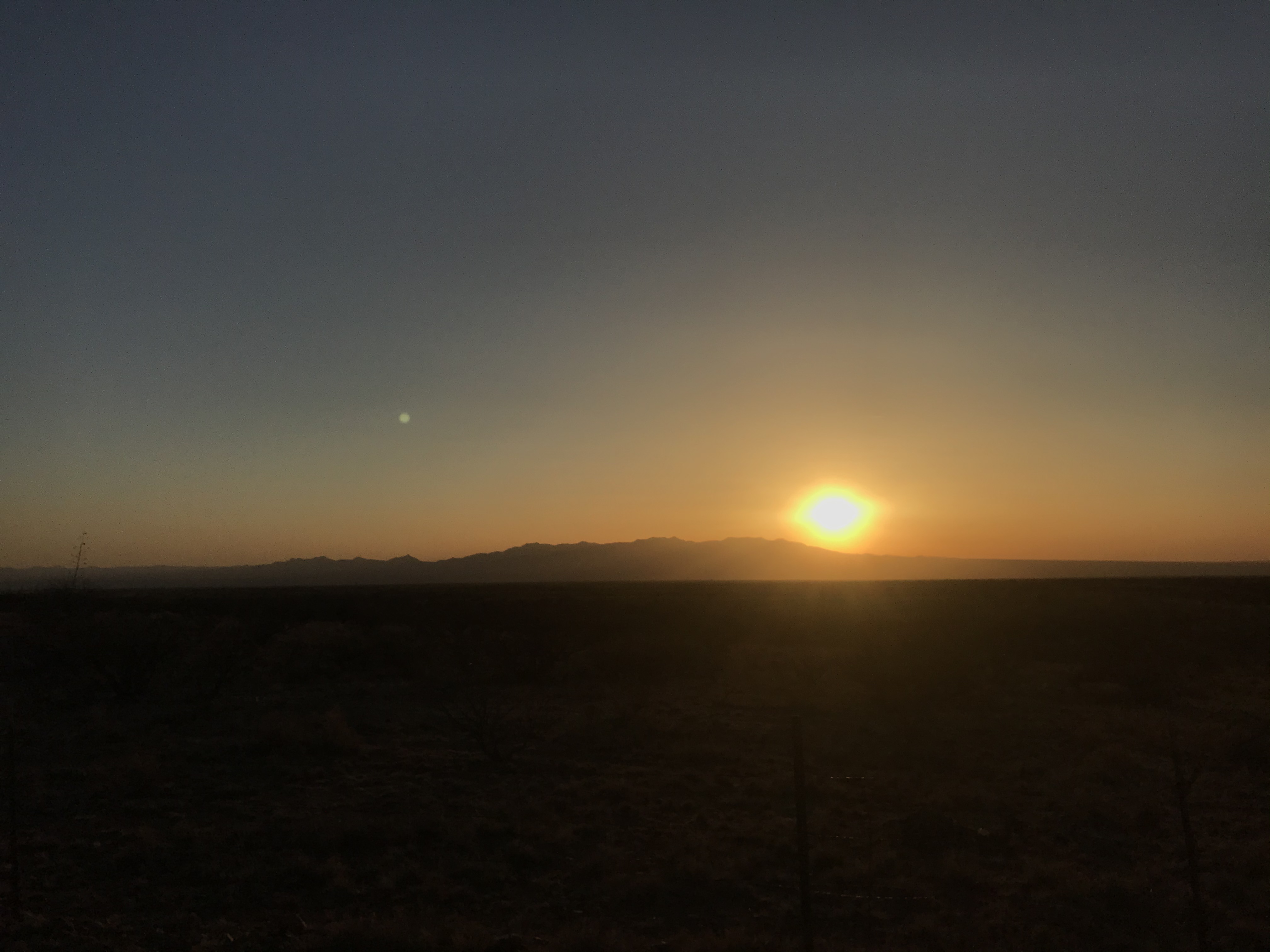
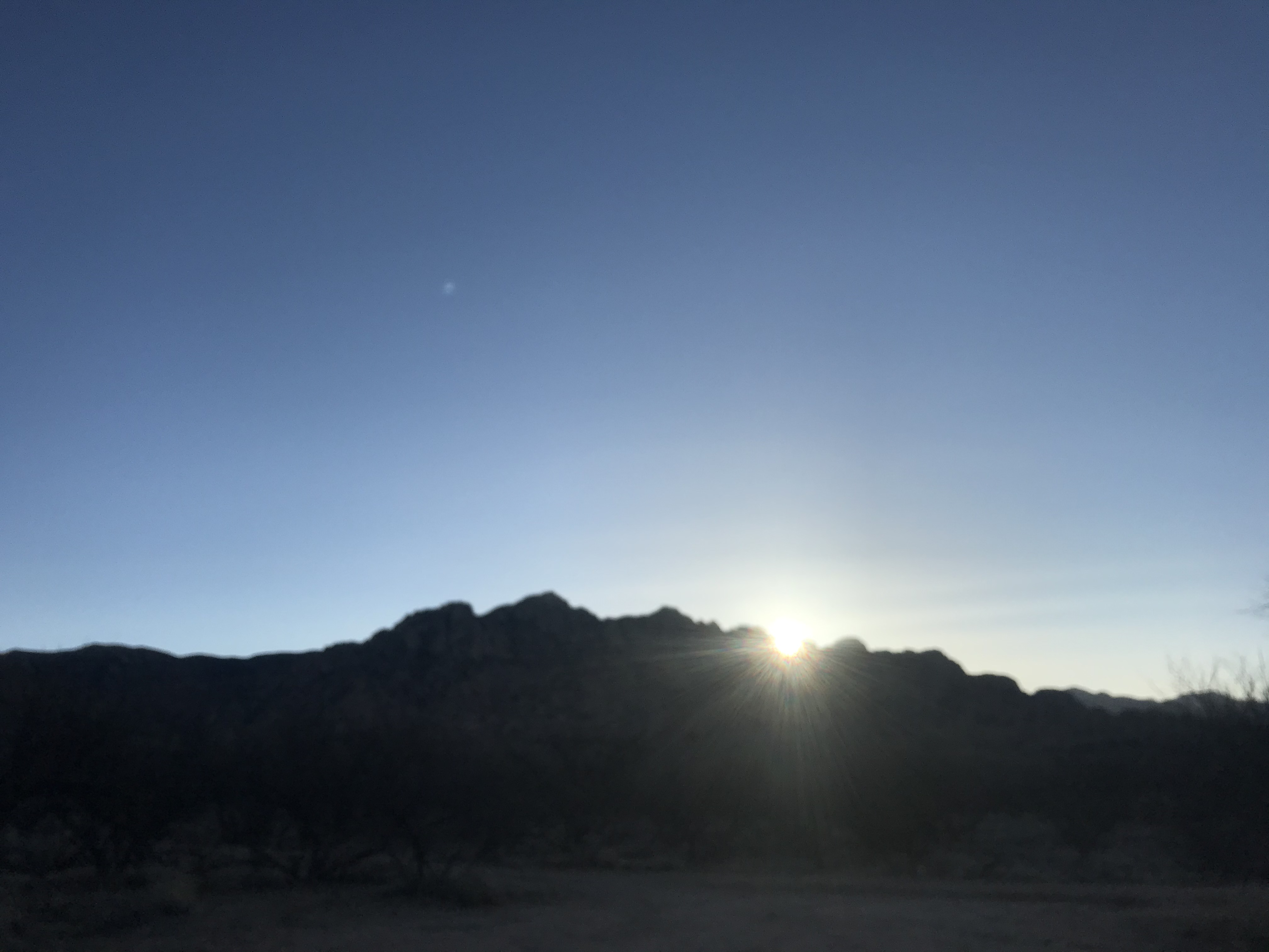
Some gorgeous desert sunsets, and sunrises too...
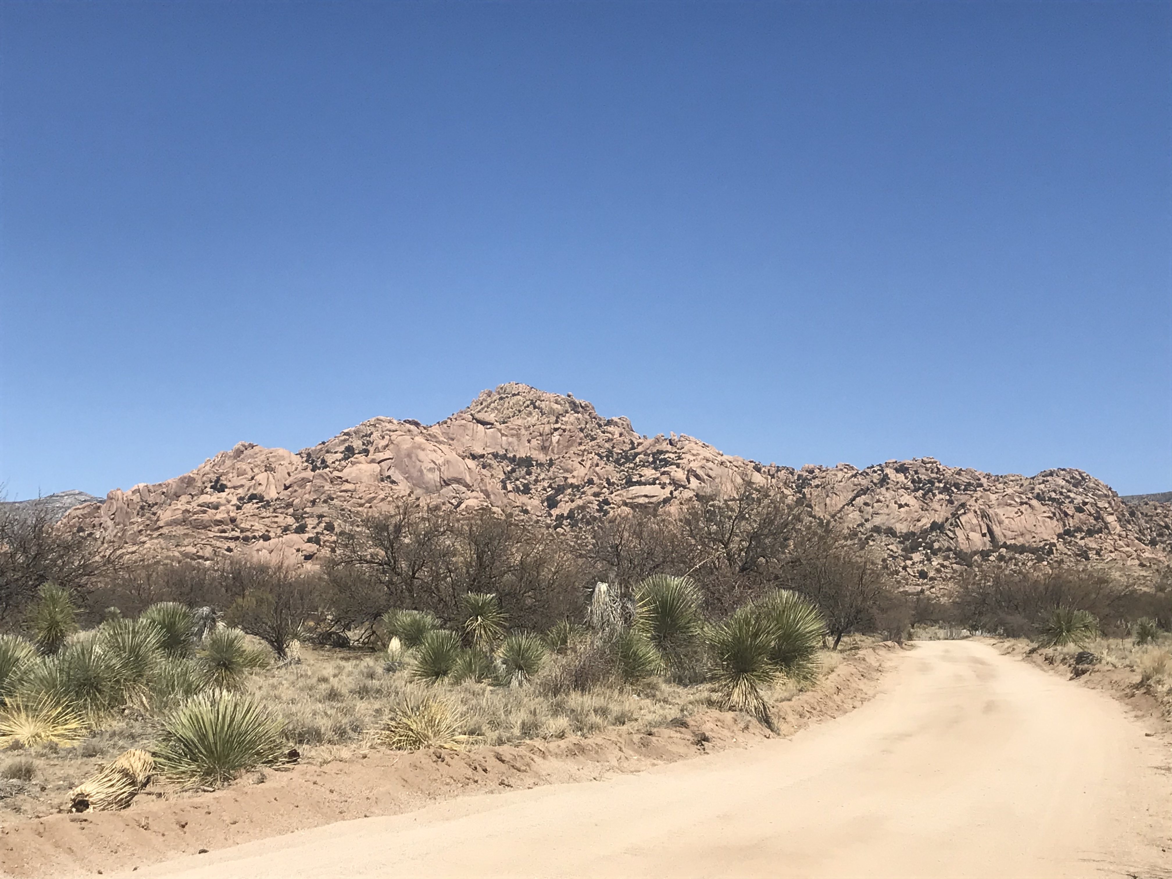
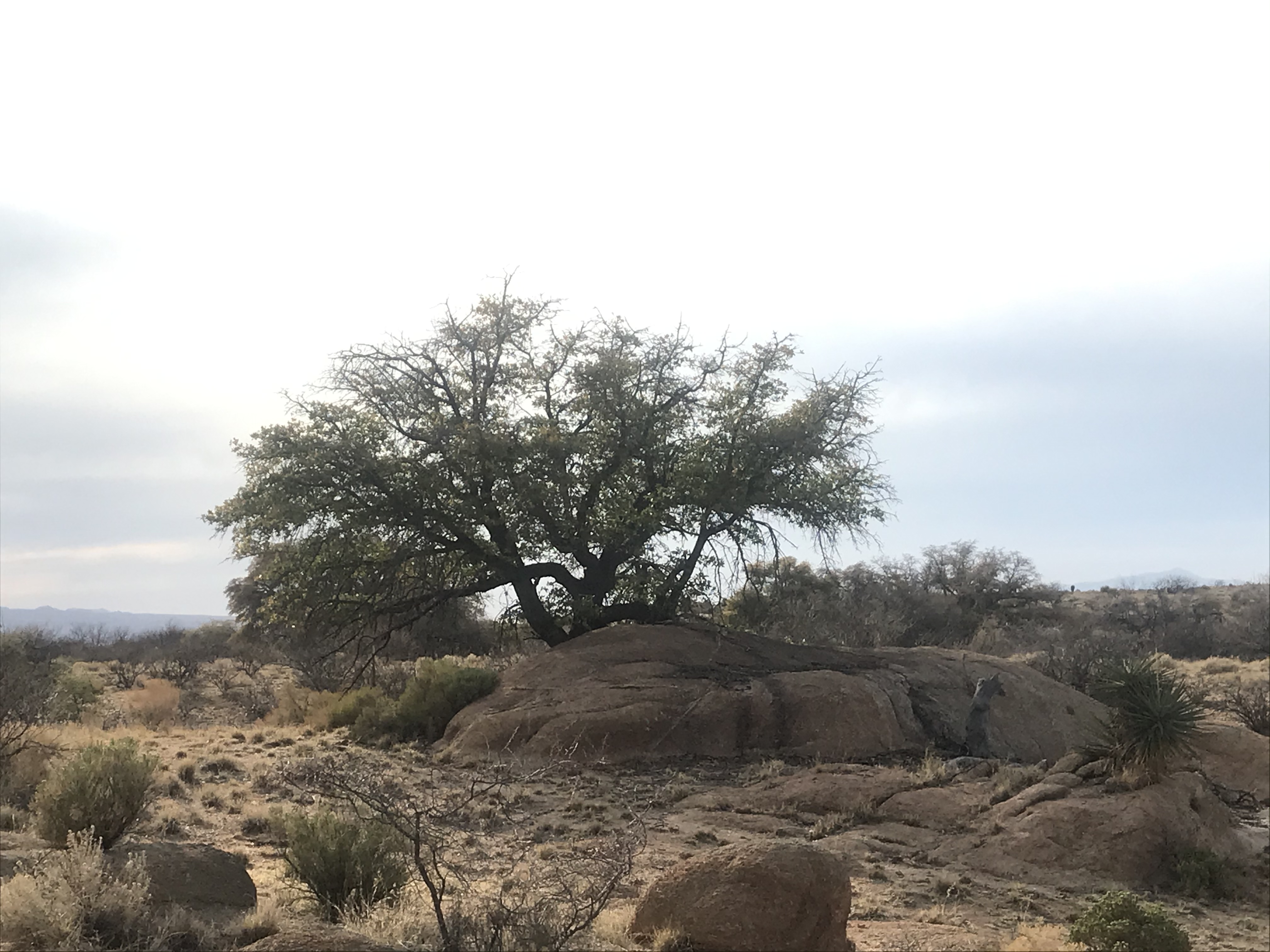
Excellent mountain biking opportunities too, with the roads being mostly hard-packed sand, not too rocky, but not the soft sand you just sink into either, the perfect desert terrain for mountain biking with a number of hiking trails in the area as well. The nearby mesa was beckoning me, so I bushwhacked the short distance to climb it for some nice sunset views one evening, and to see the lone oak tree at the top, towering over a large prickly pear cactus.
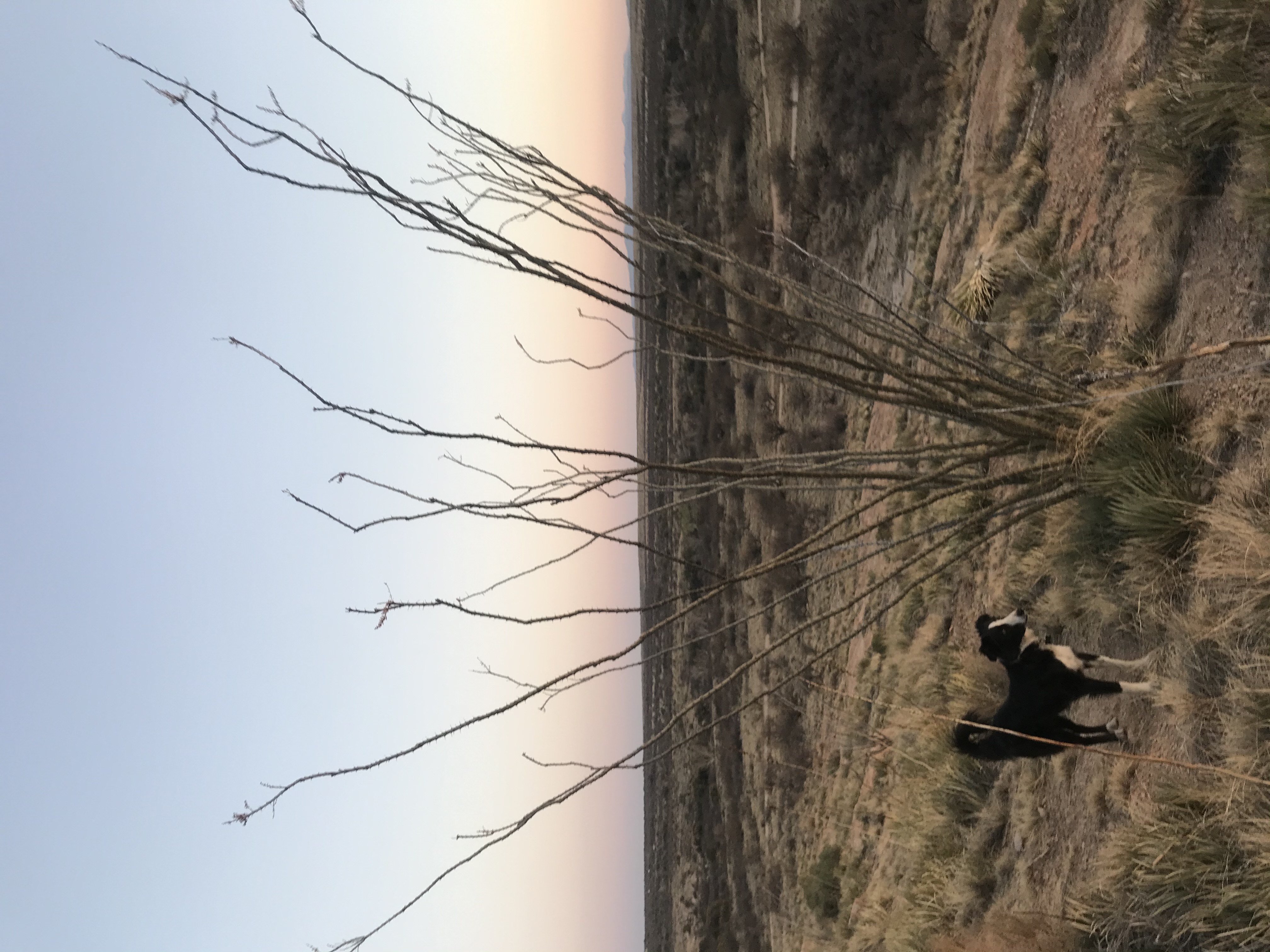
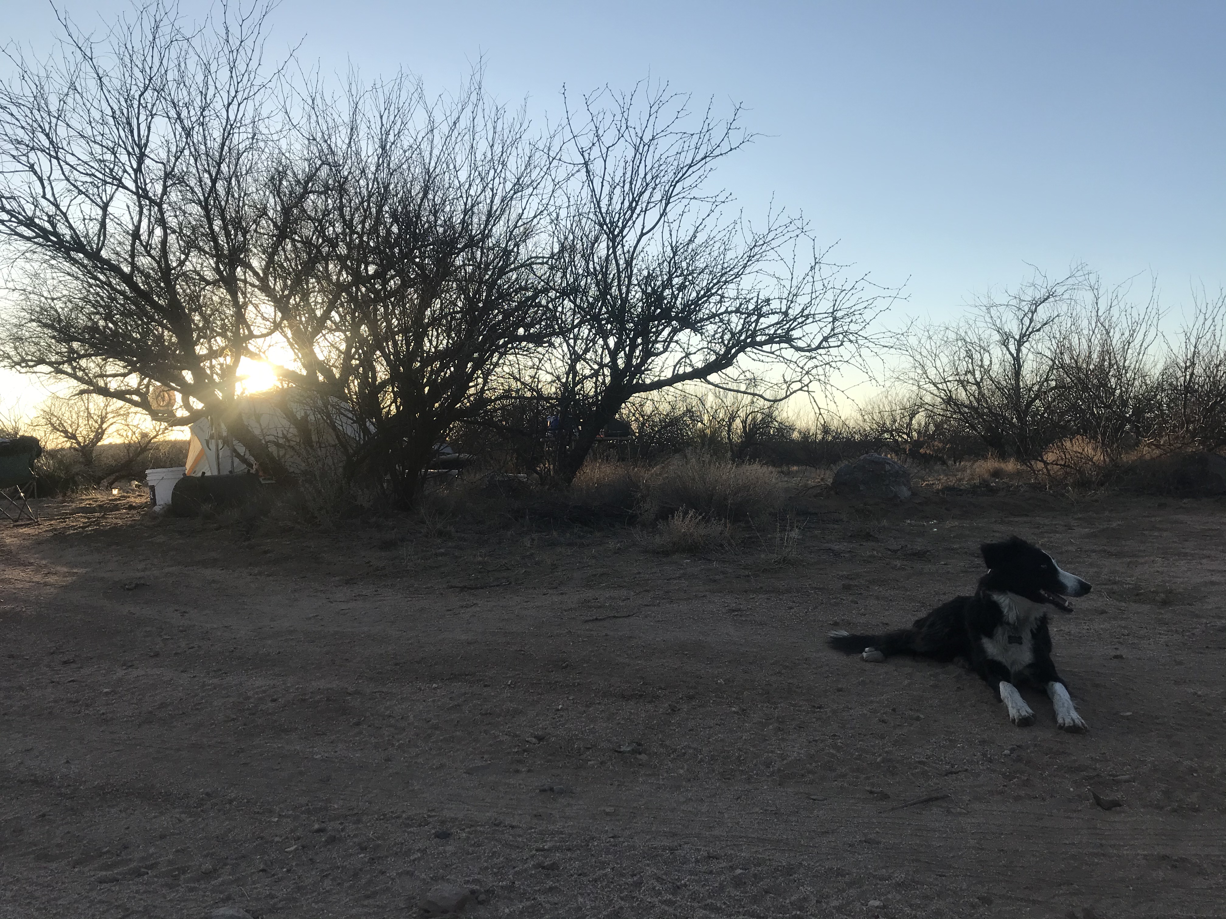
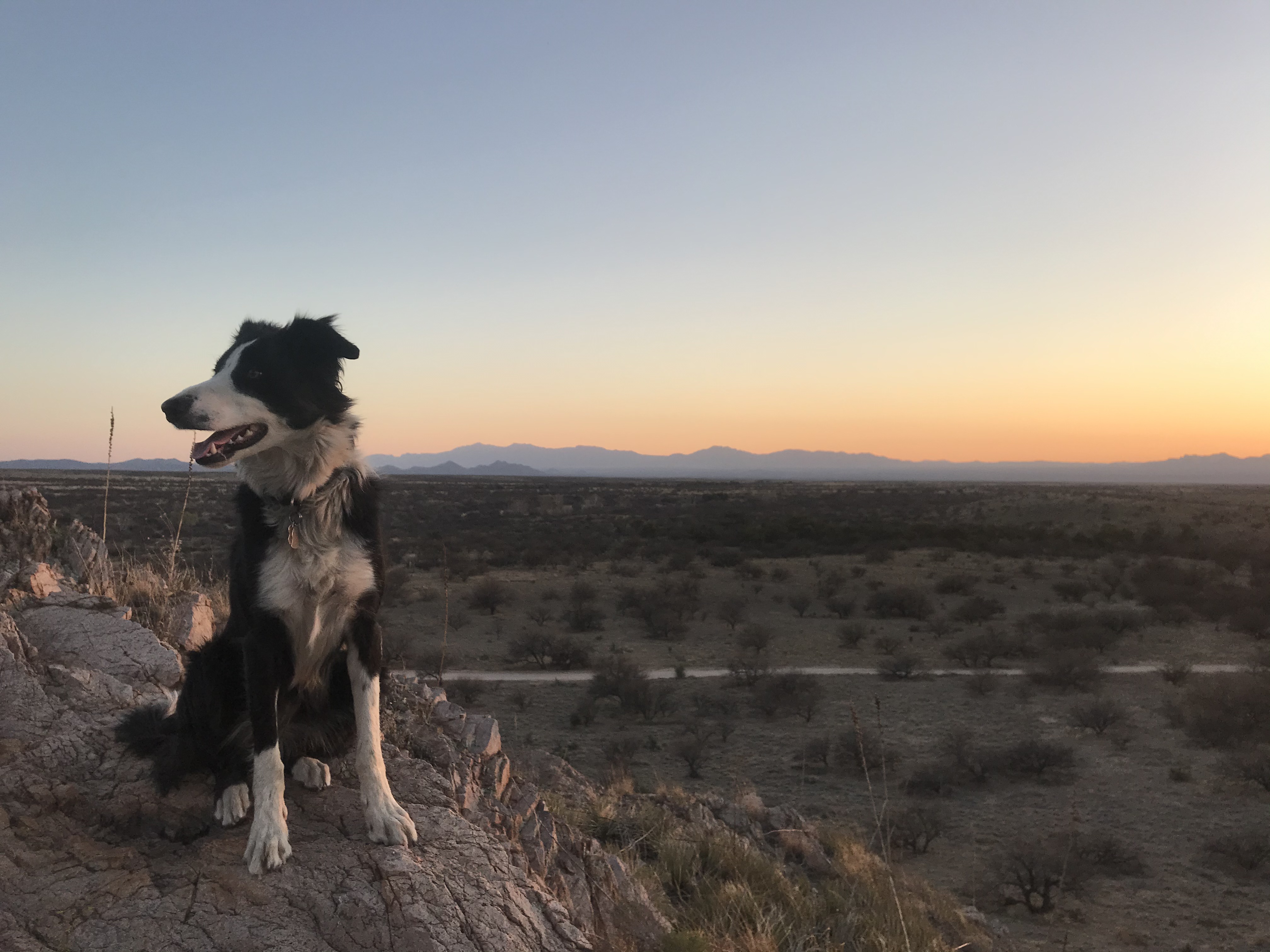
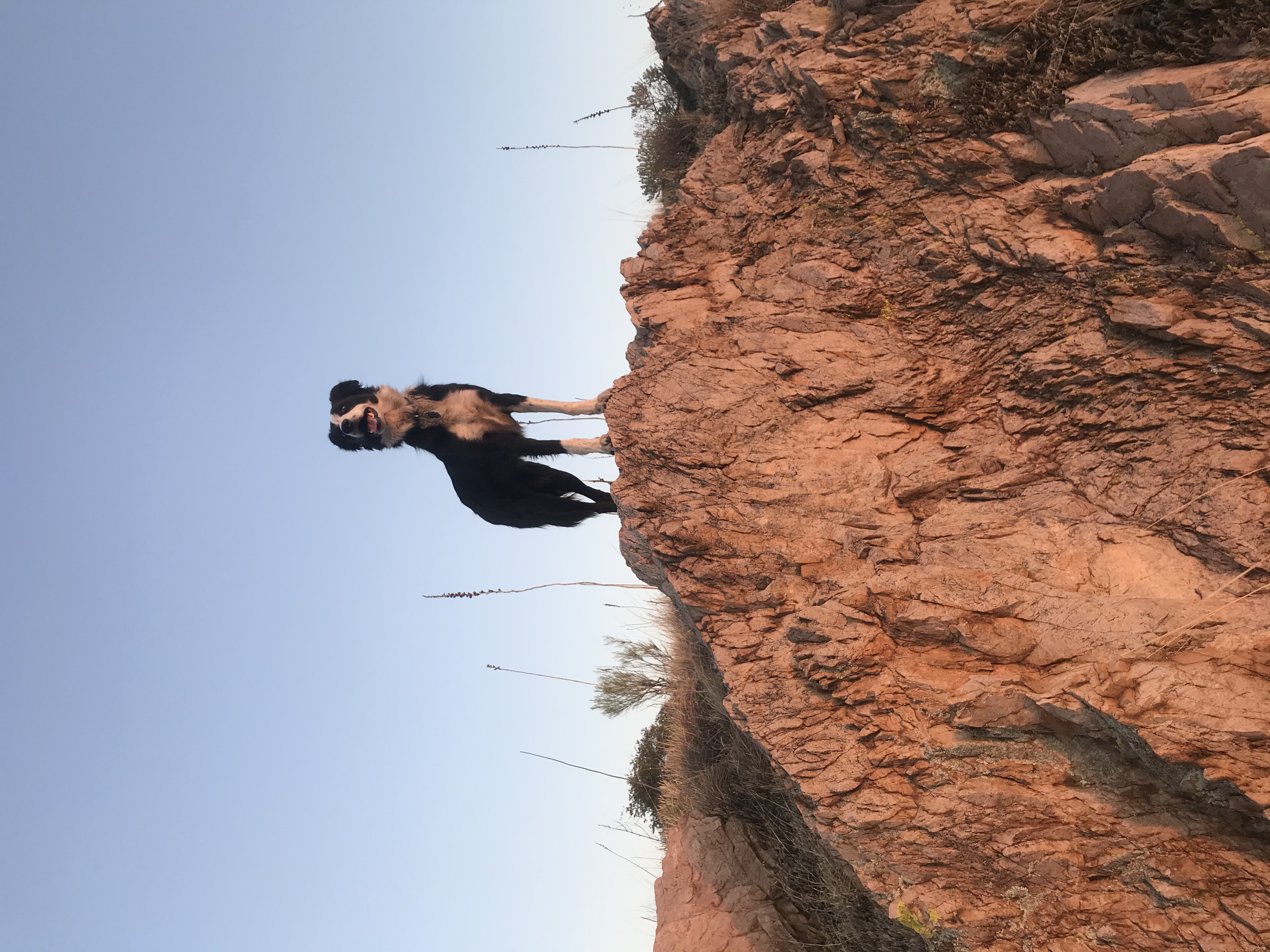
Dakota always goes straight to the highpoint on any uphill hike :)
I was only initially planning to stay a couple nights or so before moving eastward or a bit further north, but a combination of the good cell service meaning internet access, the pleasant warm nights, scenery, and mountain biking opportunities helped change my mind, and here I am beginning to approach a two week stay! I’m excited to hopefully soon head to the high Chiricahua mountains in the farthest southeast corner of the state bordering New Mexico for slightly cooler weather and mountain terrain - also Geronimo’s native territory - and then move eastward to visit family and do some volunteering at some small local Arkansas farms on the way.
But until then I’m thoroughly enjoying this unique area and all the scenery it has to offer. I’ve biked for miles up the main dirt road, which features more of a combination of the same gorgeous scenery - open desert and big boulders, mountains built of nothing but rock, and scattered oaks and mesquite trees.


Seemingly endless miles of open range, mostly flat rolling hills, reminds me of the country song, “Cowboys like us” - “and we ride...”
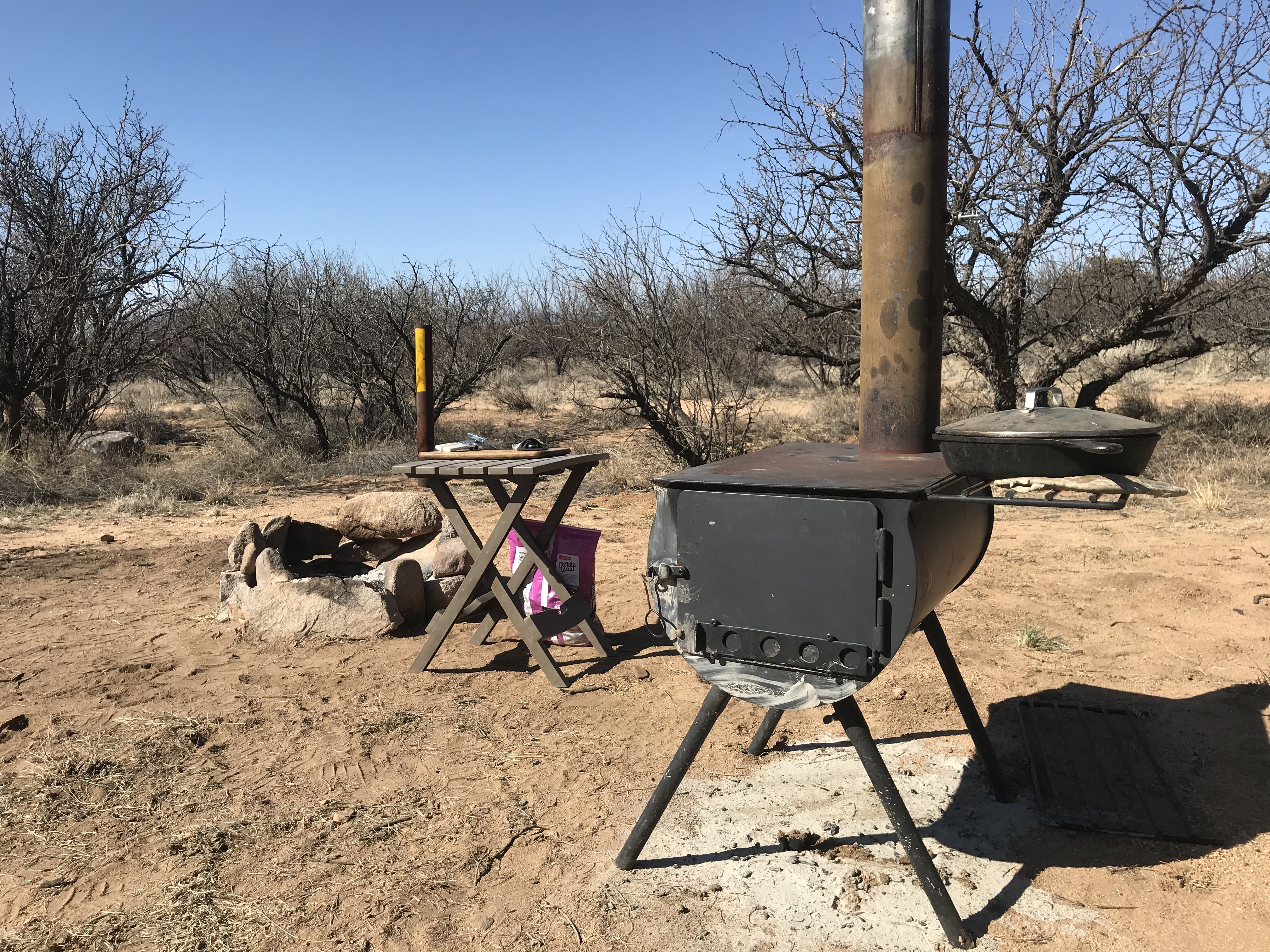
I’ve especially enjoyed sitting around the campfire with the mild night temperatures, the high 70s in the day a nice change from the slightly cooler mountain temperatures I came down from, and I decided to set up my wood stove for cooking purposes to conserve propane, some nights having both the campfire and the wood stove going at once, the desert aroma of mesquite smoke filling the air.
The area’s seen extreme drought this winter, with the typically year-round creek flowing through the area bone dry, so imagine my surprise when the warm and dry weather suddenly turned to heavy rain, and I awoke to snow on the ground, at this relatively low desert elevation all the way at the end of March!
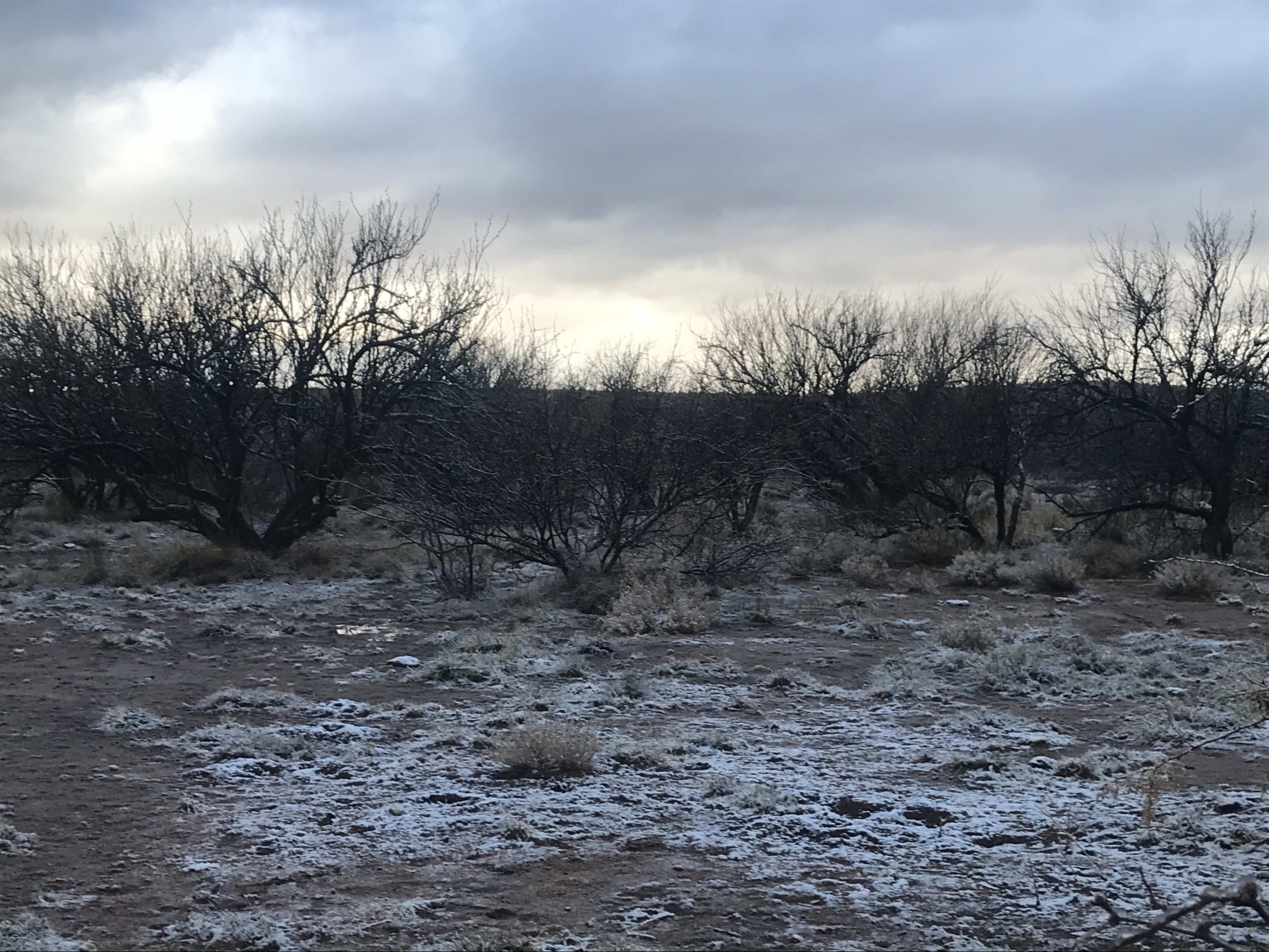

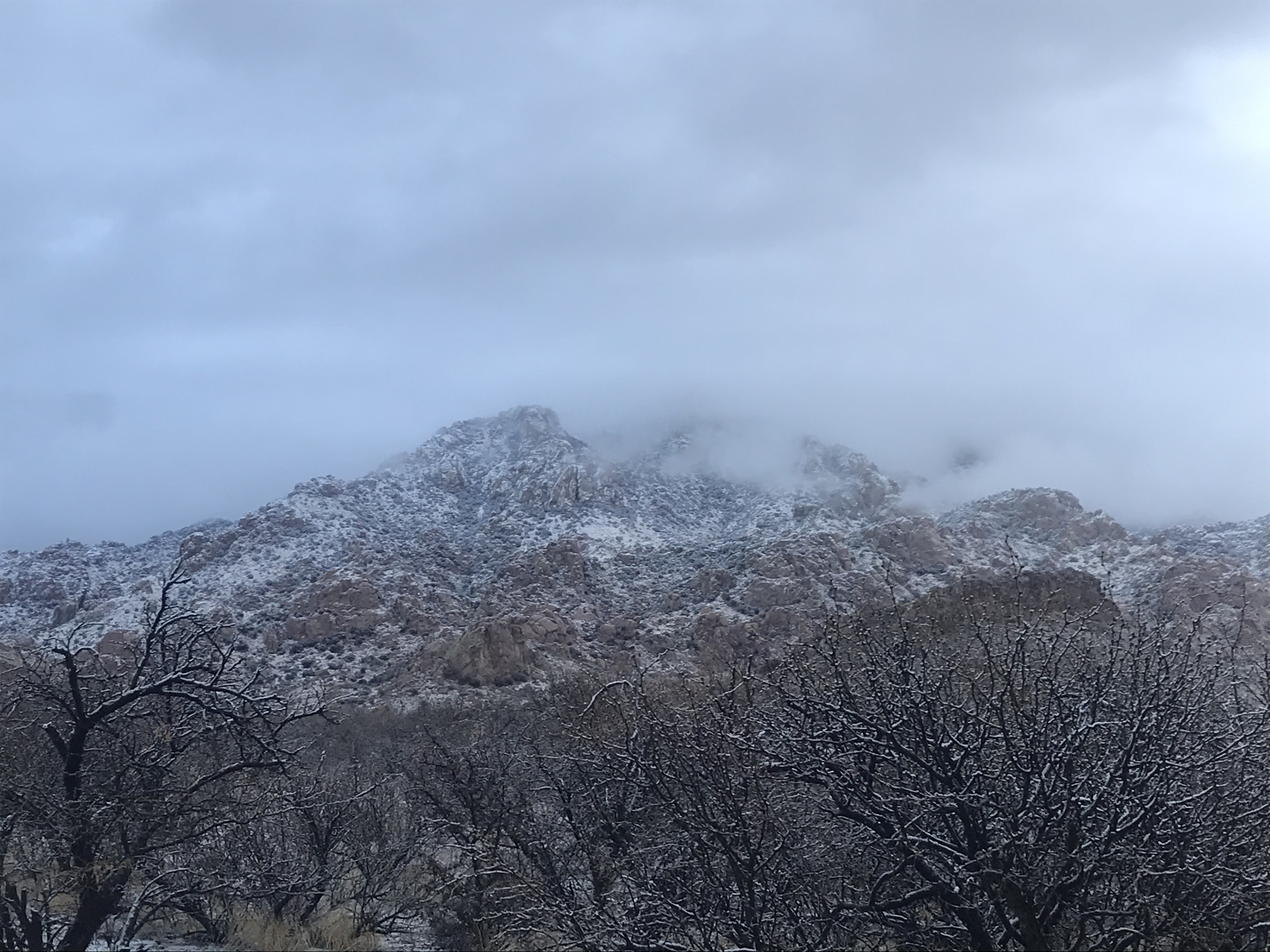
Pretty, but didn’t make for comfortable camping there for a couple nights, what with my wood stove outside and me in my small tent with no heat, lows getting down to 27F, and me having to cook meals outside in the open air in between bouts of rain and snow! But it was much needed moisture for the area, and a local rancher I talked to said he recorded 5/8” of water, and informed me snow here in March is not unusual, only unusual for this dry winter. It was enough moisture that all the grass has begun to turn green in the few days following the storm, and I’m sure helped lower the high fire danger, at least for a couple days there...
Then, after a couple days of cooler weather following the storm, temperatures are getting hot again, even reaching 80 degrees! I’m keeping my eyes out for rattlesnakes, though haven’t had any encounters yet. I’m sure they will be coming out soon, I’m told high 70s to low 80s brings them out, so we’ll see if I see my first rattlesnake of my life in southern Arizona this winter or not. I have seen a few really pretty colorful birds in the past few days including hummingbirds, but apart from the birds and lots of honeybees, haven’t seen anything in the way of wildlife, probably due to the complete lack of water in the area.
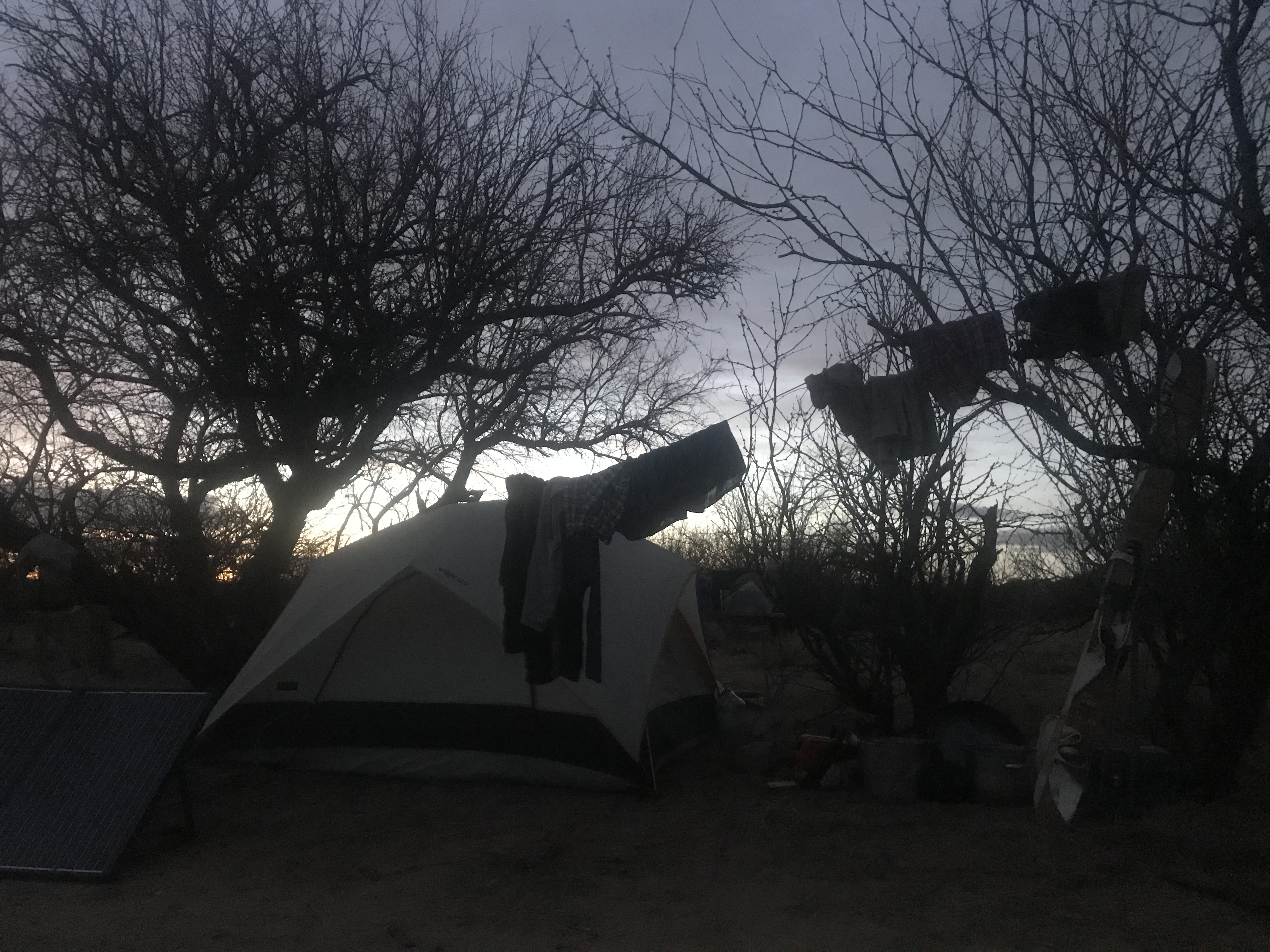
I did, however, take the opportunity to utilize the warmer dry weather to save a couple bucks by stringing a clothesline to dry my clothes in the sun after a trip into town to do laundry, because why waste the quarters that could go to wash clothes the next time in a couple weeks, when nature provides the perfect natural conditions anyway!
For anyone looking for a unique and scenic winter desert camping destination, or just those passing through the area in their travels, I would highly recommend checking out this little camping gem of the southwest, as long as you don’t mind having a few neighbors somewhat nearby, at least on a weekend, or are willing to hunt for one of the more secluded spots to setup camp. There’s a wide variety of great hiking, mountain biking, and rock climbing opportunities, not to mention being a paradise for photographers and I imagine at the right time of year, also great for birding. Just take Middlemarch road out of Tombstone toward the Dragoons until you hit the well-marked national forest boundary, and immediately take the left fork and drive until you find a place to your liking, the options are endless and begin immediately, stretching for many miles, with a number of side roads taking you to some of the coolest spots hidden from view of the main road...

Great photos! I like the V bush, and the rounded rocks.
Superb. Great shots, great post. Made me wanna grab a tent and go...😃
That's quite the stove! Never had anything like that on my camping trips..
Yes, well I’m camping as a lifestyle on and off, so I’m well equipped, and the stove actually goes into a bigger canvas yurt I’ve got as well, where it doubles as heat source and cook stove. But in warmer weather or when I’m using the smaller tent it’s still nice to set it up outside so save money on propane for cooking :)
Sounds like this place is quite a whirlwind of weather. Dry, warm, cold and snowy and rainy. Got all of it in one fell swoop lol. Looks and sounds like a wonderful place to be! Good for you for also taking a trip and volunteering on some farms in Arkansas I’m sure they are in sore need for help! Appreciate you doing that! Great post here thanks for sharing!
Yes, the weather can change fast here in Arizona, although I was really surprised to see snow in this area, as I was here last year in January for a couple weeks and it only ever rained, so snow in March during a super dry drought year was unexpected. And yeah, the farms in Arkansas sound like they can use all the help they can get, although I get free room and board out of the deal, so it should work out. I plan to post on my experiences there as well, and I should be be arriving at the first one in mid-April, so it’ll be a fun learning experience I’m thinking. The scenery will be nothing like the west, I’m pretty sure, so I’m excited.
Congratulations, your post has been added to Pinmapple! 🎉🥳🍍
Did you know you have your own profile map?
And every post has their own map too!
Want to have your post on the map too?
Hiya, @ybanezkim26 here, just swinging by to let you know that this post made it into our Top 3 in Daily Travel Digest #1159.
Your post has been manually curated by the @pinmapple team. If you like what we're doing, please drop by to check out all the rest of today's great posts and consider supporting other authors like yourself and us so we can keep the project going!
Become part of our travel community: