Venezuela is a country with many natural charms and we are privileged to have diverse ecosystems such as: beaches, deserts and mountains. Dear #haveyoubeenhere and #Hive community, a few days ago I had the opportunity to visit one of these ecosystems, so I put on my mountain shoes to exercise and spend a different day. I want to share with you the hike I did to our majestic Avila (Waraira Repano National Park) along the trail from Altamira to Sabas Nieves. This mountain is the vegetable lung of our capital city: Caracas. There you can spend a pleasant time and de-stress from the noise and the accelerated life we lead. It is very easy to get there if you take public transportation, just take the Metro to Altamira station and then take a bus of the TransChacao line that leaves you a few meters from the entrance of the park at the foot of the mountain. If you go by car, you can get there by the Boyacá highway (better known as Cota Mil) or if you want to check the best route click on this link to see the map in Pinmapple [//]:# (!pinmapple 10.512915 lat -66.853909 long d3scr)
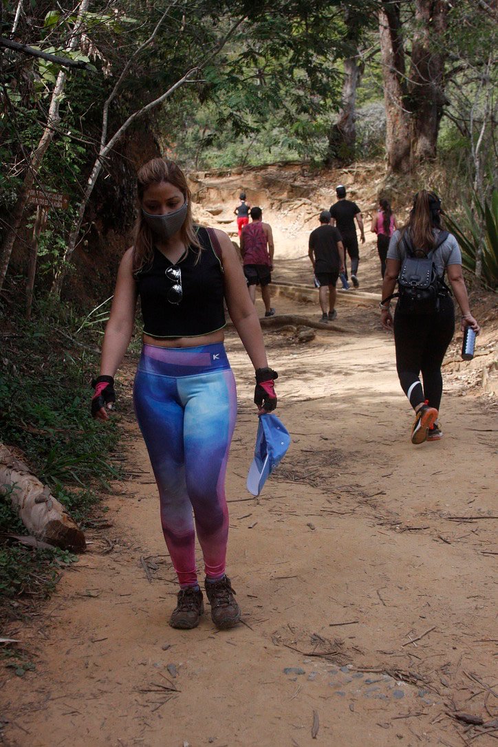
Comenzamos la caminata de 2.5 kilómetros aproximadamente.
¡Acompáñame!
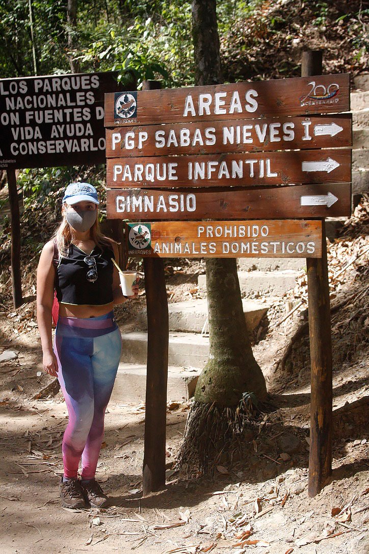
Before arriving at the park entrance, you will go through a tunnel under the highway and from there you will find commercial stands selling everything from cakes and tizana to handmade necklaces. After crossing the tunnel you will see the ranger station and welcome you to the Sabas Nieves trail.
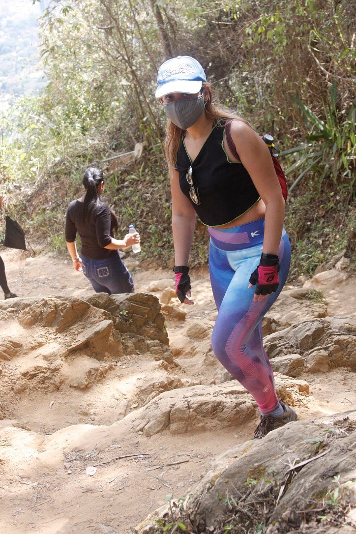
We begin the hike of approximately 2.5 kilometers.
Join me!
El Ávila tiene senderos con distintos niveles de dificultad, desde rutas cortas hasta rutas largas y difíciles para los senderistas más avanzados. Sabas Nieves es una ruta corta así como Quebrada Quintero y Los Venados. Entre las rutas de dificultad media tenemos la de Cachimbo – Piedra El Indio y Puerta Caracas – Camino de los Españoles. Para los de mayor resistencia en el hiking tenemos La Julia – Pico Naiguatá y Cachimbo – Pico Oriental.
En esta oportunidad yo elegí la ruta corta de Sabas Nieves. En la entrada encontraras dos vías para llegar. La más usada es más larga y con muchas piedras y la otra es una vía más empinada y con escaleras en algunos tramos. Las dos opciones son excelentes.
El Avila has trails with different levels of difficulty, from short routes to long and difficult routes for more advanced hikers. Sabas Nieves is a short route as well as Quebrada Quintero and Los Venados. Medium difficulty routes include Cachimbo - Piedra El Indio and Puerta Caracas - Camino de los Españoles. For those with more endurance in hiking we have La Julia - Pico Naiguatá and Cachimbo - Pico Oriental.
In this opportunity I chose the short route of Sabas Nieves. At the entrance you will find two ways to get there. The most used is longer and with many stones and the other is a steeper route with stairs in some sections. Both options are excellent.
La via de las escaleras / The way of the stairs
La via de las piedras / The way of the stones
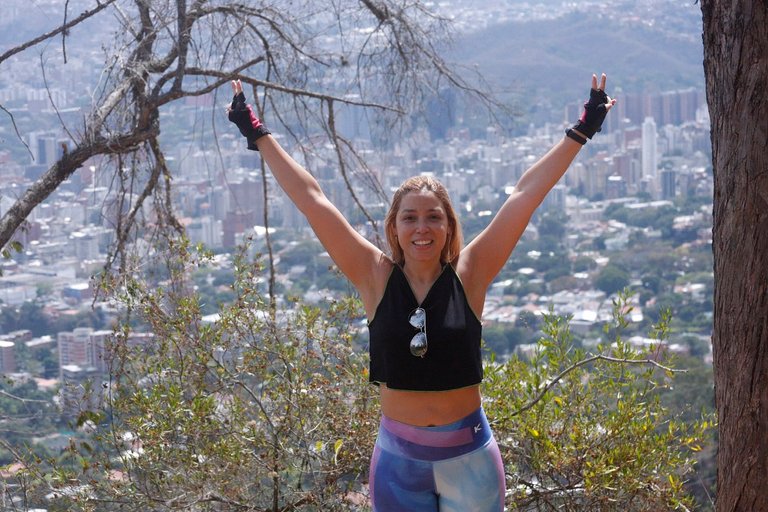
Puedes tomarte fotos hermosas porque la vista es increíble desde allá arriba. Al llegar si gustas puedes ejercitarte como yo lo hice. A mi me encanta la naturaleza y hacer ejercicio al aire libre. Relaja muchísimo y tus energías las renueva. El contacto con la naturaleza limpia tu cuerpo y alma.
You can take beautiful pictures because the view is incredible from up there. When you get there, if you like, you can exercise like I did. I love nature and exercising outdoors. It relaxes a lot and renews your energy. The contact with nature cleanses your body and soul.
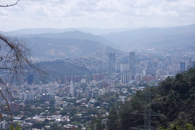
Vista de las torres del silencio desde nuestra Avila / View of the towers of silence from our Avila.
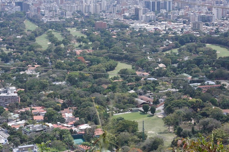
Vista del Country Club desde el Avila / View of the Country Club from the Avila
Recomendaciones para hacer senderismo:
Cuidado de la piel y ojos
- Usa bloqueador solar y gorra.
- Usa Gafas de sol.
- Aplica repelente en tu piel. Protegete de las picaduras de mosquitos
Refrigerio y estadia
- El cambur es una excelente opción por su alto contenido de potasio. Y la naranja te ofrece energía y aumenta tu rendimiento físico.
- Sandwiche si piensas quedarte más tiempo disfrutando del lugar.
- Al llegar a la meta puedes tender sobre la grama una sábana y acostarte para pasar toda una tarde diferente con tu familia.
Protege tus rodillas de lesiones
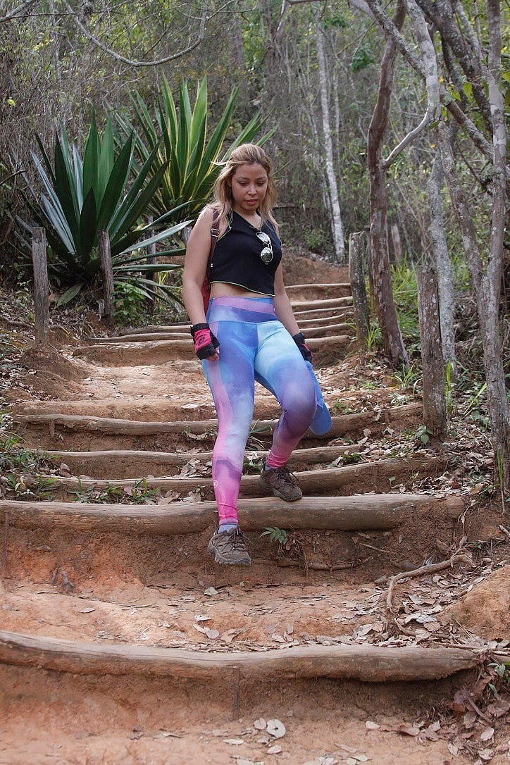
Baja la montaña despacio y de lado. Nunca bajes trotando. En la fotografía puedes apreciar cómo bajar.
Recommendations for hiking:
Skin and eye care
🏃♀🌳 Use sunscreen and a hat.
🏃♀🌳 Wear sunglasses.
🏃♀🌳 Apply repellent on your skin. Protect yourself from mosquito bites.
Refreshments and lodging
🏃♀🌳 The cambur is an excellent choice for its high potassium content. And orange gives you energy and increases your physical performance.
🏃♀🌳 Sandwiche if you plan to stay longer enjoying the place.
🏃♀🌳 When you reach the finish line you can lay down on the grass with a sheet and lie down to spend a different kind of afternoon with your family.
Protect your knees from injur
🏃♀🌳Go down the mountain slowly and sideways. Never jog down the mountain. In the picture you can see how to go down.
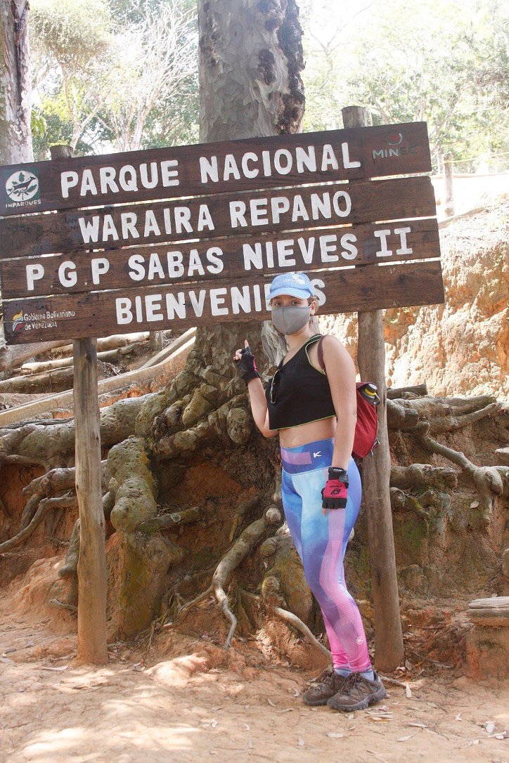
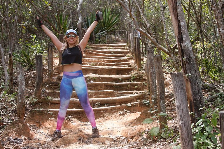
Llegando a Sabas Nieves / Arriving at Sabas Nieves
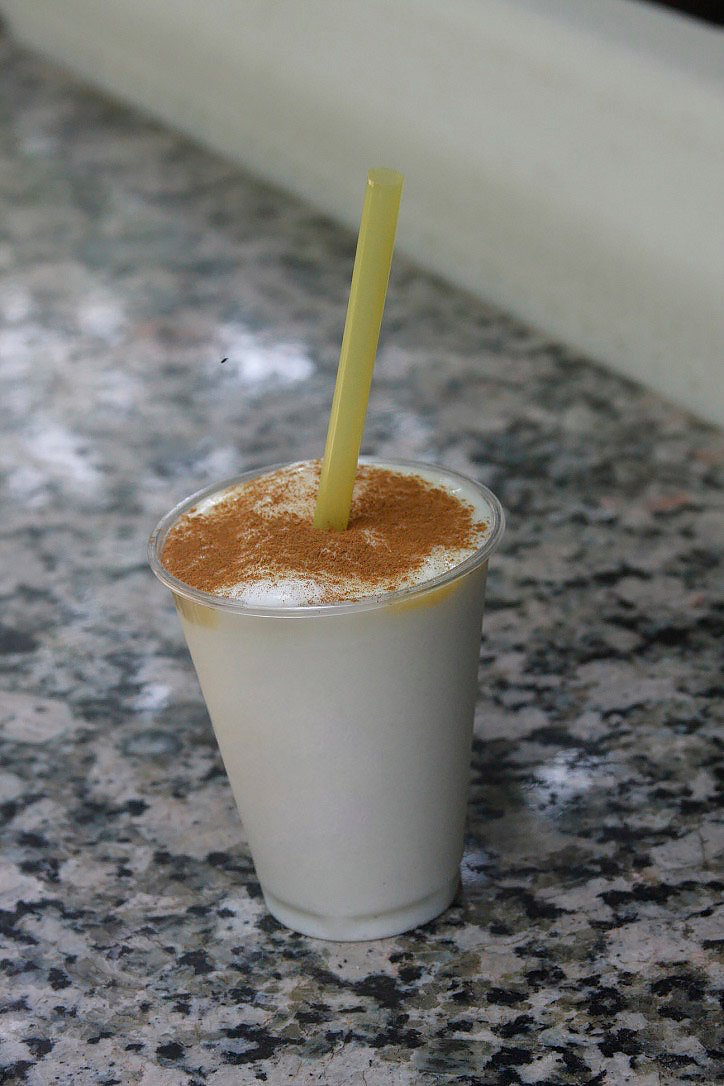
De bajada no podrás resistirte a esta deliciosa cocada que te aportará las energías necesarias a tu cuerpo. Esto lo venden en la entrada del parque. Es un granizado que contiene coco, leche, agua y azúcar. Al servir colocan un pequeño sirope de leche condensada y canela en polvo. El vaso mediano cuesta $3.
On the way down you will not be able to resist this delicious cocada that will give you the necessary energy to your body. This is sold at the entrance of the park. It is a slush that contains coconut, milk, water and sugar. When serving, they add a small syrup of condensed milk and cinnamon powder. The medium glass costs $3.
Si llegaste hasta aquí. Gracias por leerme. Nos vemos en el proximo post
Todas las fotos son propias.
Fotógrafo: Charles Prato
Cámara: Canon EOS 4D.
Edición fotográfica: InCollage y Adobe Photoshop
Traductor: https://www.deepl.com/translator
If you made it this far. Thanks for reading. See you in the next post
All photos are my own.
Photographer: Charles Prato
Camera: Canon EOS 4D.
Photo editing: InCollage and Adobe Photoshop.
Translator: https://www.deepl.com/translator
Hi there, great to see you post from the haveyoubeenhere and pinmapple community. Please note our main community rule is that all travel posts must be pinned on pinmapple, https://pinmapple.com/ as stated on the community page. In order to get your post on Pinmapple, just click on the 'get code' at the top of the map and follow the instructions or check out the FAQ to get your post on the map. Cheers
Hello! I had inserted the wrong code, but I fixed it already. Thanks for your instructions.👍 🙂
Congratulations, your post has been added to Pinmapple! 🎉🥳🍍
Did you know you have your own profile map?
And every post has their own map too!
Want to have your post on the map too?
Congratulations @jomarbym! You have completed the following achievement on the Hive blockchain and have been rewarded with new badge(s) :
Your next target is to reach 30 posts.
You can view your badges on your board and compare yourself to others in the Ranking
If you no longer want to receive notifications, reply to this comment with the word
STOPCheck out the last post from @hivebuzz:
Hiya, @LivingUKTaiwan here, just swinging by to let you know that this post made it into our Honorable Mentions in Daily Travel Digest #1153.
Your post has been manually curated by the @pinmapple team. If you like what we're doing, please drop by to check out all the rest of today's great posts and consider supporting other authors like yourself and us so we can keep the project going!
Become part of our travel community:
@livinguktaiwan I am happy to be in the honorable mention 😀. thank you very much 😀.