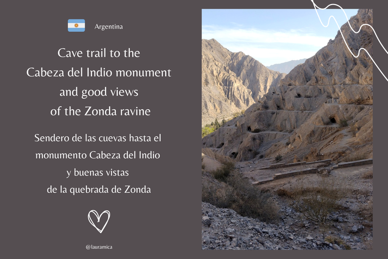
If your idea of having a good day is to go relax or do activities in the mountains of San Juan, going to the Zonda ravine is one of the most recommended options. These dry, orange mountains have options of all types and difficulties, from demanding trekking to a camping base with a pool to cool off a little. If you ask me, what I like most is to be on the move, so as soon as I could, I dedicated myself to exploring which trails I could walk on and that's how I found the one that in my opinion was the easiest of all: the one that led to the famous "Indian's Head" 😃.
Si tu idea de pasar un buen día es ir a relajarte o hacer actividades en las montañas sanjuaninas, ir a la quebrada de Zonda es una de las opciones más recomendadas. Estas montañas secas y anaranjadas cuentan con opciones de todos tipos y dificultades, desde exigentes trekkings hasta una base de camping con pileta para refrescarse un poco. Si me preguntan a mí, lo que más me gusta es estar en movimiento así que ni bien pude, me dediqué a explorar en qué senderos podía caminar y así fue como encontré el que en mi opinión fue el más fácil de todos: el que te llevaba hasta la famosa "Cabeza del Indio" 😃.
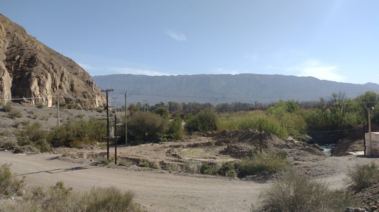
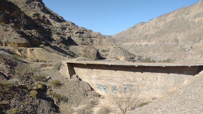
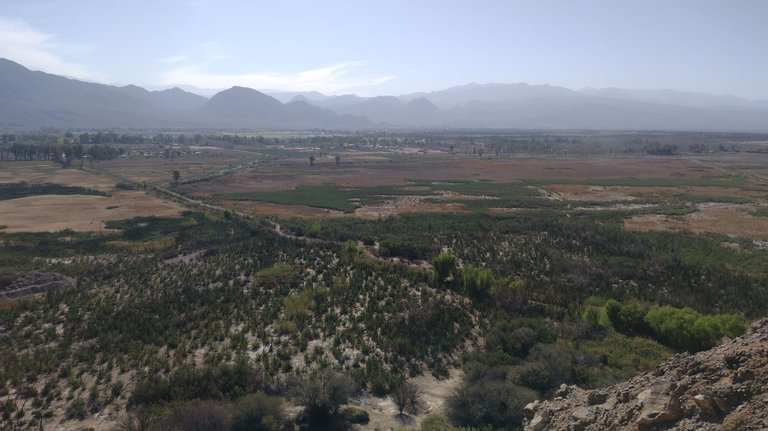
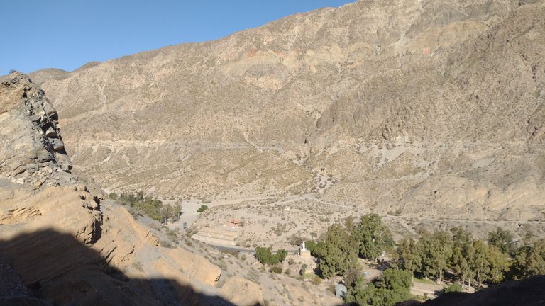
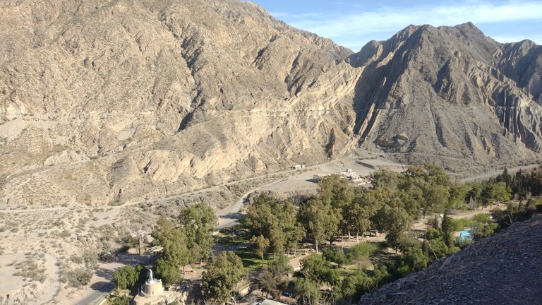
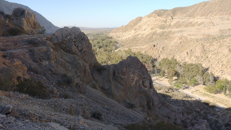
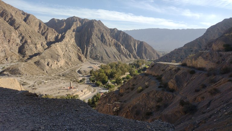
The Zonda ravine is a mountainous landscape that extends for about four kilometers, so you can easily reach one of its ends, next to which a greenish valley extends. Many people come to this place with the idea of seeing the beginning of the mountain range and there you can find a small trekking with an ascent to have more beautiful views of the entire area. The good thing is that this trail is prepared for tourists and even has stairs for easier access ❤️.
La quebrada de Zonda es un paisaje montañoso que se extiende por unos cuatro kilómetros, por lo que se puede llegar fácilmente a uno de sus extremos al lado del cual se extiende un valle verdoso. Mucha gente llega a este lugar con la idea de ver el inicio del cordón montañoso y en él se puede encontrar un pequeño trekking con ascenso para tener unas vistas más lindas de toda la zona. Lo bueno es que este sendero está preparado para los turistas que incluso cuenta con escaleras para acceder con más facilidad ❤️.
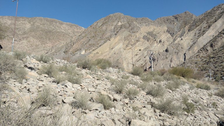
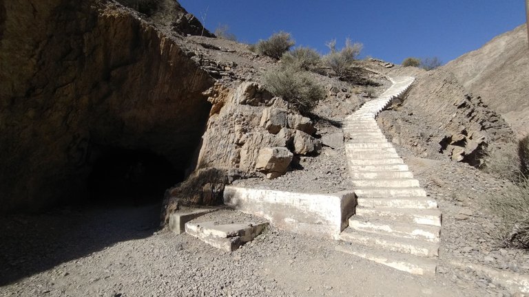
Despite the stairs and the shortness of this path, you still had to take your time so as not to lose your breath. As we climbed, the sunlit mountains decorated our landscape. I also liked that it is an easy and well-prepared trail so that many visitors can reach it ❤️.
A pesar de las escaleras y de lo corto de este camino, igualmente había que tomarse su tiempo para no perder el aire. A medida que ibamos subiendo, las montañas iluminadas por el sol decoraban nuestro paisaje. También me gustó que sea un sendero fácil y bien preparado para que muchos visitantes puedan llegar hasta él ❤️.
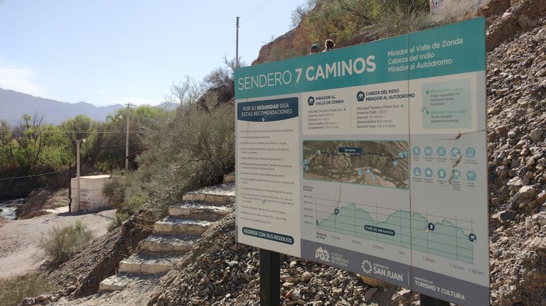
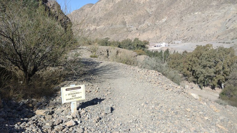
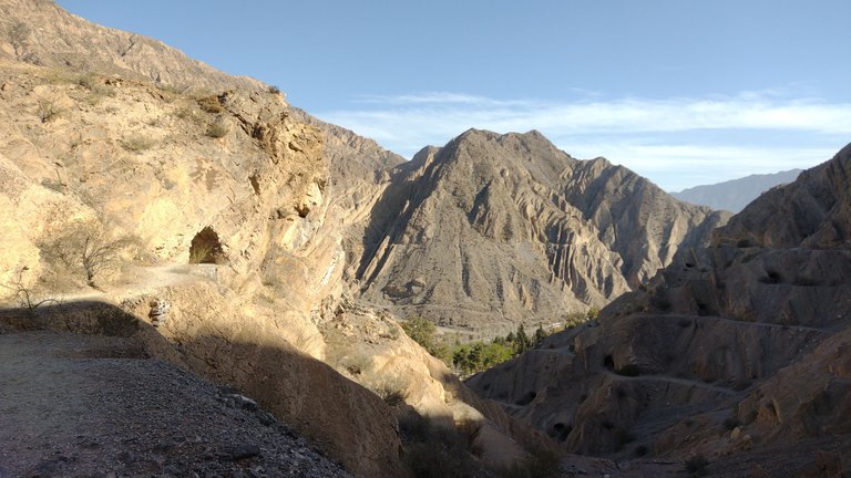
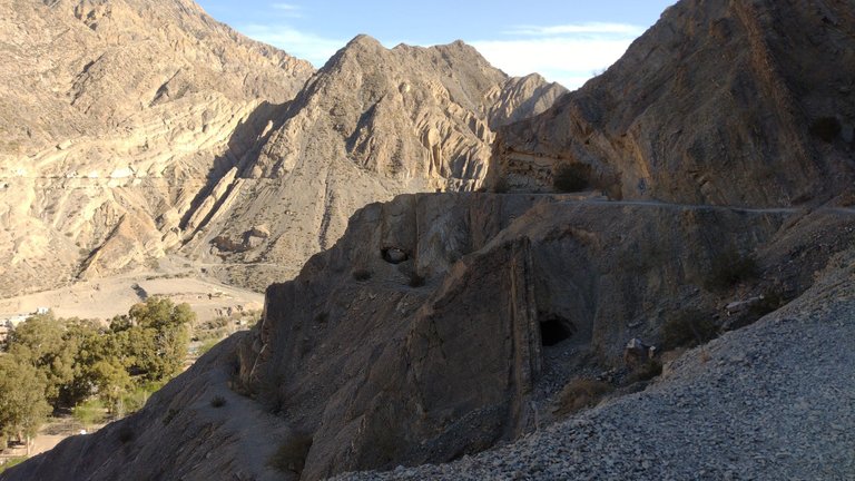
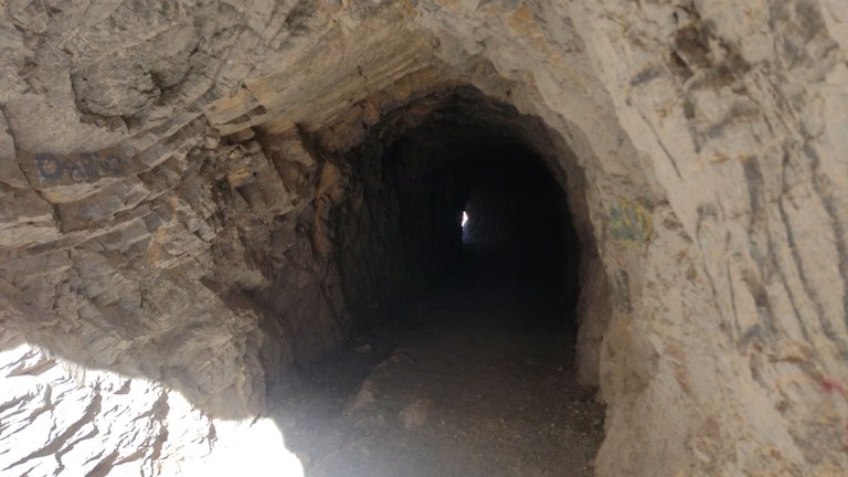
When we first started the climb, we saw a sign indicating that this trail was called "Seven Paths", but we didn't understand why until we were a little higher. Apparently, this path was originally some kind of level paths that went through some caves from one side to the other. Unfortunately, these trails had non-allowable signs, forcing you to climb the stairs until you reach the top 😶.
Cuando recién empezamos la subida, vimos un cartel que indicaba que este sendero se llamaba "Siete Caminos", pero no entendimos el por qué hasta que estuvimos un poco más arriba. Aparentemente, este sendero era originalmente una especie de distintos niveles de caminos que atravesaban unas cuevas de un lado al otro. Lamentablemente, estos senderos tenían carteles de no habilitados, obligándote a subir las escaleras hasta llegar a la cima 😶.
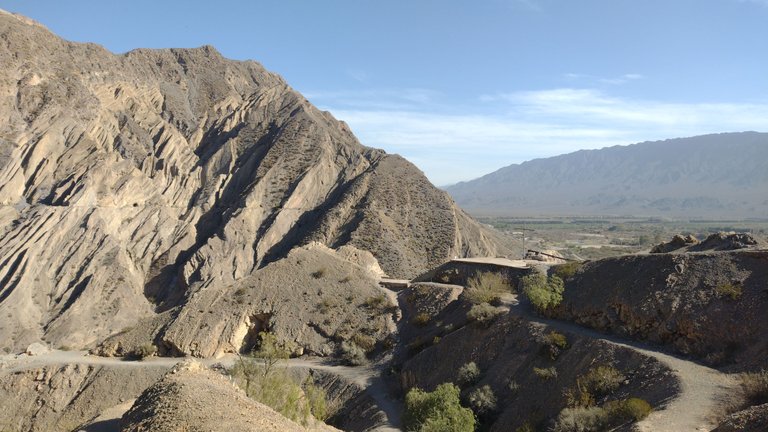
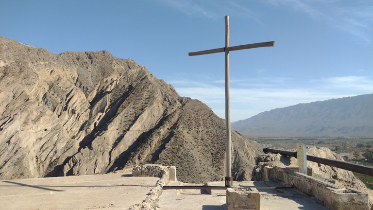
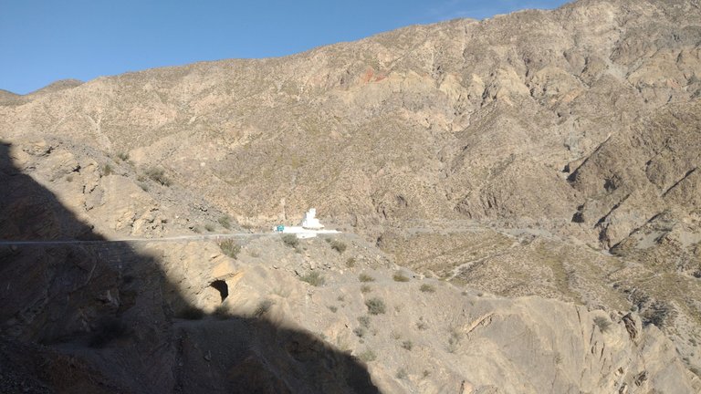
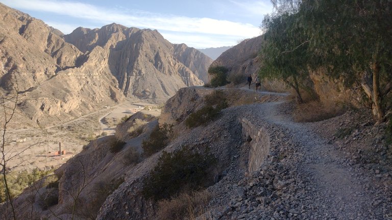
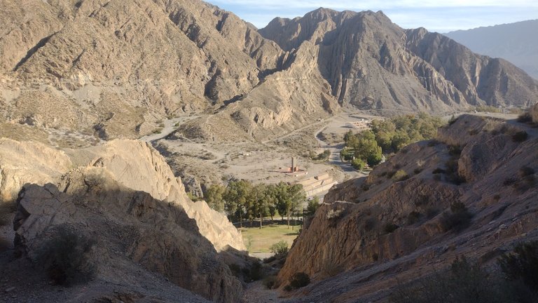
At the end of this route you could find a large white cross, a paved beach and a beautiful view of the Zonda valley. Everything was very photographable from up there and most people just stayed here enjoying the landscape. But we were not one of those and since we still had a lot of energy, we walked a little more 😅.
En el fin de este recorrido podías encontrarte con una gran cruz blanca, un playón pavimentado y una hermosa vista al valle de Zonda. Todo era muy fotografiable desde ahí arriba y la mayoría de las personas solo se quedaban acá disfrutando el paisaje. Pero nosotros no fuimos de esos y como todavía teníamos mucha energía, caminamos un poco más 😅.
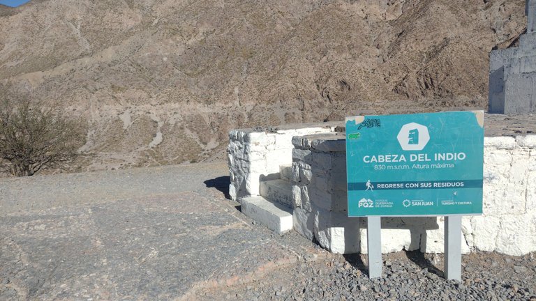
If you like to walk a little further, you can continue the path to your right along a fairly easy path but which may take a little time. The sign indicated that almost in the middle of the ravine was the Cabeza del Indio monument, so we went there 😃.
Si te gusta caminar un poco más, podes continuar el sendero hacia tu derecha por un camino bastante fácil pero que quizás lleve un poco de tiempo. La cartelería indicaba que casi en la mitad de la quebrada se encontraba en monumento Cabeza del Indio, así que hacia allá fuimos 😃.
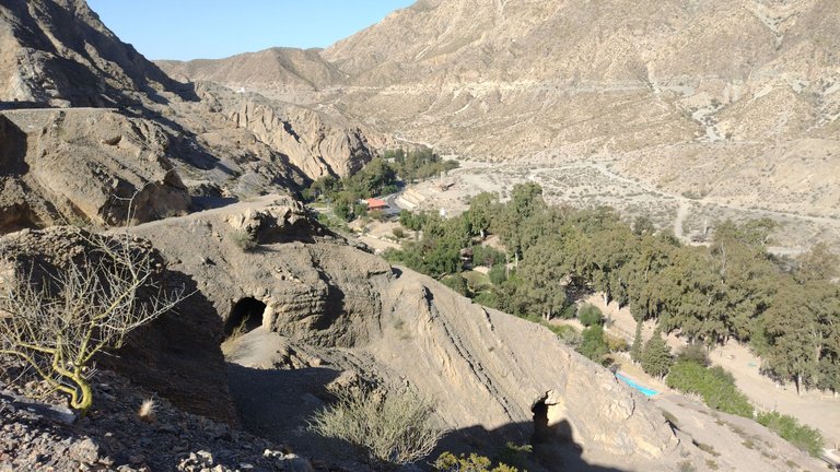
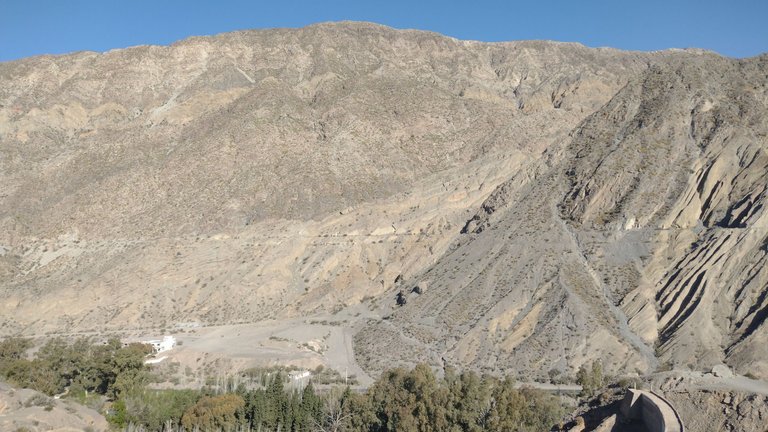
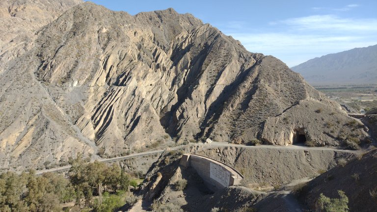
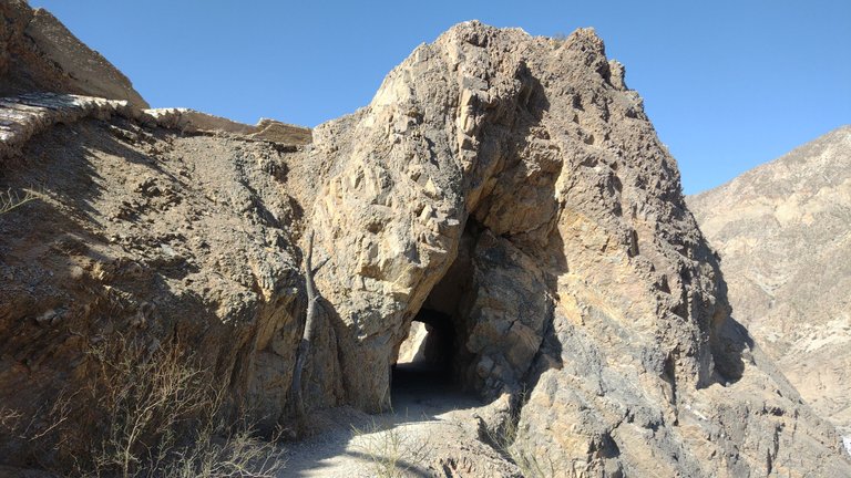
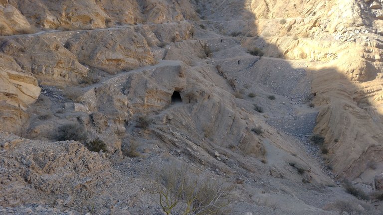
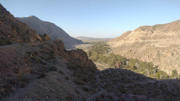
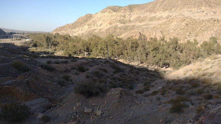
The reality is that the whole hard part was just climbing the stairs up there, because the rest of the way was mostly flat. As we went along the ravine, we could see more and more caves appearing in the landscape. These caves were like small anthills in the immensity of the mountain, and each one was on a different path 😃.
La realidad es que toda la parte difícil solo fue subir las escaleras hasta ahí arriba, porque el resto del camino era principalmente plano. A medida que íbamos recorriendo la quebrada, podíamos ver cada vez más cuevas que aparecían en el paisaje. Estas cuevas eran como pequeños hormigueros en la inmensidad de la montaña, y cada una estaba en un sendero diferente 😃.
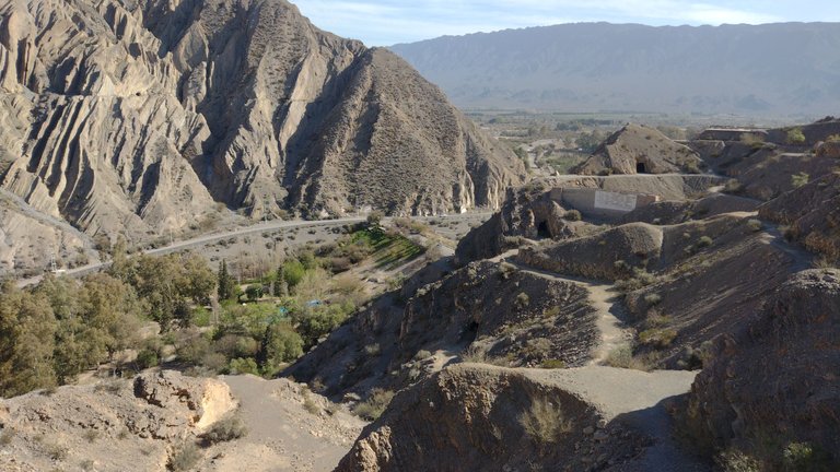
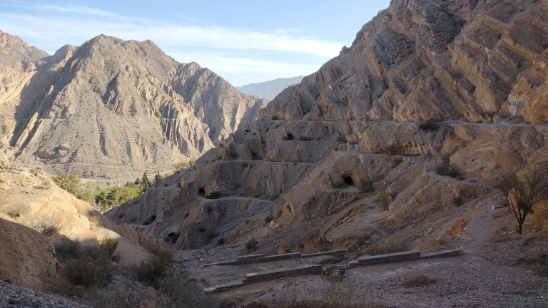
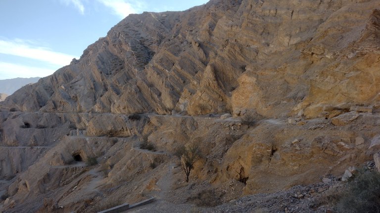
From there I could deduce that surely each of the seven paths that we had seen at the beginning would correspond to a different level of path with caves. As we climbed to the top of everything, we were traveling along the upper path. In reality, this was the only one that was apparently enabled, safe due to the constant risk of collapse in this area with constant seismic activity 😶.
De ahí pude deducir que seguramente cada uno de los siete caminos que habíamos visto al principio correspondería a un nivel diferente de sendero con cuevas. Como nosotros subimos hasta arriba de todo, estábamos transitando por el sendero superior. En realidad, este era el único que aparentemente estaba habilitado, seguro por el riesgo constante de derrumbe que hay en esta zona con constante actividad sísimica 😶.
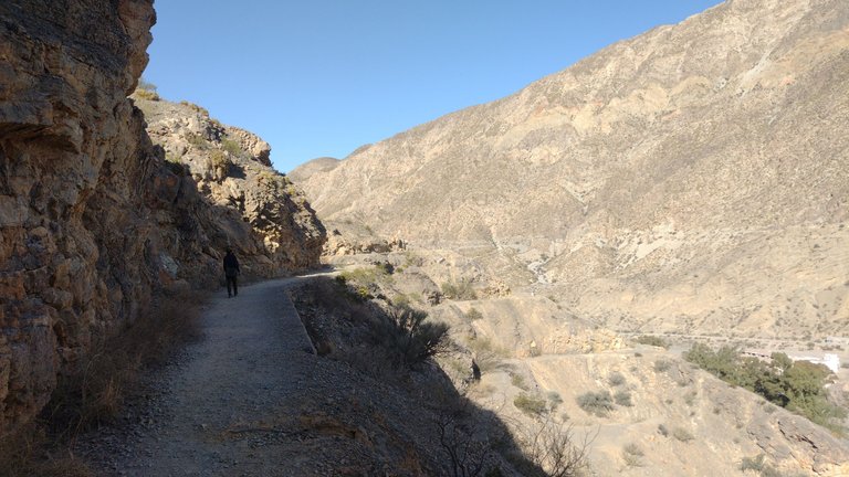
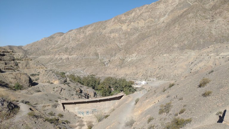
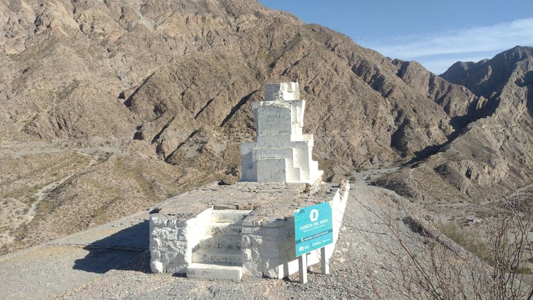
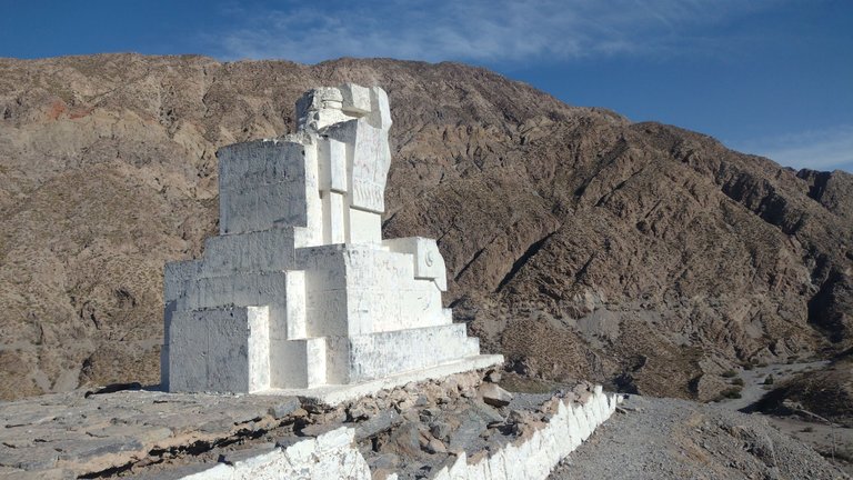
After a little more than 45 minutes of walking looking at the route below us, we began to approach what would be the famous monument. Something funny that happened to us is that on the billboard at the beginning there was no photo of the monument, so we expected to see a mountain shaped like an Indian. We clearly realized that this was not the case when we saw a white block appear in the middle of the orange landscape 😅.
Después de un poco más de 45 minutos de caminata viendo la ruta abajo nuestro, empezamos a acercarnos a lo que sería el famoso monumento. Algo gracioso que nos pasó es que en la cartelería del inicio no había ninguna foto del monumento, así que nosotros esperábamos ver una montaña con forma de indio. Claramente nos dimos cuenta de que esto no era así cuando vimos aparecer un bloque blanco en medio del paisaje anaranjado 😅.

I must say that that day I did not find the shape of an Indian head on the monument, but in my subsequent visits to the Zonda ravine and seeing the monument from another angle, I knew that I did not take the photos correctly. So at that moment I thought "what imagination do you have to have to see the shape", but at least I was satisfied with the views from up there 😅.
Debo decir que ese día no le encontré la forma de cabeza de indio al monumento, pero en mis visitas posteriores a la quebrada de Zonda y viendo el monumento desde otro ángulo, supe que no le tomé las fotos correctamente. Así que en ese momento pensé "que imaginación hay que tener para verle la forma", pero al menos quedé conforme con las vistas desde ahí arriba 😅.
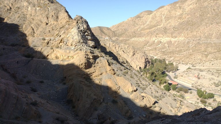
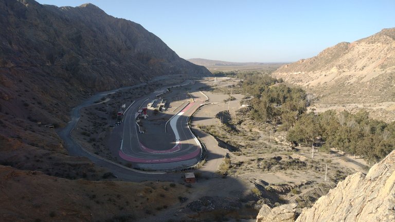
We thought we would get to the monument and that would be it, but to our surprise the path continued and continued. We, curious as always, continued until we were able to find a viewpoint with a good view of the abandoned racetrack. This racetrack has not been used for several years due to various accidents that occurred there, in addition to the fact that another larger and better racetrack was built in the province of San Juan. For now, only its nostalgic memory remains adorning the landscape 😶.
Pensábamos que llegaríamos hasta el monumento y eso sería todo, pero para nuestra sorpresa el camino continuaba y continuaba. Nosotros, curiosos como siempre, seguimos hasta que pudimos encontrarnos con un mirador hacía una buena vista al autódromo abandonado. Este autódromo no se utiliza hace varios años debido a diversos accidentes ocurridos ahí, además de que en la provincia de San Juan se construyó otro autódromo más grande y mejor. Por ahora, solo queda su recuerdo nostálgico adornando el paisaje 😶.
Of course we continued and continued walking, but little by little we realized that the path did not seem to go down the mountain at any time. We had two options: retrace our steps to civilly descend the stairs, or descend "wildly" along an improvised path. I will leave it to your discretion which option my friends and I chose, considering that the sun was already setting and that it was very close to our return bus arriving 😅.
Por supuesto que seguimos y seguimos caminando, pero poco a poco nos dimos cuenta de que el camino no parecía bajar de la montaña en ningún momento. Teníamos dos opciones: volver sobre nuestros pasos a bajar civilizadamente por las escaleras, o bajar "salvajemente" por un camino improvisado. Dejaré a su criterio cuál opción elegimos mis amigos y yo, considerando que el sol ya se estaba ocultando y que faltaba muy poco para que llegara nuestro colectivo de regreso 😅.
I really liked having arrived in the province of San Juan and discovering in-situ all the things it has to do. I feel that this province does not have as much tourist promotion as others, but that it deserves it because it is beautiful. If you like trekking and hiking, here you can find endless routes of which you could never get bored. It was great to have spent our day there and with each place we visited, we fell more and more in love with this ravine ❤️.
Me gustó mucho haber llegado a la provincia de San Juan y descubrir in-situ todas las cosas que tiene para hacer . Siento que esta provincia no tiene tanta promoción turística como otras, pero que se la merece porque es hermosa. Si te gusta el trekking y el senderismo, acá se pueden encontrar un sin fin de recorridos de los cuales nunca podrías aburrirte. Fue genial haber pasado nuestro día ahí y con cada lugar que conocíamos, nos íbamos enamorando más y más de esta quebrada ❤️.
❤️ Hope you liked this post! Thanks for reading. ❤️
❤️¡Espero que les haya gustado este post! Gracias por leer. ❤️
Lau 💕.
📸 Portada creada en Canva. Todas las imágenes son de mi propiedad 💕.
Muy buenas noches querida @lauramica !
Que linda experiencia, que maravillosos paisajes que pudiste disfrutar. Me imagino lo imponente que debe ser poder observar esos lugares tan lindos y cargados de bellas energías.
Siempre digo que una cosa es apreciar las fotos y otra muy diferente vivir la experiencia en persona, donde las emociones, las sensaciones y la energía fluye de una manera muy especial.
No es fácil hacer fotos que llamen la atención de paisajes áridos, pero sin duda has logrado hacer hermosas postales, que generan ganas de conocer esos maravillosos lugares.
Otro paso dado, otro sueño cumplido que llevarás para siempre contigo!
A seguir escuchando el corazón y a hacer todo lo que el te diga! Una vez más te felicito por tu enorme valentía de animarte a vivir la vida que has soñado!
Te dejo un gran abrazo!
Cada rincón que has recorrido en esas montañas, cada escondite descubierto
¡Muchas gracias Pablo! Si, es cierto que siempre en persona todo se ve mucho mejor pero siempre trato de sacar las mejores fotos con lo que tengo jaja. Fue un viaje super genial, la quebrada de Zonda es hermosa... Espero que algún día puedas visitarla ❤️.
Congratulations, your post has been added to Pinmapple! 🎉🥳🍍
Did you know you have your own profile map?
And every post has their own map too!
Want to have your post on the map too?
Wow what spectacular views you seen on these trails. I can imagine the views were even more breath taking in person. It's a good thing you all had lots of energy, haha. I didn't let my imagination drift for too long I wanted to see what the Indian head looked like so I searched, whoops 😂
I love that abandoned race track, too bad it was too dangerous to race on. Probably too scenic for the drivers, haha.
Thanks for sharing it really looks a great hike or trek :)
Thank you, glad you liked it!
Look, that day I didn't see the shape, but on my second to last day in San Juan, I went trekking on the mountain that is right in front... from there I discovered that that is the correct angle hahaha. When you approach it from that caves path you are seeing his back!
I wonder of those caves are human-made or have been there since the beginning..
From what I read, these were paths and caves made by immigrants who sought to extract gold from these mountains...
Currently, these mountains are still being exploited by mining companies, but not in this part. This part is more touristy and walking, all the economic activity is a few km further away.
Wow. Thank you for sharing this adventure @lauramica. It is an amazing mountainous place to trek. Trekking in an adventure is one of my favorites. I like to go to the peak of the mountain to see the overall view below.
Yes, the higher the better. I really enjoy that too :D
Sin duda una gran aventura a pesar de no conseguirse con el monumento que imaginaban. En cuanto a las circunstancias que se presentaban en el momento para irse, considero que bajaron "salvajemente", o por lo menos yo fuese hecho eso😅.
Gracias por compartir, saludos💕
Jajaj por supuesto que bajamos salvajemente, o divertidamente. Fue más rápido y más memorable que haber vuelto atrás 😅.
Saludos y muchas gracias por pasar ❤️
Good afternoon dear friend @lauramica, how are you?
What a beautiful experience you have had in this beautiful province, you have seen very beautiful places, I love hiking in the mountains, especially if you have a beautiful view of the top.
Beautiful photographs, you have taken very beautiful shots, I appreciate that you have shared this pleasant experience and the beautiful images
have a wonderful afternoon
Thank you very much Luis :) Everything was very beautiful in this area, and if you like hiking even more. I had a great time, and seeing the photos is like remembering the whole moment all over again. Thank you for your visit ❤️.
Wow, this place looks really interesting. Thank you for sharing with us 😊
Thank you for stopping by ❤️
Hiya, @livinguktaiwan here, just swinging by to let you know that this post made it into our Top 3 in Travel Digest #2052.
Your post has been manually curated by the @pinmapple team. If you like what we're doing, please drop by to check out all the rest of today's great posts and consider supporting other authors like yourself and us so we can keep the project going!
Become part of our travel community:
Thank youuuuu ❤️
Beautiful site. Magnificent
Thank you! :)