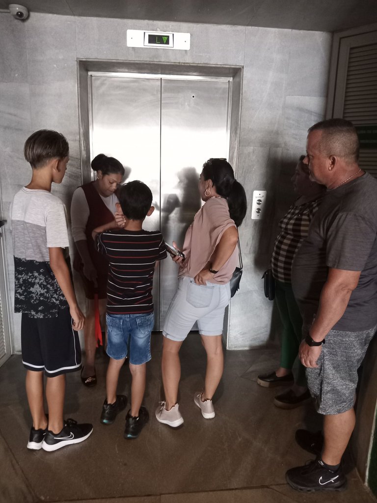
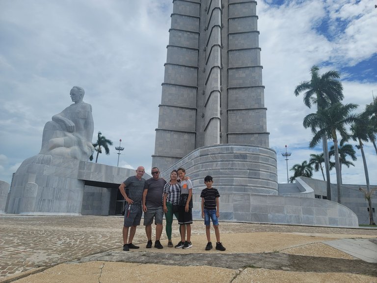
Without wasting any more time, we dressed appropriately and went as a group, walking and talking about the area, the way to get there and other familiar topics. The children were running around us making a good expenditure of energy that would ensure that they would not disturb the house so much.
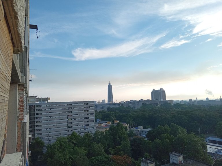
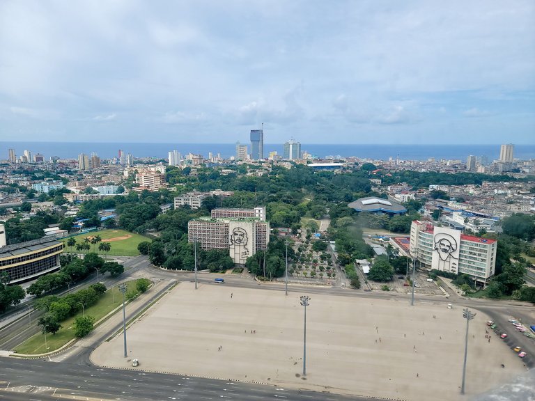
The monument to José Martí is located in an area between Paseo Avenue, which in that area almost runs from east to west, and trapped between two branches that lead to Rancho Boyeros Avenue: one that carries vehicular traffic from north to south and is officially called Carlos Manuel de Céspedes Avenue and the other, which runs in the opposite direction, called Independencia Avenue. The Plaza de la Revolución is located next, limited to the north by Aranguren Street. In that area is where the population is concentrated in events and commemorations.
Sin perder más tiempo, nos vestimos apropiadamente y fuimos en grupo, caminando y conversando sobre la zona, la vía para acceder allí y otros temas familiares. Los niños correteaban a nuestro alrededor haciendo un buen gasto de energía que garantizaría que no molestaran tanto en la casa.
El monumento a José Martí se encuentra en una zona comprendida entre la avenida Paseo, que en esa zona casi va de este a oeste, y atrapada entre dos ramas que desembocan en la Avenida de Rancho Boyeros: una que lleva el tráfico de vehículos de norte a sur y que se llama oficialmente Avenida Carlos Manuel de Céspedes y otra, que va en sentido contrario, llamada Avenida Independencia. La Plaza de la Revolución se encuentra a continuación, limitada al norte por la calle Aranguren. En esa zona es que se concentra la población en eventos y conmemoraciones.
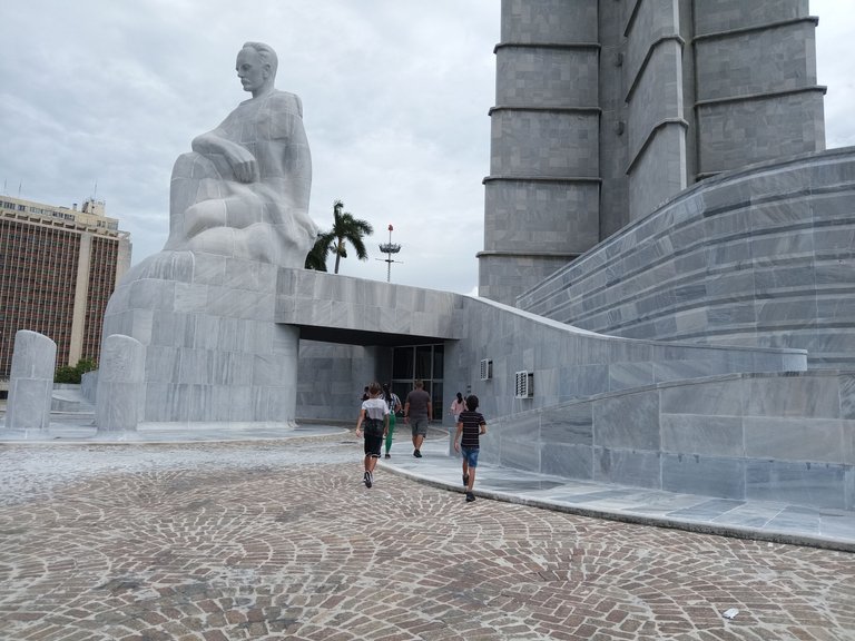
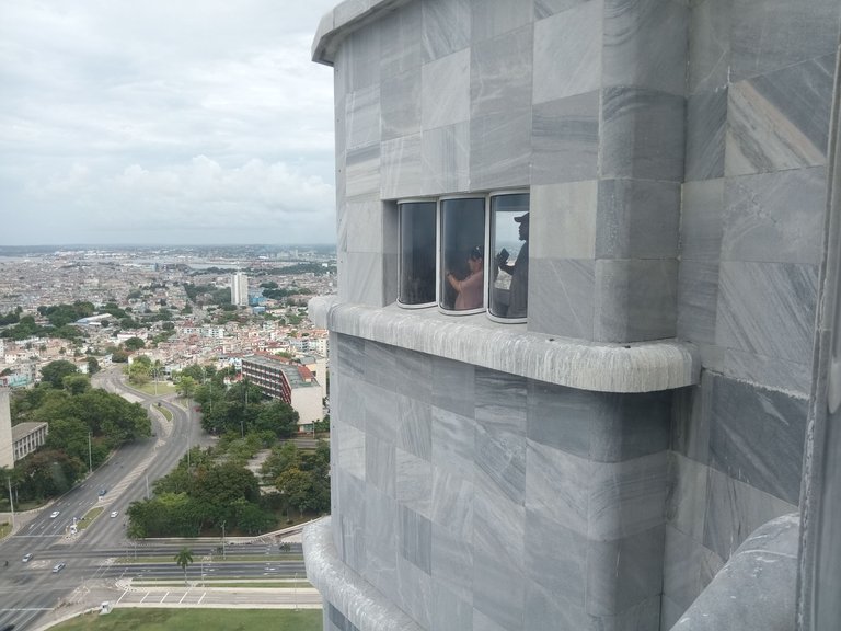
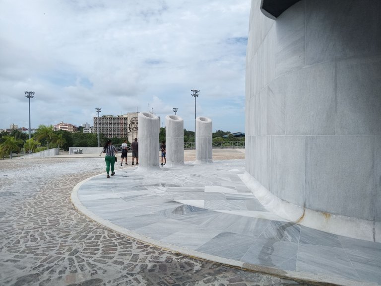
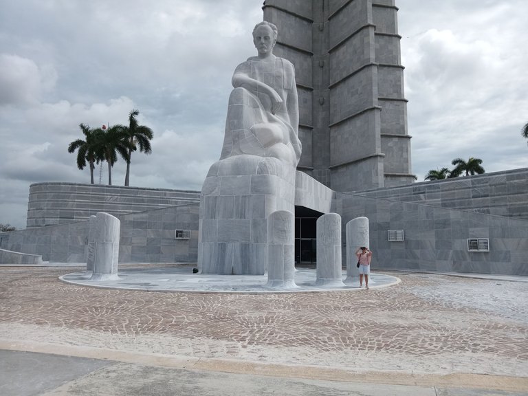
To get to the entrance of the museum, which is located on the first floor of the monument, where there is a small esplanade, you have to go up one of the side ramps designed for that purpose. When I got there, I slowed down a bit to take a couple of snapshots of the family entering the museum.
Apart from the recreational aspects, the pleasant fresh air and the light overcast of that day that favors a diffused and comfortable illumination for the eyes, I could not help but stop to appreciate the architectural beauty of the building.
Para llegar a la entrada del museo, que radica en la planta baja del monumento, donde hay una pequeña explanada, hay que subir por una de las rampas laterales concebidas para esa función. Al llegar allí, me retrasé un poco para tomar un par de instantáneas donde ve a la familia entrando al museo.
Al margen de los aspectos recreativos, del agradable aire fresco y del nublado ligero de ese día que favorece una iluminación difuminada y cómoda para la vista, no pude evitar detenerme a apreciar la belleza arquitectónica del edificio.
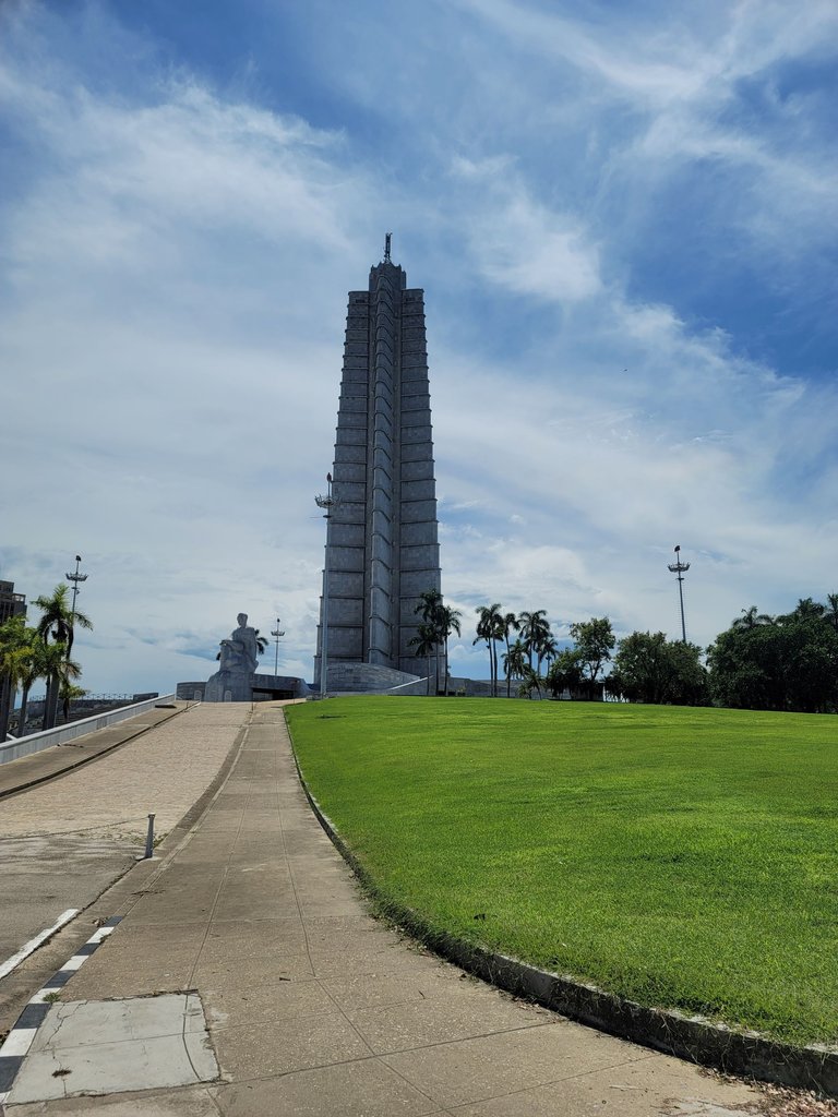
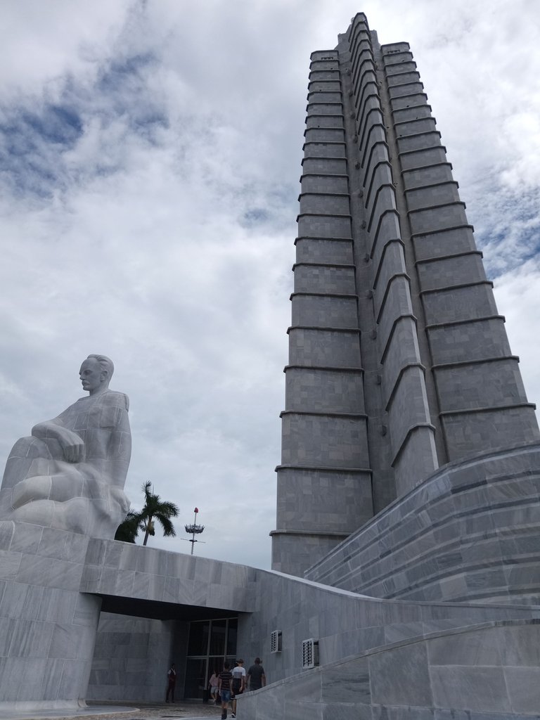
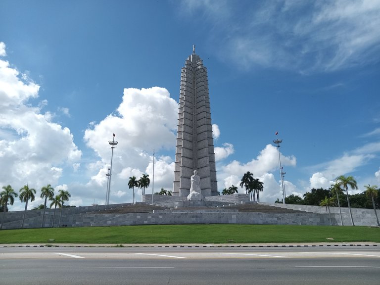
The figure of José Martí, pensive, with a defined shape in the upper part and in the face, but semi-fused with the marble rock as we look closer to the base, gives us the impression that it has been suffering for centuries the action of wind and water that have been wearing away the forms. Likewise, it gives the impression that it could be there for several more centuries. The obelisk, in the shape of a star, reminded me of the solitary star of the Cuban flag, but I don't know why the poem "Yugo y Estrella", written by the apostle, came to my mind. I recommend that you look it up, because it raises the dilemma that we all have to serve meekly and live on what the master provides, or have the courage to carry the light, suffer loneliness and grow with effort. You will not regret it: they are beautiful verses.
La figura de José Martí, pensativo, con forma definida en la parte superior y en el rostro, pero semi fundida con la roca de mármol en la medida que miramos más cerca de la base, nos da la impresión de que lleva siglos sufriendo la acción del viento y el agua que han ido desgastando las formas. Así mismo, da la impresión de que podría estar ahí por varios siglos más. El obelisco, en forma de estrella, me recordó la estrella solitaria de la bandera cubana, pero no sé porque me vino a la mente el poema “Yugo y Estrella”, escrito por el apóstol. Les recomiendo que lo busquen, porque plantea la disyuntiva que tenemos todos de servir mansamente y vivir de lo que provee el amo, o tener el valor portar la luz, sufrir soledad y crecer con esfuerzo. No se arrepentirán: son versos bellísimos.
In studies I have read about the pyramids, there is talk of their religious purpose, of their emphasis on pointing to the sky, as if they were a launching pad for the spirit of the pharaohs (in the case of the Egyptian ones) or the prayers of the priests (in the case of the American ones). In any case, I get the impression that the architect who designed it had a similar idea in mind.
I had never looked at this monument from that point of view before. I had always related it to a January 1st, a May 1st or other political events.
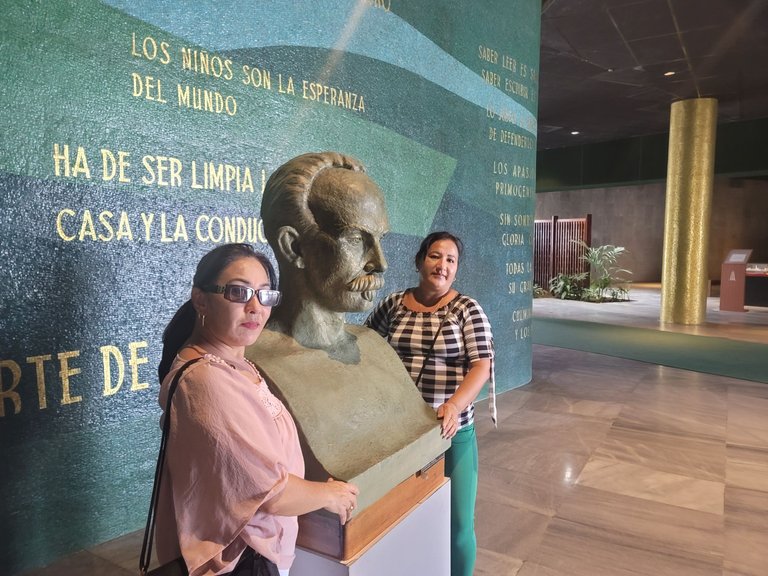
Inside the premises on the first floor, we find ample spaces and a 5 to 6-meter prop. The place has several areas separated by curved partitions, with a finish that simulates granite and adorned with golden writings that reproduce phrases and verses of José Martí. The atmosphere is cozy and at the same time imposing with some areas of flower beds with ornamental plants that complement the decoration.
En estudios que he leído sobre las pirámides, se habla de su propósito religioso, de su énfasis en apuntar al cielo, como si fuera una plataforma de lanzamiento para el espíritu de los faraones (en el caso de las egipcias) o de las plegarias de los sacerdotes (en el caso de las americanas). En cualquier caso, me da la impresión de que el arquitecto que la diseñó tenía en mente una idea similar.
Nunca antes había mirado este monumento desde ese punto de vista. Siempre lo había relacionado con un 1ro de enero, con un 1ro de mayo o con otros eventos políticos.
Dentro del local de la planta baja, encontramos amplios espacios y un puntal entre 5 y 6 metros. El lugar cuenta con varias áreas separadas por tabiques curvos, con terminación que simula granito y adornadas con escrituras doradas que reproducen frases y versos de José Martí. El ambiente es acogedor y a la vez imponente con algunas zonas de canteros con plantas ornamentales que complementan la decoración.
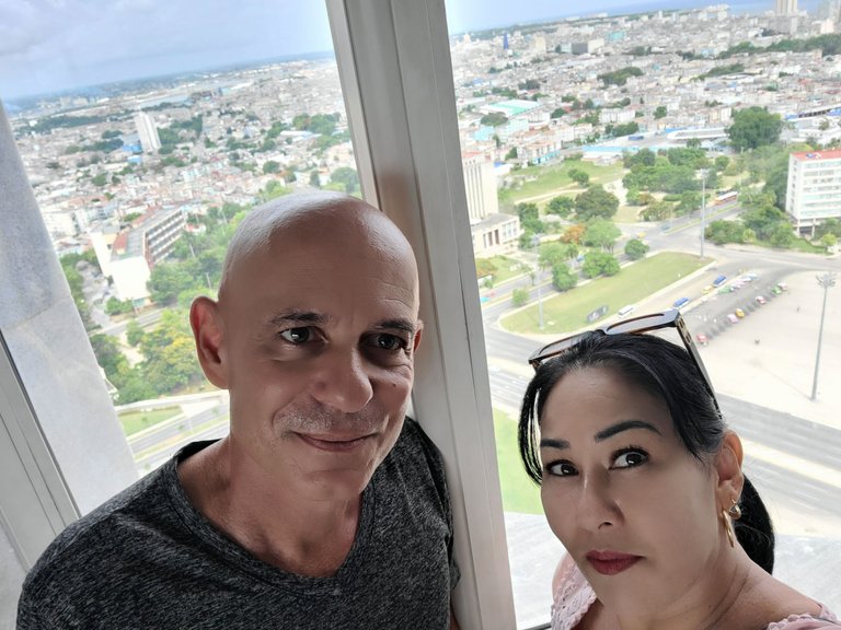
The only one in the group not pictured is Anais, my wife, who agreed to photograph us with her Samsung Note 20 Ultra 5G.
La única del grupo que no aparece en la foto es Anais, mi esposa, que accedió a fotografiarnos con su Samsung Note 20 Ultra 5G.
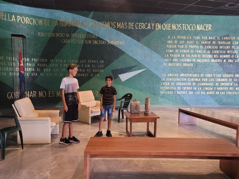
In this area, we see a sort of living room, with nice varnished wooden tables and vinyl-covered armchairs. A couple of plastic chairs that must have been left there by some custodian of the facility are a bit out of place. Behind, one of the curved dividing walls that delimit the spaces without reaching the ceiling. Zainel and Caleb, from left to right, served as my models on this
occasion.
En esta área, vemos una especie de sala de estar, con bonitas mesas de madera barnizada y butacas forradas en vinil. Desentona un poco un par de sillas plásticas que debe haber dejado allí algún custodio de la instalación. Detrás, uno de los muros curvos divisorios que delimitan los espacios sin llegar al techo. Zainel y Caleb, de izquierda a derecha, me sirvieron de modelos en esta ocasión.
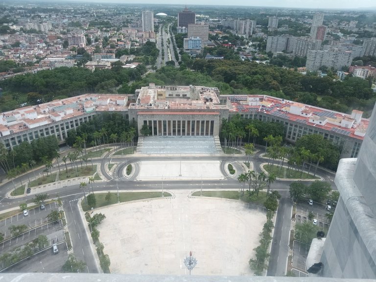
During the wait, I told my sister-in-law that, for the construction of the great monument, an international architectural competition was held in which several projects participated.
To make this review, I looked for more details and I tell you: The idea of this contest arose in the 40's of the last century. Although in 1943, the winning project was known, it was not until 1952 that the idea was taken up again because the following year the centenary of the birth of José Martí would be commemorated. The government decided that, because of its vertical structure, the design that won third place was more appropriate to be built. For this, no state funds were allocated, but a collection was made for that purpose.
The construction was not completed until 1958 and the official inauguration was in 1961. The height of the reinforced concrete construction is 112.75 meters and if we measure up to the flags and lighthouses, we obtain almost 142 meters. The statue of Martí that guards the base of themonument measures 18 meters and is made of 52 solid blocks of marble.
I always wondered what the meaning of the cylindrical columns surrounding the apostle was. It turns out that there are 6 of them and they represent the provinces into which the Cuban territory was divided at that time. One finds it hard to relate because from 1976 to 2010, Cuba had 14 provinces and one special municipality. As of 2011 the former province of Havana was divided into Artemisa and Mayabeque and the City of Havana changed its name to Havana.
Después de recorrer y explotar toda la planta baja, fuimos a subir al mirador. Al parecer había muchas personas visitándolo, porque nos pidieron que esperáramos a que bajara un grupo. La otra forma de subir es por una escalera que tiene 567 escalones.
Durante la espera, le comentaba a mi concuña que, para la construcción del gran monumento, se realizó un concurso internacional de arquitectura en el que participaron varios proyectos.
Para hacerles esta reseña, busqué más detalles y les cuento: La idea de este concurso surgió en los años 40 del siglo pasado. Aunque en 1943, se conoció el proyecto premiado, no fue hasta 1952 que se retomó la idea porque al año siguiente se conmemoraría el centenario del nacimiento de José Martí. El gobierno decidió que, por su estructura vertical, era más apropiado el diseño que obtuvo el tercer lugar para ser construido. Para esto, no se destinaron fondos del estado, sino que se realizó una recaudación con ese propósito.
La construcción no se terminó hasta el año 1958 y la inauguración oficial fue en 1961. La altura de la construcción de hormigón armado tiene 112.75 m y medimos hasta las banderas y faros de posición, obtenemos casi 142 m. La estatua de Martí que custodia la base del monumento mide 18 metros y está conformada por 52 bloques macizos de mármol.
Siempre me pregunté qué significado tenían las columnas cilíndricas que rodean al apóstol. Resulta que son 6 de ellas y representan las provincias en las que se dividía el territorio cubano en aquella época. A uno le es difícil relacionarlo porque desde 1976 hasta el 2010, Cuba tuvo 14 provincias y un municipio especial. A partir del 2011 la antigua provincia de La Habana se dividió en Artemisa y Mayabeque y la Ciudad de La Habana cambió su nombre por La Habana.
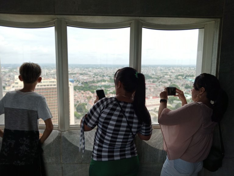
As you can see, my wife and sister-in-law set out to take advantage of the breathtaking views that surrounded us.
Ya en el mirador, que tiene una planta en forma de estrella, como el resto de la torre, pudimos ver que está rodeado de ventanas con grandes cristales curvos diseñados para soportar la fuerza de cualquier huracán e incluso el impacto de objetos de tamaño mediano. No obstante, tienen además una transparencia adecuada para tomar fotografías de bastante calidad.
Como pueden ver, mi esposa y mi cuñada se pusieron en función de aprovechar las vistas impresionantes que nos rodeaban.
In modern life, we are accustomed to activities that require us to see at small distances, at home, at school, at work, but it is not normal to focus our eyes to infinity to see objects that are more than 10 km away.
There are scientists who believe that this is the cause of the high statistics of myopia because the eyes, during life and from generation to generation, are losing the ability to focus for long distances.
En la vida moderna, nos acostumbramos a actividades que requieren ver a pequeñas distancias, en la casa, la escuelas, el trabajo, pero no es normal enfocar la vista al infinito para ver objetos que se encuentran a mas de 10 km de distancia.
Hay científicos que plantean que esta es la causa de las altas estadísticas de miopía porque los ojos, durante la vida y de generación en generación, van perdiendo la capacidad de enfocarse para las grandes distancias.
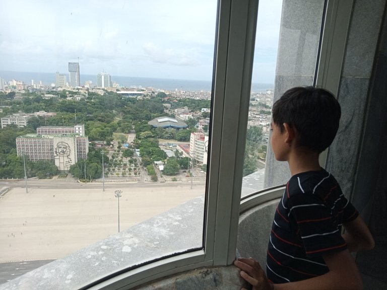
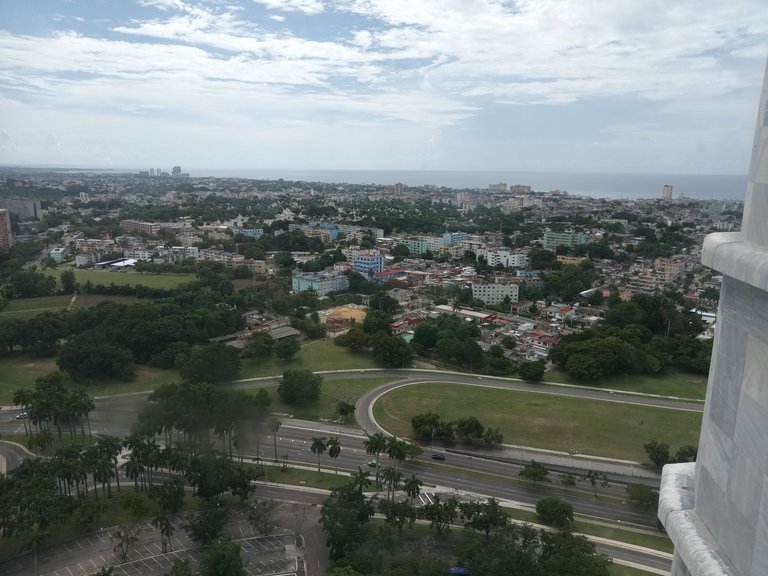
To the right we can see the intersection of Avenida de Rancho Boyeros with Avenida Paseo. The latter forks into the streets "20 de Mayo" and "Manglar", which move away into the Cerro municipality. Above, to the right, part of Havana Bay can be seen.
A la derecha podemos ver la intercepción de la Avenida de Rancho Boyeros con la Avenida Paseo. Esta última se bifurca hacia las calles “20 de Mayo” y “Manglar, que se alejan adentrándose en el municipio Cerro. Arriba, a la derecha, puede distinguirse parte de la bahía de La Habana.
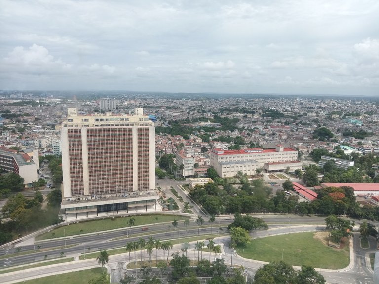
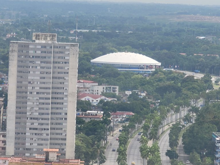
Boyeros Avenue itself can be seen zigzagging off into the distance with its lane dividers lined with royal palms. Along its route it passes by the José Martí Airport and ends in the town of Santiago de las Vegas. On a trip by car, we will see many buildings with various functions, such as factories, schools, homes, polyclinics, recreational centers, etc., but two or three blocks further back, away from the roadway, vegetation will predominate.
If you look closely, you will see above, in the center, an elevated tank, model "Güira", which is located more than 20 km away, in the municipality of La Lisa.
La propia Avenida de Boyeros, puede apreciarse zigzagueando hacia la distancia con sus separadores de carriles poblados de palmas reales. A lo largo de su recorrido pasa por el Aeropuerto José Martí y termina en el pueblo de Santiago de las Vegas. En un viaje en auto, veremos muchas construcciones con diversas funciones, como fábricas, escuelas, viviendas, policlínicos, centros recreativos, etc., pero dos o tres cuadras más atrás, alejándose de la calzada, predominará la vegetación.
Si miran con atención, verán arriba, al centro, un tanque elevado, modelo “Güira”, que se encuentra a más de 20 km de distancia, en el municipio La Lisa.
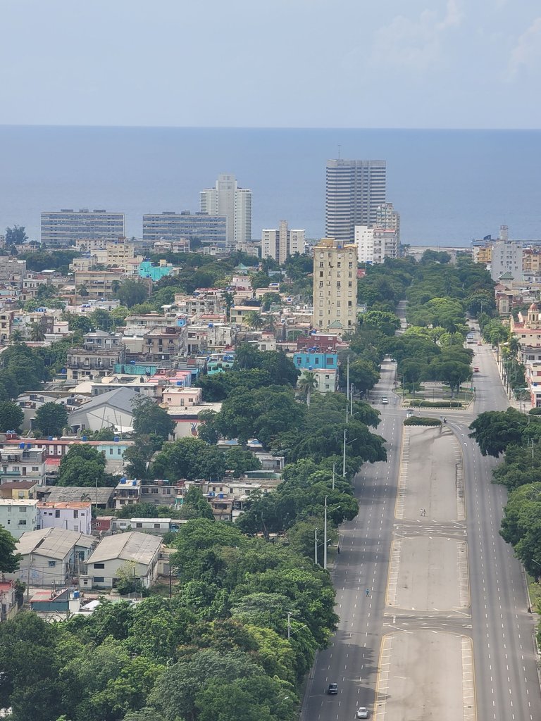
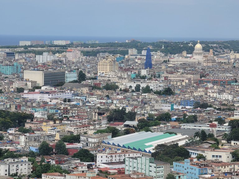
Practically in the center of the photo we have the National Theater. To the right, we can see the mural with the face of Che Guevara on the wall of the Ministry of the Interior building. Between these two is the El Desa stadium. That's where I took physical education classes during my pre-university years. To its right, almost hidden by the trees, is the Ministry of Construction. Behind, more to the center, painted in yellow ochre and red, is the building shared by the Manuel Fajardo Hospital and the Endocrinology Institute.
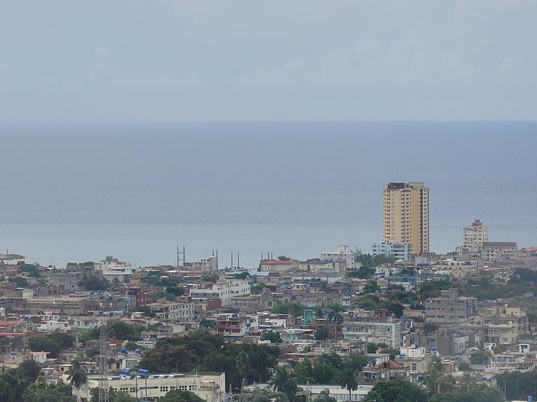
Behind there is a large residential area with medium and small buildings, but cut out against the blue background of the sea we see a series of buildings that attract attention. Some older ones alternate with others of recent construction. The Habana Libre Hotel, on the upper right, now seems small compared to the "K Tower" on the left. The latter, still under construction, makes the Focsa building look rather unimportant from this point of view. Keep in mind that the Focsa is almost at sea level and the Torre K much higher, after climbing a steep slope, on 23rd Street.
According to documentation consulted, the horizon line we see from this viewpoint is about 60 km
away.
Prácticamente en el centro de la foto tenemos al Teatro Nacional. A la derecha, podemos ver el mural con el rostro del Che Guevara en la pared del edificio del Ministerio del Interior. Entre estos dos, esta el estadio El Desa. Ahí me dieron clases de educación física durante el preuniversitario. A su derecha, casi oculto por las arboledas, se encuentra el Ministerio de la Construcción. Detrás, mas al centro, pintado de amarillo ocre y rojo está el edificio que comparten el Hospital Manuel Fajardo con el Instituto de Endocrinología.
Detrás hay una amplia zona residencial con edificaciones medianas y pequeñas, pero recortados sobre el fondo azul del mar vemos una serie de edificios que llaman la atención. Se alternan algunos más viejos con otros de reciente construcción. El Hotel Habana Libre, arriba a la derecha, ahora parece pequeño comparado con la “Torre K” que se encuentra a su izquierda. Esta última, aún en construcción hace que el edificio Focsa parezca algo sin importancia desde este punto de vista. Hay que tener en cuenta que el Focsa se encuentra casi a nivel del mar y la Torre K mucho más arriba, después de subir una buena pendiente, en la calle 23.
Según documentación consultada, la línea del horizonte que vemos desde este mirador se encuentra a unos 60 km de distancia.
On the right of the photo, we see the image of Camilo Cienfuegos on the wall of the Ministry of Communications building. Further back we see Havana's bus terminal. In the upper right corner of the visible area of the city, we see the Hermanos Ameijeiras Hospital.
It is worth noting the amount of vegetation that adorns this part of the city, intertwined with buildings from different eras.
A la derecha de la foto, vemos la imagen de Camilo Cienfuegos sobre la pared del edificio del Ministerio de comunicaciones. Mas atrás la terminal de ómnibus de La Habana. En la esquina superior derecha de la zona visible de la ciudad, vemos el hospital Hermanos Ameijeiras.
Es de notar la cantidad de vegetación que adorna esta parte de la ciudad, entrelazada con las construcciones de diferentes épocas.
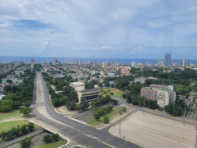
Among the buildings that stand out, we find, almost in the center of the image, the Great Masonic Temple of Cuba, with its characteristic globe crowning it. To its left, the Ministry of Energy and Mines. Further to the right, covered in protective netting, because it is in the process of restoration, the Church of the Sacred Heart of Jesus (everyone knows it as the Church of Reina). Further to the right, with its striking golden dome, the capitol of Havana. If you enlarge the image, you will see to the left of the dome, the Institute of Meteorology, which is located in Casa Blanca, on the other side of the bay. Further to the left, surrounded by vegetation, you will see the Christ of Havana. Further up, with its silhouette silhouetted against the sea, you can see the Pan American Stadium. This is the farthest recognizable construction in that direction and is 8 km away. The buildings on the left, on the coast, belong to the Camilo Cienfuegos neighborhood in the municipality of Habana del Este.
Entre los edificios que resaltan, encontramos, casi en el centro de la imagen, el Gran Templo Masónico de Cuba, con su característico globo terráqueo coronándolo. A su izquierda, el Ministerio de Energía y minas. Mas a la derecha, forrada en mallas de protección, por estar en proceso de restauración, la Iglesia del Sagrado Corazón de Jesús (todos la conocen por Iglesia de Reina). Más a la derecha, con su llamativa cúpula dorada, el capitolio de La Habana. Si amplían la imagen, verán a la izquierda de la cúpula, el Instituto de Meteorología, que se encuentra en Casa Blanca, al otro lado de la bahía. Mas a la izquierda, rodeado de vegetación verán al Cristo de la Habana. Más arriba, con su silueta recortada sobre el mar, se aprecia el Estadio Panamericano. Esta es la construcción más lejana reconocible en esa dirección y se encuentra a 8 km. Los edificios que se observan a la izquierda, en la costa, pertenecen al reparto Camilo Cienfuegos, del municipio Habana del Este.
After everyone had enjoyed the view and commented on our impressions, we called the children who were frolicking around the lookout almost running. We took the elevator again and went back down to the first floor.
Después que todos disfrutaron de las vistas y comentamos nuestras impresiones, llamamos a los niños que retozaban dándole la vuelta casi corriendo al mirador. Tomamos de nuevo el elevador y salimos de nuevo a la planta baja.
Looking at the photo, the monument reminded me again of the pyramids. The lower part looks like a mound like those built with earth by the Celts, but the obelisk and lookout point that tops it, takes it to another level. The elegance of its proportions makes it more pleasing to the eye and more impressive.
Then the same doubt that has crossed the minds of many comes to my mind: Shouldn't José Martí be buried there, instead of resting in the Santa Ifigenia cemetery in Santiago de Cuba? It has been explained to me that he fell in Dos Rios, there in Oriente, that his body was exhumed to confirm his identity, then moved several times and that he should be left to rest in peace. I understand those reasons, but... it would be so perfect if this were his mausoleum.
It is clear, however, that our apostle does not need any launching pad to immortality. He earned it with all the ideological legacy he left us, with his preaching for years of Cuban independence and by signing his work with his blood, giving his life for freedom. Without any doubt, he will be remembered by many generations of Cubans.
Mirando la foto, el monumento volvió a recordarme las pirámides. La parte baja parece un túmulo como los construidos con tierra por los celtas, pero el obelisco – mirador que lo remata, lo lleva a otro nivel. La elegancia de sus proporciones lo hace mas agradable a la vista y más impresionante.
Entonces me asalta la misma duda que le ha pasado por la mente a muchos: ¿No debería estar José Martí allí sepultado, en vez de descansar en el cementerio de Santa Ifigenia, en Santiago de Cuba? Me han explicado, que él cayó en Dos Ríos, allá en Oriente, que su cuerpo fue exhumado para confirmar su identidad, luego trasladado varias veces y que había que dejarlo descansar en paz. Entiendo esas razones, pero… sería tan perfecto que éste fuera su mausoleo.
Esta claro, de todas formas, que nuestro apóstol no necesita ninguna plataforma de lanzamiento hacia la inmortalidad. Él se la ganó con todo el legado ideológico que nos dejó, con su prédica durante años de la independencia de Cuba y al firmar su obra con su sangre dando su vida por la libertad. Sin ninguna duda, será recordado por muchas generaciones de cubanos.
The vast majority of the photos were taken with my Samsung Galaxy A04 cell phone. Some with my wife's Samsung Galaxy Note 20 Ultra 5G.
The photos were edited only to correct lighting with the Photos application, which is part of the Windows 11 tools.
Searches and measurements on the map were performed with Google Maps and Pinmapple.
The English translation was done with DeepL in its free WEB version.
Bibliography consulted:
Ecured
Congratulations @rafael1192! You have completed the following achievement on the Hive blockchain And have been rewarded with New badge(s)
Your next target is to reach 100 comments.
You can view your badges on your board and compare yourself to others in the Ranking
If you no longer want to receive notifications, reply to this comment with the word
STOPTo support your work, I also upvoted your post!
Check out our last posts:
Thank you for your support!
Congratulations, your post has been added to Pinmapple! 🎉🥳🍍
Did you know you have your own profile map?
And every post has their own map too!
Want to have your post on the map too?
Wow, que amplia tu publicación amigo, le debía un post a esa raspadura gigante que me encanta , sobre todo mirar la Habana desde lo alto, es el lugar más alto de la Habana 👍👍
Thank you! It was also a debt of mine. I think that monument is one of the most striking buildings in Havana. The views from there are beautiful and instructive.
Muy linda descripción del monumento José Marti y de sus alrededores desde planos altos. Muy buena toda la información que nos brinda. Gracias por compartir.
Gracias! Ese día tiramos fotos desde todas las ventanas del mirador. Casi todas me gustaron, pero había que escoger...
Hola
Que vistas más asombrosas! Una pregunta, ya está abierto el Mirador al público entonces? Porque una vez pasé y me dijeron que estaba cerrado. Me gustaría mucho ir, y ahora leyendo tu publicación aún más. Quisiera llevar a mi niña.
Saludos, bellas fotos!
Si!! Esta abierto el mirador! Otras veces he ido y ha estado cerrado. Muchas veces por reparación.
Que bueno saberlo, y no hay que reservar ni nada? Es solo llegar y entrar?
No hay que reservar. Yo fui un sábado. Solo recuerda que los museos no abren los lunes.
Travel Digest #2049.
Become part of our travel community:
- Join our Discord
Hiya, @livinguktaiwan here, just swinging by to let you know that this post made it into our Honorable Mentions in Your post has been manually curated by the @pinmapple team. If you like what we're doing, please drop by to check out all the rest of today's great posts and consider supporting other authors like yourself and us so we can keep the project going!Thank you very much for your support. Yes, I like the topic of travel and visits to places of architectural interest. I will read the posts you recommend.
Wow! a spectacular viewpoint, the sculpture looks in very good condition, the tower is my favorite part, I like the color and design, the photos were excellent, thank you for sharing your incredible visit and a detailed publication.
Greetings!
Thank you for your comments. It really is an interesting place to visit. In fact, many tourists go to the square and take pictures of the monument from there.