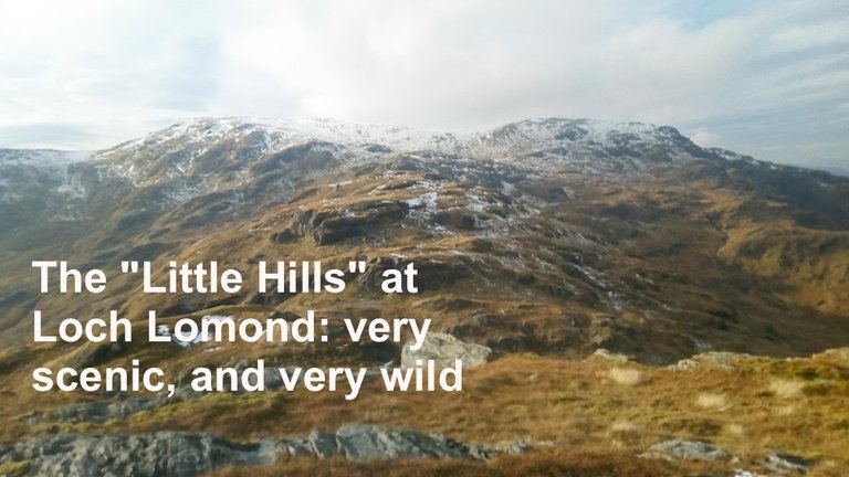
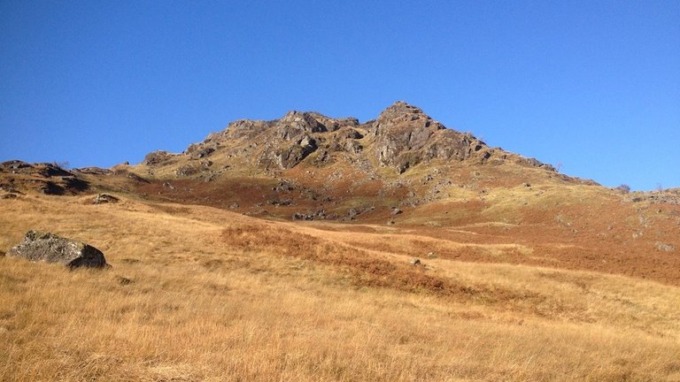
Could any hills be less appropriately named? The "Little Hills" of Arrochar are rough, rocky and not little at all!
At altitudes of 793m and 808m, the only thing "little" about these hills is that they are not quite as big as their close neighbour, the Ben Vorlich, 943m a wonderfully steep Munro which I've already climbed twice.
Ben Vorlich
The Little Hills have no status as Munros, Corbetts or any other type of listing – and as a result, very few people climb them, which makes them ideal ground for contour navigation practice!
I am working towards my Mountain Leader award. I passed most of the ML assessment in May, but I was deferred on one aspect of navigation: contour recognition on 1:25,000 OS Maps.
I thought I understood contours at the time, but actually I needed to become much more familiar with them.
Unexpected car park closure
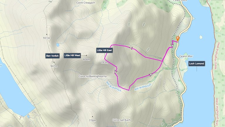
My intention was to park at Inveruglas car park and walk along a track to an area rich in contour features. What I didn't realise was that Inveruglas car park is closed for refurbishment until mid-November. There is nowhere else to park near the path, and I had to drive four miles north to Ardlui and tackle the Little Hills from the north instead of the south side.
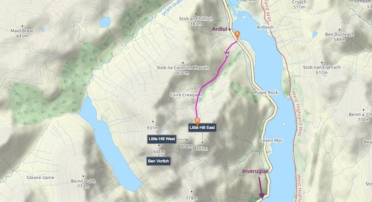
My route to the Little Hills from Ardlui.
This actually put the first section of the walk slightly outside my map. I did have a larger-scale map with me, so I decided to follow a path that wasn't actually on the map, and do my navigation exercise from the north side of the Little Hills, instead of the planned south side.
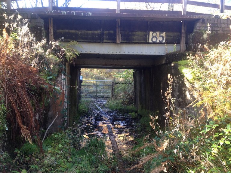
The approach to the path starts from a very boggy railway underpass.
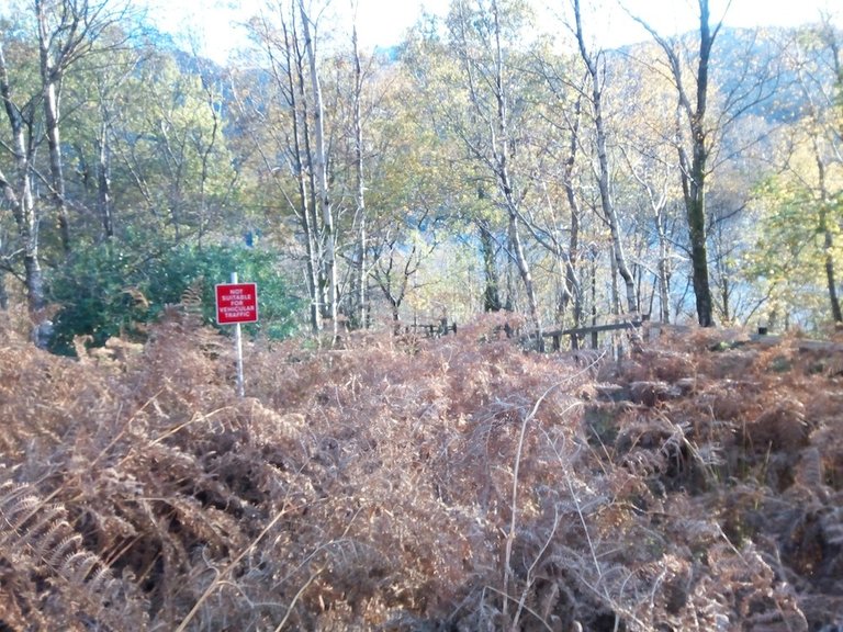
Once you've waded through the mire to the other side, you're greeted with a rather ominous warning sign.
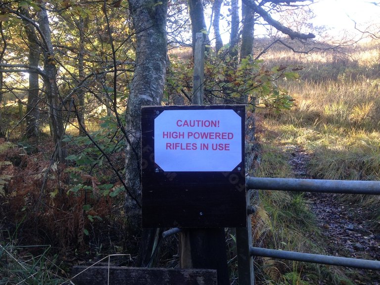
I was glad that I was wearing brightly-coloured clothes, and not deer-like brown.
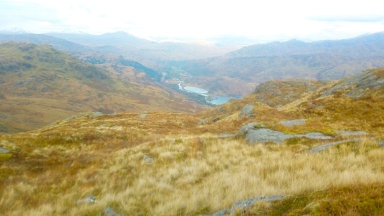
The views were encouraging.
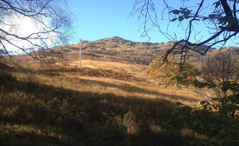
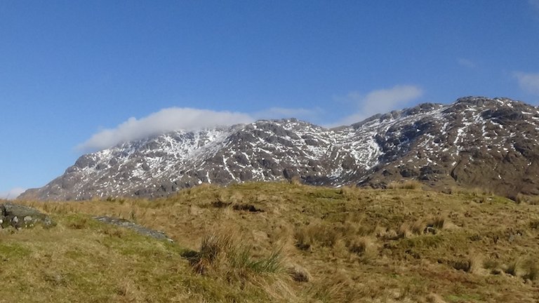
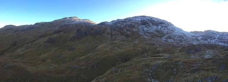
As I climbed higher up the track, a peak dusted with snow came into view. This was part of the ridge of Ben Vorlich.
The summit ridge of Ben Vorlich in the distance.
A man with his young daughter passed me. They seemed to be in a hurry – probably hoping to climb Ben Vorlich and get back by sunset at 4.45pm.

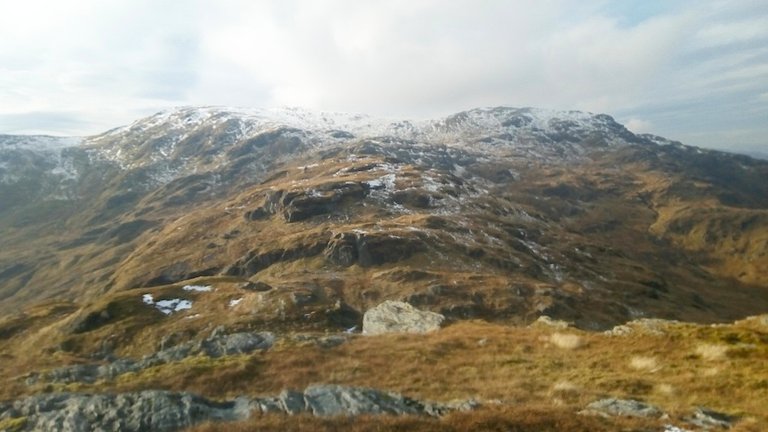
I was going at a slower pace, seeking the heavily-featured slopes of the Little Hills. As I climbed higher, an impressive rocky peak was on my right, Stob nan Coinnich Bhachain, or "Hill of the Mossy Knolls". Its altitude is just 647m, but it looks like a tempting climb.
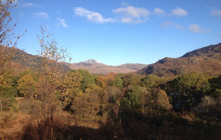
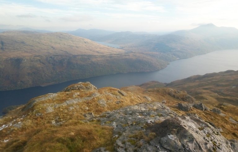
Loch Lomond was below me, with Beinn Chabhair on the other side.
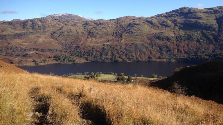
Loch Lomond and Beinn Chabhair.
I spent so much time trying to identify contours that by 3pm I still hadn't made it to the summits of the Little Hills. I was about a kilometre away from the highest one, with about 160m to climb. It would have taken me less than half an hour, but with sunset less than two hours away, despite carrying two headtorches and spare batteries, I didn't want to risk coming down over rough ground in the dark.
The Little Hills, tantalisingly close – but not close enough.
I decided to turn back.
Second attempt
When I got home, I realised that the navigation hadn't gone as well as I'd thought. I usually try to identify specific targets and then check them using an app on my phone. But the app had recently been updated, and I hadn't been able to get it to work properly.
I had also tracked my route, using a different app, and the results were not as good as I'd initially thought. I decided to return to the Little Hills, this time approaching them from their eastern flank.
The railway was the main barrier to this approach, but I'd noticed a footbridge marked on the map. I'd also identified a tiny layby on Google Street View.
My route up the eastern flank of the Little Hills.
So two days after my first attempt on these hills, I got up much earlier and parked in the tiny layby at 8am.
Painful problem
Despite feeling a bit tired, I was full of excitement... until I put my backpack on and started to notice a distinct ache in my lower back. About 200m into the forest, I felt a piercing stabbing pain.
My back had gone.
There was only one thing for it. I've experienced lower back pain on and off for about 25 years, so I know how to tackle it. I crouched down and started to do some yoga moves. Luckily the piles of fallen leaves provided a good "mat".
After about 10 minutes, things didn't seem to be improving. I reluctantly decided to turn back to my car. I bent down to pick up my backpack... and found that the pain was ebbing away.
I re-packed my backpack. It felt "bottom loaded", so I put some of the heavy things at the bottom nearer the top.
Then I set off again. The pain didn't return until that evening when I got back home.
Something spooky in the air...
The next challenge was to fight my way through tangled bracken and prickly bramble vines. The bracken was dense and acted like tripwires. Things brushed against my face, and I kept remembering that it was Hallowe'en. But I knew that the footbridge was only about 120m away.
As I approached it, I saw this sign.
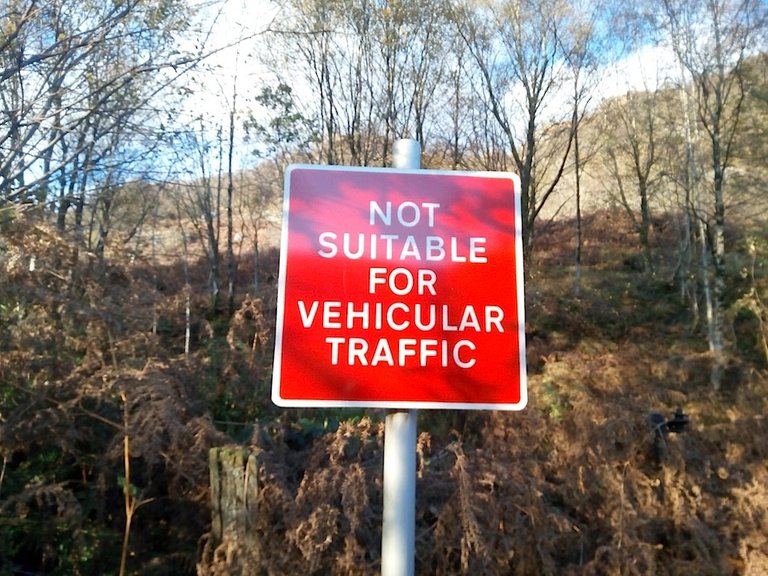
The idea of any type of vehicle getting through this kind of territory seemed like a bizarre joke. I wondered if the footbridge was still in existence.
It was... just!
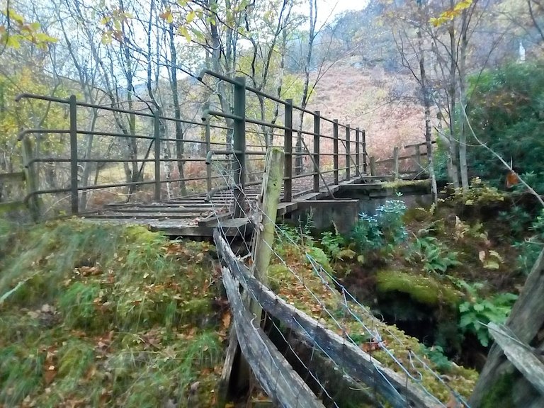
It did not look safe to cross! But cross it I did, treading cautiously and listening to any ominous creaks.
Once across the other side, this was the view.
It was a pretty rough ascent – steep, slippy and not a path in sight. I had to wade through a sea of bracken. But once I got up to about 350m altitude, the ground became much easier, and I started identifying features.
Success at last
Despite the inauspicious start to the day, things went much more smoothly. I hit my targets one after the other, and I was able to check them off on my phone, as I'd got the app working again.
The view down to Loch Lomond and Ardlui.
And this time I managed to reach the summit of one of the Little Hills.
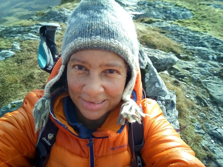
Summit selfie at the top of the easternmost Little Hill.
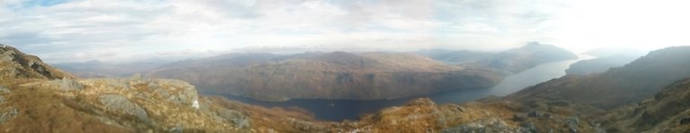
View down to Loch Lomond with Loch Arklet beyond and Ben Lomond on the right.
The second Little Hill was tantalisingly close, but with even rougher ground to return over, I didn't want to risk returning in the dark, so I decided to keep it for another day – a day with longer daylight hours!
The westernmost Little Hill, with the ridge of Ben Vorlich beyond.
The descent was pretty nerve-wracking at times. I returned down a much less steep shoulder than the route I'd climbed up, knowing that if my navigation went wrong I could end up at a cliff face!
It didn't go wrong. But the last 300m of altitude, over steep, uneven ground with numerous streams to cross and holes concealed by bracken "tripwires" was a blooming nightmare!
Gunfire
To add to the fun, I started hearing the unmistakable sound of high-powered rifle fire. Maybe it wasn't surprising, as there were deer all over the place. I exchanged my woolly hat for my red elasticated buff scarf, hoping that in bright red and orange I wouldn't be mistaken for a deer.
At last I got to the railway. I re-crossed the rickety bridge and only when I was almost within sight of my car, did I stop for "lunch" in the forest. It was 4.30pm and almost sunset. I felt quite chuffed that I'd managed to come out at exactly the right point where the little layby was.
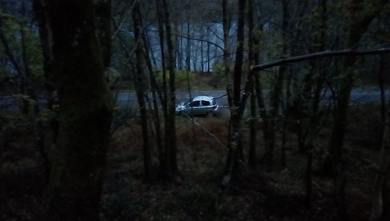
My little car in the layby.
I would definitely not recommend this route up to the Little Hills! At some point, that rickety railway bridge is going to collapse, and I would hate for you to be on it when that happens.
When the days get longer again, and Inveruglas car park is open once more, I'll climb Ben Vorlich from the Little Hills, maybe as a group walk. But I won't be going via the railway bridge!

All photos author's own.
Posted from my blog with SteemPress : http://ramblingandscrambling.co.uk/mountains/navigating-my-way-around-the-little-hills/

.gif)

Interesting signs on the way to the little hills! I like seeing some
signs, some are perplexing and comical. Makes one wonder what
kind of vehicular traffic was up there to need a sign. They sure weren't
kidding about the rifle fire! Surprising no sign on the old bridge.
Such a beautiful area, wonderful photos of the mountains, hills and
your next trip up there! Maybe with less tripwires! :-) rocks! Awesome hike and posting @natubat! Looking forward to
Thanks @shasta. What intrigues me is the good condition of the "vehicular traffic" sign – it looked as if it had been put up just a few years ago! Very weird.
Congratulations, Your Post Has Been Added To The Steemit Worldmap!
Author link: http://steemitworldmap.com?author=natubatPost link: http://steemitworldmap.com?post=navigatingmywayaroundthelittlehills-vk968k71gr
Want to have your post on the map too?
Its a wonderful place to hike
This post has been appreciated and featured in daily quality content rewards. Keep up the good work.
that's the kind of hiking that i think i could get on board with. When i was in Nepal a lot of the stuff we were doing was a bit more extreme than i was interested in. There certainly looks to be a lot of different options for exploration there. Nice one!
You're right about the Little Hills area - many different options, pretty rough ground, but nothing too extreme.Glad you enjoyed my post @gooddream. I went to Nepal in the 1990s and I loved it. I did the "Teahouse trek" in the Annapurna region - nothing too extreme, just beautiful scenery.
i did the Langtang Valley trek when i went. It was tea trekking as well. I guess you could say i liked it but some of the 9 hour days were a little bit more than i had hoped to do that day. I do lose nearly 10kg on that trip though!
Ah - maybe you went with a guide. I just went with a bunch of people I'd met, so we were able to set our own pace. It was bliss!
10kg weight loss! Altitude sometimes leads to weight loss, but that is a lot!
i was with a guide only in the sense that I was there with someone that had done it before. It was easy to know when you were supposed to stop each day because it was the only signs of civilization anywhere. Some days were longer than others!
I was quite overweight when i went and also had pretty terrible eating habits back then. When pizza and beer me was introduced to lentils and rice as well as 5+ hours a day of exercise, the kg's just fell off of me :)
It sounds like a wonderful adventure and a great way to diet!