Our planet has so many beautiful places. The landscapes varies so much, depending on where we are. Some years ago I was in Tibet and Nepal, driving across the roof of the world - from Lhasa (Tibet) to Kathmandu (Nepal). This is a selection of photos taken from day one until day seven, showing this wild, diverse and remote part of the world.
It takes 6 days if driving in a private car. We were a small group of three who had hired a car and a chaufer. Because of a detour to Everest Base Camp and a two night stayt here, we spent 7 days driving the Friendship Highway that runs from Lhasa to Kathmandu, one of the classic routes between the two countries. This stretch of road covers a distanse of 1300 kilomteters. If you drive by privat car (or rent a car with a driver) it should take 6 to 7 days. If you chose to do it by local bus, it might take weeks.

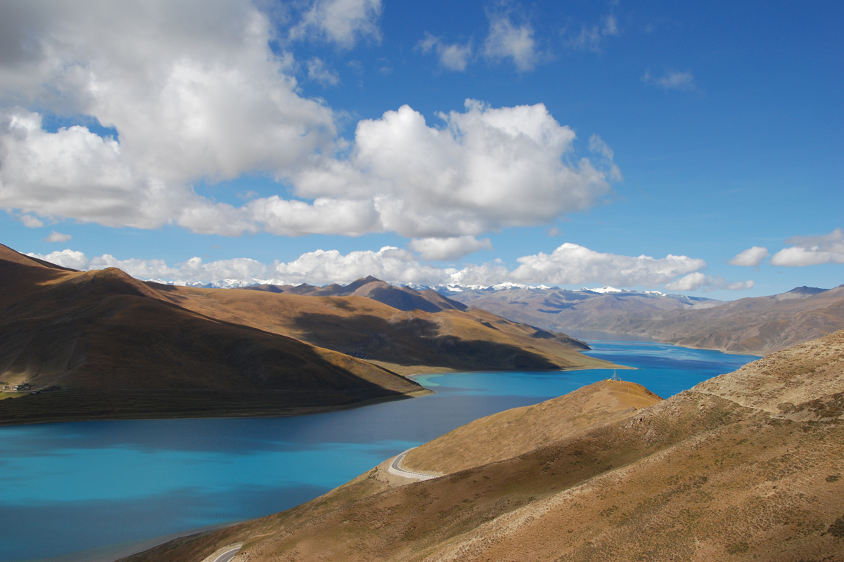 Yamdrok-tso
Yamdrok-tso is one of four holy lakes in Tibet. It is located at 4,488 m. above sea level, but it is only when you reach the top of the Kamba-la pass (4,794 m.) That you see it is lower. If you see the lake from the air, it resembles a scorpion.


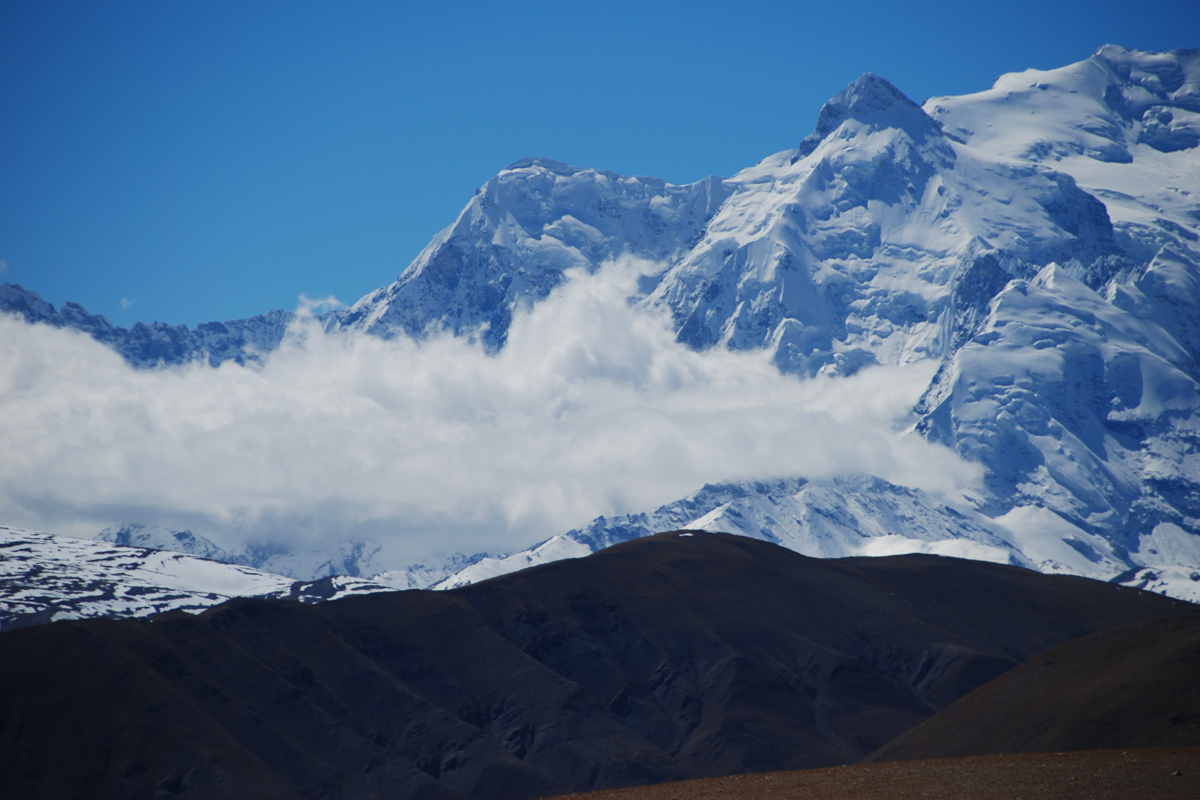
Tibet is known for its mountains, that are among the highest in the world. The Himalayas were created thousand of years ago because of tectonic plate movement. There are many mountain passes that makes passing to other regions possible.


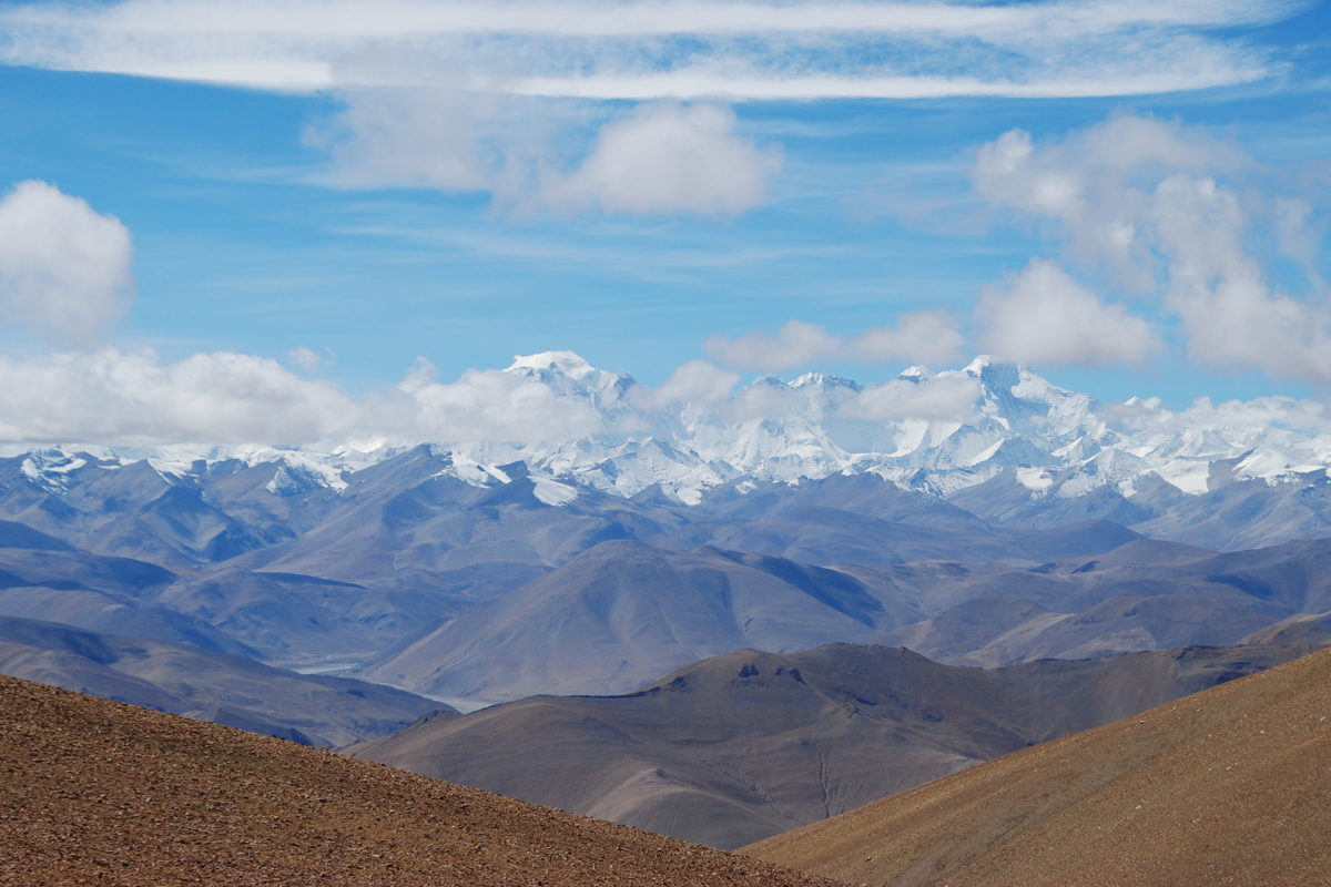
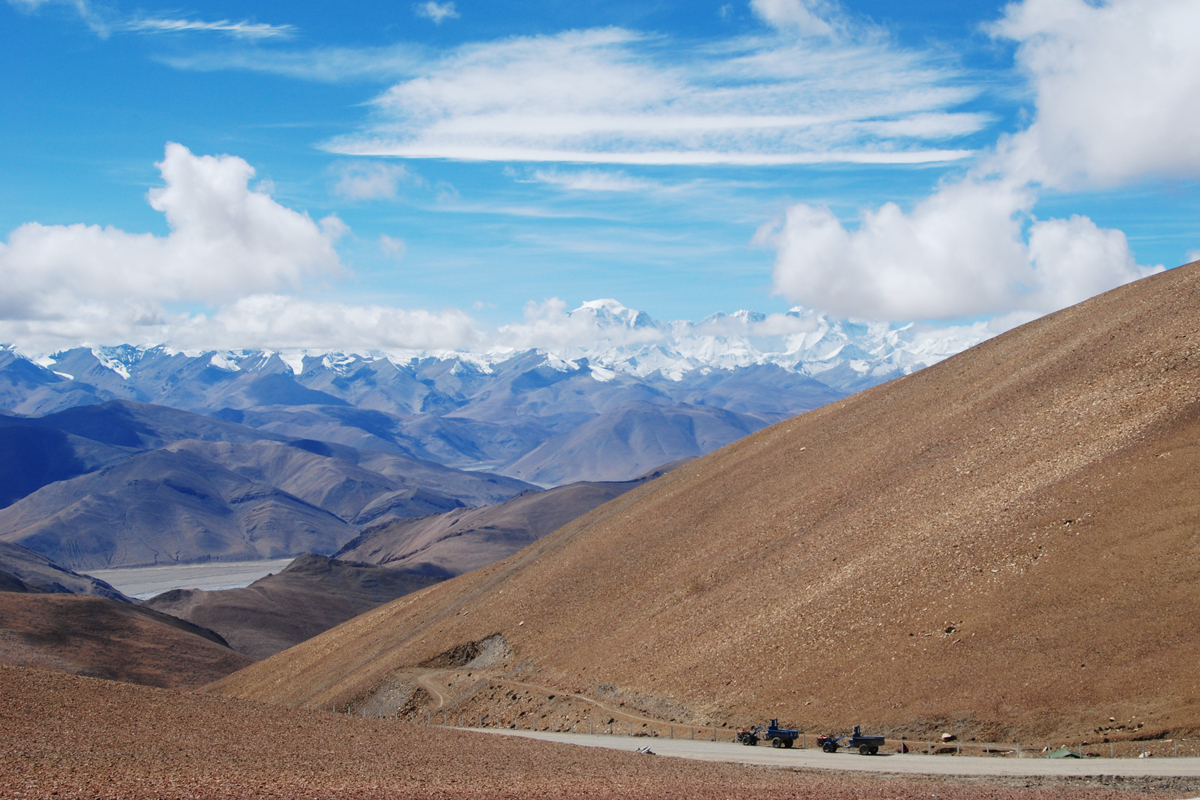
The first days we drove through a barren, moon-like landscape. Lots of wind and dust swirling up. We also felt the altitude. It became necessary to walk slowly. The same day we made a detour to get close to Mt. Everest. The Pang-la pass is situated at 5120 m. above sea level. When we stand here we look beyond all the highest peaks of the Himalayas. That is when I got that feeling of standing on the roof of the world.
 Mt. Everest
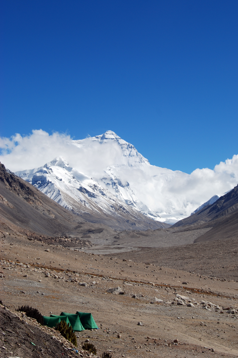
 Mt. Everest seen from Base camp
Standing in awe of Mt. Everest or Qomolangma, the Tibetan name, one of the most popular trekking destinations in the world. I can see why. It offers this amazing view of the north face of the highest mountain in the world. It was also on the Tibetan side of the mountain the first attempts (between 1921-1938) were made to climb to the top. The most famous of these are probably George Mallory and Andrew Irvine who did the attempt in 1924. They died on the mountain and it' still not known it they made it. After WWII and the Chinese take over of Tibet the borders closed. From then on the attempts were done from the Nepalese side, where Edmund Hillary and Tenzing Norgay were the first to reach the summit in 1953.
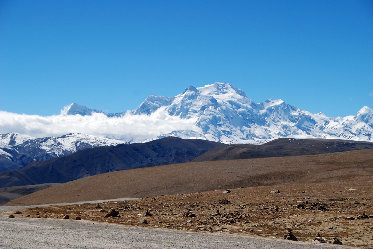
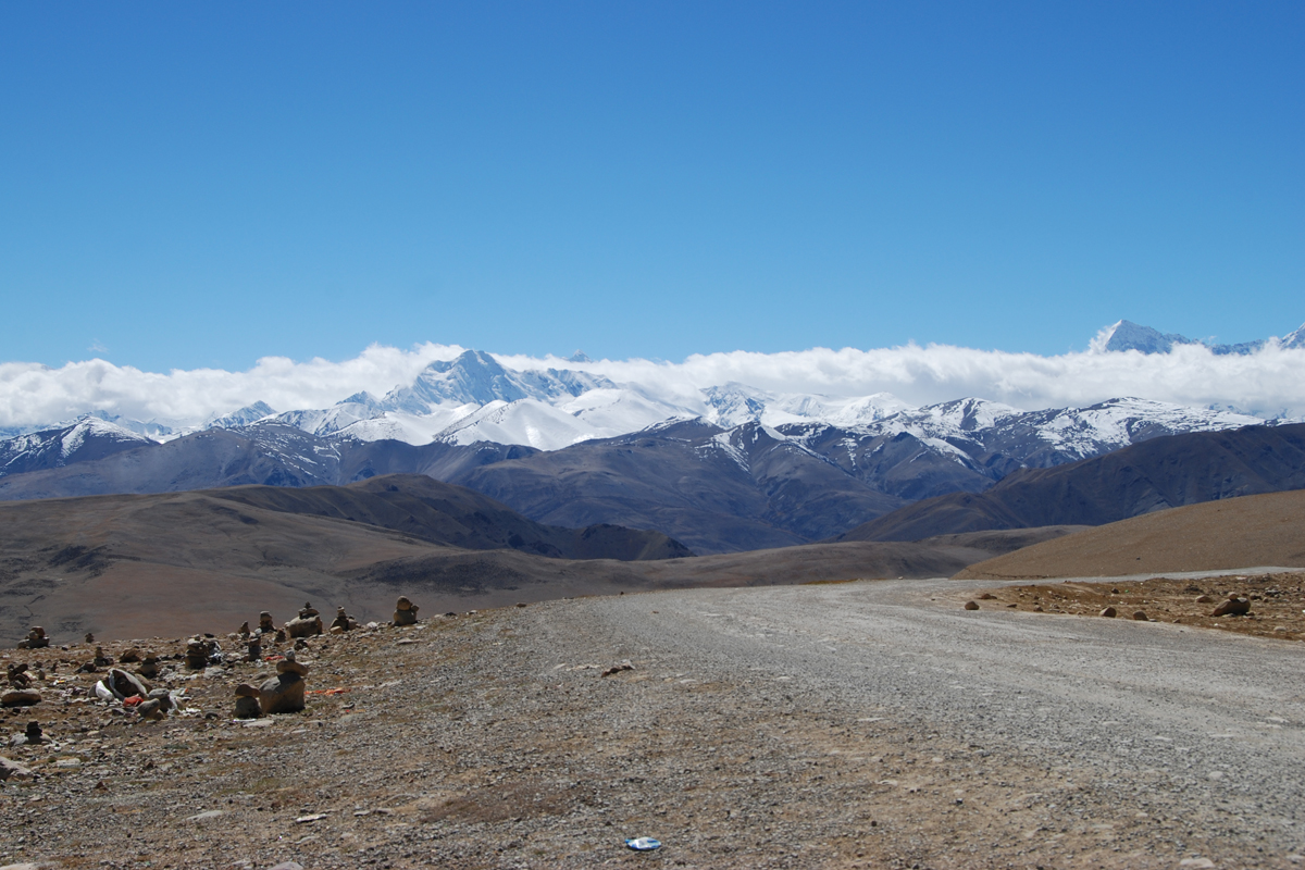
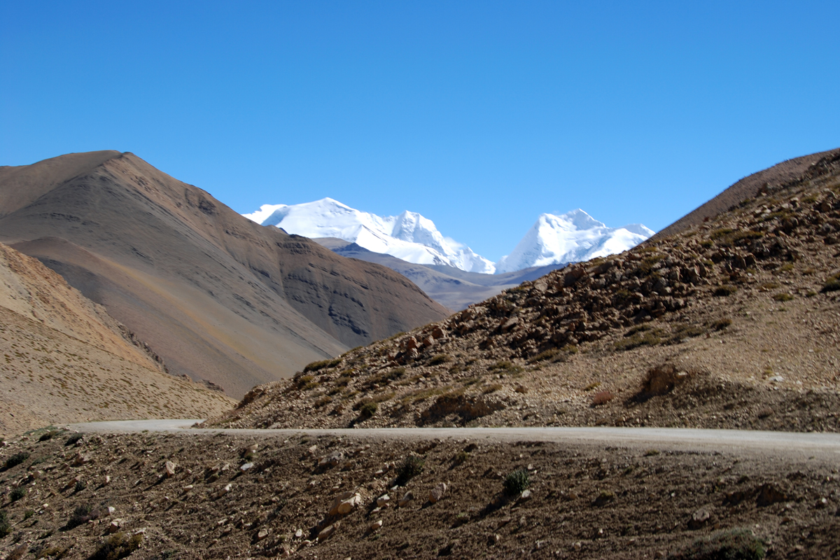
 Tingri
From the small town of Tingri the view of the snowcaped mountains is stunning. To the far left you see the top of Mt. Everest. In the middle Gyachung Kang and to the far right you see Cho Oyu. The town itself seems to be a small, dusty town, but does have hotels, as it's a popular place to stay a night before going straight to the Nepalese border.

The last day we drove 12 hours from B.c. To Zhangmu which is the border town of Nepal. Here we made a stop at Tong-la pass (5120 m). From now on, it goes downhill all the way towards the Nepali border.


Himalaya offers amazing mountain views, but some other facts I learned is that this region provides the third largest freshwater source in the world. We know it is home to the highest mountains in the world, but is is also here that several rivers in Asia originates here. Among these is the mighty Mekong that starts in Tibet and passes through South- East Asia, untill it ends up in the South-China Sea. The scenery is spectacular.
Please do follow if you want to keep up with my next photo shoot. Any upvotes or resteems are hugely appreciated!
Latest photo shoot, check out :
MONOMAD - An arctic town (3 photos)
U.J
Kristiansand, Norway
All the photoes are mine, Ulla Jensen (flickr, Instagram and facebook)
[//]:# (!pinmapple 29.667383 lat 91.173306 long Landscape photography – On the roof of the world (Tibet / 19 photos) d3scr)
Read about us? // Main page!
Latest content: Travel, Art, Food, Article, Poetry
Hi @digi-me!
Wow! The view of the mountains is amazing! They looks like a cake. Beautiful! I would like to ask you about the colours flags. I saw them in other picts and movies but I don't know what is their meaning.
Himalaya does offer breathtaking scenery. The flags are prayerflags. They are sold in town, but as we were driving, they were found many places along the trails. I think they are uses as a sort of blessing.
Wahoo beautiful pics with these mountains 👍
@tipu curate
Upvoted 👌 (Mana: 65/78) Liquid rewards.
Thanks :) Tibet does offer varied scenery, though the view to snowcaped mountains are almost everywhere
Love those basecamp shots. And the road shots, it just looks so empty!
Thanks. Base camp was awsome. Never got tired of looking at Everest!
How admirable the photos of the mountains, with their snow capped peaks. Beautiful landscapes
Crossing the Himalayas, really does give the feeling of being on the roof of the world. I never got tired of looking at those peaks, trying to figure the known peaks.
That experience must be the ultimate experience, I would like to do it one day!
Awesome. The views are stunning. I don't think i can handle those altitudes. Did a hike at 4km in Peru but it kilde me 😂 But this highway definitely is on my bucketlist wright now. thanks!
It's a vast, wild, but beautiful place. The altitude did offer some challenges, but you get used to. We flew to Lhasa, which is at a hight of 4000 m. The first few days we just took it easy. So stay at least 3-4 days here before starting the drive.
That's very whise! thanks.
Absolutely breathtaking! It is my strongest wish to be able to visit Tibet once in my life.
Thanks. I hope you do. Those snow capped peaks...The will take your breath away. Standing in front of Everest ..couldn't take my eyes away...
Congratulations, your post has been added to Pinmapple! 🎉🥳🍍
Did you know you have your own profile map?
And every post has their own map too!
Want to have your post on the map too?
Hiya, @choogirl here, just swinging by to let you know that this post made it into our Top 3 in Daily Travel Digest #1228.
Your post has been manually curated by the @pinmapple team. If you like what we're doing, please drop by to check out all the rest of today's great posts and consider supporting other authors like yourself and us so we can keep the project going!
Become part of our travel community: